- DA postcode area
-
Dartford postcode area 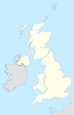
 DA
DAPostcode area DA Postcode area name Dartford Post towns 11 Postcode districts 18 Postcode sectors 58 Postcodes (live) 9,026 Postcodes (total) 11,411 Statistics as at October 2006 [1] The DA postcode area, also known as the Dartford postcode area,[2] is a group of 18 postcode districts in England, which are subdivisions of 11 post towns. Some of these postcode districts cover places in south east London, some cover places in north west Kent.
The main sorting office is in Dartford and the area served includes most of the London Borough of Bexley, the Kent boroughs of Dartford and Gravesham, and a very small part of the London Borough of Greenwich.
Contents
Coverage
The approximate coverage of the postcode districts:
Postcode district Post town Coverage Local authority area DA1 DARTFORD Dartford, Crayford, Barnes Cray Dartford, Bexley DA2 DARTFORD Dartford, Stone, Joydens Wood (part), Wilmington, Bean Dartford, Sevenoaks DA3 LONGFIELD Longfield, Hartley, Fawkham Dartford, Sevenoaks DA4 DARTFORD Dartford, South Darenth, Farningham, Eynsford Dartford, Sevenoaks DA5 BEXLEY Bexley, Albany Park, Joydens Wood (part) Bexley, Dartford DA6 BEXLEYHEATH Bexleyheath, Upton Bexley DA7 BEXLEYHEATH Bexleyheath(some parts are in SE2), Barnehurst Bexley DA8 ERITH Erith, Northumberland Heath, Slade Green Bexley DA9 GREENHITHE Greenhithe, Stone Dartford DA10 SWANSCOMBE Swanscombe, Ebbsfleet Dartford DA11 GRAVESEND Gravesend (west), Northfleet Gravesham, Dartford DA12 GRAVESEND Gravesend (east) Gravesham DA13 GRAVESEND Meopham Gravesham DA14 SIDCUP Sidcup, Foots Cray, Albany Park, Longlands Bexley DA15 SIDCUP Sidcup, Blackfen, Longlands, Lamorbey, Avery Hill Bexley, Greenwich DA16 WELLING Welling, Falconwood, East Wickham Bexley DA17 BELVEDERE Belvedere, Lessness Heath Bexley DA18 ERITH Erith Marshes Bexley Adjacent areas
Adjacent postcode areas RM 
SE  DA
DA 
ME 
BR TN Clockwise from the east, the adjacent postcode areas are: ME (Rochester), TN (Tonbridge), BR (Bromley), SE (London SE), RM (Romford). The northern boundary is the River Thames.
See also
References
- ^ "National Statistics Postcode Directory" (PDF). Office for National Statistics Postcode Directory (November 2006). Office for National Statistics. November 2006. http://www.statistics.gov.uk/geography/downloads/NSPDVersionNotes.pdf. Retrieved 2009-05-29.
- ^ Royal Mail, Address Management Guide, (2004)
External links
Postcode areas in the United Kingdom, Channel Islands and Isle of Man AB AL B BA BB BD BH BL BN BR BS BT BX CA CB CF CH CM CO CR CT CV CW DA DD DE DG DH DL DN DT DY E EC EH EN EX FK FY G GIR GL GU GY HA HD HG HP HR HS HU HX IG IM IP IV JE KA KT KW KY L LA LD LE LL LN LS LU M ME MK ML N NE NG NN NP NR NW OL OX PA PE PH PL PO PR RG RH RM S SA SE SG SK SL SM SN SO SP SR SS ST SW SY TA TD TF TN TQ TR TS TW UB W WA WC WD WF WN WR WS WV YO ZE
Postcode areas in London London postal district Outer areas Categories:- Postcode areas covering London
- Postcode areas covering South East England
- Dartford
- Media and communications in Bexley

Wikimedia Foundation. 2010.