- Mengla County
-
Mengla County — County — Chinese transcription(s) - Characters 勐腊县 - Pinyin Měnglà Xiàn Traffic in the town of Mengla Location of Mengla County (pink) and Xishuangbanna Prefecture (yellow) within Yunnan province of China
 Location in Yunnan, China
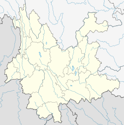
 Mengla County
Coordinates: 21°28′N 101°35′E / 21.467°N 101.583°E Country China Province Yunnan Prefecture Xishuangbanna GB/T 2260 CODE[1] 532823 Area - Total 7,056 km2 (2,724.3 sq mi) Population - Total 194,360 - Density 27.5/km2 (71.3/sq mi) Time zone China Standard Time (UTC+8) Postal code 666300[2] Area code(s) 0691[2] Website http://www.mlzf.yn.gov.cn/ 1Yunnan Statistics Bureau [1]
2Xishuangbanna Gov. [2]
3Yunnan Portal [3]Mengla County (勐腊县; pinyin: Měnglà Xiàn) is a county under the jurisdiction of Xishuangbanna Dai Autonomous Prefecture, Yunnan province, China. The last Indochinese tiger in the wild in China is believed to have been killed near Mengla in 2009. The perpetrator is believed to have been sentenced to 12 years imprisonment for this.
Contents
Climate
Climate data for Mengla (1971−2000) Month Jan Feb Mar Apr May Jun Jul Aug Sep Oct Nov Dec Year Average high °C (°F) 25.0
(77.0)27.5
(81.5)30.3
(86.5)31.9
(89.4)31.5
(88.7)30.6
(87.1)29.7
(85.5)29.8
(85.6)30.0
(86.0)28.6
(83.5)26.1
(79.0)23.7
(74.7)28.73
(83.71)Average low °C (°F) 11.6
(52.9)11.8
(53.2)14.0
(57.2)17.7
(63.9)20.7
(69.3)22.3
(72.1)22.2
(72.0)22.0
(71.6)21.1
(70.0)19.1
(66.4)15.7
(60.3)12.2
(54.0)17.53
(63.56)Precipitation mm (inches) 17.8
(0.701)21.4
(0.843)40.5
(1.594)98.5
(3.878)169.9
(6.689)211.6
(8.331)317.2
(12.488)307.1
(12.091)165.4
(6.512)91.8
(3.614)52.8
(2.079)26.7
(1.051)1,520.7
(59.87)Avg. precipitation days (≥ 0.1 mm) 5.5 4.2 6.0 12.9 18.5 22.1 25.5 23.6 16.5 12.0 7.3 5.7 159.8 Source: Weather China Transport
- Nearest airport is Xishuangbanna Gasa
- China National Highway 213
References
External links
Coordinates: 21°28′00″N 101°35′00″E / 21.4667°N 101.5833°E
Categories:- County-level divisions of Xishuangbanna Prefecture
- Yunnan geography stubs


Wikimedia Foundation. 2010.