- Erigavo
-
Erigavo
CeerigaaboLocation in Somalia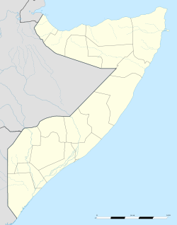
 Erigavo
Coordinates: 10°37′N 47°22′E / 10.617°N 47.367°ECoordinates: 10°37′N 47°22′E / 10.617°N 47.367°E Country  Somalia
Region Sanaag District Erigavo Government - Mayor Jibrell Ali Salaad Population (2007) - City 180,000 - Metro 150,000 Time zone GMT+3 (UTC+3) Erigavo or Erigabo (Somali: Ceerigaabo) is the administrative capital of the Sanaag region in northern Somalia.
Local control is disputed between Somaliland, a self-declared independent republic that is internationally recognized as an autonomous region of Somalia, the autonomous Puntland region in northeastern Somalia, and HBM-SSC (Hoggaanka Badbaadada iyo Mideynta SSC), a local unionist group whose goal is the creation of its own regional administration (Sool, Sanaag and Cayn or SSC).[1]
Erigavo is also the seat of a handful of local non-governmental organizations (NGOs) and governmental officials from Somaliland. The city has two hospitals, with one being constructed as of early 2009. In addition, a small airport lies to the east of the town. 10 km (6 m) to the north of Erigavo are the remains of a juniper forest,[2] running along the edge of the escarpment which looks down to the Gulf of Aden. The escarpment is approximately 2,000 m (6,562 ft) above sea level, where the road from Erigavo drops down to the coast. 2 km (1.2 mi) to the west, it rises to the highest point in Somalia (2,416 m [7,927 ft]). Known variously as Shimbiris/Shimbir Beris (abode of the birds), Surad Cad, and other names, the peak was one of the locations where Sayyid Mohammed Abdullah Hassan built a fort, which was subsequently attacked and destroyed by British forces in 1920.
Contents
Description
 Erigavo street
Erigavo is the administrative capital of the Sanaag region, which has an estimated population of just over 180,000. The city, at an altitude of over 1,800 meters above sea level, which is the mildest[clarification needed] in that part of Somalia.[citation needed]
Erigavo lies at the bottom of the highest peak in Somalia Surud about 2670 ft above the sea level. It is surrounded by very beautiful natural views like Mountain Daallo. There is a road which goes to the top of this high mountain. At the mountain's peak, one can see the sea as well as a tiny village called Mait about 60 km away. Sometimes the roar of leopards can be heard, for which the local people have many stories to share.[citation needed]
Erigavo is a fast growing city, but has no good roads connect to other cities in Somaliland.[1] The road was constructed in a form suitable for trucks by the British during World War II, using the labour of Italian prisoners of war. Before then there was a long established camel track down the escarpment. Frankincense grows throughout the area north of the escarpment, and is a source of income for the people of this area. The area has change since a lot of diaspora come back home to build houses, The surrounding area is where the Sayyīd Muhammad `Abd Allāh al-Hasan, fought against British, Italian, and Ethiopian soldiers.
History
 Overview of Erigavo.
In the government area of the town of Erigavo referred to as the Shaab, a simple masonry monument holds the wrecked engine block of a British biplane that crashed in the area in 1920 while carrying out bombing operations against Mohammed Abdullah Hassan. This operation, based out of Aden, is thought to be one of the first uses of aircraft in war on the African continent.
Scattered throughout the coastal ranges and some distance inland from the escarpment are large graves. The latter are in the shape of cairns of large stones loosely piled on top on each other, and extend up to three meters in height and six to ten metres in width. These are known as Galla graves (Taalla Galla), and are thought to predate the settlement of the area by Somali people.[citation needed] Some have been opened up, showing a small burial chamber covered by a flat rock. The cairns near the coast at Mait seem to be more complex in design, with two distinct levels, the use of different colored stone for different sections, and sometimes an outer boundary ring of stones some metres away from the cairn itself.
People
Pastoralism is the principal source of livelihood for people in the region. Nomads herd goats, sheep and camels, over ranges of open country defined on a clan rather than a household basis. In the town proper, remittances from family members outside of Somalia also serve as an important source of sustenance.
Environment and wildlife
 The Dorcas Gazelle.
Daallo Mountain and Surad mountain range, two popular local tourist destinations, offer a scenic view, as does Mount Shimbiris, the highest peak in Somalia. Mount Shimbiris sits at an altitude of 2450 meters above sea level, and is located in the Surud mountain range. SRTM data shows that its often quoted elevation of 2,416 m is slightly low.
One can also take in the local wildlife, such as the Black-backed Jackal, the Dorcas Gazelle, the Hamadryas baboon, the Suidae, Common Dwarf Mongoose, Abdim's Stork, Long-crested Eagle and the Hartebeest.
Government
The mayor of Ceerigaabo is Mudane Ismaiil Haji Nuur.
Telecommunication
Erigavo has a modern telephone system. Nearly everyone in the city has access to telephone landline and mobile services. The main mobile communication services in Erigavo are operated by Golis Telecom, Telcom and Telesom[citation needed]. STC Somaliland, another major local telecommunications company, manages electricity and telephone landlines only.
Scouting
The city is also home to a Boy Scouts organization. Formed in 2005 by the local Sanaag administration, the Scouts partake in various activities, including a 2006 training program on governance, peace and leadership.[3]
Notes
References
Categories:- Populated places in Somalia
- Geography of Somalia
- Archaeological sites in Somalia
- Somaliland


Wikimedia Foundation. 2010.