- Charford
-
For the hamlets in Hampshire, see North Charford and South Charford.
Coordinates: 52°19′30″N 2°04′01″W / 52.325107°N 2.066863°W
Charford 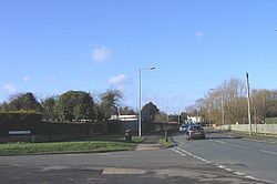
The road junction between Lyttleton Avenue and Charford Road in the village.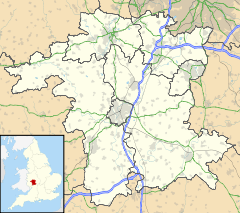
 Charford
Charford shown within WorcestershireDistrict Bromsgrove Shire county Worcestershire Region West Midlands Country England Sovereign state United Kingdom Post town BROMSGROVE Postcode district B60 Dialling code 01527 EU Parliament West Midlands UK Parliament Bromsgrove List of places: UK • England • Worcestershire Charford is a small village located close to the town centre of Bromsgrove in Worcestershire.
Contents
History
Charford used to be farm land[citation needed] with a mill, Charford Mill (known as The Lint Mill) provided employment by the manufacture of sanitary towels and wound dressings but was derelict for many years until it was demolished to make way for South Bromsgrove High School which retained the old mill pond at the front of the complex. This however has since been filled in due to the demolition and redevelopment of the school on an adjacent field though the sluice gate can still be seen to the side of the Sugarbrook that runs along the front of the school off Charford Road.
The original housing estates of Charford were built for workers[citation needed] of the Garringtons Automotive factory in nearby Aston Fields that provided car components for various companies.
Transport
Bus services in Charford are provided by First Midland Red, Diamond Bus, Clearway and MRD Travel. There are routes to Bromsgrove, Droitwich, Worcester, Birmingham and Redditch. Bromsgrove railway station is situated in the adjacent village of Aston Fields with train services to Birmingham, Worcester and Hereford.
Education
Charford has two schools; Charford First School and South Bromsgrove High School, the latter having been recently rebuilt on the original playing fields as a brand new modern complex. The old buildings were demolished by DSM Demolition and the land is now a car park for staff and visitors.
Notable residents
- Joyce Carpenter (1929–73) who was the shortest adult ever in the UK at 74 cm (29ins).
Links
References
Towns Villages Alvechurch • Aston Fields • Barnt Green • Belbroughton • Bell End • Beoley • Blackwell • Bordesley • Bournheath • Burcot • Catshill • Clent • Charford • Cofton Hackett • Dodford • Fairfield • Finstall • Frankley • Hagley • Hollywood • Holt End • Holy Cross • Hopwood • Hunnington • Lickey • Lickey End • Marlbrook • Romsley • Rowney Green • Rubery • Sidemoor • Stoke Heath • Stoke Prior • Tardebigge • Tutnall • Upper Bentley • WythallCivil Parishes Categories:


Wikimedia Foundation. 2010.