- Chemax Municipality
-
Chemax — Municipality — Location of the Municipality in the state of Yucatán Location of the Municipality in Mexico
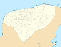
 Chemax
Coordinates: 20°35′N 87°33′W / 20.583°N 87.55°WCoordinates: 20°35′N 87°33′W / 20.583°N 87.55°W Country  Mexico
State  Yucatán
Mexico Ind. 1821 Yucatan Est. 1824 Municipality Est. 1918[1] Government - Municipal President Lucio Balam Herrera[1] Area - Total 1,098.6 km2 (424.2 sq mi) [1] Elevation 25 m (82 ft) Population (2005 [2][3]) - Total 30,023 - Demonym Chemaxeño Time zone Central Standard Time (UTC-6) - Summer (DST) Central Daylight Time (UTC-5) Postal Code 97770 INEGI Code 019 Major Airport Merida (Manuel Crescencio Rejón) International Airport IATA Code MID ICAO Code MMMD Website Official Website The Municipality of Chemax is one of the 106 subdivisions of the State of Yucatán in Mexico. Its municipal seat is located in the City of Chemax.
Contents
Location
This municipality is located in the eastern part of the State of Yucatán. It is between latitude 20º 35' and 20º 38' north and longitudes 87º 33' and 88 04' west.[1]
It borders the following municipalities: to the north Temozón and Tizimín, to the south Valladolid, on the east the State of Quintana Roo and to the west also by Valladolid.[1]
Communities
The municipality is made up of 170 different communities, of which the most important are:[1]
- Chemax Municipal Seat
- X-Can
- Xalau
- Sisbichen
- X-Catzin
Folk Festivals
- From 10 to 13 June, festival in honor of San Antonio de Padua, patron saint of the town of Chemax.[1]
References
- ^ a b c d e f g "Nuestros municipios - Chemax". http://www.yucatan.gob.mx/estado/municipios/31019a.htm. Retrieved 2009-11-11.
- ^ "Encyclopedia of the Municipalities of Mexico: Yucatan". http://www.e-local.gob.mx/wb2/ELOCAL/EMM_yucatan. Retrieved 2009-11-01.
- ^ Census Results by Locality, 2005 INEGI.
Mérida, Yucatán (capital) Topics 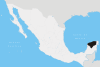
Metros Larger cities Smaller cities Akil · Tzucacab · Tekit · Halachó · Tecoh · Dzidzantún · Seyé · Buctzotz · Caucel · Conkal · Cacalchén · Celestún · Temax · Temozón · Homún · Dzilam González · Kinchil · Teabo · Sotuta · Panabá · Cholul · Chichimilá · Itzincab · Hoctún · X-Can · Dzan · Pisté · Huhí · Cansahcab · Baca · Chocholá · Opichén · Hocabá · Maní · Chicxulub · Popolá · Komchén · Tetiz · Sucilá · Cuzamá · Timucuy · Ixil · Kimbilá · Kantunil · Sacalum · Tahmek · Telchac Pueblo · Tixpéhual · Santa Elena · Tahdziú · Popolnáh · Tixcacalcupul · Chablecal · Tekantó · Cenotillo · San José Tzal · Dzemul · Chelem
Municipalities Abalá · Acanceh · Akil · Baca · Bokobá · Buctzotz · Cacalchén · Calotmul · Cansahcab · Cantamayec · Celestún · Cenotillo · Chacsinkín · Chankom · Chapab · Chemax · Chicxulub Pueblo · Chichimilá · Chikindzonot · Chocholá · Chumayel · Conkal · Cuncunul · Cuzamá · Dzan · Dzemul · Dzidzantún · Dzilam de Bravo · Dzilam González · Dzitás · Dzoncauich · Espita · Halachó · Hocabá · Hoctún · Homún · Huhí · Hunucmá · Ixil · Izamal · Kanasín · Kantunil · Kaua · Kinchil · Kopomá · Mama · Maní · Maxcanú · Mayapán · Mérida · Mocochá · Motul · Muna · Muxupip · Opichén · Oxkutzcab · Panabá · Peto · Progreso · Quintana Roo · Río Lagartos · Sacalum · Samahil · Sanahcat · San Felipe · Santa Elena · Seyé · Sinanché · Sotuta · Sucilá · Sudzal · Suma · Tahdziú · Tahmek · Teabo · Tecoh · Tekal de Venegas · Tekantó · Tekax · Tekit · Tekom · Telchac Pueblo · Telchac Puerto · Temax · Temozón · Tepakán · Tetiz · Teya · Ticul · Timucuy · Tinúm · Tixcacalcupul · Tixkokob · Tixméhuac · Tixpéhual · Tizimín · Tunkás · Tzucacab · Uayma · Ucú · Umán · Valladolid · Xocchel · Yaxcabá · Yaxkukul · Yobaín
Categories:- Municipalities of Yucatán
- Populated places in Yucatán


Wikimedia Foundation. 2010.