- Cherry Grove, HO-1
-
Cherry Grove, HO-1
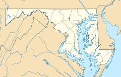

Location: 2937 Jennings Chapel Road, Woodbine, Maryland Coordinates: 39°17′39.3786″N 77°05′37.7262″W / 39.294271833°N 77.093812833°WCoordinates: 39°17′39.3786″N 77°05′37.7262″W / 39.294271833°N 77.093812833°W Built: 1798 Architect: Unknown Architectural style: No Style Listed Governing body: Private NRHP Reference#: 07000567
[1]Added to NRHP: June 21, 2007 Cherry Grove is a historic home and farm located at Woodbine, Howard County, Maryland, United States. The multi-part house was built starting in about 1798. The complex includes a ca. 1798 log ground barn, an 1860-1890 frame wagon shed with corn crib, an early-20th century frame water tower, frame ground barn with cantilevered forebay, frame shed, frame dairy barn, concrete silo, concrete block dairy, and several frame shelter sheds. The buildings are located on a generally flat site surrounded by gently rolling terrain and are set well back from the road along a gravel drive that winds through the center of the farm.[2] The remains of Maryland's 45th Governor Edwin Warfield (1848–1920), are buried in the family cemetery.
Cherry Grove was listed on the National Register of Historic Places in 2007.[1]
References
- ^ a b "National Register Information System". National Register of Historic Places. National Park Service. 2008-04-15. http://nrhp.focus.nps.gov/natreg/docs/All_Data.html.
- ^ "Maryland Historical Trust". Cherry Grove, Howard County. Maryland Historical Trust. 2008-11-21. http://www.mht.maryland.gov/nr/NRDetail.aspx?HDID=1517&COUNTY=Howard&FROM=NRCountyList.aspx?COUNTY=Howard.
External links
- Cherry Grove, Howard County, including undated photo, at Maryland Historical Trust
- Cherry Grove, HO-1 on Google Street View
U.S. National Register of Historic Places in Maryland Lists by county Allegany • Anne Arundel • Baltimore County • Calvert • Caroline • Carroll • Cecil • Charles • Dorchester • Frederick • Garrett • Harford • Howard • Kent • Montgomery • Prince George's • Queen Anne's • Somerset • St. Mary's • Talbot • Washington • Wicomico • Worcester
Lists by city Other lists Keeper of the Register • History of the National Register of Historic Places • Property types • Historic district • Contributing property Categories:- Houses on the National Register of Historic Places in Maryland
- 1798 architecture
- Howard County, Maryland landmarks
- Houses in Howard County, Maryland
- Maryland Registered Historic Place stubs


Wikimedia Foundation. 2010.