- Cheyenne metropolitan area
-
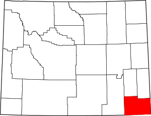 Map of the Cheyenne Metropolitan Statistical Area
The Cheyenne Metropolitan Statistical Area is a United States Census Bureau defined Metropolitan Statistical Area (MSA) located in the Cheyenne region of the State of Wyoming. The Cheyenne Metropolitan Statistical Area is defined as Laramie County, Wyoming. Many consider the Cheyenne Metro Area to be the economic hub of eastern Wyoming. The Census Bureau estimates that the population was 86,353 in 2007, ranking as the 340st most populous metropolitan area in the United States.[1]
The Cheyenne Metropolitan Statistical Area includes the City of Cheyenne, the Town of Albin, the Town of Burns, the Town of Pine Bluffs and the unincorporated areas of Laramie County.
See also: U.S. Metropolitan Statistical Areas, Cheyenne, Wyoming, Laramie County, Wyoming, the Metropolitan Areas of Wyoming, and the Front Range Urban Corridor.
See also
 United States census statistical areas by state, district, or territoryASMPGUVI
- Laramie County, Wyoming
- Wyoming census statistical areas
- Wyoming metropolitan areas
- Combined Statistical Area
- Core Based Statistical Area
- Metropolitan Statistical Area
- Micropolitan Statistical Area
- Table of United States Combined Statistical Areas
- Table of United States Metropolitan Statistical Areas
- Table of United States Micropolitan Statistical Areas
- Table of United States primary census statistical areas
- Larger urban regions that contain the Cheyenne Metropolitan Statistical Area:
- Core Based Statistical Areas adjacent to Cheyenne Metropolitan Statistical Area:
- Laramie Micropolitan Statistical Area
- Greeley Metropolitan Statistical Area (Colorado)
References
- ^ "Annual Estimates of the Population of Metropolitan and Micropolitan Statistical Areas: April 1, 2000 to July 1, 2006 (CBSA-EST2006-01)" (CSV). 2007 Population Estimates. United States Census Bureau, Population Division. 2007-04-05. Archived from the original on 2007-09-14. http://web.archive.org/web/20070914155415/http://www.census.gov/population/www/estimates/metro_general/2006/CBSA-EST2006-01.csv. Retrieved 2007-05-16.
 State of Wyoming
Topics - Governors
- Delegations
- Geography
- Government
- History
- People
- Visitor Attractions
- State Symbols
- Radio Stations
Society - Crime
- Demographics
- Economy
- Education
- Politics
Regions Cities Counties Categories:- Metropolitan areas of Wyoming


Wikimedia Foundation. 2010.