- Castle (District Electoral Area)
-
Castle
District Electoral Area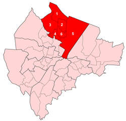
Map showing Castle wards within BelfastArea 19 km2 (7.3 sq mi) Population 28,290 (2008 Estimate) - Density 1,489 /km2 (3,860 /sq mi) District Belfast City Council County County Antrim Country Northern Ireland Sovereign state United Kingdom EU Parliament Northern Ireland UK Parliament Belfast North NI Assembly North Belfast List of places: UK • Northern Ireland • Antrim Castle is one of the nine district electoral areas in Belfast, Northern Ireland. Located in the north of the city, the district elects six members to Belfast City Council and contains the wards of Bellevue; Castleview; Cavehill; Chichester Park; Duncairn and Fortwilliam. Castle, along with the neighbouring Court and Oldpark districts and parts of Newtownabbey Borough Council, forms the Belfast North constituencies for the Northern Ireland Assembly and UK Parliament. The district is bound to the east by the Victoria Channel, to the north by Newtownabbey Borough Council and Belfast Lough, to the south by North Street and to the west by the Cavehill Road and Oldpark Road.
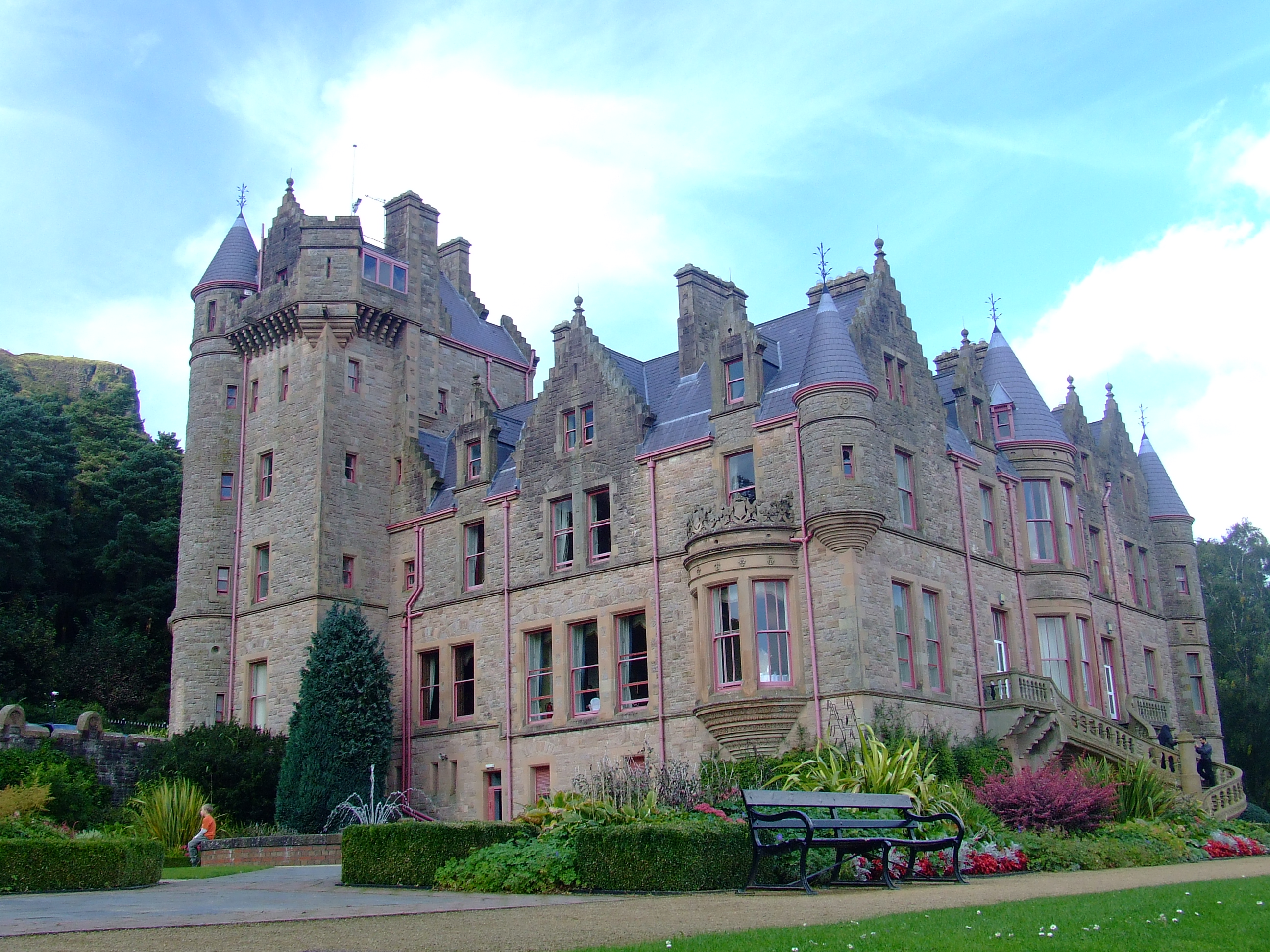
The district takes its name from Belfast Castle which is located on Cavehill in the north of the district, while, the southern section of the district is part of the city centre and forms one of the Belfast's main cultural areas, known as the Cathedral Quarter. The east of the area also contains the Port of Belfast. Castle is served by the M2 and M5 motorways and the Yorkgate railway station.
Castle is one of the most mixed areas in the city, with just over half of the district's population being Protestant at the 2001 Census, this has resulted in the construction of a number of peace lines, for example along the Whitewell Road.
Contents
History
Castle was created for the 1985 local elections. All six wards came from the former Area H, with only the Cliftonville ward and northern section of the Waterworks ward omitted from the new district.
Amenities
- Albert Memorial Clock
- Belfast Castle
- Belfast Central Library
- Belfast Exposed photographic gallery
- Belfast Harbour
- Belfast Hebrew Congregation
- Belfast Zoo
- Cavehill
- Dividers Sculpture
- Giant's Park
- McHugh's Bar
- Merchant Hotel
- The Northern Whig Bar
- NvTv (Northern Visions Television)
- Obel Tower
- St Anne’s Cathedral (Church of Ireland)
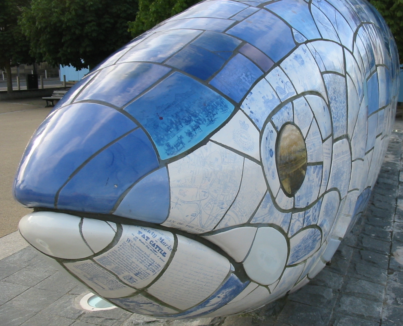
- The Big Fish, sculpture
Sport
- Seaview, Crusaders F.C. home ground
- Skegoneill Avenue, Brantwood F.C. home ground
Education
Wards
Map Ward Population
(2008 Estimate)Population
(2001 Census)Catholic Protestant Other Area Density NI Assembly UK Parliament Ref 1 Bellevue 4,750 4,942 60.7% 35.2% 4.1% 2.96 km2 1,670/km2 Belfast North Belfast North [1] 2 Castleview 4,769 4,878 31.2% 64.3% 4.5 % 1.41 km2 3,460/km2 Belfast North Belfast North [2] 3 Cavehill 4,965 5,282 51.3% 45.1% 3.6% 3.41 km2 1,549/km2 Belfast North Belfast North [3] 4 Chichester Park 5,077 5,109 74.9% 20.2% 4.9% 0.95 km2 5,378/km2 Belfast North Belfast North [4] 5 Duncairn 4,055 4,007 5.5% 90.2% 4.3% 9.24 km2 434/km2 Belfast North Belfast North [5] 6 Fortwilliam 4,674 4,798 32.9% 64.1% 3.0% 1.03 km2 4,658/km2 Belfast North Belfast North [6] Castle 28,290 29,016 44.3% 51.6% 4.1% 19 km2 1,527/km2 Councillors
 The Big Fish sculpture
Election Councillor
(Party)Councillor
(Party)Councillor
(Party)Councillor
(Party)Councillor
(Party)Councillor
(Party)2011 Tierna Cunningham
(Sinn Féin)Lydia Patterson
(DUP)David Browne
(UUP)Mary Campbell
(Sinn Féin)Pat Convery
(SDLP)Guy Spence
(DUP)2005 Nigel Dodds
(DUP)Cathal Mullaghan
(SDLP)Ian Crozier
(DUP)2001 Danny Lavery
(Sinn Féin)Alban Maginness
(SDLP)1997 Tom Campbell
(Alliance)Nelson McCausland
(UUP)1993 Jonathan Stephenson
(SDLP)John Carson
(UUP)Nelson McCausland
(Independent Unionist)1989 Tom Campbell
(Alliance)Frank Millar
(Independent Unionist)1985 Alfie Redpath
(UUP)2011 Elections
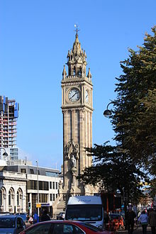 Albert Memorial Clock, Custom House Square
Belfast City Council elections, 2011[7] Party Candidate 1st Pref Democratic Unionist Lydia Patterson 1,489 Sinn Féin Tierna Cunningham 1,377 SDLP Pat Convery 1,367 Sinn Féin Mary Campbell 1,293 Ulster Unionist David Browne 1,181 Democratic Unionist Guy Spence 946 SDLP Cathal Mullaghan 883 Alliance David McKechnie 689 Democratic Unionist Lee Reynolds 629 Workers' Party John Lavery 170 Turnout 10,024 Sinn Féin gain from Social Democratic and Labour See also
- Belfast City Council
- Electoral wards of Belfast
- Local government in Northern Ireland
- Members of Belfast City Council
References
- ^ "Ward Information for Bellevue ward 95GG08". NISRA. http://www.ninis.nisra.gov.uk/mapxtreme/pf_report.asp?sLevel=WARD&sID=95GG08&sName=Bellevue. Retrieved 13 June 2011.
- ^ "Ward Information for Castleview ward 95GG13". NISRA. http://www.ninis.nisra.gov.uk/mapxtreme/pf_report.asp?sLevel=WARD&sID=95GG13&sName=Castleview. Retrieved 13 June 2011.
- ^ "Ward Information for Cavehill ward 95GG14". NISRA. http://www.ninis.nisra.gov.uk/mapxtreme/pf_report.asp?sLevel=WARD&sID=95GG14&sName=Cavehill. Retrieved 13 June 2011.
- ^ "Ward Information for Chichester Park ward 95GG16". NISRA. http://www.ninis.nisra.gov.uk/mapxtreme/pf_report.asp?sLevel=WARD&sID=95GG16&sName=Chichester%20Park. Retrieved 13 June 2011.
- ^ "Ward Information for Duncairn ward 95GG20". NISRA. http://www.ninis.nisra.gov.uk/mapxtreme/pf_report.asp?sLevel=WARD&sID=95GG20&sName=Duncairn. Retrieved 13 June 2011.
- ^ "Ward Information for Fortwilliam ward 95GG24". NISRA. http://www.ninis.nisra.gov.uk/mapxtreme/pf_report.asp?sLevel=WARD&sID=95GG24&sName=Fortwilliam. Retrieved 13 June 2011.
- ^ Elections 2011: Castle, Belfast City Council

Newtownabbey Borough Council Newtownabbey Borough Council Belfast Lough Oldpark 
Victoria  Castle

Court
Lower FallsLaganbank Pottinger Belfast City Council General 
People District Electoral Areas Amenities Parks and gardens Cemeteries Balmoral Cemetery • Belfast City Cemetery • Clifton Street Cemetery • Roselawn CemeteryElections See also: Local government in Northern Ireland • CategoryCategories:- Electoral wards of Belfast


Wikimedia Foundation. 2010.