- Chilapa de Álvarez (municipality)
-
Chilapa de Álvarez — Municipality — Location in Mexico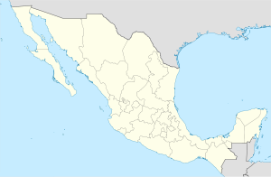
 Chilapa de Álvarez
Coordinates: 17°19′N 98°58′W / 17.317°N 98.967°WCoordinates: 17°19′N 98°58′W / 17.317°N 98.967°W Country  Mexico
State Guerrero Municipal seat Chilapa de Álvarez Area – Total 566.8 km2 (218.8 sq mi) Population (2005) – Total 105,146 Chilapa de Álvarez is one of the 81 municipalities of Guerrero, in south-western Mexico. The municipal seat lies at Chilapa de Álvarez. The municipality covers an area of 566.8 km².
As of 2005, the municipality had a total population of 105,146.[1]
References
- ^ "Chilapa de Álvarez". Enciclopedia de los Municipios de México. Instituto Nacional para el Federalismo y el Desarrollo Municipal. http://www.e-local.gob.mx/work/templates/enciclo/guerrero/municipios/12028a.htm. Retrieved December 23, 2008.
Municipalities/
(seats)Acapulco (Acapulco) · Acatepec (Acatepec) · Ajuchitlán del Progreso (Ajuchitlán) · Ahuacuotzingo (Ahuacuotzingo) · Alcozauca de Guerrero (Alcozauca de Guerrero) · Alpoyeca (Alpoyeca) · Apaxtla (Apaxtla de Castrejón) · Arcelia (Arcelia) · Atenango del Río (Atenango del Río) · Atlamajalcingo del Monte (Atlamajalcingo del Monte) · Atlixtac (Atlixtac) · Atoyac de Álvarez (Atoyac de Álvarez) · Ayutla de los Libres (Ayutla de los Libres) · Azoyú (Azoyú) · Benito Juárez (San Jerónimo de Juárez) · Buenavista de Cuéllar (Buenavista de Cuéllar) · Chilapa de Álvarez (Chilapa de Álvarez) · Chilpancingo de los Bravo (Chilpancingo de los Bravo) · Coahuayutla de José María Izazaga (Coahuayutla de Guerrero) · Cochoapa el Grande (Cochoapa el Grande) · Cocula (Cocula) · Copala (Copala) · Copalillo (Copalillo) · Copanatoyac (Copanatoyac) · Coyuca de Benítez (Coyuca de Benítez) · Coyuca de Catalán (Coyuca de Catalán) ·
Cuajinicuilapa (Cuajinicuilapa) · Cualac (Cualac) · Cuautepec (Cuautepec) · Cuetzala del Progreso (Cuetzala del Progreso) · Cutzamala de Pinzón (Cutzamala de Pinzón) · Eduardo Neri (Zumpango del Río) · Florencio Villarreal (Cruz Grande) · General Canuto A. Neri (Acapetlahuaya) ·General Heliodoro Castillo (Tlacotepec) · Huamuxtitlán (Huamuxtitlán) · Huitzuco de los Figueroa (Huitzuco) · Huixtac Iguala de la Independencia (Iguala de la Independencia) · Igualapa (Igualapa) · Ixcateopan de Cuauhtémoc (Ixcateopan de Cuauhtémoc) · Iliatenco (Iliatenco) · José Joaquín de Herrera (Hueycantenango) · Juan R. Escudero (Tierra Colorada) · Juchitán (Juchitán) · La Unión de Isidoro Montes de Oca (La Unión) · Leonardo Bravo (Chichihualco) · Malinaltepec (Malinaltepec) · Marquelia (Marquelia) · Mártir de Cuilapán (Apango) · Metlatónoc (Metlatónoc) · Mochitlán (Mochitlán) · Olinalá (Olinalá) · Ometepec (Ometepec) · Pedro Ascencio Alquisiras (Ixcapuzalco) · Petatlán (Petatlán) · Pilcaya (Pilcaya) · Pungarabato (Ciudad Altamirano) · Quechultenango (Quechultenango) · San Juan Union (San Juan) San Luis Acatlán (San Luis Acatlán) · San Marcos (San Marcos) · San Miguel Totolapan (San Miguel Totolapan) · Taxco de Alarcón (Taxco de Alarcón) · Tecoanapa (Tecoanapa) · Tecpán de Galeana (Tecpán de Galeana) · Teloloapan (Teloloapan) · Tepecoacuilco de Trujano (Tepecoacuilco de Trujano) · Tetipac (Tetipac) · Tixtla de Guerrero (Tixtla de Guerrero) · Tlacoachistlahuaca (Tlacoachistlahuaca) · Tlacoapa (Tlacoapa) · Tlalchapa (Tlalchapa) · Tlalixtaquilla de Maldonado (Tlalixtaquilla) · Tlapa de Comonfort (Tlapa de Comonfort) · Tlapehuala (Tlapehuala) · Xalpatlahuac (Xalpatlahuac) · Xochihuehuetlan (Xochihuehuetlan) · Xochistlahuaca (Xochistlahuaca) · Zapotitlán Tablas Zapoapa (Zapotitlán Tablas) · Zihuatanejo de Azueta (Zihuatanejo) · Zirándaro (Zirándaro de los Chávez) · Zitlala (Zitlala)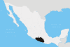 Categories:
- Municipalities of Guerrero
- Guerrero geography stubs


Wikimedia Foundation. 2010.