- Chinar, Russia
-
Chinar (English)
Чинар (Russian)- Rural locality[citation needed] -
Selo[citation needed]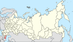
Location of the Republic of Dagestan in Russia
 Chinar
Coordinates: 42°06′27″N 48°08′38″E / 42.1075°N 48.14389°ECoordinates: 42°06′27″N 48°08′38″E / 42.1075°N 48.14389°E Administrative status Country Russia Federal subject Republic of Dagestan Administrative district Derbentsky District[citation needed] Selsoviet Chinarsky Selsoviet[citation needed] Statistics Area 47.3 km2 (18.3 sq mi)[citation needed] Population (2002 Census) 4,357 inhabitants[1] Density 92 /km2 (240 /sq mi)[2] Time zone MSD (UTC+04:00)[3] Postal code(s) 368622[citation needed] Dialing code(s) +7 87240[citation needed] Chinar (Russian: Чинар; Azerbaijani: Çınar) is a rural locality (a selo) in Derbentsky District of the Republic of Dagestan, located in the southeastern part of the republic, 107 kilometers (66 mi) from the republic's capital Makhachkala and 5 kilometers (3.1 mi) from Dagestanskiye Ogni, where the nearest railway station is. Population: 4,357 (2002 Census);[1] 2,908 (1989 Census).[4]. The ethnic composition of the population is mostly Azeris, Dargins, Tabasarans, Aguls, and Lezgins.
References
- ^ a b c Федеральная служба государственной статистики (Federal State Statistics Service) (2004-05-21). "Численность населения России, субъектов Российской Федерации в составе федеральных округов, районов, городских поселений, сельских населённых пунктов – районных центров и сельских населённых пунктов с населением 3 тысячи и более человек (Population of Russia, its federal districts, federal subjects, districts, urban localities, rural localities—administrative centers, and rural localities with population of over 3,000)" (in Russian). Всероссийская перепись населения 2002 года (All-Russia Population Census of 2002). Federal State Statistics Service. http://www.perepis2002.ru/ct/doc/1_TOM_01_04.xls. Retrieved 2010-03-23.
- ^ The value of density was calculated automatically by dividing the 2002 Census population by the area specified in the infobox. Please note that this value may not be accurate as the area specified in the infobox does not necessarily correspond to the area of the entity proper or is reported for the same year as the population.
- ^ Правительство Российской Федерации. Постановление №725 от 31 августа 2011 г. «О составе территорий, образующих каждую часовую зону, и порядке исчисления времени в часовых зонах, а также о признании утратившими силу отдельных Постановлений Правительства Российской Федерации». Вступил в силу по истечении 7 дней после дня официального опубликования. Опубликован: "Российская Газета", №197, 6 сентября 2011 г. (Government of the Russian Federation. Resolution #725 of August 31, 2011 On the Composition of the Territories Included into Each Time Zone and on the Procedures of Timekeeping in the Time Zones, as Well as on Abrogation of Several Resolutions of the Government of the Russian Federation. Effective as of after 7 days following the day of the official publication).
- ^ "Всесоюзная перепись населения 1989 г. Численность наличного населения союзных и автономных республик, автономных областей и округов, краёв, областей, районов, городских поселений и сёл-райцентров. (All Union Population Census of 1989. Present population of union and autonomous republics, autonomous oblasts and okrugs, krais, oblasts, districts, urban settlements, and villages serving as district administrative centers.)" (in Russian). Всесоюзная перепись населения 1989 года (All-Union Population Census of 1989). Demoscope Weekly (website of the Institute of Demographics of the State University—Higher School of Economics. 1989. http://demoscope.ru/weekly/ssp/rus89_reg.php. Retrieved 2010-03-23.
Categories:- Rural localities in Dagestan


Wikimedia Foundation. 2010.