- Chopwell Colliery
-
Chopwell Colliery Location of Chopwell Colliery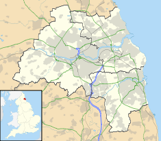

Country England Location Chopwell Coordinates 54°55′16″N 1°49′23″W / 54.921°N 1.823°WCoordinates: 54°55′16″N 1°49′23″W / 54.921°N 1.823°W Status Demolished Power station information Primary fuel Coal Chopwell Colliery was a coal mine situated at Chopwell, in Gateshead, Tyne and Wear. The pit was first sank in 1781, and was closed on 25 November 1966. The colliery was bought by the Consett Iron Company in 1896, before being handed over to the National Coal Board in 1947 when the British coal industry was nationalised. The colliery's highest employment numbers were in 1921 when 2,185 people worked there.[1]
A coal-fired power station was situated at the colliery, which as well as generating its own electricity, received surplus electricity from the generating equipment at Derwenthaugh Coke Works.[2]
References
- ^ "Chopwell Colliery". www.dmm.org.uk. http://www.dmm.org.uk/colliery/c004.htm. Retrieved 26 June 2011.
- ^ Simon, Siney A. (15 April 2009). "Modern coke works". Mining Electrical Engineer. http://fds.duke.edu/db/pratt/BME/faculty/sas/publications/64957. Retrieved 26 June 2011.
Electricity generation in North East England Generating
sitesActiveProposed/FutureActiveLynemouth · WiltonClosedBerwick upon Tweed · Blyth · Carville · Chopwell Colliery · Close · Consett · Darlington · Derwenthaugh Coke Works · Dunston · Forth Banks · Hebburn · Horden Colliery · Lemington · Mainsforth Colliery · Manors · Morrison Busty Colliery · Neptune Bank · Newburn Steelworks · North Tees · Ouston Colliery · Pandon Dene · Philadelphia · South Shore Road · South Shields · Stella · Sunderland · Vane Tempest Colliery · WhinfieldProposed/FutureEston Grange (Gasification)Refused/ShelvedBlyth Clean Coal · KepierActiveProposed/FutureConocoPhillips Teesside · Thor CogenerationRefusedNewburnActiveClosedActiveRefusedActiveWiltonActiveTeesside · Path Head landfillClosedFutureNorth Eastern Energy Recovery Centre · Wilton 11RefusedActiveBlyth Harbour · Blyth Offshore · Broom Hill · Great Eppleton · Hare Hill · High Sharpley · High Volts · Holmside Hall · Kirkheaton · Langley Park · Tow Law · Trimdon Grange · Walkway · West DurhamFutureBlyth Harbour (repowering) · Butterwick Moor · Great Eppleton (repowering) · Haswell Moor · Kiln Pit Hill · Lynemouth · Royal Oak · TeessideProposedBarmoor South · Green Rigg · Kielder · Moorsyde · Ray Hill · South Sharpley · Steadings · Teeswind North · The Isles · Todd Hill · West Ancroft · Wingates
Organisations
and personnelA. Reyrolle & Company · C. A. Parsons and Company · CE Electric UK · Charles Algernon Parsons · Charles Hesterman Merz · Clarke Chapman · John Theodore Merz · L J Couves & Partners · Merz & McLellan · NaREC · Newcastle and District Electric Lighting Company · North Eastern Electric Supply Company · Northern Electric · Northern Engineering Industries · Pre-nationalisation North East electric power companiesCategories:- Power stations in North East England
- Buildings and structures in Tyne and Wear
- Demolished power stations in the United Kingdom
- Coal mines in England

Wikimedia Foundation. 2010.