- St Mary's Church, Barton Bendish
-
St Mary's Church, Barton Bendish 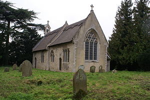
St Mary's Church, Barton Bendish, from the southeastLocation in Norfolk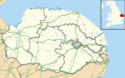
 St Mary's Church, Barton Bendish
Coordinates: 52°37′11″N 0°31′27″E / 52.6198°N 0.52423°E OS grid reference TF 709 054 Location Barton Bendish, Norfolk Country England Denomination Anglican Website Churches Conservation Trust Architecture Functional status Redundant Heritage designation Grade I Designated 8 July 1959 Architectural type Church Style Norman, Gothic Groundbreaking 14th century Specifications Materials Brick and stone
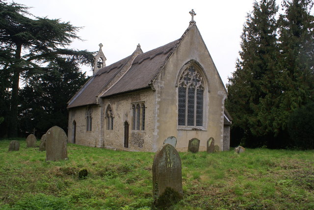
Roofs thatchedSt Mary's Church, Barton Bendish, is a redundant Anglican church in the village of Barton Bendish, Norfolk, England. It has been designated by English Heritage as a Grade I listed building,[1] and is under the care of the Churches Conservation Trust.[2] The architectural historian Nikolaus Pevsner was of the opinion that its west door is "one of the best Norman doorways in England".[2] The church stands in an isolated position to the west of the village.[3]
Contents
History
The church dates from the 14th century.[1] It formerly had a tower, but this fell in 1710.[2] The church was restored in 1788–89.[1] During this restoration a 12th-century doorway was moved into it from the nearby church of All Saints, which was being demolished.[2][4] There were further restorations in 1858 and 1871.[1]
Architecture
St Mary's is constructed in brick, rubble and carstone, parts of which have been rendered. The roofs are thatched. Its plan is simple, consisting of a nave and a chancel with a north vestry, and a bellcote at the west end. The west doorway dates from the middle of the 12th century. Above it is a two-light window dating from 1858. On the west gable is a bellcote of 1871. In the south wall of the nave is a doorway with a plain arch, and to its east is a two-light early 14th-century window. The south wall of the chancel contains a two-light window, a priest's door over which is a finial, and a three-light 19th-century square-headed window. The east window has three lights. On the north side of the chancel is a two-light window, and there is another two-light window in the north wall of the nave.[1]
Inside the church are box pews dating from 1789; these were cut down in size in 1865. On the south wall of the nave are the remains of a wall painting depicting Saint Catherine with her wheel.[1]
See also
- List of churches preserved by the Churches Conservation Trust in the East of England
References
- ^ a b c d e f "Church of St Mary, Barton Bendish", The National Heritage List for England (English Heritage), 2011, http://list.english-heritage.org.uk/resultsingle.aspx?uid=1077859, retrieved 11 May 2011
- ^ a b c d St Mary's Church, Barton Bendish, Norfolk, Churches Conservation Trust, http://www.visitchurches.org.uk/Ourchurches/Completelistofchurches/St-Marys-Church-Barton-Bendish-Norfolk/, retrieved 25 March 2011
- ^ Barton Bendish, Streetmap, http://www.streetmap.co.uk/map.srf?x=570950&y=305450&z=0&sv=TF709054&st=5&mapp=map.srf&searchp=ids.srf, retrieved 15 February 2011
- ^ Barton Bendish, St Mary's church, Britain Express, http://www.britainexpress.com/attractions.htm?attraction=4077, retrieved 15 February 2011
External links
Categories:- Grade I listed buildings in Norfolk
- Grade I listed churches
- Church of England churches in Norfolk
- Norman architecture
- English Gothic architecture
- Churches preserved by the Churches Conservation Trust
- 14th-century church buildings

Wikimedia Foundation. 2010.