- Church of St Margaret, Tintinhull
-
Church of St Margaret 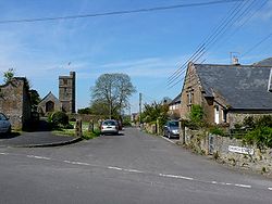 Church Street
Location: Tintinhull, Somerset, England Coordinates: 50°58′28″N 2°42′57″W / 50.97444°N 2.71583°WCoordinates: 50°58′28″N 2°42′57″W / 50.97444°N 2.71583°W Built: 13th century Listed Building – Grade I Designated: 19 April, 1961[1] Reference #: 426090 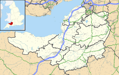
 Location of Church of St Margaret in Somerset
The Church of St Margaret in Tintinhull, Somerset, England dates from the 13th century and has been designated as a Grade I listed building.[1]
There was a chu8rch in the village during the 12th century which was replaced by the present building. It was associated with Montacute Priory,[2] as part of its foundation estate which was granted by William, Count of Mortain and remained linked to the Priory until the dissolution of the monasteries.[3]
The original building was remodelled with the addition of a chancel arch in the 14th century, with the perpendicular windows of the nave being added in the 15th.[3] The interior includes a 15th century octagonal font and an altar table and octagonal panelled timber pulpit from the 17th century.[1]
It has a four stage tower with the top stage, parapet and the north-east stair turret being added to the original 13th century work during 1516 and 1517.[3] The earlier three stage tower is in the Early English Period and supported by angle buttresses.[4] The tower has five bells.[3]
It has the old parsonage which is now called Tintinhull Court.[5]
The church is now part of the United Benefice of Tintinhull, Chilthorne Domer, Yeovil Marsh & Thorne Coffin, within the Diocese of Bath and Wells.[6]
See also
- List of Grade I listed buildings in South Somerset
- List of towers in Somerset
References
- ^ a b c "Church of St Margaret". Images of England. English Heritage. http://www.imagesofengland.org.uk/Details/Default.aspx?id=426090. Retrieved 2009-06-08.
- ^ "Our churches". United Benefice of Tintinhull, Chilthorne Domer, Yeovil Marsh & Thorne Coffin. http://fourcrosses.weebly.com/our-churches.html. Retrieved 29 August 2011.
- ^ a b c d Dunning, Robert; A. P. Baggs, R. J. E. Bush & Margaret Tomlinson. "Parishes: Tintinhull". A History of the County of Somerset: Volume 3 (1974), pp. 255-265. British History Online. http://www.british-history.ac.uk/report.aspx?compid=66505#s5. Retrieved 29 August 2011.
- ^ "Tintinhull — St Margaret: Towards a structural history" (PDF). Tintinhull Local History Group. http://www.tintinhull-localhistory.org.uk/pdfs/structural%20history%20St%20Margaret%27s.pdf. Retrieved 29 August 2011.
- ^ "Tintinhull Court". Images of England. http://www.imagesofengland.org.uk/Details/Default.aspx?id=426254. Retrieved 2008-03-17.
- ^ "Four Crosses". United Benefice of Tintinhull, Chilthorne Domer, Yeovil Marsh & Thorne Coffin. http://fourcrosses.weebly.com/. Retrieved 29 August 2011.
Categories:- Church of England churches in Somerset
- 13th-century architecture
- Grade I listed churches
- Grade I listed buildings in Somerset
- South Somerset


Wikimedia Foundation. 2010.