- Číčenice
-
Číčenice — Municipality — 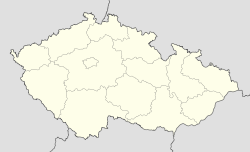
 Číčenice
Coordinates: 49°9′17″N 14°13′28″E / 49.15472°N 14.22444°ECoordinates: 49°9′17″N 14°13′28″E / 49.15472°N 14.22444°E Country  Czech Republic
Region South Bohemian District Strakonice Area – Total 11.97 km2 (4.6 sq mi) Elevation 484 m (1,588 ft) Population – Total 454 – Density 37.9/km2 (98.2/sq mi) Postal code 389 01 Website http://cicenice.cz Číčenice is a village and municipality (obec) in Strakonice District in the South Bohemian Region of the Czech Republic.
The municipality covers an area of 11.97 square kilometres (4.62 sq mi), and has a population of 454.
Číčenice lies approximately 27 kilometres (17 mi) south-east of Strakonice, 28 km (17 mi) north-west of České Budějovice, and 105 km (65 mi) south of Prague.
References
Towns, market towns and villages of Strakonice District Bavorov · Bělčice · Bezdědovice · Bílsko · Blatná · Bratronice · Březí · Budyně · Buzice · Cehnice · Čečelovice · Čejetice · Čepřovice · Čestice · Číčenice · Doubravice · Drahonice · Drachkov · Drážov · Droužetice · Dřešín · Hajany · Hájek · Hlupín · Horní Poříčí · Hornosín · Hoslovice · Hoštice · Chelčice · Chlum · Chobot · Chrášťovice · Jinín · Kadov · Kalenice · Katovice · Kladruby · Kocelovice · Krajníčko · Kraselov · Krašlovice · Krejnice · Krty-Hradec · Kuřimany · Kváskovice · Lažánky · Lažany · Libějovice · Libětice · Litochovice · Lnáře · Lom · Mačkov · Malenice · Mečichov · Měkynec · Milejovice · Miloňovice · Mnichov · Mutěnice · Myštice · Nebřehovice · Němčice · Němětice · Nihošovice · Nišovice · Nová Ves · Novosedly · Osek · Paračov · Pivkovice · Pohorovice · Pracejovice · Předmíř · Přední Zborovice · Předslavice · Přechovice · Přešťovice · Radějovice · Radomyšl · Radošovice · Rovná · Řepice · Sedlice · Skály · Skočice · Slaník · Sousedovice · Stožice · Strakonice · Strašice · Strunkovice nad Volyňkou · Střelské Hoštice · Škvořetice · Štěchovice · Štěkeň · Tchořovice · Truskovice · Třebohostice · Třešovice · Úlehle · Únice · Uzenice · Uzeničky · Vacovice · Velká Turná · Vodňany · Volenice · Volyně · Záboří · Zahorčice · Zvotoky
This South Bohemian Region location article is a stub. You can help Wikipedia by expanding it.
