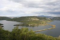
Čikola — ist ein 47,8 km[1] langer Fluss in der Dalmatinska Zagora (dalmatinisches Hinterland) in Kroatien. Die Quelle befindet sich etwas oberhalb des Dorfes Čavoglave, fließt durch Drniš und mündet beim Skradinski Buk in den Fluss Krka. Im Sommer… … Deutsch Wikipedia
Dalmatinisches Hinterland — Die Dalmatinska Zagora oder auch einfach Zagora ( Dalmatinisches Hinterland ) ist eine submediterrane Binnenlandschaft im Hinterland von Dalmatien (Kroatien). Sie wird durch die Gebirge Mosor und Biokovo vom Meer getrennt und bietet deshalb ein… … Deutsch Wikipedia
Dalmatinska zagora — Die Dalmatinska Zagora oder auch einfach Zagora ( Dalmatinisches Hinterland ) ist eine submediterrane Binnenlandschaft im Hinterland von Dalmatien (Kroatien). Sie wird durch die Gebirge Mosor und Biokovo vom Meer getrennt und bietet deshalb ein… … Deutsch Wikipedia
Aires protégées de Croatie — En 2007, les aires protégées de Croatie couvraient au total 5 320,6 km2, soit 6,07 % du territoire national. Le pays comptait 8 parcs nationaux, 11 parcs naturels, et, en tout, 447 sites naturels protégés[1]. De plus quatre sites… … Wikipédia en Français
List of rivers of Europe — These are the main rivers of Europe (ecologically, the extreme west of the Palearctic ecozone which includes Russia in the east). See each article for their tributaries, drainage areas, etc.The longest rivers of Europe are: *Volga (3,692 km/2,294 … Wikipedia
Neretva — River Picture taken from train between Jablanica and Mostar (Neretva valley) … Wikipedia
Miljevci plateau incident — A Croatian infantryman poses in front of a road sign in Širitovci, June 21, 1992 … Wikipedia
Leuciscus turskyi — Taxobox name = Leuciscus turskyi status = CR | status system = IUCN3.1 trend = unknown regnum = Animalia phylum = Chordata classis = Actinopterygii ordo = Cypriniformes familia = Cyprinidae genus = Leuciscus species = L. turskyi binomial =… … Wikipedia
Zagora (Croatia) — Zagora (pronounced [zâgɔra]), sometimes also called Dalmatian Zagora (Croatian: Dalmatinska Zagora), is the southern inland region of Croatia. The name Zagora means behind hills , which is a reference to the fact that it is the part of… … Wikipedia
Kričke — is a village in Dalmatia, near Drniš, Croatia. The village is situated 3 km southest from Drniš, in Petrovo polje field, beneath Moseć mountain. It is 5 km long in direction NW SE. Kričke has a shape of line in the contact of field and mountain.… … Wikipedia