- City Heights, San Diego
-
City Heights — Community of San Diego — Location within Central San Diego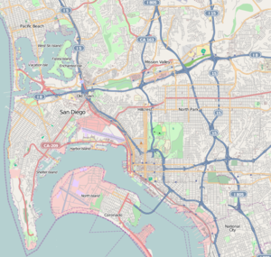
 City Heights
Coordinates: 32°44′N 117°06′W / 32.74°N 117.10°W Country United States State California County County of San Diego City City of San Diego Population (2005) - Total 65,450 City Heights is a large community in the eastern part of San Diego, California, known for its ethnic diversity.[1] Along the main streets (which include University Avenue, El Cajon Boulevard and Fairmount Avenue) one can find Hispanic, White American, East African, African American, Indian, Middle Eastern, and Southeast Asian businesses. City Heights was previously the city of East San Diego.
Socially and economically, City Heights has a high concentration of lower income businesses and households, resulting from the newly arrived immigrant communities. Businesses tend to be smaller and wider spread than to the north and east. Like other urban mesa neighborhoods north of Balboa Park, City Heights has a high rate of pedestrian activity, relative to the rest of San Diego. Crime rates were quite high until the recent renaissance, which ushered in one of the highest concentrations of police presence in the city.
Contents
History
A short history of the City Heights neighborhood can be found on the City Heights Business Association website.[2]
In the 1880s, Entrepreneurs Abraham Klauber and Samuel Steiner purchased over 240 acres (0.97 km2) of unincorporated land that sat 400 feet (120 m) above sea level northeast of Balboa Park in hopes of developing the area. Together they named it "City Heights" or the "Steiner, Klauber, Choate and Castle Addition" after the original developers of the property.[3] With the opening of the Panama Canal and the planned Panama-California International Exposition in 1915, the voters of the area voted for City Heights to become an incorporated city known as East San Diego on November 2, 1912. Population boomed in the next few years from 400 in 1910 to 4000 during the incorporation.
On December 31, 1923, the City of East San Diego ceased to exist and was annexed into the City of San Diego. The status of the city was in limbo throughout the early part of 1924, since the East San Diego trustees did not immediately recognize the annexation. Complete annexation occurred over the next few years with the City of San Diego taking over, improving or adding new services into the City Heights area.
During most of the 1930s, 1940s, and the 1950s the area was an important commercial center. In 1959 the neighborhood began to experience a decline as Fashion Valley, Mission Valley and the College Grove Shopping Center siphoned off merchants and customers from the University Avenue and El Cajon Boulevard corridor.
In 1965 the San Diego City Council approved the Mid-City Plan. The plan proposed to densify City Heights and surrounding areas, as a means of increasing business and commerce. The plan resulted in many single-family homes being replaced with multi-family apartments. The 1970s and 1980s saw an increase in crime with the arrival of the illegal drug industry, mainly methamphetamine. White flight started taking place and intensified into the early 1990s.
In 1993, three teen boys were killed in a gang-related fight at Hoover High School. The community reacted and spurred efforts to reduce crime in the neighborhood. The City Heights Business Improvement Association erected billboards that declared Welcome to City Heights, San Diego's Crime Capital. Won't Anybody Help? to gain city officials' attention.
In November 1993, the city of San Diego proposed to build a new police station to address the rising crime rate. However, the city was strapped for cash and did not have funds readily available. Entrepreneur and philanthropist Sol Price pledged money for redevelopment efforts in concert with the city and his for-profit redevelopment corporation. The city and Sol Price's redevelopment corporation opened the new police substation in 1996. Sol Price collaborated with SDSU to help students in City Heights attend college providing them with scholarships and supports.
The 2000s have seen redevelopment efforts continue and new public facilities have opened. New services are being provided to residents of City Heights including schools, a library and a community center. Crime rates are also down and a new urban retail village is serving the community.
Geography
City Heights is large and diffuse, with many subneighborhoods. The neighborhood is divided into two pieces by Fairmount Avenue: City Heights East and City Heights West. The neighborhood is bounded by Interstate 805 to the West, El Cajon Boulevard to the north, 54th Street to the east, and Home Avenue/Euclid Avenue/Chollas Parkway to the southeast.
"Downtown" City Heights is generally regarded as around Fairmount and University Avenues.
The neighborhood is further divided into sixteen sub-neighborhoods: Teralta East, Teralta West, Corridor, Cherokee Point, Colina Park, Castle, Fairmount Village, Fox Canyon, Islenair, Chollas Creek, Swan Canyon, Azalea Park, Hollywood Park, Fairmount Park, Ridgeview, and Bayridge.
Demographics
Population stands at 65,450 as of 2005. Median household income is $19,393. Median family size 5. Racial makeup is approximately 65% Hispanic, 14% Asian, 19% African-American, 2% White Non-Hispanic . Median age is approximately 23 years old.[citation needed]
Renaissance
As with other older neighborhoods found just north of Downtown San Diego and Balboa Park, City Heights is currently enjoying a renaissance.
In an effort to reverse the high crime rate and the depressed economy, the community has undergone some redevelopments. The local projects are a major focus of the Smart Growth strategy by the City of San Diego, which is funded in part by private organizations and philanthropic individuals, notably Sol Price (founder of Fedmart and Price Club).
These projects concentrate primarily on education, crime and gang-related activity reduction, economic improvements, smart urban growth, renewal of community pride and improvement of overall quality of life, while at the same time enhance the "melting-pot" identity for which City Heights is known.
Recent projects that have been completed include the very first alternative fuel station in the city, a new retail complex with some mixed-use developments, several newly expanded and improved basic schools, a new "urban village" with a new library, a new police headquarter and a gymnasium, as well as a number of innovative uses of open spaces as parks.
A significant addition to the neighborhood is City Heights Square Senior Housing Project on 43rd Street.[4] Completed in 2008 with subsidies provided by the Redevelopment Agency Affordable Housing Program,[5] the project provides critically needed affordable housing for seniors. This very successful project is marred however by a burgeoning and very noisy homeless camp directly next to the building. Persistent calls by residents to the police have been unsuccessful in having anything done about the continuous disturbance caused by these unfortunate homeless people.
Twice a year FaceLife chooses a Neighborhood in City Heights and closes off the streets and renovates 12 - 15 homes by painting, landscaping, and cleaning up the surrounding area in a one day event. FaceLift is a program of Community HousingWorks a non-profit organization connected with NeighborWorks America.
Project CLEAN is another program with Community HousingWorks that provides graffiti supplies and clean-up organization to any resident that would like to get involved in making their community a better place to live.
As a result of the improvements, population in the neighborhood has been on the increase, reversing the trend of urban flight for those who could afford to move just a few years prior. Indeed, the redevelopment is now starting to focus on controlling growth.
A few trendy bars and clubs have started to move into the neighborhood; some would argue that gentrification is happening along with redevelopment. This most evident in Normal Heights and Kensington which is not actually a part of City Heights, but borders.
Arts, culture, businesses and cuisine
Due to the large immigrant population of City Heights, a vast array of ethnic restaurants can be found in the community. Most are located along the main arteries of University Avenue, El Cajon Boulevard and Fairmount Avenue.
The annual International Village Celebration is held around late spring or early summer and is aimed at highlighting the community's diversity.
City Heights is home to types of cuisine from all corners of the world, including Vietnamese, Korean, African, and Mexican. There are also a few Ethiopian restaurants in City Heights, although there are almost none elsewhere in San Diego. City Heights also has a Jamba Juice, Subway, Albertson's, a drive-thru Starbucks, many car repair shops, and Pet Zone, a local pet shop/tropical fish store.[6] Quite a few pubs and bars such as The Tower Bar, Til-Two Club, Last Call & Black Cat Bar cater to those into the nightlife.
Transportation
City Heights is a walkable neighborhood with many of the restaurants, businesses and shops near the main residential pockets. It is common to see pedestrians, cyclists and scooters throughout the neighborhood and surrounding communities. Centrally located within San Diego, City Heights has easy access to freeways, Mission Valley commercial centers and the downtown area. University Avenue, El Cajon Boulevard and Fairmount Avenue are the major thoroughfares.
Because of the presence of the University Avenue transit corridor (the busiest in the metro region), City Heights has substantial bus service connecting to Downtown as well as to the Mission Valley trolley stops.
Education
City Heights is home to twelve public elementary schools, three public middle schools, two public high schools, and two private grade schools, and one charter school.
Charter school
- Health Science High & Middle College (HSHMC)
- City Heights Prep Academy
Private grade schools
- Waldorf School of San Diego[7]
- Our Lady of the Sacred Heart School (OLSH)
Public elementary schools
- Cherokee Point (San Diego Unified School District)
- Hamilton (San Diego Unified School District)
- Euclid (San Diego Unified School District)
- Marshall (San Diego Unified School District)
- Edison (San Diego Unified School District)
- Central (San Diego Unified School District)
- Florence Griffith Joyner (San Diego Unified School District)
- Herbert Ibarra (San Diego Unified School District)
- Mary Lanyon Fay (San Diego Unified School District)
- Wilson (San Diego Unified School District)
- Rowan (San Diego Unified School District)
- Rosa Parks (San Diego Unified School District)
Public middle schools
- Clark (Monroe) (San Diego Unified School District)
- Wilson (San Diego Unified School District)
- Mann (San Diego Unified School District)
Public high schools
Both in San Diego Unified School District
- Hoover High School
- Crawford Educational Complex (former Will C. Crawford High School)
- Community Health and Medical Practices School (CHAMPS)
- Invention and Design Educational Academy (IDEA)
- School of Law and Business (LAB)
- Multimedia and Visual Arts School (MVAS)
References
- ^ San Diego Neighborhood Profile: City Heights, About.com San Diego, January 20, 2011
- ^ "A Short History of City Heights"
- ^ PIONEER SPIRIT: The Klauber Wangenheim Company, The Journal of San Diego History, Winter 1983
- ^ City Redevelopment Agency Supports City Heights Mixed-Use Projects, January 10, 2007
- ^ City Heights Redevelopment Project Area
- ^ "Pet Zone Tropical Fish - San Diego, California". Petzonesd.com. http://www.PetZoneSD.com. Retrieved 2010-07-26.
- ^ "The Waldorf School of San Diego | Waldorf School of San Diego | San Diego, CA". Waldorf School of San Diego. http://waldorfschoolofsandiego.com/. Retrieved 2010-07-26.
External links
Coordinates: 32°44′N 117°06′W / 32.74°N 117.10°W
Neighborhoods of San Diego Northern Bay Ho · Bay Park · Carmel Valley · Clairemont · Del Mar Heights · Del Mar Mesa · La Jolla · La Jolla Village · Mission Beach · North City · Pacific Beach · Pacific Highlands Ranch · Torrey Hills · Torrey Pines · University City · Village of La JollaNortheastern Black Mountain Ranch · Carmel Mountain Ranch · Mira Mesa · Miramar · Rancho Bernardo · Rancho Encantada · Rancho Peñasquitos · Sabre Springs · San Pasqual Valley · Scripps Ranch · Sorrento Valley · Sorrento Mesa · Torrey HighlandsEastern Birdland · Kearny Mesa · Mission Valley East · Navajo (Allied Gardens · Del Cerro · Grantville · San Carlos) · Serra Mesa · TierrasantaWestern Burlingame · Hillcrest · Linda Vista · Midtown · Mission Hills · Mission Valley West · Morena · North Park · Ocean Beach · Old Town · Point Loma (La Playa · Liberty Station · Loma Portal · Midway · Point Loma Heights · Roseville-Fleetridge · Sunset Cliffs · Wooded Area) · University HeightsCentral Downtown (Columbia · Core · Cortez Hill · East Village · Gaslamp Quarter · Harborview · Little Italy · Marina) · Balboa Park · Bankers Hill · Barrio Logan · Golden Hill · Grant Hill · Logan Heights · Middletown · Sherman Heights · South Park · StocktonMid-City Adams North · Azalea/Hollywood Park · Castle · Cherokee Point · Chollas Creek · City Heights · Colina del Sol · College Area · Corridor · Darnall · El Cerrito · Fairmont Park · Fox Canyon · Gateway · Islenair · Kensington · Normal Heights · Oak Park · Ridgeview · Redwood Village · Rolando · Swan Canyon · Talmadge · Teralta · WebsterSoutheastern Alta Vista · Bay Terraces · Broadway Heights · Chollas View · Emerald Hills · Encanto · Jamacha-Lomita · Lincoln Park · Mountain View · Mount Hope · Paradise Hills · Shelltown · Skyline · Southcrest · Valencia ParkSouthern Border · Egger Highlands · Nestor · Ocean View Hills · Otay Mesa · Otay Mesa West · Palm City · San Ysidro · Tijuana River ValleyCategories:- Neighborhoods in San Diego, California
- Urban communities in San Diego, California

Wikimedia Foundation. 2010.