- City Loop
-
City Loop railway line, Melbourne 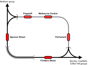
Line details Commenced 1971 Completed 1981 Stations 5 Tracks 2 single bidirectional tunnels Flinders Street – Parliament
4 single bidirectional tunnels Parliament – Flagstaff
3 single bidirectional tunnels Flagstaff – Southern Cross
6 Southern Cross – Flinders StreetUsed by Metro Trains Melbourne Rolling stock Hitachi, Comeng, X'Trapolis, Siemens Connections All suburban lines Railways in Melbourne List of stations
Freight railways
Closed railways
Proposed railwaysThe City Loop (properly called the Melbourne Underground Rail Loop or MURL) is a mostly-underground, partly surface-level and partly elevated railway around the central business district of Melbourne, Victoria, Australia.
The loop includes the city's two largest (both above-ground) stations: Flinders Street and Southern Cross (formerly Spencer Street); and three underground stations: Flagstaff, Melbourne Central (formerly Museum) and Parliament.
Melbourne's 16 radial suburban railway lines feed into the Loop at its northwestern and southeastern corners. The underground section of the Loop follows La Trobe and Spring Streets along the northern and eastern edges of the CBD's street grid.
Contents
History
Problems and solutions
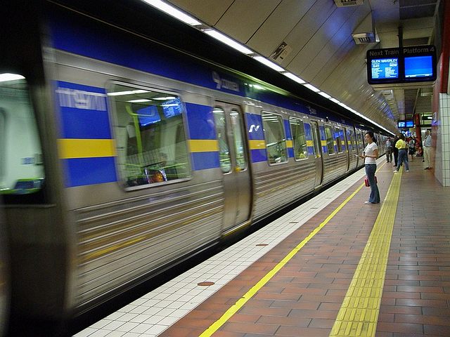
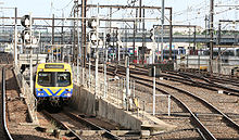 Comeng train exiting the Caulfield Group tunnel at Southern Cross
Prior to the construction of the Loop, Flinders Street and Spencer Street (now called Southern Cross) stations were connected only by the four track Flinders Street Viaduct beside the Yarra River. The suburban terminus of Flinders Street had become seriously congested by the 1970s, with a throughput of only ten trains per platform per hour (roughly 1,700 trains a day) — compared to a maximum of 24 if there was through running.[1] Many trains were through routed from the southern and eastern suburbs through to the north and west, but the flow was imbalanced and a number of trains were required to reverse direction.[1] The Epping and Hurstbridge lines stood alone from the rest of the network, having Princes Bridge station for their own exclusive use.
Several plans had been proposed over the preceding decades to alleviate the bottleneck. The one that was adopted was the building of a circular railway allowing trains to continue past Flinders Street, turn around and return to the suburbs. It was expected to boost platform capacity, allowing more trains per platform per hour on the same number of Flinders Street platforms. The loop would also bring train commuters directly into the northern and eastern sections of the CBD, delivering workers closer to their offices, students closer to RMIT University, and government officials directly to the Parliament buildings. Although the city's tram network already covered the CBD extensively, trams are not as efficient as trains when bringing large numbers of commuters into the city.
Planning
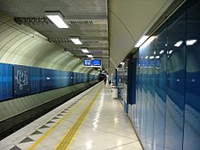 Parliament Station platform
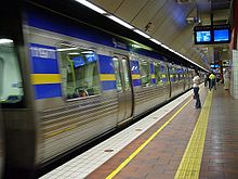 Melbourne Central Station platform
Plans for an underground city railway in Melbourne are almost as old as electrification of the network itself. In 1929, the Metropolitan Town Planning Commission released a report recommending an underground city bypass from Richmond to North Melbourne stations via Exhibition and Victoria streets.[2] The 1940 Victorian Railways Ashworth Improvement Plan recommended a different approach, with additional platforms at the Flinders Street/Princes Bridge station complex to be built over two levels, along with a connection to an underground City Railway.[3] The Victorian Railways promoted another route in 1950 as part of the Operation Phoenix rehabilitation plan, the line running from Richmond towards Jolimont station, under the Fitzroy Gardens and Lonsdale Street then turning north to North Melbourne station. A branch line turned north from William Street, and went through the Flagstaff Gardens.[4] In 1954 the Melbourne and Metropolitan Board of Works released their Planning Scheme for Melbourne report, which included the Richmond - North Melbourne Lonsdale Street route.[2]
A Parliamentary Committee on Public Works reported favourably on a city loop in 1954, and in 1958 a City Underground Railway Committee was appointed by the Transport Minister. It stated bluntly that the aim of the loop was not to just to relieve crowding at Flinders Street, but to win back patronage from private cars, and if it did not then the project was a waste of time and resources.[5] The plan included four stations, being cut to the present three by the elimination of one under Latrobe Street.[1]
The 'City of Melbourne Underground Railway Construction Act' was passed in 1960, and test bores were sunk by the Mines Department in 1961, but no funding was provided. Throughout the next few years many proposals were made for providing more car parking in the city, so in 1963 the Government set up the Metropolitan Transportation Committee to look at both road and rail transport. It released a report in 1965 that included the same rail plan as the 1960 Act.[6]
Construction
 Melbourne Underground Rail Loop Authority logo
Following the 1969 Melbourne Transportation Plan, the Melbourne Underground Rail Loop Act 1970 was brought forward by Transport Minister Vernon Wilcox, with the Melbourne Underground Rail Loop Authority (MURLA) created in 1 January 1971 to oversee the construction and operation of the Loop. The City of Melbourne, the Melbourne and Metropolitan Board of Works and the Victorian Railways all made annual contributions to support the operating costs of the authority.[6] Requests were made to the Federal Government for funding but no assistance was given.[1]
Funding of the project was though debentures, with the State Government paying 60% of the cost, while a special city levy from 1963 was to fund the remainder. The levy was to last for 53 years, but was ended in 1995.[6] A consortium of four engineering companies was established to construct the project: one from Australia, one from the United Kingdom, one from Canada and one from the United States of America. The first sod was turned in the middle of Jolimont Yard on 22 June 1971 by then Transport Minister Vernon Wilcox.[7]
Tunnelling works under the city streets commenced in June 1972, using a tunnel boring machine and conventional boring methods. At North Melbourne, Spencer Street and Jolimont Yard, cut and cover tunnelling was used to build the access ramps, with the above ground running lines being slewed from time to time as work proceeded. The first completed tunnel was the Burnley Loop, with the final breakthrough made on 8 June 1977 near the Museum station site.[7]
The Loop comprises four single-track tunnels on two levels, and the use of four pre-existing elevated tracks between Flinders Street and Spencer Street stations. A new double track concrete viaduct was erected beside the existing quadruple track Flinders Street Viaduct in order to replace capacity for non-loop trains. Construction began in 1975 and was completed in 1978.[7] Of the three new stations, Museum was built using the cut and cover method in a 26 metre deep box,[7] while Flagstaff and Parliament were excavated using mining methods. During the excavation of Museum station, La Trobe Street and its tram tracks were temporarily relocated from December 1973 to the south onto the site of what is now the Melbourne Central Shopping Centre, and was moved back in 1978.[7]
The traction power was turned on in October 1980,[8] and the first test train ran on December 4, 1980.[9]
Opening
The Loop was opened gradually between 1981 and 1985. Museum station and the Burnley and Caulfield tunnels opened first, on 24 January 1981.[8] The City Circle tunnel opened with special services on 6 December 1981: Clifton Hill services started using the Loop on 31 October 1982. Parliament station opened on 22 January 1983 , the Northern tunnel on 7 January 1985 (14 January 1985 with limited services) and Flagstaff station on 27 May 1985.[8]
Queen Elizabeth II toured Museum station during her 1981 tour of Australia. Two short documentary films, Loop and Action Loop, were commissioned by the MURLA to advertise the new railway to Melburnians, as well as abroad. (These videos can be downloaded from the Department of Infrastructure). A third film was planned, but never shot.[8]
Achievements
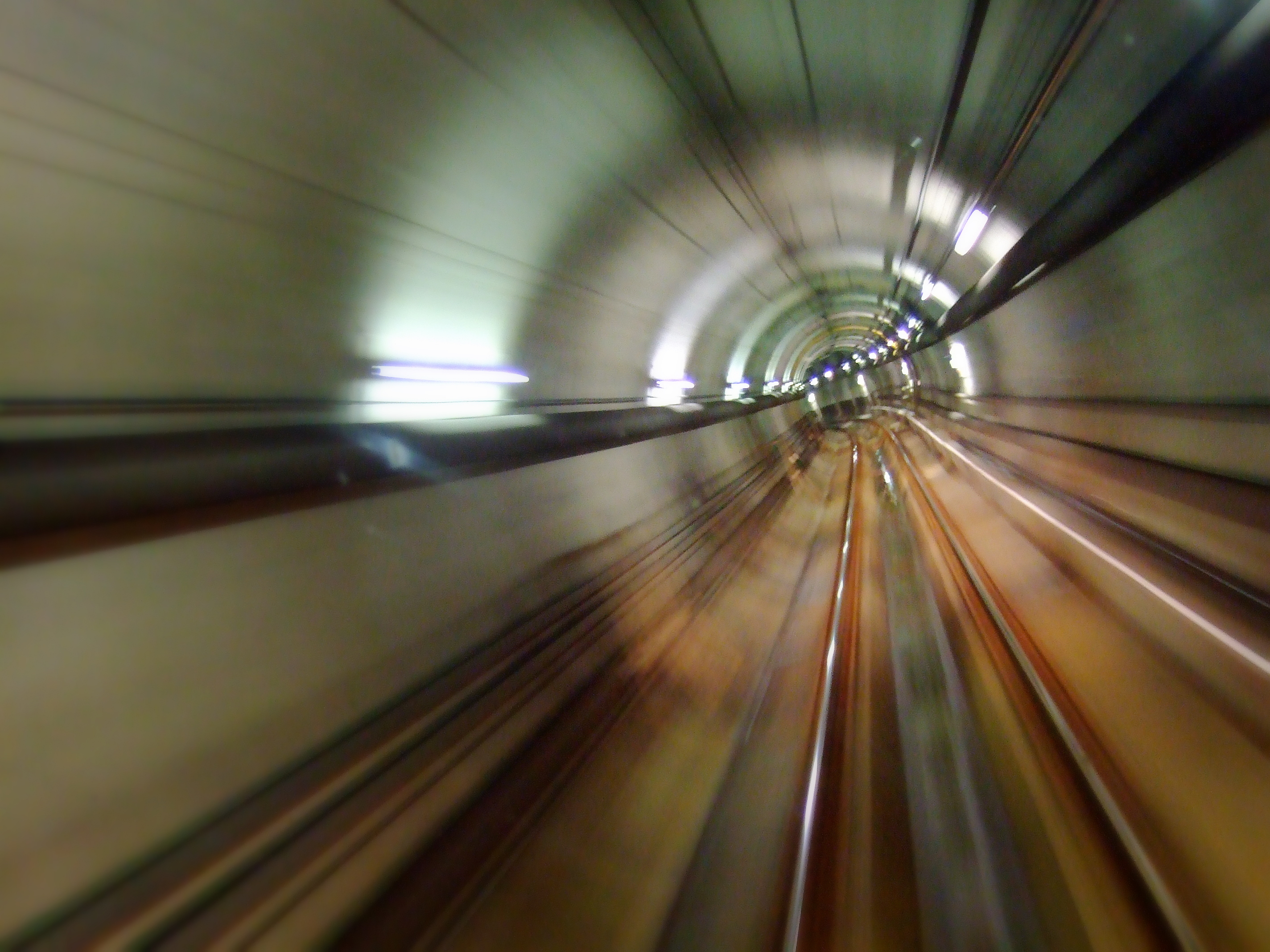
 Inside a section of bored tunnel
The total length of tunnels in the Loop is 12 km (7.5 mi) and 10 km (6.2 mi) of circular tunnels, and 2 km (1.2 mi) of box tunnels. The four tunnels have an average length of 3.74 km (2.32 mi), with a further kilometre of track connecting with surface tracks. Some 900,000 m3 (1,200,000 cu yd) of earth was removed and 300,000 m3 (390,000 cu yd) of concrete poured to form the stations and line the tunnel walls. 30,000 tonnes (33,000 short tons) of steel reinforcement were used, with another 10,000 tonnes (11,000 short tons) used temporarily during construction.
The General Manager and Chief Engineer of MURLA, Frank Watson liaised closely with the engineers working on Sydney's Eastern Suburbs Railway and was struck by their 'degree of unpreparednesses' and sought to improve on the contemporary project. The 'double sleeper' floating track system used solved the problem of ground transmitted vibration and track noise, and the loop has some of the best designed and quietest underground stations in the world.[6] At the time of construction Parliament station had the Southern Hemisphere's longest escalators.[10]
In 1965 the cost of the project had been estimated at between £30 and £35 million, by 1975 high inflation had resulted in it rising to $255,600,000.[6] The final cost was $500 million and resulted in reversing a 30 year trend of falling suburban rail patronage.[10]
Future expansion
The Victorian Government has intimated that the Loop could be expanded with the addition of a further two tunnels on a third level. The Loop (and particular tunnels especially) is slowly approaching capacity, but any extension would not occur for at least 20 to 30 years at current service levels. Other more nebulous schemes have been suggested that would see a new linear railway running under the city centre from north to south, following the line of Swanston Street. The north-south plan has been suggested by Sir Rod Eddington, In his report that examines possible options to relieve the pressure on Melbourne's rail network. A third level to the loop is not believed to be under consideration, and is not suggested by his report. The north-south tunnel forms part of the future Melbourne Metro, announced by the State Government as part of the Victorian Transport Plan.
Suggestions have been made to include Melbourne University, with adjacent Royal Melbourne Hospital, Royal Women's Hospital and nearby Royal Children's Hospital, on the Loop. This proposal was considered at the time of Loop construction, but was ruled out for cost reasons. With the increase in passenger numbers since then, the trams currently servicing this area suffer severe overcrowding at peak times and the call for a Loop expansion has been raised again.[11] The Victorian State Government announced in December 2008, as part of the Victorian Transport Plan, that it would commence planning for a new underground rail tunnel linking suburban lines from the north western suburbs to the south east, with new stations at Melbourne University and the Kings Domain (St Kilda Road), an interchanges with the existing city loop and other suburban routes at Melbourne Central and Flinders Street.
Services and direction of travel
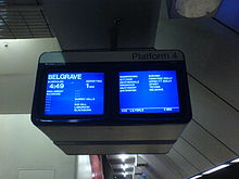 Next train display at Melbourne Central
All suburban trains serve Flinders Street, some having travelled through the Loop first, some travelling directly to Flinders Street then through the Loop, and a small number reversing at Flinders Street (as many trains did before the Loop was built). At midday most services reverse direction through the loop. The reversal of the loop gives some passengers the best possible route into and out of the city, but at the same time gives other passengers the worst route twice a day.[6] This reversal is likely unique to Melbourne and is criticised for catering primarily to CBD work commuters, whilst causing confusion for irregular or off-peak passengers.[12]
Until 1993, a 'City Circle' service operated continuously around the Loop to provide cross-CBD travel, and was replaced by the much slower City Circle Tram in 1994.[8] As a result depending on the time of day, direction, and stations chosen; when travelling between adjacent stations by train a change at the third station may be required. In 1997, regular Sunday services though the loop were introduced, as before this time they only stopped at Melbourne Central until 6.45pm. In 2000, Sunday services were expanded to the last train.[8] The direction of travel changes in each tunnel according to the time of day and day of week, as shown in the table below. Each suburban line belongs to one of four groups, each group running through one tunnel. The direction change occurs between approximately 12.30 and 1.00 pm, during which time no trains run through the Loop.
In November 2008, the Clifton Hill group was altered to run clockwise all day during weekdays, to avoid the flat junction at Jolimont and permit increased service frequency.[13] The Werribee line service was also removed from the Northern Loop tunnel during peak hour, instead running direct to Flinders Street. In June 2010, many services from Frankston to the city were also altered, and now do not travel through the city loop.
Burnley group Caulfield group Clifton Hill group
/ City CircleNorthern group Weekday mornings All loop trains except Clifton Hill group run via the Loop to Flinders Street Anti-clockwise Anti-clockwise Clockwise Clockwise Weekday afternoons All loop trains run via the Loop after departing Flinders Street Clockwise Clockwise Clockwise Anti-clockwise Weekends All loop trains except Caulfield and Clifton Hill group trains run via the Loop after departing Flinders Street Clockwise Anti-clockwise Anti-Clockwise Anti-clockwise Line guide
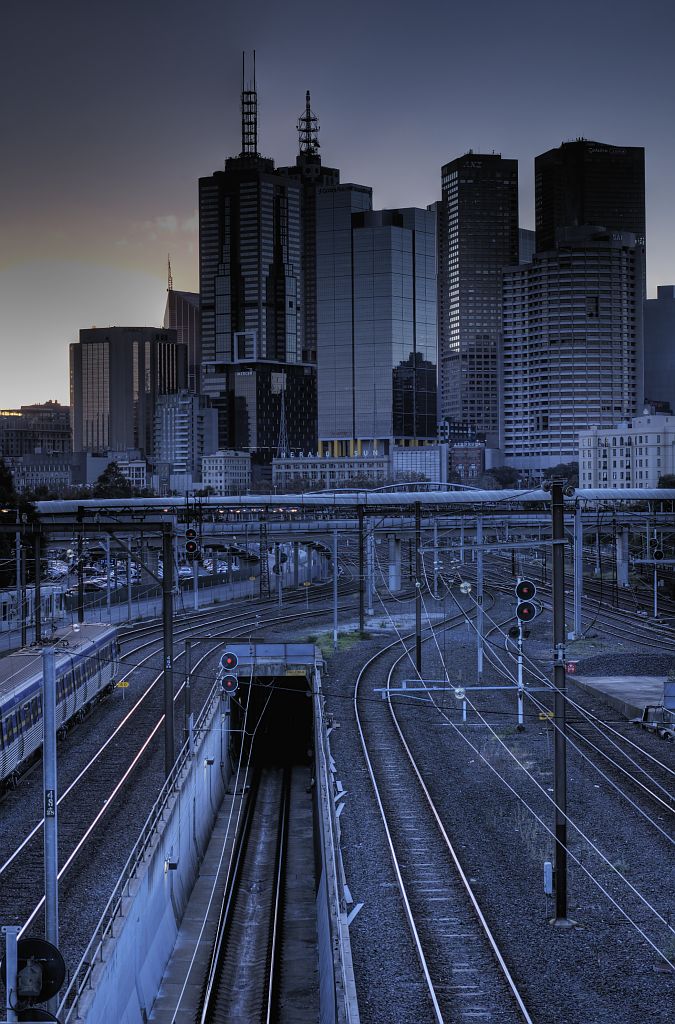
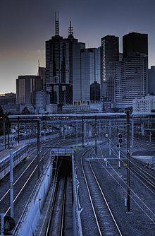 City Loop exit towards Richmond, in the former Jolimont Yards.
Bold stations are termini, where some train services terminate; italic stations are staffed.
Connects to all suburban lines in Melbourne from Flinders Street.
City Loop railway line Legend

Northern group 


2.6 km Flagstaff (FGS) Zone 1 

1.2 km Southern Cross (SSS) Zone 1 

2.4 km Melbourne Central (MCE) Zone 1 0.0 km Flinders Street (FSS) Zone 1 

1.2 km Parliament (PAR) Zone 1 Burnley, Caulfield, Clifton Hill groups Layout
The layout of the City Loop is effectively four balloon loops which operate one way during the morning and the other way in the afternoon.
References
- ^ a b c d S.E. Dornan and R.G. Henderson (1979). Electric Railways of Victoria. Australian Electric Traction Society. p. 92. ISBN 0 909459 06 1.
- ^ a b C L Fouvy. "The Melbourne Region's Opportunity and need for Rapid Transit". Railway Technical Society of Australasia. http://rtsa.com.au/assets/2008/03/rapid-transit-by-l-fouvy.pdf. Retrieved 2008-07-20.
- ^ S.E. Dornan and R.G. Henderson (1979). Electric Railways of Victoria. Australian Electric Traction Society. p. 32. ISBN 0 909459 06 1.
- ^ Public Relations and Betterment Board (1950). Operation Phoenix. Victorian Railway Commissioners. (VR publicity brochure)
- ^ Lee, Robert (2007). The Railways of Victoria 1854-2004. Melbourne University Publishing Ltd. p. 190. ISBN 9780522851342.
- ^ a b c d e f Lee, Robert (2007). T rahe Railways of Victoria 1854-2004. Melbourne University Publishing Ltd. p. 191. ISBN 9780522851342.
- ^ a b c d e S.E. Dornan and R.G. Henderson (1979). Electric Railways of Victoria. Australian Electric Traction Society. p. 93. ISBN 0 909459 06 1.
- ^ a b c d e f Department of Infrastructure. "Public transport - City Loop history". www.doi.vic.gov.au. http://www.doi.vic.gov.au/Doi/Internet/transport.nsf/AllDocs/74164766E0CEAF95CA25700500122952?OpenDocument. Retrieved 2008-07-20.
- ^ Vincent Adams Winter (1990). VR and VicRail: 1962 - 1983. p. 206. ISBN 0 9582069 3 3.
- ^ a b Metropolitan Transport Authority. "MURL Booklet". www.doi.vic.gov.au. http://www.doi.vic.gov.au/doi/doielect.nsf/2a6bd98dee287482ca256915001cff0c/44507f9d12a4406cca25700c0012fe36/$FILE/MURL%20booklet.pdf. Retrieved 2008-07-20.
- ^ The Age: Call for 'tube' line underneath Melbourne - November 7, 2005
- ^ Mees, Paul (2000). A Very Public Solution: Transport in the Dispersed City. Melbourne University Press p. 237. ISBN 0522848672.
- ^ Train timetable changes – first stage effective 27 April 2008 - Metlink - Your guide to public transport in Melbourne and Victoria
External links
- Metlink - official website of Melbourne's public transport
- Zen and the City Loop (a more detailed explanation of the five train direction configurations)
- Department of Infrastructure - City Loop history and photo page
- Publicity leaflets circa 1970
Railway Lines in Victoria Main lines
Bendigo Line · Mildura line · North East Line · (Melbourne-Sydney) · Orbost Line · Port Fairy Line · Portland line · Serviceton Line · South Gippsland Line · Tocumwal line · Western SG line (Melbourne-Adelaide)Branch linesAlexandra line · Alvie line · Balranald line · Bolangum line · Briagolong line · Bright line · Buninyong line · Carpolac line · Casterton line · Cobram line · Cohuna line · Coleraine line · Cudgewa line · Daylesford line · Deniliquin line · Forrest line · Grampians line · Heathcote line · Kulwin line · Lancefield line · Maffra line · Mansfield line · Mortlake line · Mirboo North line · Navarre line · Noojee line · Oaklands line · Outtrim line · Patchewollock line · Peechelba East line · Picola line · Portland line · Redesdale line · Red Hill line · Robinvale line · Skipton line · Strzelecki line · Stony Crossing line · Tatong line · Thorpdale line · Timboon line · Wahgunyah line · Waubra line · Wedderburn line · Wonthaggi line · Woodside line · Yackandandah line · Yanac line · Yaapeet line ·
Cross Country linesAvoca line · Geelong-Ballarat line · Eaglehawk–Inglewood line · Moolort Line · Toolamba–Echuca line
V/Line servicesGeelong Line · Warrnambool Line · Ballarat Line · Maryborough Line · Ararat Line · Bendigo Line · Swan Hill Line · Echuca Line · Seymour Line · Shepparton Line · Albury-Wodonga Line · Traralgon Line · Bairnsdale Line
Melbourne suburban servicesCity Loop · Werribee line · Williamstown line · Sydenham line · Craigieburn line · Flemington Racecourse line · Upfield line · Epping line · Hurstbridge line · Lilydale line · Belgrave line · Alamein line · Glen Waverley line · Pakenham line · Cranbourne line · Frankston line · Stony Point line (unelectrified) · Sandringham line
Inner Circle line · Outer Circle line · Rosstown Railway · St Kilda - Windsor line · Spring Vale Cemetery line · Mont Park line · Kew line · Red Hill line · Whittlesea line · Warburton line · Mornington line · Healesville line · St Kilda line · Port Melbourne line Tourist railwaysNarrow gauge branch linesWhitfield line · Gembrook line · Crowes line · Walhalla line
Melbourne goods linesNewport-Sunshine line · Albion-Jacana line · South Kensington-West Footscray line
Categories:- Railway lines in Melbourne
- Railway tunnels in Australia
- Railway loop lines
- Underground rapid transit in Australia
- Railway lines opened in 1981
- Tunnels completed in 1981


Wikimedia Foundation. 2010.