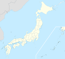
- Shizuoka City
-
Shizuoka
静岡— Designated city — 静岡市 · City of Shizuoka[1] Top left: Shizuoka Sengen Shrine; Top right: Nihondaira Stadium
Middle: Mt. Fuji & Shimizu Port from Nihondaira
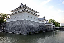
Upper bottom left Green tea fields; Lower bottom left Toro ruins; Bottom right: Tatsumi yagura of Sunpu Castle
FlagLocation of Shizuoka in Shizuoka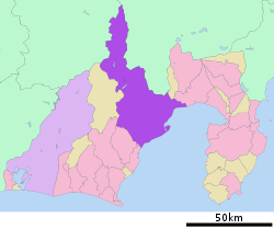
 Shizuoka
Coordinates: 34°59′N 138°23′E / 34.983°N 138.383°ECoordinates: 34°59′N 138°23′E / 34.983°N 138.383°E Country Japan Region Chūbu Prefecture Shizuoka Government – Mayor Tanabe Nobuhiro Area – Total 1,411.85 km2 (545.1 sq mi) Population (March 2011) – Total 724,140 – Density 507/km2 (1,313.1/sq mi) Time zone Japan Standard Time (UTC+9) City symbols - Tree Flowering Dogwood - Flower Hollyhock - Bird Common Kingfisher Phone number 54-254-2111 Address 5-1 Ōtemachi, Aoi-ku, Shizuoka-shi, Shizuoka-ken
420-8602Website city.shizuoka.jp/english/ Shizuoka (静岡市 Shizuoka-shi) is the capital city of Shizuoka Prefecture, Japan, and the prefecture's second-largest city in terms of both population and area. It became one of Japan's 19 "designated cities" in 2005.
Contents
Geography
Shizuoka City centrally located in Shizuoka Prefecture, about halfway between Tokyo and Nagoya along the Tokaido Corridor, sandwiched between Suruga Bay to the south and the Minami Alps in the north. Shizuoka had the largest area of any municipality in Japan after merging with Shimizu City in April, 2003, until February 2005, when Takayama, Gifu merged with nine surrounding municipalities.
The total area is 1,411.82 km2 (545.11 sq mi).[2] Shizuoka is currently the 5th largest city in Japan in terms of geographic area after Takayama, Hamamatsu, Nikkō, and Kitami. It is also the 2nd largest city in Shizuoka Prefecture in terms of both geographic area and population after Hamamatsu, but ranks higher as an Urban Employment Area,[3] and leads as a metropolitan area and business region.
Basic data
- Area of densely populated region: 98.8 km²
- Urban planning area: 223.0 km²
- Area zoned for urbanization: 99.2 km²
Bordering municipalities
Climate
Climate data for Shizuoka City Month Jan Feb Mar Apr May Jun Jul Aug Sep Oct Nov Dec Year Record high °C (°F) 25.7
(78.3)26.2
(79.2)26.6
(79.9)33.3
(91.9)38.0
(100.4)38.3
(100.9)38.4
(101.1)38.7
(101.7)37.1
(98.8)33.9
(93.0)28.0
(82.4)24.5
(76.1)38.7
(101.7)Average high °C (°F) 11.4
(52.5)11.4
(52.5)14.5
(58.1)19.2
(66.6)22.9
(73.2)25.6
(78.1)29.2
(84.6)30.6
(87.1)27.5
(81.5)22.9
(73.2)18.4
(65.1)13.8
(56.8)20.6 Average low °C (°F) 1.6
(34.9)2.1
(35.8)5.4
(41.7)10.4
(50.7)14.4
(57.9)18.7
(65.7)22.4
(72.3)23.5
(74.3)20.4
(68.7)14.7
(58.5)9.2
(48.6)3.7
(38.7)12.2 Record low °C (°F) −6.8
(19.8)−5.8
(21.6)−4.6
(23.7)−1.4
(29.5)5.1
(41.2)12.5
(54.5)15.4
(59.7)16.9
(62.4)10.6
(51.1)3.9
(39.0)−1.7
(28.9)−5.1
(22.8)−6.8
(19.8)Rainfall mm (inches) 71.6
(2.819)102.2
(4.024)212.5
(8.366)237.2
(9.339)221.5
(8.72)283.3
(11.154)279.7
(11.012)245.4
(9.661)304.3
(11.98)171.8
(6.764)132.8
(5.228)59.6
(2.346)2,321.9
(91.413)% humidity 57.4 58.0 62.7 68.4 72.6 78.5 79.7 77.9 76.4 72.1 67.8 61.6 69.4 Avg. rainy days 11.3 12.1 17.4 16.0 16.6 19.7 20.4 17.7 19.4 16.9 12.4 9.9 189.8 Sunshine hours 206.4 185.4 190.3 184.6 188.7 139.4 162.4 204.6 153.5 160.3 170.7 198.5 2,144.8 Source no. 1: Japan Meteorological Agency[4] Source no. 2: Japan Meteorological Agency[5] On the south-central Pacific coast Shizuoka has a humid subtropical climate, which is hot and humid in the summers and rarely snows in winter.[6] Being closer to the warm Kuroshio current, Shizuoka is wet even by Japanese standards with only slightly less precipitation than Kanazawa on the opposite side of Honshu, but it is paradoxically the sunniest of Japan's major cities owing to the absence of summer fog and its sheltered location from the northwesterly winds off the Sea of Japan. Further north, however, the mountainous Ikawa area is part of the Japanese snow country, and there are ski areas.
Nature
Mountains
- Mount Aino (間ノ岳 Aino-dake)
- Mount Shiomi (塩見岳 Shiomi-dake)
- Mount Warusawa (悪沢岳(荒川岳) Warusawa-dake (Arakawa-dake))
- Mount Akaishi (赤石岳 Akaishi-dake)
- Mount Hijiri (聖岳 Hijiri-dake)
- Mount Tekari (光岳 Tekari-dake)
- Mount Yanbushi (山伏 Yanbushi)
- Mount Daimugen (大無間山 Daimugen-zan)
- Mankan Pass (満観峠 Mankan-tōge)
- Mount Mafuji (真富士山 Mafuji-san)
- Mount Jūmai (十枚山 Jūmai-san)
- Mount Ryūsō (竜爪山 Ryūsō-zan)
- Mount Shizuhata (賤機山 Shizuhata-yama)
- Mount Yatsu (谷津山 Yatsu-yama)
- Mount Yahata (八幡山 Yahata-san)
- Mount Udo (Nihondaira) (有度山(日本平) Udo-san (Nihondaira))
- Mount Kajiwara (梶原山 Kajiwara-yama)
- Mount Satta (Satta Pass) (薩埵山(薩埵峠) Satta-yama (Satta-tōge))
- Mount Hamaishi (浜石岳 Hamaishi-dake)
- Mount Ōmaru (大丸山 Ōmaru-yama)
- Mount Ōhira (大平山 Ōhira-yama)
Rivers
- Ōi River (大井川 Ōi-gawa) (upstream)
- Abe River (安倍川)
- Warashina River (藁科川 Warashina-gawa)
- Mariko River (丸子川 Mariko-gawa)
- Tomoe River (巴川 Tomoe-gawa)
- Ōya River Drainage Ditch (大谷川放水路 Ōya-gawa Hōsui-ro)
- Nagao River (長尾川 Nagao-gawa)
- Fuji River (富士川 Fuji-kawa)
- Okitsu River (興津川 Okitsu-gawa)
- Ōzawa River (大沢川 Ōzawa-gawa)
- Ihara River (庵原川 Ihara-gawa)
- Yamakiri River (山切川 Yamakiri-gawa)
- Nakagōchi River (中河内川 Nakagōchi-gawa)
- Ōhashi River (大橋川 Ōhashi-gawa)
- Kogōchi River (小河内川(興津川支流) Kogōchi-gawa)
Lakes
- Lake Ikawa (井川湖 Ikawa-ko) (Ikawa Dam)
- Lake Hatanagi (畑薙湖 Hatanagi-ko) (Hatanagi-I Dam)
- Asahata Marsh (Asahata Anti-flood Pond) (麻機沼(麻機遊水地) Asahata-numa (Asahata Yūsuichi))
- Kujira Pond (鯨ヶ池 Kujira-ike)
- Udosaka Pond (有東坂池 Udosaka-ike)
- Futatsu Pond (Oshika Pond) (二ツ池(小鹿池) Futatsu-ike (Oshika-ike))
- Funakoshi Dike (船越堤 Funakoshi-tsutsumi)
Demographics
As of March 2011, the city has an estimated population of 724,140[7] and a population density of 507 persons per km².
Demographic Population As of Male 352, 896 2011-09[7] Female 371, 244 Households 299, 802 Foreign 8, 441 2009[8] Total 724, 026 2011-03[7] Administration
Wards
 A map of Shizuoka's Wards
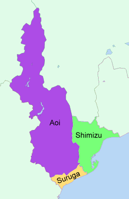
- Aoi Ward (葵区 Aoi-ku)
- Administrative center, made up of the former Shizuoka north of the Tōkaidō Main Line excluding Osada district
- Suruga Ward (駿河区 Suruga-ku)
- Former Shizuoka south of the Tōkaidō Main Line and Osada district
- Shimizu Ward (清水区 Shimizu-ku)
- Former city of Shimizu and towns of Kanbara and Yui.
Administrative District "Image Colours"
On 22 December 2006, colours and logos were established for each of the wards.[9]
Aoi Ward ■ Aoi Ward Green Suruga Ward ■ Suruga Ward Red Shimizu Ward ■ Shimizu Ward Blue Ward offices
- Shizuoka City Office/Aoi Ward Office:
5-1 Ōtemachi, Aoi-ku, Shizuoka-shi 420-8602- Aoi Ward Ikawa Branch Office:
656-2 Ikawa, Aoi-ku, Shizuoka-shi 428-0504
- Aoi Ward Ikawa Branch Office:
- Suruga Ward Office:
10-40 Minamiyahata-chō, Suruga-ku, Shizuoka-shi 422-8550- Suruga Ward Osada Branch Office:
13-1 Kami-Kawahara Suruga-ku, Shizuoka-shi 421-0132
- Suruga Ward Osada Branch Office:
- Shimizu City Office/Shimizu Ward Office:
6-9 Asahi-chō, Shimizu-ku, Shizuoka-shi 424-8701- Shimizu Ward Kanbara Branch Office:
1-21-1 Kanbara Shinden, Shimizu-ku, Shizuoka-shi 421-3211
- Shimizu Ward Kanbara Branch Office:
Mayors (since 2003 merger)
Term Name Start Finish 1-2 Zenkichi Kojima 14 April 2003 12 April 2011 3 Nobuhiro Tanabe 13 April 2011 current History
Ancient history
The area that is now the city of Shizuoka has been inhabited since prehistoric times. Numerous kofun have been found within the city limits, and the Toro archaeological site indicates that a major Yayoi period (circa 400 BC-300 AD) settlement existed in what is now part of the central city area.
Suruga was established as a province of Japan in the early Nara period. At some point between the year 701 and 710, the provincial capital was relocated from what is now Numazu, to a more central location on the banks of the Abe River at a location named Sunpu (駿府) (a contraction of "Suruga no Kokufu" (駿河の国府)) or alternatively "Fuchū" (府中).
Pre-modern Shizuoka
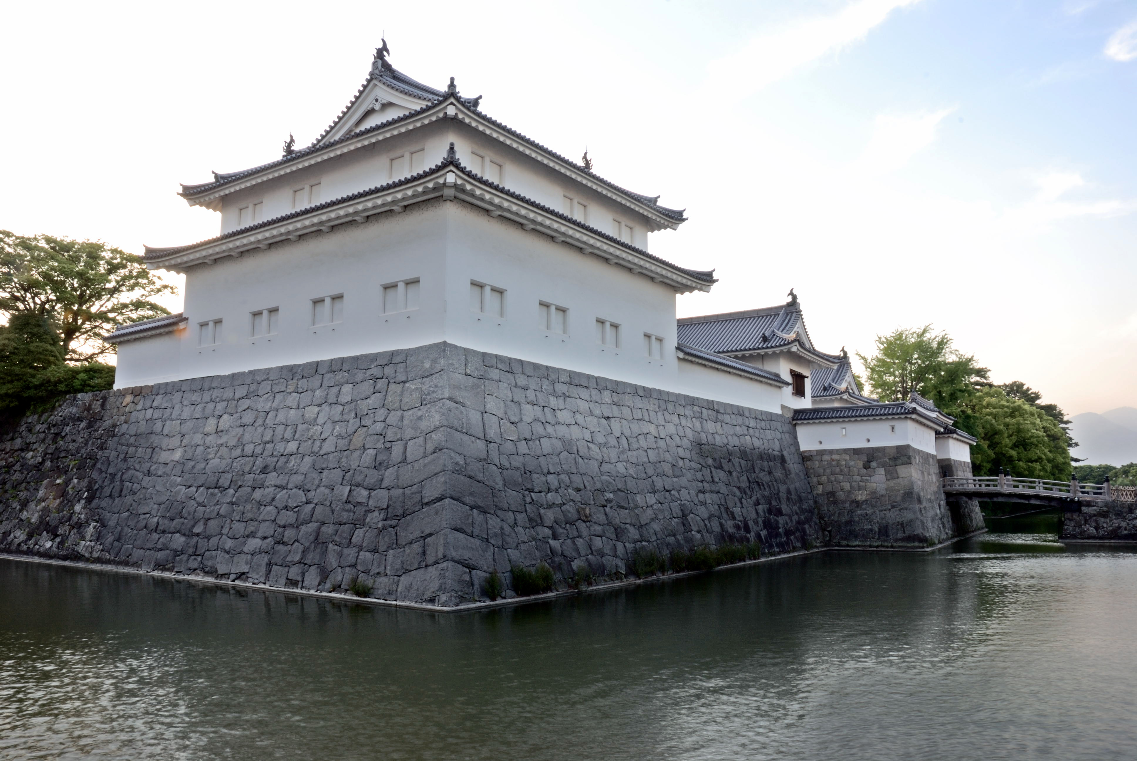
During the Muromachi period, Sunpu was the capital of the Imagawa clan. The Imagawa were defeated at the Battle of Okehazama, and Sunpu was subsequently ruled by Takeda Shingen, followed by Tokugawa Ieyasu. However, Toyotomi Hideyoshi relocated Ieyasu, and installed Nakamura Kazutada to rule Sunpu. After the Toyotomi were defeated in the Battle of Sekigahara, Ieyasu recovered Sunpu, reassigning it to his own retainer, Naitō Nobunari in 1601. This marked the start of Sunpu Domain.
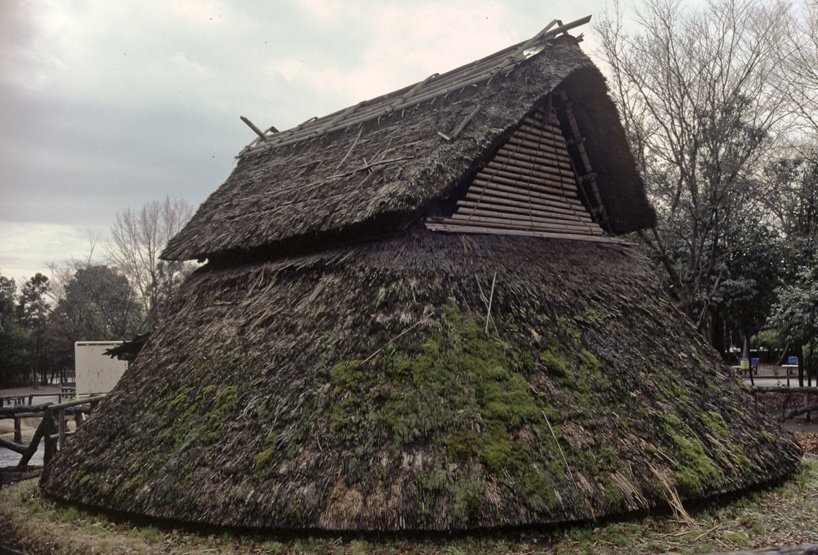
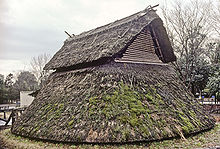 Reconstructed building at the Toro archeological site
In April 1606, Ieyasu officially retired from the post of Shogun, and retired to Sunpu, where he established a secondary court, from which he could influence Shogun Tokugawa Hidetada from behind the scenes. Subsequently, aside for brief periods, Sunpu was tenryō (territory under direct administration by the Shogunate), ruled by the Sunpu jōdai (駿府城代), an appointed official based in Sunpu.
From the Meiji period to World War II
In 1869, after the fall of the Tokugawa Shogunate, the former shogunal line, headed by Tokugawa Iesato was sent to Sunpu and assigned the short-lived Shizuoka Domain. The same year, Sunpu was renamed "Shizuoka". Shizuoka Domain became Shizuoka Prefecture with the abolition of the han system in 1871, which was expanded in 1876 through merger with the former Hamamatsu Prefecture and western portions of Ashigaru Prefecture in 1876. Shizuoka Station on the Tōkaidō Main Line was opened on February 1, 1889. The same day, a fire burned down most of downtown Shizuoka.
The modern city was founded on April 1, 1889. At the time, the population was 37,681, and Shizuoka was one of the first 31 cities established in Japan.
An electric tram service began in 1911. In 1914, due to heavy rains caused by a typhoon, the Abe River flooded, inundating the downtown area. In the national census of 1920, the population of Shizuoka was 74,093. The area of the city continued to expand through the 1920s and 1930s through merger with outlying towns and villages. In 1935, the city was struck by a 6.4 magnitude earthquake, resulting in much damage. Although soon rebuilt, a large fire in 1940 again destroyed much of the center of the city.
During World War II, Shizuoka lacked targets of major military significance, and was initially only lightly bombed during several American air raids. However, in a major firebombing raid of June 19, 1945, the city suffered an extreme amount of damage with high civilian casualties.
Post-war Shizuoka
The area of the city continued to expand through the 1950s and 1960s through merger with outlying towns and villages. On October 1, 1964, the Tokaido Shinkansen began services to Shizuoka, and on April 25, 1969 the city was connected to the Tomei Expressway. On July 7, 1974, the Abe River flooded, and landslides occurred during heavy rains, killing 23 people.
On August 16, 1980, a major gas leak in an underground shopping center near Shizuoka Station resulted in an explosion, killing 15 people and seriously injuring 233 others. The Shizuoka City Hall moved to new premises in 1986. On April 1, 1992, Shizuoka was designed a core city by the central government, giving it increased autonomy.
The April 1, 2003 merger with Shimizu city (current Shimizu Ward) greatly expanded the area and population of Shizuoka, which then became a designated city on April 1, 2005, and was divided into three wards.
Kanbara merged with Shizuoka on March 31, 2006, becoming part of Shimizu Ward. On November 1, 2008, Yui also merged into Shimizu Ward.
Economy
- Shizuoka has 39,237 businesses as of 2004, placing it first in the prefecture.
- Employment by industry: Agriculture 0.1%, Manufacturing: 26.9%, Service 73.0%
Fuji Dream Airlines is headquartered in Aoi-ku, Shizuoka.[10]
Agriculture
- Green tea
- Varieties such as Motoyama and Yabukita are grown in all corners of the city, and the varieties grown especially in the Warashina area in Aoi Ward and the Ryōgōchi area of Shimizu Ward are known for their high quality
- Strawberries
- "Stonewall strawberries" (石垣いちご ishigaki ichigo) are strawberries that grow in holes on inclined stone walls, grown especially along an 8 km (5 mi) stretch of Kunō Kaidō (route 150), also known as "Strawberry Road", along the coast of Suruga Bay.[11]
- Wasabi
- especially in areas such as Utōgi in Aoi Ward
- Mandarin Oranges and other citrus fruits
- especially Satsuma, a seedless and easy-peeling citrus mutant, known as mikan (みかん) or formally unshū mikan (ウンシュウミカン)[12][13][14][15]
- Lotus roots
- especially in the Asahata area of Aoi Ward
- Roses
- especially in the Ihara and Okitsu areas in Shimizu Ward
- Peaches
- especially in the Osada area
Fishery
Shimizu Port boasts the largest haul of tuna in all Japan.[citation needed] Kanbara Harbour enjoys a prosperous haul of sakura ebi, and Mochimune Harbour enjoys a prosperous haul of shirasu sardines.
Products
Abekawa Mochi is a type of rice cake (or mochi) in kinako soy flour that is a specialty of Shizuoka.
Shizuoka has a long history of being involved in the craft industries going back over 400 years ago, using trees, including hinoki cypress. The model industry goes back to the late 1920s when wood was used to produce model toys, using sashimono woodworking joinery techniques, purely for educational purposes. Craftsmen later moved on to lighter woods including balsa, but following the war, with the importation of US built scale models, many companies either turned to plastic models to compete or went under.[16][17]
The town has since became internationally notable for its plastic scale model kits[18] and is resident to its long established companies such as Aoshima, Fujimi, Hasegawa and the most renowned of them all, Tamiya. The city hosts the long-running Shizuoka Hobby Show annually in May at Twin Messe Shizuoka, which attracts visitors from around the world.[19]
Cuisine
- Oden
- a Japanese dish consisting of several ingredients such as boiled eggs, daikon radish, konnyaku, and processed fish cakes stewed in a light, soy-flavoured dashi broth.
- Oden in Shizuoka uses a dark coloured broth flavoured with beef stock and dark soy sauce. All ingredients are skewered. Dried, ground fish (sardine, mackerel, or katsuobushi) and aonori powder (edible seaweed) are sprinkled on top before eating.
- Gyoza
- Soba noodles
- Seafood
- Zoni soup
- rice cakes in a broth cooked with vegetables, popular at New Year's
- Tororo
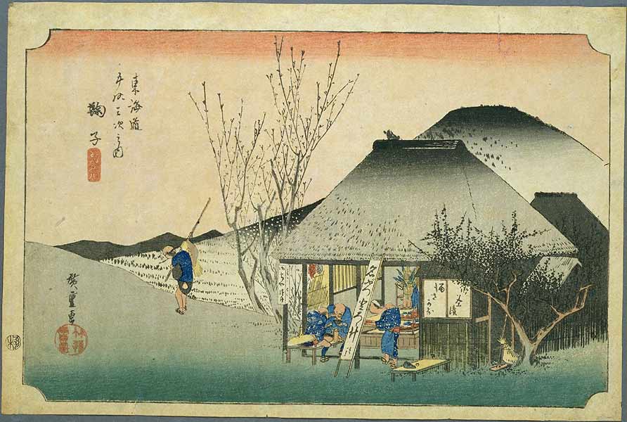
- A grated yam soup. Chojiya, a tororo restaurant founded in 1598 in Mariko-juku area of Shizuoka, west of the Abe River, was made famous by Hiroshige when he depicted it in his series of ukiyoe prints of the 53 stops along the Tōkaidō.
Culture
There are three main festivals on Shizuoka's calendar.
- Shizuoka Festival (静岡まつり Shizuoka Matsuri)
- The City's April festival during the high point of the year for Cherry Blossoms. A flower-viewing procession imitates the shogun Tokugawa Ieyasu's custom of taking daimyo (feudal lords) to Sengen Shrine to view the cherry blossoms.
- Abekawa Fireworks (安倍川花火 Abekawa Hanabi)
- A gigantic fireworks display held upstream on Shizuoka's Abe River in late July.
- Daidogei World Cup (大道芸ワールドカップ Daigougei Waarudo kappu)
- Street Performance World Cup. Probably the biggest event on Shizuoka's Calendar, it is an annual international busker's festival, held in November. It includes various shows such as juggling, pantomime, magic, etc. Performers come from around the world and perform throughout the central part of the city as well as in some peripheral locations. From 2005, it expanded from a 3-day to a 4-day festival.
Sports
With the Shimizu merger, Shimizu S-Pulse became the major soccer club in the city. Recently, however, a new rival club, Shizuoka F.C. from Suruga, has been rising in the regional league ranks as a contender for a place in the Japan Football League.
Transportation
Rail
Shizuoka lies on the Tōkaidō Main Line, the JR main rail line from Tokyo to Osaka, and is well-served by the Tōkaidō Shinkansen, limited express and regional trains. The central station of Shizuoka is in the city centre. Shizuoka also has an LRT line, the Shizuoka Railway, administered by the Shizuoka Railway Co., Ltd. at Shizuoka Station.
Airport
The nearest airport is Shizuoka Airport, between Makinohara and Shimada. The more distant Tokyo International Airport (Haneda), Narita International Airport, and Chūbu Centrair International Airport are commonly used.
Colleges and universities
- Shizuoka University
- National university, founded 1949. Main campus in Suruga Ward. Abbreviated to 静大 (Shizudai).
- University of Shizuoka
- Public university whose main campus is in Suruga Ward, close to Kusanagi Station.
- Tokai University
- Shimizu campus of the Tokyo-based private university
- Tokoha Gakuen University
- Private university founded in 1946
- Shizuoka Eiwa Gakuin University
- Co-educational private university founded by missionaries from the Methodist Church of Canada with the support of the Shizuoka prefectural government. First institution in Shizuoka Prefecture to offer secondary education for girls. Two-year Shizuoka Eiwa College was established in 1966, and Eiwa became a four year coeducational university in 2002.
Media
Print media
The Shizuoka Shimbun is the area's primary newspaper.
Broadcast media
Television
- NHK Shizuoka (Analogue Channel 9; Digital Channel 1)
- NHK Shizuoka Educational Channel (Analogue Channel 2; Digital Channel 2)
- Shizuoka Broadcasting System (SBS) (Analogue Channel 11; Digital Channel 6)
- TV Shizuoka (Analogue Channel 35; Digital Channel 8)
- Shizuoka Daiichi Television (Analogue Channel 31; Digital Channel 4)
- Shizuoka Asahi Television (Analogue Channel 33; Digital Channel 5)
Cable Television
Shizuoka Cable Television (Dream Wave Shizuoka)
Radio
- NHK1 882 kHz
- NHK2 639 kHz FM88.8 MHz
- SBS 1404 kHz
- K-MIX 79.2 MHz
- FM・Hi!76.9 MHz
- Marine Pal (FM Shimizu) 76.3 MHz
- Guzen Media Japan A podcast and vidcast based in Shizuoka, Japan.
Major attractions
Historic spots
In Aoi Ward
- Shizuoka Sengen Shrine
- A collection of Shinto shrines that was patronised by powerful warrior clans since ancient times, most notably the Tokugawa clan.
- Sunpu Park/Sunpu Castle ruins
- The castle of the Imagawa and Tokugawa clans, originally built in 1599, was destroyed in 1869. Today, only the moats remain. The rest was turned into a park, and is now a popular place for hanami.
In Suruga Ward
- Toro
- Late Yayoi archaeological site notable as the first archaeological site excavated in Japan in which remains of a 1st century AD Yayoi-era wet-rice Paddy fields were found.
- Kunōzan Tōshōgū
- Shintō shrine that was the original burial place of Shōgun Tokugawa Ieyasu, and the oldest of the Tōshō-gū shrines in Japan. The main festival of the shrine is held annually on April 17, although its spring festival from February 17–18 is a larger event.[20]
- Mariko-juku
- Twentieth of the fifty-three stations of the old Tōkaidō road, an old travel route during the Edo period.
In Shimizu Ward
 Hiroshige's Mariko-juku
- Miho Peninsula
- Famous for the scenic Miho no Matsubara (三保の松原 Miho Pine Grove), renowned as a seashore with beautiful green pine trees and white sands spanning over seven kilometers, designated as one of New Three Views of Japan (新日本三景 Shin Nihon Sankei). Also known as the scene of the legend of Hagoromo, which is based on the traditional swan maiden motif.
Notable people
- Princess Akishino — princess in the Japanese Imperial Family
- Yoshitaka Amano — illustrator and animator, designed the artwork for the original Final Fantasy video game
- Masafumi Goto — lead vocalist/rhythm guitarist of the J-rock band Asian Kung-Fu Generation
- Koji Gyotoku — football player and coach of Bhutan national football team
- Kazuyoshi Hoshino — racing driver
- Takashi Kiuchi (Masuda) — Rome/Tokyo Olympic basketball player
- Keiko Masuda — Singer, "Kei" of female pop music duo Pink Lady
- Kazuyoshi Miura — football player
- Kawashita Mizuki — cartoonist, creator of Strawberry 100%
- Riyo Mori — Miss Universe 2007
- Mitsuyo Nemoto — Singer, "Mie" of Pink Lady
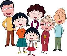
- Momoko Sakura — cartoonist, creator of Chibi Maruko-chan
- Keisuke Serizawa — textile designer, Honorary Citizen
- Atsuto Uchida — football player
- Takahiro Yamada — bassist of Asian Kung-Fu Generation
Sister and friendship cities
Shizuoka has twin and friendship relationships with several cities.[21][22]
Twin cities
Overseas
 Stockton, California, United States (since October 16, 1959)
- Omaha, Nebraska, United States (since April 1, 1965)
- Shelbyville, Indiana, United States (since November 3, 1989)
 Cannes, France (since November 5, 1991)
Within Japan
 Muroran, Hokkaidō (since December 24, 1976)
- Joetsu, Niigataa (since October 12, 1995)
Friendship cities
Overseas
 Huế, Vietnam (since April 12, 2005)
Within Japan
- Saku, Nagano (since October 12, 1989)
Other
- City Song
- Watashi no Machi, Shizuoka 『わたしの街 静岡』[23]
- Written: 13 April, 2005
- Lyrics: Citizen competition entry
- Music, Additions: Kei Ogura
- Arranged: Shin Kawabe
- Eri Itō sang on the CD release
References
- ^ http://www.city.shizuoka.jp/gaikokugo.html Shizuoka's official English Name
- ^ [1]
- ^ Urban Employment Area (UEA) Code Table. (2004). retrieved 2011-05-06
- ^ "平年値(年・月ごとの値)". Japan Meteorological Agency. http://www.data.jma.go.jp/obd/stats/etrn/view/nml_sfc_ym.php?prec_no=19&prec_ch=%8B%FA%98H%8Ex%92%A1&block_no=47656&block_ch=%8B%FA%98H&year=&month=&day=&view=a1. Retrieved 2011-10-07.
- ^ "観測史上1~10位の値(年間を通じての値)". Japan Meteorological Agency. http://www.data.jma.go.jp/obd/stats/etrn/view/rank_s.php?prec_no=19&prec_ch=%8B%FA%98H%8Ex%92%A1&block_no=47656&block_ch=%8B%FA%98H&year=&month=&day=&elm=rank&view=. Retrieved 2011-10-07.
- ^ Snow depth for Shizuoka
- ^ a b c "静岡市の統計情報". City of Shizuoka website. 2011-03. http://www.city.shizuoka.jp/deps/joho/tokei_index.html. Retrieved 2011-05-05. (in Japanese)
- ^ 外国人登録人口, The City of Shizuoka, 2010-11-30
- ^ District Image Colours and Logo Marks
- ^ "会社概要." Fuji Dream Airlines. Retrieved on May 20, 2009.
- ^ What is cool and hot in this season – Strawberry Picking around Kuno
- ^ Hanelt, Peter et al. (2001). Mansfeld's encyclopedia of agricultural and horticultural crops (except ornamentals). Springer. p. 1033. ISBN 3540410171. http://books.google.com/books?id=10IMFSavIMsC&pg=PA1033&dq=%22Citrus+unshiu%22#v=onepage&q=%22Citrus%20unshiu%22&f=false.
- ^ Wiersema, John Harry; León, Blanca (1999). [http://books.google.com/books?id=hQL-2sdxgDAC&pg=PA136&dq=%22Citrus+unshiu%22#v=onepage&q=%22Citrus%20unshiu%22&f=false page = 136 World Economic Plants: A Standard Reference]. CRC Press. ISBN 0849321190. http://books.google.com/books?id=hQL-2sdxgDAC&pg=PA136&dq=%22Citrus+unshiu%22#v=onepage&q=%22Citrus%20unshiu%22&f=false page = 136.
- ^ "Plant Name Details: Rutaceae Citrus unshiu Marcow.". International Plant Names Index. http://www.ipni.org/ipni/idPlantNameSearch.do?id=772094-1&back_page=%2Fipni%2FeditSimplePlantNameSearch.do%3Ffind_wholeName%3Dcitrus%2Bunshiu%26output_format%3Dnormal.
- ^ "Taxon: Citrus unshiu Marcow.". Germplasm Resources Information Network(GRIN), United States Department of Agriculture. http://www.ars-grin.gov/cgi-bin/npgs/html/taxon.pl?10793.
- ^ Amazon.co.uk: Master Modeler: Creating the Tamiya Style: Shunsaku Tamiya, Giles Murray: Books
- ^ 田宮模型の仕事: Creating the Tamiya Style By Shunsaku Tamiya
- ^ Business & Industry
- ^ Record of Past International Conferences
- ^ Plutschow, Herbe. Matsuri: The Festivals of Japan. RoutledgeCurzon (1996) ISBN 1873410638
- ^ International Sister Cities & Friendship Cities ‐ 静岡市 Shizuoka Web site retrieved July 8, 2008
- ^ Domestic Sister Cities & Friendship Cities ‐ 静岡市 Shizuoka Web site retrieved July 8, 2008
- ^ "市歌". City of Shizuoka. 2007. http://www.city.shizuoka.jp/deps/soumu/sika.html. Retrieved 2011-05-09. (Complete lyrics on display; in Japanese)
External links
 Media related to Shizuoka, Shizuoka at Wikimedia Commons
- Official website in English and other languages
- Daidogei World Cup in Shizuoka
 Shizuoka Prefecture
Shizuoka (capital city) Wards 
Hamamatsu Wards Other cities Kamo District Tagata District Suntō District Haibara District Shūchi District Metropolitan cities of Japan Tokyo Metropolis Designated cities Core cities Akita · Amagasaki · Aomori · Asahikawa · Fukuyama · Funabashi · Gifu · Hakodate · Higashiōsaka · Himeji · Iwaki · Kagoshima · Kanazawa · Kashiwa · Kawagoe · Kōchi · Kōriyama · Kumamoto · Kurashiki · Kurume · Maebashi · Matsuyama · Miyazaki · Morioka · Nagano · Nagasaki · Nara · Nishinomiya · Ōita · Okazaki · Ōtsu · Shimonoseki · Takamatsu · Takasaki · Takatsuki · Toyama · Toyohashi · Toyota · Utsunomiya · Wakayama · YokosukaSpecial cities Akashi · Atsugi · Chigasaki · Fuji · Fukui · Hachinohe · Hirakata · Hiratsuka · Ibaraki · Ichinomiya · Isesaki · Jōetsu · Kakogawa · Kasugai · Kasukabe · Kawaguchi · Kishiwada · Kōfu · Koshigaya · Kumagaya · Kure · Matsumoto · Mito · Nagaoka · Neyagawa · Numazu · Odawara · Ōta · Sasebo · Sōka · Suita · Takarazuka · Tokorozawa · Tottori · Toyonaka · Tsukuba · Yamagata · Yamato · Yao · YokkaichiPrefectural capitals
(not included above)Categories:- Cities in Shizuoka Prefecture
- Port settlements in Japan
- Shizuoka
- Populated coastal places in Japan


Wikimedia Foundation. 2010.