- Clarksville, Albany County, New York
-
Clarksville Hamlet Formerly: West Bethlehem Country United States State New York Region Capital District County Albany Municipality Town of New Scotland River Onesquethaw Creek Elevation 659 ft (201 m) Coordinates 42°34′31″N 73°57′25″W / 42.57528°N 73.95694°W Area 2.7 sq mi (7 km2) Population 131 (2010[1]) Density 49 / sq mi (19 / km2) Timezone EST (UTC-5) - summer (DST) EDT (UTC-4) ZIP Code 12041 Area code 518 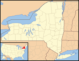
 Location of Clarksville within the state of New York
Clarksville is a hamlet in the town of New Scotland, Albany County, New York. It is situated along Delaware Turnpike (New York State Route 443) in the southern part of the town at the foot of the Helderberg Escarpment. It is the site of the Clarksville Cave and has an annual Clarksville Heritage Day and Car Show.
Contents
History
In 1805 the Albany and Delaware Turnpike was constructed through what would later become Clarksville. Since this place was halfway between Albany and Rensselaerville Clarksville became a popular place for travelers to stop. Several inns, taverns, and other businesses were quickly established. Clarksville was originally the site of the Bethlehem post office, it being a part of that town until the establishment of the town of New Scotland. The post office and hamlet were later named Clarksville for Adam A. Clark, who came to the area in 1822. In 1853 the Reformed Church of Clarksville was established and a church built, and the Methodist church in 1860-1. In 1854 a plank road was built from Clarksville north and east to Feura Bush and Bethlehem Center to connect with the Albany and Bethlehem Turnpike to Albany.[2] Clarksville was once the largest settlement in the town of New Scotland until the convergence of railroads in Voorheesville in the late 19th century led to a boom in the north part of town.[2][3][4]
Geography
Clarksville is situated in the southern portion of the town of New Scotland, along Delaware Turnpike (New York State Route 443) east of and at the foot of the Helderberg Escarpment. Albany County Route 301 leads south to Tarrytown, Route 43 leads east to Unionville and west to the town of Berne. The Onesquethaw Creek flows east along the south side of Route 443. The Clarksville ZIP Code (12041) is roughly a triangle with Stove Pipe Road on the west side and Upper Flat Rock Road as the east side. Bennett Hill Road and Plank Road are approximately the southern base of the triangle.[5] Bennett Hill, 400 feet higher than the hamlet, towers over it to the south and west. The top of the hill is a plateau at an average height of 1120 feet above sea level with the highest point being 1135 feet. The hill is part of a wilderness preserve owned by the Mohawk Hudson Land Conservancy.[6]
Clarksville Cave has three entrances and 4,800 feet of passages. Owned by the Northeastern Cave Conservancy Inc. and is open to the public, the cave is the most actively used noncommercial cave system in the United States. First discovered in the 19th century access was unrestricted until 2004 when the conservancy purchased two of the three entrances and began regulating access.[7]
Location

Hamlet of New Salem
Vly Creek ReservoirHamlet of Unionville Town of Berne 
Hamlet of Feura Bush  Hamlet of Clarksville

Hamlet of Tarrytown Culture
Clarksville celebrates annually the Clarksville Heritage Day and Car Show every August, sponsored by the Clarksville Historical Society.[8]
Education
Clarksville is a part of the Bethlehem Central School District (BCS) and the children attend either Slingerlands or Eagle Elementary Schools for kindergarten through fifth grade; and Bethlehem Central Middle School and Bethlehem Central High School for sixth through twelfth.
Historic structures
- Clarksville Elementary School is listed on the National Register of Historic Places
References
- ^ "Homefinder.com". Homefinder.com LLC. http://www.homefinder.com/zip-code/12041/. Retrieved 2010-03-14.
- ^ a b George Howell and Jonathan Tenney (1886). Bi-Centennial History of Albany: History of the County of Albany from 1609-1886; Volume II. W.W. Munsell and Company. pp. 900–8. http://books.google.com/books?id=nWkJAQAAIAAJ&pg=PA940&dq=lisha's+kill&cd=5#v=onepage&q=lisha's%20kill&f=false. Retrieved 2010-03-09.
- ^ New Scotland Historical Association (2000). New Scotland Township. Arcadia Publishing. p. 8. ISBN 0-7385-0420-3. http://books.google.com/books?id=nGtX0Mfi7awC&pg=PA8&dq=%22feura+bush%22&lr=&as_drrb_is=q&as_minm_is=0&as_miny_is=&as_maxm_is=0&as_maxy_is=&as_brr=0&cd=11#v=onepage&q=%22feura%20bush%22&f=false. Retrieved 2010-03-09.
- ^ Barbara Hayden (September 15, 1987). "To Residents, Hamlet of Clarksville is Still a Small Town with a Big Heart". Albany Knickerbocker News. p. 4A. http://archives.timesunion.com/mweb/wmsql.wm.request?oneimage&imageid=5432672. Retrieved 2010-03-18.
- ^ Jimapco (2003). Capital District Supermap; 18th edition (Map).
- ^ "Bennett Hill Preserve". Mohawk Hudson Land Conservancy. http://www.mohawkhudson.org/preserves/Bennett.htm. Retrieved 2010-03-18.
- ^ Carol DeMare (October 12, 2004). "In this Subterranean Realm, Cavers are King". Albany Times Union. p. B1. http://archives.timesunion.com/mweb/wmsql.wm.request?oneimage&imageid=6257757. Retrieved 2010-03-18.
- ^ "Clarksville Captions". Clarksville Elementary School. June 12, 2009. http://bcsd.k12.ny.us/clarksville/eNews/06.12.09/06.12.09_ClarksvilleCaptions.html. Retrieved 2010-03-18.
Capital District of New York Central communities Albany (History · City Hall · Coat of Arms) · Schenectady (City Hall) · Troy (History) · List of all incorporated places
Largest communities
(over 20,000 in 2000)Medium-sized communities
(10,000 to 20,000 in 2000)City of Amsterdam · Brunswick · Cohoes · East Greenbush · Glens Falls · Gloversville · Halfmoon · Malta · North Greenbush · Schodack · Watervliet · WiltonSmall communities
(5,000 to 10,000 in 2000)Town of Amsterdam · Ballston Spa · Cobleskill · Village of Colonie · Duanesburg · City of Johnstown · Town of Johnstown · Kinderhook · Mechanicville · New Scotland · Rensselaer · Sand Lake · Scotia · Town of Stillwater · WaterfordCounties Albany · Columbia · Fulton · Greene · Montgomery · Rensselaer · Saratoga · Schenectady · Schoharie · Warren · WashingtonHistory Mohawks · Mahicans · Fort Orange · Rensselaerswyck · Beverwyck · Albany Plan of Union · Timeline of town creation · Toponymies of places · Tech ValleyGeography Hudson River (Valley) · Mohawk River · Erie Canal · Lake Albany · Lake George · Albany Pine Bush (Rensselaer Lake · Woodlawn Preserve) · Adirondack Mountains · Catskill Mountains · Rensselaer PlateauReligion and culture Culture in New York's Capital District · Sports in New York's Capital District · Episcopal Diocese of Albany · Roman Catholic Diocese of AlbanyEducation Public school districtsList of school districts in New York's Capital DistrictHigher educationNewspapers TV/Radio Broadcast television in the Capital District Local stations WRGB (6.1 CBS, 6.2 This TV) • WTEN (10.1 ABC, 10.2 Weather, 10.3 RTV) • WNYT (13.1 NBC, 13.2 Weather, 13.3 Weather Radar) • WMHT (17.1 PBS, 17.2 ThinkBright, 17.3 HD) • WXXA (23.1 Fox, 23.2 The Cool TV) • WNGN-LP 35 / WNGX-LP 42 (FN) • WCWN (45.1 The CW, 45.2 Uni Sp) • WNYA / WNYA-CD (51.1 MNTV, 51.2 Antenna TV) • W52DF 52 (silent)
Outlying area stations WVBK-CA 2 (RSN' Manchester, VT) • W04AJ 4 (PBS; Glens Falls) • W04BD 4 (PBS; Schoharie) •
WNCE-CA 8 (A1; Glens Falls) • WYBN-CA 14 (RSN; Cobleskill) • WCDC (19.1 ABC; Adams, MA) • WVBG-LP 25 (RSN; Greenwich) • W36AX 36 (PBS / VPT; Manchester, VT) • W47CM 47 (silent; Glens Falls) • WYPX (55.1 Ion, 55.2 qubo, 55.3 Life; Amsterdam) • W53AS 53 (PBS / VPT; Bennington, VT)Adjacent locals Cable-only stations YNN Capital Region • TW3 • YES • SNY • MSG Network
Defunct stations New York State television: Albany/Schenectady • Binghamton • Buffalo • Burlington/Plattsburgh • Elmira • New York City • Rochester • Syracuse • Utica • Watertown
Vermont Broadcast television: Albany/Schenectady • Boston, MA • Burlington/Plattsburgh
Massachusetts television: Albany • Boston • Providence • Springfield
Radio stations in the Albany / Schenectady / Troy market by FM frequency 88.3 · 89.1² · 89.7 · 89.9 · 90.3/93.1² · 90.7/94.9 · 90.7 · 90.7 · 90.9 · 91.1 · 91.5 · 92.3 · 92.9 · 93.5 · 93.7 · 94.5 · 94.7 · 95.5 · 95.9 · 96.3 · 96.7 · 97.3 · 97.5 · 97.7 · 97.9 · 98.3² · 98.5 · 98.5 · 99.1 · 99.5² · 100.3 · 100.9 · 101.3 · 101.7 · 101.9 · 102.3² · 102.7 · 103.1² · 103.5 · 103.9 · 104.5 · 104.9 · 105.7² · 106.1 · 106.5² · 107.1 · 107.7²by AM frequency NOAA Weather Radio frequency 162.550by callsign W226AC · W235AY · W256BU · W291BY · WABY · WAJZ · WAMC (AM) · WAMC-FM² · WBAR · WBPM · WCDB · WCKL · WCKM · WCQL · WCSS · WCTW · WDCD · WDCD-FM · WDDY² · WENT · WEQX · WEXT · WFFG · WFLY · WFNY · WGDJ · WGNA² · WGXC · WGY¹² · WGY-FM² · WHAZ · WHAZ-FM · WHUC · WHVP · WIZR · WJIV · WKBE · WKKF² · WKLI · WLJH · WMHT² · WMYY · WNYQ · WOFX² · WOPG · WPGL · WPYX² · WQAR · WQBJ · WQBK · WQSH² · WRIP · WROW · WRPI · WRUC · WRVE² · WSDE · WTMM · WTRY² · WUAM · WVCR · WVKZ · WVTL · WXL34 · WYAI · WYJB · WYKV · WZCR · WZMRDefunct stations New York Radio Markets: Albany-Schenectady-Troy • Binghamton • Buffalo-Niagara Falls • Elmira-Corning • Hamptons-Riverhead • Ithaca • Nassau-Suffolk (Long Island) • New York City • Newburgh-Middletown (Mid Hudson Valley) • Olean • Plattsburgh • Poughkeepsie • Rochester • Syracuse • Utica-Rome • Watertown
Other New York Radio Regions: Jamestown-Dunkirk • North Country • Saratoga
See also: List of radio stations in New YorkMunicipalities and communities of Albany County, New York Cities Albany | Cohoes | Watervliet
Towns Berne | Bethlehem | Coeymans | Colonie | Green Island | Guilderland | Knox | New Scotland | Rensselaerville | Westerlo
Villages Altamont | Colonie | Green Island | Menands | Ravena | Voorheesville
CDPs Other
hamletsAlcove | Boght Corners | Clarksville | Crescent Station | Dunsbach Ferry | Elsmere | Feura Bush | Fort Hunter | Fullers | Glenmont | Guilderland | Guilderland Center | Karner | Latham | Lisha Kill | Loudonville | Mannsville | McKownville | New Salem | Newtonville | Normansville | Roessleville | Selkirk | Slingerlands | South Bethlehem | Verdoy | West Albany
Categories:- New Scotland, New York
- Hamlets in New York
- Populated places in Albany County, New York


Wikimedia Foundation. 2010.