- Cold Springs Rancheria of Mono Indians of California
-
The Cold Springs Rancheria of Mono Indians of California is a federally recognized tribe of Mono Native Americans. Cold Springs Rancheria is the name of the tribe's reservation, which is located in Fresno County, California.[1]
Contents
Culture
The Cold Springs tribe is composed of Western Mono Indians, whose traditional homeland is in the southern Sierra Nevada foothills of California. The Mono language is part of the Uto-Aztecan language family. Acorns are a traditional staple food with great symbolic importance.[2] Their oral history is included in Mono traditional narratives.
Government
They ratified their current tribal constitution on April 11, 1970 and last amended it in 2001.[3] Their Tribal Council is democratically elected and includes a Chairperson, Vice-Chairperson, Secretary-Treasurer and three Council Members. Additionally all tribal members 18 years old or older form a voting General Council.[3]
Enrollment
Tribal enrollment to the Cold Springs Rancheria is limited to those members listed on the 1960 Plan for Distribution of Assets of the Cold Springs Rancheria roles and their lineal descendants that have a blood quantum of at least one-quarter degree of Californian Indian blood.[3] Approximately 159 to 193 people lived on the Cold Springs Rancheria, and there are 265 to 275 enrolled members of the tribe.[4][5]
Reservation
The Cold Springs Rancheria occupies 155 acres (0.63 km2) in Sycamore Valley, located 45 miles (72 km) east of Fresno, California. The lands are close to Tollhouse, California, where the tribe is headquartered.[5]
Mono tribes
Other federally recognized Mono tribes are the Tule River Indian Tribe of the Tule River Reservation, the Big Sandy Rancheria of Mono Indians of California,[1] the Northfork Rancheria of Mono Indians of California, Big Pine Band of Owens Valley Paiute Shoshone Indians of the Big Pine Reservation.
Notes
- ^ a b Pritzker, 137
- ^ California Indians and Their Reservations. SDSU Library and Information Access. (retrieved 24 July 2009)
- ^ a b c Constitution and Bylaws of the Cold Springs Rancheria. (retrieved 24 July 2009)
- ^ Pritzker, 136-7
- ^ a b California Indians and Their Reservations. SDSU Library and Information Access. (retrieved 24 July 2009)
References
- Pritzker, Barry M. A Native American Encyclopedia: History, Culture, and Peoples. Oxford: Oxford University Press, 2000. ISBN 978-0195138771
External links
Coordinates: 36°58′18″N 119°19′28″W / 36.97167°N 119.32444°W
Municipalities and communities of Fresno County, California Cities 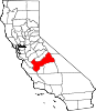
CDPs Auberry | Big Creek | Biola | Bowles | Calwa | Cantua Creek | Caruthers | Centerville | Del Rey | Easton | Fort Washington | Friant | Lanare | Laton | Malaga | Mayfair | Minkler | Monmouth | Old Fig Garden | Raisin City | Riverdale | Shaver Lake | Squaw Valley | Sunnyside | Tarpey Village | Three Rocks | Tranquillity | West Park
Unincorporated
communitiesAlder Springs | Arbios | Avocado | Balch Camp | Barstow | Benito | Big Bunch | Biola Junction | Bretz Mill | Broadview Farms | Burness | Burrel | Calflax | Camden | Cameo | Camp Sierra | Cecile | Cedar Crest | Cedar Grove | Cedarbrook | Cella | Chaney Ranch | Cincotta | Clint | Clotho | Conejo | Crabtree | Cromir | Deer Crossing | Dinkey Creek | Dora Belle | Dunlap | Edmiston | Elk | Elm View | Etheda Springs | Figarden | Five Points | Floyd | Giffen Cantua Ranch | Glorietta | Goldleaf | Goodmill | Gordon | Gravesboro | Helm | Herndon | Highway City | Hoffman Point | Hub | Hume | Hume Station | Humphreys Station | Huntington Lake | Ingle | Ivesta | Jamesan | Kanawyers | La Jolla Ranch | Lacjac | Lakeshore | Lerona | Levis | Locans | Lone Star | Marshall Junction | Mathews Mill | Mattei | Meadow Lakes | Mercey Hot Springs | Miley | Miramonte | Mono Hot Springs | Murietta Farm | Muscatel | Navelencia | New Auberry | Ockenden | Old Bretz Mill | Oleander | Ora | Oro Loma | Oxalis | Panoche Junction | Parkfield Junction | Piedra | Pilibos Ranch | Pinehurst | Pineridge | Prather | Pratton | Raco | Riverbend | Rock Haven | Rodgers Crossing | Rolinda | Sawmill Flat | Schilling | Shaver Lake Heights | Sierra Cedars | Sierra Sky Park | Snow Bend | Tarpey | Tollhouse | Trimmer | Turk | Uva | Vanguard | Wahtoke | Westhaven | Westside | Wildflower | Wineland | Wolf | Wood Ranch | Zediker
Indian
reservationsBig Sandy Rancheria | Cold Springs Rancheria | Table Mountain Rancheria
Ghost towns Andrews | Barton | Bender | Bridge | Bronge | Butler | Cadogan | Caldwell | Carlile | Carmelita | Coalinga Mineral Springs | Collins | Darwin | Dathol | Deseret | Dickerson | El Prado | Elkhorn Station | Eshel | Everts | Fargo | Fort Camp | Fresno Beach | Fresno City | Fruitvale | Garfield | Granz | Hawthorne's Station | Hayes | Kelso | Kingriver | Kingston | La Libertad | Last | Leroy | Letcher | Lillis | Marshall Station | McKenzie Spring | McMullin | Mendota Station | Millerton | Mountain Rest | Nares | Nevills | Oakhurst | Oleander | Peteras Mill | Pinedale | Pool's Ferry | Pool's Fort | Poso de Chane | Portal | Pueblo de las Juntas | Rancho de los Californios | Reka | Riverview | Robinson | Rogers | Rugg | Sanders | Sentinel | Sharpville | Shaver | Shipp | Smith's Ferry | Sparkville | Tarn | Temperance | Thermal | Tisechu | Vanris | Vino | Warsaw
Categories:- Mono tribe
- American Indian reservations in California
- Geography of Fresno County, California
- Native American tribes in California
- Federally recognized tribes in the United States

Wikimedia Foundation. 2010.