- Coleby, North Lincolnshire
-
Coordinates: 53°39′58″N 0°38′24″W / 53.666°N 0.640°W
Coleby 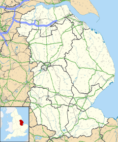
 Coleby
Coleby shown within LincolnshirePopulation 331 (2001 Census) OS grid reference SE898197 - London 150 miles Parish West Halton Unitary authority North Lincolnshire Ceremonial county Lincolnshire Region Yorkshire and the Humber Country England Sovereign state United Kingdom Post town SCUNTHORPE Postcode district DN15 Dialling code 01724 Police Humberside Fire Humberside Ambulance East Midlands EU Parliament Yorkshire and the Humber List of places: UK • England • Lincolnshire Coleby is a hamlet in the civil parish of West Halton in North Lincolnshire, England, situated half a mile south-west of West Halton, approximately 7 miles north of Scunthorpe.
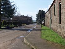 A view of Coleby from the bus shelter.
Coleby pre-dates the Norman Conquest, its name is derived from old Norse and means the "farmstead of a man named Koli".[1]
Coleby has 24 dwellings including 3 farms: Eastdale Farm, Hall Farm and Manor Farm. The village no shops or pubs, and its telephone box was removed in 2008. Public Transport is provided by Stagecoach and subsidised by North Lincolnshire Council.[citation needed]
Internet is delivered by ADSL through underground, waxed-paper insulated, copper wires that were laid by the GPO in 1955; its speed is up to 2 Mbps.[citation needed]
References
- ^ Mills, A. D. A Dictionary of English Place-Names, Oxford University Press, 1991 ISBN 0198691564
External links
 Media related to Coleby, North Lincolnshire at Wikimedia CommonsCategories:
- Villages in Lincolnshire


Wikimedia Foundation. 2010.