- Colonia Algarín
-
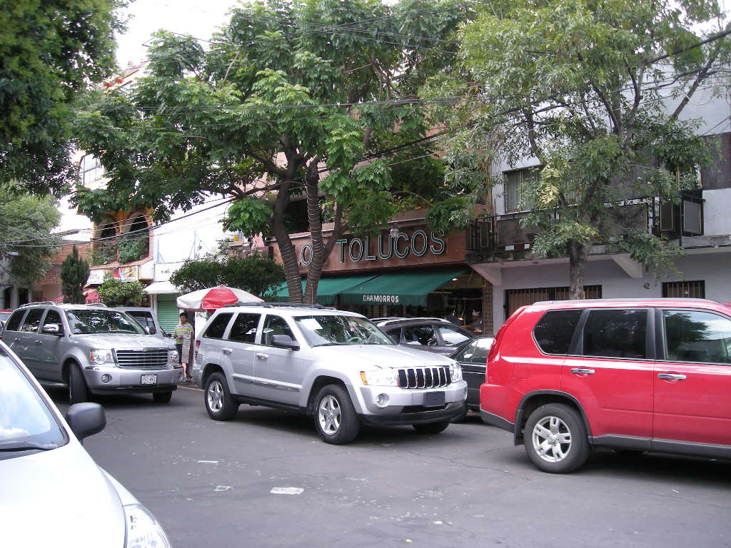
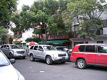 View of the Los Tolucos pozole restaurant on Juan E. Hernández y Dávalos Street.
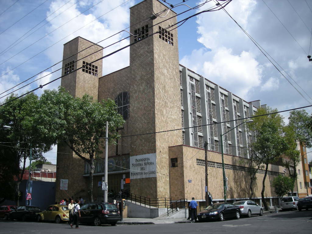
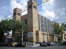 Nuestra Señora de Perpetuo Socorro Parish, on J. E. Hernández y Dávalos St.
Colonia Algarín is a very small working class residential neighborhood[1] located south of the historic center of Mexico City. Its border to the north is Eje 3 Sur José Peón Contreras, to the south Viaducto Miguel Alemán, to the east San Antonio Abad Ave (Calzada de Tlalpan) and to the west Eje Central Lázaro Cárdenas. Colonia Algarín is located between colonias Buenos Aires (Eje Central), Álamos (Viaducto), Obrera (Eje 3 Sur) and Asturias (San Antonio Abad). On the south border, alongside Viaducto Miguel Alemán, flows the Río de la Piedad. This river is encased in cement.[2]
The exact origin of the name is unknown. The family that owned the land in the area before the neighborhood was established was named Algara. One story states that one of the sons was a fan of sports, earning him the nickname of Algarín, which became extended to the family. The first houses of the neighborhood were built in the 1910s, when a square meter of land cost between 25 and 30 cents. The first main streets were Algarín, now Juan E. Hernández y Dávalos, and Casa del Niño and Hospicio, today Toribio Medina. Now the four main streets are: José Peón Contreras, Bolívar, Isabel La Católica, and 5 de Febrero. Most of the rest of the streets are named for writers, poets and journalists: José María Bustillos, Antonio Plaza, Enrique Granados, Manuel Navarrete, Bernardo Couto, and Marcelino Dávalos. There was a hospice for street children called the Hospicio de Niños Expósitos that existed from 1905 until the 1960s, when it was demolished to house barracks associated with the Presidential Guard Brigade.[2]
The area is known for restaurants that serve Guerrero style pozole, a type of meat and corn soup/stew as well as carnitas. It attracts many families for pozole, rivaling the San Camilito Market in Plaza Garibaldi.[1][3][4] Recommended by newspaper El Universal,Chilango magazine and chowhound.com is Los Tolucos, located on the corner of Viaducto Miguel Alemán and Eje 3 Sur José Peón Contreras. It offers the white and green varieties.[3][4][5] Another well-known place is Pozolería Tixtla next door.[1]
The parish church for the area is the Parroquia Nuestra Señora del Perpetuo Socorro, located on Juan E. Hernández y Dávalos Street.[6] In 2007, the parish blessed a fleet of taxis dedicated to providing services to the disabled. This taxi service is base at the Magdalena de las Salinas and Gea González hospitals.[7]
The market of the area is located on Isabel La Católica Ave., between Eje 3 Sur and J. E. Hernández y Dávalos.
The neighborhood is also known, jointly with Colonia Obrera, for the great number of printing business where t-shirts, caps, uniforms, advertisements and many other printed issues are made.
References
- ^ a b c "Pozolería Tixtla". Lonely Planet. http://www.lonelyplanet.com/mexico/mexico-city/restaurants/376429. Retrieved July 28, 2010.
- ^ a b "Colonia Algarín" (in Spanish). Mexico City: Government of the Distrito Federal. http://www.cuauhtemoc.df.gob.mx/delegacion/mapa/mapa%20colonias.swf. Retrieved July 28, 2010.
- ^ a b "Libro Taqueria IV Los Tolucos [Taco Place Book IV – Los Tolucos]" (in Spanish). Mexico City: Chilango (magazine). http://www.chilango.com/restaurantes/nota/2010/02/17/los-tolucos. Retrieved July 28, 2010.
- ^ a b "BEST POZOLE IN D.F.?". http://chowhound.chow.com/topics/597634. Retrieved July 28, 2010.
- ^ Óscar Cedillo (September 13, 2005). "Pozoliza para dar el Grito [Bit of pozole to “give the shout” (of Independence Day)]" (in Spanish). El Universal (Mexico City). http://www.mexiconews.com.mx/tudinero/1540.html. Retrieved July 28, 2010.
- ^ "Parroquias del Distrito Federal [Parishes of the Federal District]" (in Spanish). Mexico City: Archdiocese of Mexico City. http://directorio.arquidiocesismexico.org.mx/Modulo_Parroquias/fichaParroquias.asp?idParr=00000107/0. Retrieved July 28, 2010.
- ^ Jonás López (April 29, 2007). "Bendicen flotilla de taxis para gente discapacitada [Bless flotilla of taxis for disabled people]" (in Spanish). Reforma (Mexico City): p. 3.
19°24′17.99″N 99°8′19.76″W / 19.4049972°N 99.1388222°WCoordinates: 19°24′17.99″N 99°8′19.76″W / 19.4049972°N 99.1388222°W
Colonias and Neighborhoods of Cuauhtémoc, D.F. Colonias Colonia Centro • Colonia Doctores • Colonia Obrera • Colonia Roma • Tepito • Colonia Algarín • Colonia Ampliación Asturias • Colonia Asturias • Colonia Atlampa • Colonia Buenavista • Colonia Buenos Aires • Centro Urbano Benito Juárez • Colonia Condesa • Colonia Cuauhtémoc • Colonia Esperanza • Colonia Exhipódromo de Peralvillo • Colonia Felipe Pescador • Colonia Guerrero • Colonia Hipódromo • Colonia Hipódromo Condesa • Colonia Juárez • Colonia Maza • Colonia Morelos • Colonia Paulino Navarro • Colonia Peralvillo • Colonia San Rafael • Colonia San Simón Tolnahuac • Colonia Santa María Insurgentes • Colonia Santa María la Ribera • Unidad Habitacional Nonoalco-Tlatelolco • Colonia Tabacalera • Colonia Tránsito • Colonia Valle Gómez • Colonia Vista Alegra • Zona Rosa
Categories:- Neighborhoods in Mexico City
Wikimedia Foundation. 2010.