- Colorado State Highway 74
-
State Highway 74
Evergreen Parkway 
Route information Maintained by CDOT Length: 18.110 mi[1] (29.145 km) Major junctions West end:  I-70 at El Rancho
 US 40 at El Rancho
East end:  SH 8 at Morrison
Highway system ←  SH 72
SH 72SH 75  →
→State Highway 74 is a 18.1 mi (29.1 km) long state highway in central Colorado. The route begins Interstate 70 as Evergreen Parkway and intersects U.S. Route 40 while heading southward. Continuing southward and meeting several parks, the road heads eastward at Evergreen, where it is no longer Evergreen Parkway. SH 74 continues through Kittredge and Idledale to its eastern terminus at SH 8.
A road was built in the area in 1873 for miners and loggers, following some of today's route. The route was formally defined in the 1920s, following a much longer route from State Highway 103 at Echo Lake to U.S. Route 285 in Morrison. The terminus was corrected to U.S. Route 40 by 1938 and to Interstate 70 by 1992. Since then, the alignment of the route has not been majorly adjusted.
Contents
Route description
 SH 74 near Bergen Park
The route begins at Interstate 70 in El Rancho with an interchange. The road then travels southward along Evergreen Parkway and almost instantly hits U.S. Route 40 along a parking lot. SH 74 moves westward out of the town and into dense evergreen forest.[2] After turning southward and meeting Kerr Gulch road, the parkway turns abruptly west again, meeting the community of Hidden Valley along the south side of Filius Park.[1] SH 74 turns southward and meets CR 65, where it enters the community of Bergen Park, which it skims the western side of. After intersecting Squaw Pass Road, the east side of the parkway becomes Buchanan Park, where several ponds are located. The west side of SH 74 becomes Elk Meadow Open Space Park, where open grassland is dotted with occasional trees. The road passes through several suburbs surrounded by dense forest.[2] While passing Wah Keeney Park, the road turns southeastward and continues south to the community of Hiwan Hills. SH 74 enters Evergreen, where it passes Evergreen Lake and Dedisse Park, surrounded by pine forest.[2]
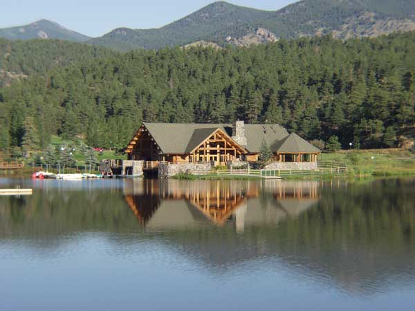
 A house along Evergreen Lake in Dedisse Park near SH 74
SH 74 then curves eastward and northward as it winds out of town and enters a mountainous area. A few miles north, the route, which is no longer Evergreen Parkway, enters Kittredge, where it meets CR 120.[3] Near a narrow curve in the road, SH 74 passes by Corwina Park and Lair O the Bear Open Space Park, where the dense forest transitions to hilly grassland. The route continues eastward through Idledale as the landscape turns rocky, ending at SH 8 in Morrison.[4]
History
In 1873, a road was built from Morrison to Bear Creek Canyon that forms an original section of SH 74.[5] This road gave access to several mining and logging camps in the area.[6] In July 1896, the Bear Creek overflowed and flooded the town of Morrison, considerably damaging a section of the road as well. The first oiling of SH 74 took place during the fall of 1928, when it was paved from Morrison to Evergreen. SH 74 was formally defined by the 1920s from SH 103 at Echo Lake and headed east along today's SH 103 east through Evergreen to U.S. Route 285 at Morrison. By 1938, SH 68 had replaced SH 74 from Echo Lake to Bergen Park, and the route was extended to U.S. Route 40. When the Interstate highway system was completed in 1992, the west end was further extended to Interstate 70.[6]
Due to the continued flooding of the river, the road was often damaged. Following the September 1938 flood, crews built walls along the side of the creek, measuring about 34 feet (10 m) high.[7] SH 74 was realigned in 1956 in an attempt to abandon the continually flooding areas along the creek, moving the route slightly away from the creek. CDOT began work on expanding Evergreen Parkway in the summer of 1993 to a four-lane divided expressway.[6] Since then, the route has not undergone any alignment changes.[3]
Major intersections
The entire route is located in Jefferson County.
Location Mile[1] Destination Notes El Rancho 0.000 I-70 / US 40 eastInterchange 0.374 US 40 westMorrison 18.110 SH 81.000 mi = 1.609 km; 1.000 km = 0.621 mi References
- ^ a b c Colorado Department of Transportation. "Segment Descriptions for Highway 074". http://www.dot.state.co.us/app_DTD_DataAccess/Highways/index.cfm?fuseaction=Description&route=074&begRefPt=0&endRefPt=500&Printable=true. Retrieved 2010-05-20.
- ^ a b c Microsoft. Map of Overview map of SH 74 – Bing Maps (Map). Cartography by NavTEQ, Inc. http://www.bing.com/maps/#JmNwPTM5LjY3MzAzNjIzNTc1OTUzfi0xMDUuMjkwOTYxMTE2NTUyMzUmbHZsPTEzJnN0eT1yJnJ0cD1wb3MuMzkuNjk5MDgxOTI3NTM3OTJfLTEwNS4zMzA4Njk3MDQ0ODQ5NF9FbCUyMFJhbmNobyUyQyUyMENPX19fZV9+di4zOS42MzMyNDg0NDgzNzE4OV8tMTA1LjMyNTA1ODY5ODY1NDE3X1NSLTc0JTIwJTJGJTIwSGlnaHdheSUyMDc0fnBvcy4zOS42NTExOTEwODU1NzcwMV8tMTA1LjE5MzY3OTQwNzIzODk2X01vcnJpc29uJTJDJTIwQ09fX19lXyZtb2RlPUQmcnRvcD0wfjB+MH4=. Retrieved 2010-05-20.
- ^ a b Colorado Department of Transportation. "Map of Jefferson County". http://www.dot.state.co.us/App_DTD_DataAccess/Downloads/CountyMaps/Jefferson.pdf. Retrieved 2010-05-23.
- ^ Colorado Department of Transportation. "Map of Morrison, Colorado". http://www.dot.state.co.us/App_DTD_DataAccess/Downloads/CityMaps/Morrison.pdf. Retrieved 2010-05-23.
- ^ Chain & Hardy (1884). Nell's Topographic and Township Map of the State of Colorado (Map). Cartography by Louis Nell. http://www.davidrumsey.com/luna/servlet/detail/RUMSEY~8~1~2127~190036:Nell-s-Topographical-&-Township-Map?sort=Pub_List_No_InitialSort,Pub_Date,Pub_List_No,Series_No&qvq=sort:Pub_List_No_InitialSort,Pub_Date,Pub_List_No,Series_No;lc:RUMSEY~8~1&mi=57&trs=26006. Retrieved March 13, 2011.
- ^ a b c Colorado Department of Transportation. "Highways to the Sky". http://www.coloradodot.info/programs/environmental/archaeology-and-history/highways-to-the-sky/ch11.pdf/view. Retrieved 2010-05-20.
- ^ "Construction of New Walls along Bear Creek". Rocky Mountain News. 1939-05-28.
External links
Categories:


Wikimedia Foundation. 2010.