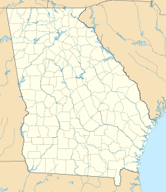
- Columbus Historic District (Columbus, Georgia)
-
Columbus Historic District
Location: Roughly bounded by 9th and 4th sts., 4th Ave., and the Chattahoochee River (original), Bounded by Ninth and Fourth Sts., Chattahoochee River and Fourth Ave. (increase), Columbus, Georgia Coordinates: 32°27′29″N 84°59′32″W / 32.45806°N 84.99222°WCoordinates: 32°27′29″N 84°59′32″W / 32.45806°N 84.99222°W Architect: Thomas,Edward Lloyd (increase) Architectural style: Greek Revival, Georgian, Italian Villa (original); Mid 19th Century Revival, Late 19th And 20th Century Revivals, Late Victorian (increase) Governing body: Local (original) and State (increase) NRHP Reference#: 69000045 and 88002048[1] Added to NRHP: July 29, 1969 (original)
October 21, 1988 (increase)Columbus Historic District in Columbus, Georgia is a historic district that was listed on the National Register of Historic Places in 1969.[1] Its area was increased in 1988.[1]
References
- ^ a b c "National Register Information System". National Register of Historic Places. National Park Service. 2009-03-13. http://nrhp.focus.nps.gov/natreg/docs/All_Data.html.
U.S. National Register of Historic Places Topics Lists by states Alabama • Alaska • Arizona • Arkansas • California • Colorado • Connecticut • Delaware • Florida • Georgia • Hawaii • Idaho • Illinois • Indiana • Iowa • Kansas • Kentucky • Louisiana • Maine • Maryland • Massachusetts • Michigan • Minnesota • Mississippi • Missouri • Montana • Nebraska • Nevada • New Hampshire • New Jersey • New Mexico • New York • North Carolina • North Dakota • Ohio • Oklahoma • Oregon • Pennsylvania • Rhode Island • South Carolina • South Dakota • Tennessee • Texas • Utah • Vermont • Virginia • Washington • West Virginia • Wisconsin • WyomingLists by territories Lists by associated states Other  Category:National Register of Historic Places •
  Portal:National Register of Historic PlacesCategories:
- Historic districts in Georgia (U.S. state)
- Georgian architecture in Georgia (U.S. state)
- Greek Revival architecture in Georgia (U.S. state)
- Victorian architecture in Georgia (U.S. state)
- Historic districts in Columbus, Georgia
- Georgia (U.S. state) Registered Historic Place stubs
Wikimedia Foundation. 2010.

