Combe Haven

Combe Haven
Combe Haven
Site of Special Scientific Interest
Combe Haven is located in East Sussex
{{{alt}}}
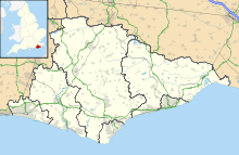
Shown within East Sussex
Area of Search East Sussex
Grid reference TQ770102
Coordinates 50°51′50″N 0°30′58″E / 50.864°N 0.516°E / 50.864; 0.516Coordinates: 50°51′50″N 0°30′58″E / 50.864°N 0.516°E / 50.864; 0.516
Interest Biological
Area 156.1 ha (386 acres)
Notification 1985 (1985)
Natural England website

Combe Haven is a 156.1 hectare (385.7 acre) biological Site of Special Scientific Interest, located in East Sussex, England. The site was notified in 1985 under the Wildlife and Countryside Act 1981.

The site consists of mainly alluvial meadows and the largest reed bed in the county, creating a very important site for a variety of fauna.

References


Wikimedia Foundation. 2010.

Игры ⚽ Нужно решить контрольную?

Look at other dictionaries:

  • Haven Holidays — Haven Leisure Limited Britain’s Favourite Seaside Holiday Type Private Industry Leisure / Holidays Founded 1985 (1985) …   Wikipedia

  • Haven and British Holidays — Infobox Company company name = Haven and British Holidays company company type = Private foundation = 2004 as Haven and British Holidays location = flagicon|UK Hemel Hempstead, England, UK industry = Holiday parent = Bourne Leisure related = Park …   Wikipedia

  • Bexhill West Branch Line — The Bexhill West Branch Overview Type Heavy rail …   Wikipedia

  • Liste des cours d'eau d'Angleterre — Cet article présente une liste des cours d eau d Angleterre, classés par position géographique dans le sens inverse des aiguilles d une montre. Ils passent par l Angleterre et se jettent dans les mers qui bordent le pays. Pour l Esk, la Tweed, la …   Wikipédia en Français

  • Hastings — For other uses, see Hastings (disambiguation). Coordinates: 50°51′N 0°34′E / 50.85°N 0.57°E / 50.85; 0.57 …   Wikipedia

  • Crowhurst, East Sussex — Coordinates: 50°53′N 0°30′E / 50.89°N 0.50°E / 50.89; 0.50 …   Wikipedia

  • A259 road — Infobox road marker state=United Kingdom highway name=A259 name notes= type= A road (Primary Route) route= Emsworth to Folkestone alternate name= maint=Highways Agency section=(Between Pevensy and Brenzett) length mi= length round= length ref=… …   Wikipedia

  • Sussex coast — The Sussex Coast is the southern coast of Sussex in England. The coast faces the English Channel, and is largely built up with a variety of resort towns and ports. It has two main sections, between Selsey Bill and Beachy Head, and then from… …   Wikipedia

  • Chailey Common — Site of Special Scientific Interest …   Wikipedia

  • Glyne Gap — is a strip of marshland that separates the towns of Hastings and Bexhill on Sea. The southern boundary is formed by the A259 road, the East Coastway railway line and the English Channel. To the north is the Pebsham landfill site and Combe Haven… …   Wikipedia

Share the article and excerpts

Direct link
Do a right-click on the link above
and select “Copy Link”