- Constable Hook
-
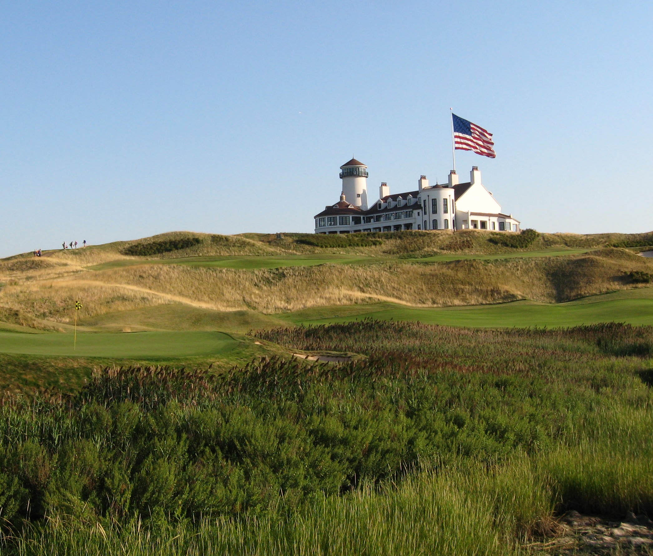
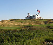 Bayonne Golf Club
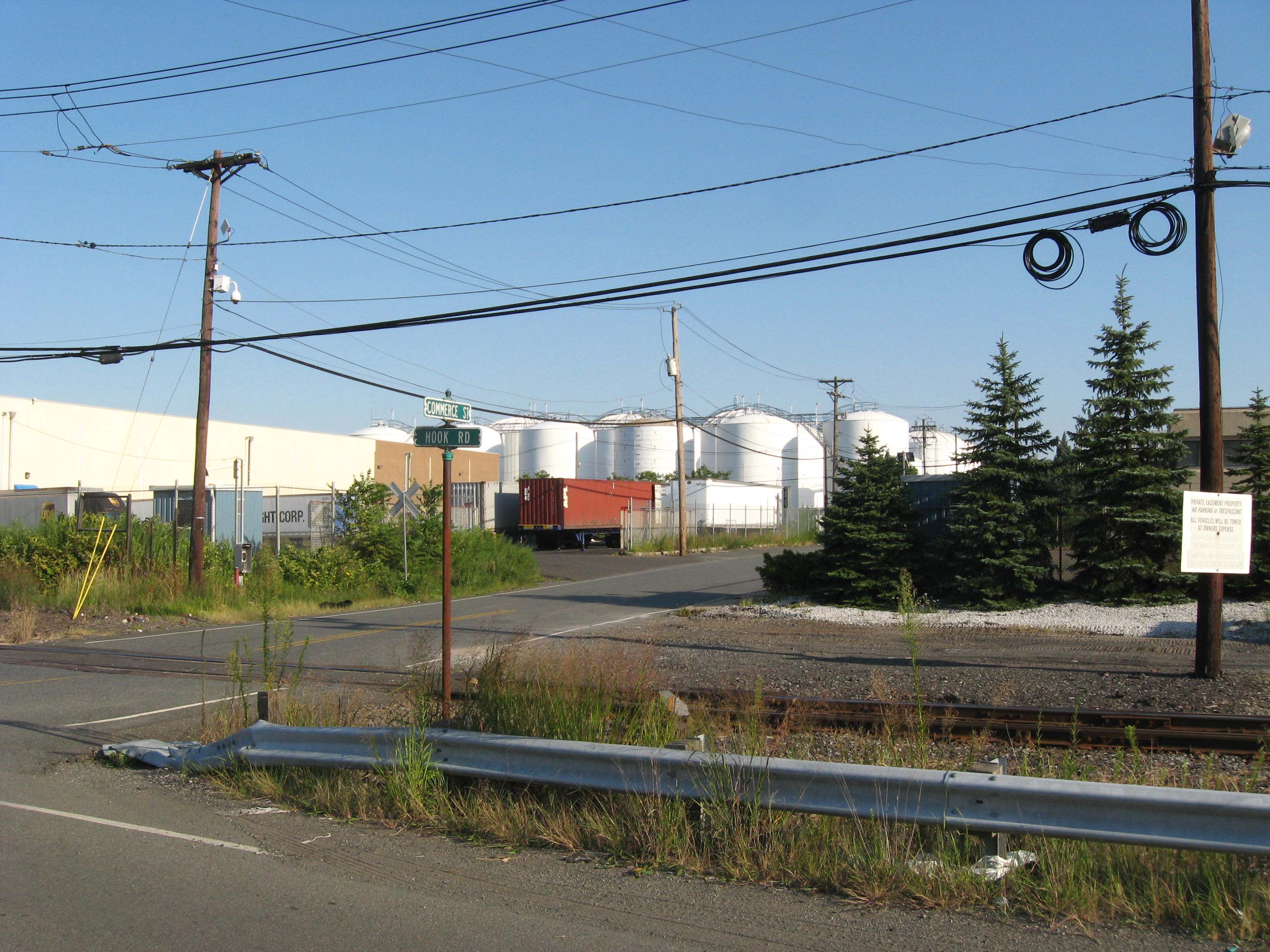
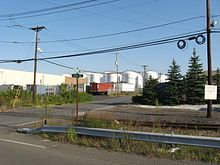 Oil tanks on Hook Road
 South Cove Commons mall
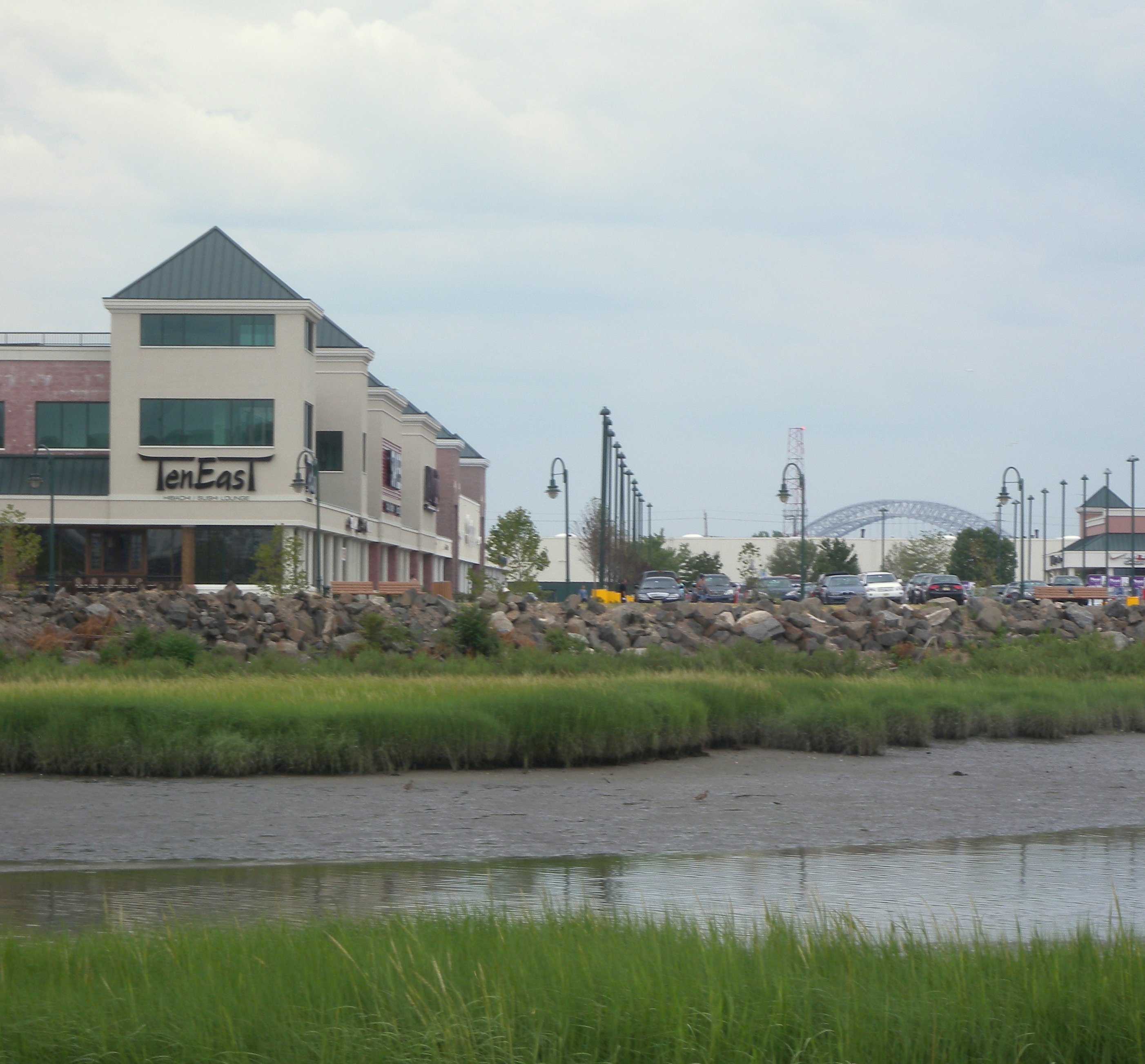
Constable Hook also called Constable's Hook, is a short cape located on the north side of the outlet of Kill van Kull into Upper New York Bay (40°39′28″N 74°05′58″W / 40.65778°N 74.09944°WCoordinates: 40°39′28″N 74°05′58″W / 40.65778°N 74.09944°W). It forms the eastmost extent of the industrial Port Johnson in southeast Bayonne. Historically the term may be used more broadly, as synonymous with Bergen Point such as when it defined the southern extent of Bergen Township in 1693.
Site of a Standard Oil fire of July 1900, southern Constable Hook between Hook Road and Kill Van Kull still has oil docks and storage tanks including those of Exxon. Most of eastern Constable Hook was the 20th century Bayonne city dump, and now belongs to the Bayonne Golf Club, including a recreated lighthouse on the highest hill on the cape, serving as its clubhouse. The Robbins Reef Light actually serves to guide harbor traffic. The north end has South Cove Commons, a late 20th century shopping mall on North Hook Road, and a public shoreside nature walk east of there, affording views of tidal mudflats, the former Military Ocean Terminal at Bayonne, and New York Harbor.
Contents
History
In 1646, the Dutch West India Company, under the leadership of Director-General William Kieft, gave a land grant to Jacob Jacobsen Roy who was a chief gunner or constable in Fort Amsterdam in New Amsterdam. The area, "Konstapel's Hoeck" in Dutch, takes its name from Roy's title. Roy, however, never cultivated or settled on the land.[1]
The first settler is believed to be Pieter Van Buskirk (Boskerck). Born around January 1, 1665, Van Buskirk built a stone house overlooking Upper New York Bay on Constable Hook at what became known as Van Buskirk's Point around the year 1700. Van Buskirk started a small family cemetery next to his house in 1736. His wife, Tryntje died on October 31 of that year and was buried in the cemetery. Pieter Van Buskirk died two years later on July 20, 1738 and was also buried in the cemetery.
For over 200 years, Van Buskirk and his descendants lived in his farmhouse. The house was demolished in 1906 by the Standard Oil Company, which owned the land and were expanding their refinery. Standard Oil has now refurbished the cemetery.[2]
In 1798, Van Buskirk descendent's sold a portion of Constable Hook to the Hazard Powder Co. that built a factory and dock. During the War of 1812, the Hazard Powder Co. factory produced gunpowder for the U.S. Navy and for fortifications in and around New York harbor.
In 1854 James J. Van Buskirk (1791–1856), wrote a will and mentioned 2 acres (8,100 m2) of his land situated at Constable Hook off East 22 Street was to be reserved for a cemetery. The cemetery was not opened until December 1854 and plots in the cemetery were sold soon after. The official name of the cemetery is not known, but it was often referred to in documents as "Hook Cemetery", "Bayonne Cemetery", "Constable Hook" et al. It is currently being called the "Bayonne Constable Hook Cemetery". Today part of the cemetery still exists due to a restoration project of the 1980s. The cemetery is surrounded by property owned by IMTT and is also maintained by them.[3]
On March 15, 1861, the New Jersey Legislature approved unification of Constable Hook along with Bergen Point, Centerville and Salterville into the Township of Bayonne. Three weeks later the Charter for the City of Bayonne was signed by Governor Charles S. Olden.[4]
In 1864, after building a railroad bridge over Newark Bay, the Central Railroad of New Jersey laid railroad tracks through Bayonne into Constable Hook. After the American Civil War, they built the Port Johnston Coal Docks, at the time the largest coal port in the world. Many Irish immigrants took jobs with the railroad living in Constable Hook. So many Irish had moved there that the residents of Bayonne referred to the area as "Irishtown." In 1872, John D. Rockefeller's Standard Oil bought land on Constable Hook. Three years later, Prentice Oil Company was also established at Constable Hook. This company was later sold to a subsidiary of the Pennsylvania Railroad called Empire Transportation Company, a competitor of Standard Oil. Other oil companies like Tidewater and Ocean Oil also built refineries on Constable Hook. The oil companies attracted Hungarian, Czech and Slovakian immigrants from Eastern Europe.[5]
On July 26, 1877, the first full scale strike occurred in Bayonne at the Port Johnston Coal Docks when workers walked off the job.
Further information: Port Johnston Coal DocksPort Johnston was the site of a prisoner-of-war camp for Italian soldiers during WW2.[6]
On July 4, 1900, a fire broke out in the Standard Oil refinery on Constable Hook. It started when lightning caused a number of the large oil tanks to explode. Flaming oil spread out into New York Bay. It took three days to extinguish the fire that in the end caused $2.5 million in damages yet only nine injuries.
Workers at the Standard Oil Company of New Jersey (modern day Exxon) went on strike over wages and union organization from July 15 to July 29, 1915. Bayonne police battled the strikers causing the death of one striker. A week later, on July 22, a riot broke out as gunfire would take the lives of four more men, one as young as 19, and injuring many others, one as young as twelve.
A second strike would occur the following year. On October 10, a riot broke out that left three policeman and several strikes injured. As the riots continued in the streets, police and strikers traded gunfire and one woman was killed. The strike ended on October 19 as the strikers returned to work and Standard Oil agreed to give everyone a raise.[5]
See also
External links
- Constable Hook, NJ real time tides (forecast guidance), NOAA.
- Bayonne Constable Hook Cemetery.
- Chapter XIX, Old Bergen,Daniel Van Winkle, 1902.
- Sunset, Constable's Hook, etching, Childe Hassam, 1915, Cleveland Museum of Art.
- Old Firefighter movie, Constable Hook, July 5, 1900, from Library of Congress collections.
References
- ^ Joan F. Doherty, Hudson County The Left Bank, ISBN 0-89781-172-0 (Windsor Publications, Inc., 1986)
- ^ The Bayonne Times, June 1, 1969
- ^ Graveinfo.com, accessed September 06, 2008.
- ^ Bayonne Historical Society, accessed December 15, 2007.
- ^ a b Kathleen M. Middleton, Images of America - Bayonne, ISBN 0-7524-0069-X (Arcadia Publishing Corp., 1995)
- ^ http://www.colorantshistory.org/ItalianPOWCamp.html
Categories:- New Netherland
- Peninsulas of New Jersey
- Neighborhoods in Hudson County, New Jersey
- Geography of Hudson County, New Jersey
Wikimedia Foundation. 2010.