- Continental Divide of the Americas
-
- For continental divides in general, see Continental divide.
 A map of the principal hydrological divides of North America. The Continental Divide is shown in red. There are three closed drainage areas along the divide, which appear as loops. From north to south they are the Great Divide Basin, the Guzmán Basin, and the Bolsón de Mapimí.
The Continental Divide of the Americas, or merely the Continental Gulf of Division or Great Divide, is the name given to the principal, and largely mountainous, hydrological divide of the Americas that separates the watersheds that drain into the Pacific Ocean from (1) those river systems that drain into the Atlantic Ocean (including those that drain into the Gulf of Mexico and the Caribbean Sea), and (2) along the northernmost reaches of the Divide, those river systems that drain into the Arctic Ocean.
There are many other hydrological divides in the Americas, however the Great Divide is by far the most prominent of these because it tends to follow a line of high peaks along the main ranges of the Rocky Mountains and Andes, at a generally much higher elevation than the other divides.
Contents
Geography
 The Continental Divide in the Front Range of the Rocky Mountains of north central Colorado, taken from the International Space Station on October 28, 2008
The Continental Divide of the Americas begins at Cape Prince of Wales, Alaska, the westernmost point on the mainland of the Americas. The Divide crosses northern Alaska into the Yukon, then zig-zags south into British Columbia via the Cassiar Mountains and Omineca Mountains and northern Nechako Plateau to Summit Lake, north of the city of Prince George and just south of the community of McLeod Lake. From there the Divide traverses the McGregor Plateau to the spine of the Rockies, following the crest of the Canadian Rockies southeast to the 120th meridian west, from there forming the boundary between southern British Columbia and southern Alberta.
The Divide crosses into the United States in northwestern Montana, at the boundary between Waterton Lakes National Park and Glacier National Park. In Canada, it forms the western boundary of Waterton Lakes National Park, and in the US bisects Glacier National Park. Further south, the Divide forms the backbone of the Rocky Mountain Front (Front Range) in the Bob Marshall Wilderness, heads south towards Helena and Butte, then west through the Anaconda-Pintler Wilderness to the Bitterroot Range, where it forms the eastern third of the state boundary between Idaho and Montana. The Divide crosses into Wyoming within Yellowstone National Park and continues south-southeast into Colorado, then western New Mexico. Note that, although the Divide represents the height of land between watersheds, it does not always follow the highest ranges/peaks within each state or province.
In Mexico, it passes through Chihuahua, Durango, Zacatecas, Aguascalientes, Jalisco, Guanajuato, Querétaro, México, the Federal District, Morelos, Puebla, Oaxaca, and Chiapas. In Central America, it continues through southern Guatemala, southwestern Honduras, western Nicaragua, and western/southwestern Costa Rica, and southern Panama.
The Divide continues into South America, where it follows the peaks of the Andes Mountains, traversing western Colombia, central Ecuador, western and southwestern Peru, and eastern Chile (essentially conforming to the Chile-Bolivia and Chile-Argentina boundaries), southward to the southern end of Patagonia and Tierra del Fuego.
In North America another, mainly non-mountainous divide, the Laurentian Divide (or Northern Divide), further separates the Hudson Bay-Arctic Ocean drainage region from the Atlantic watershed region. There are also secondary divides which separate the watersheds flowing into the Great Lakes and Saint Lawrence Seaway (ultimately into the Atlantic) from those which enter the Atlantic via the Missouri-Mississippi complex, as well as one following the Appalachian chain which separates those streams and rivers which flow directly into the Atlantic Ocean from those which exit via the Mississippi River.
Triple points
Triple Divide Peak in Glacier National Park, Montana, is the point at which two of the principal continental divides in North America converge, the Great Divide and the Northern or Laurentian Divide. From this point, waters flow to the Pacific Ocean, the Atlantic Ocean via the Gulf of Mexico, and the Arctic Ocean via Hudson Bay. Most geographers, geologists, meteorologists, and oceanographers generally consider this point to be the hydrological apex of North America. This is the only place on earth where two oceanic divides meet, i.e., where waters from a single point area feed into three different oceans. This status of Triple Divide Peak is the main reason behind the designation of Waterton-Glacier International Peace Park as the "Crown of the Continent" of North America[1] Sources differ, however, on whether Hudson Bay is part of the Atlantic or Arctic Ocean. Hudson Bay's waters flow predominantly to the Atlantic and do not directly contribute to the Arctic Ocean.[2]
Another triple divide or triple point occurs in Canada on a prominent peak directly on the border between Alberta and British Columbia, called Snow Dome because the Columbia Icefield completely covers the summit.[3] From this peak, water flows into the Pacific Ocean via the Columbia River system; the Arctic Ocean via the Athabasca River and MacKenzie River systems; and Hudson Bay via the North Saskatchewan River system. Canadians generally consider Snow Dome to be the hydrological apex of North America because they consider Hudson Bay to be an extension of the Atlantic Ocean,[4] and also because Snow Dome is 1,000 metres (3,300 ft) higher than Triple Divide Peak and receives considerably more precipitation.[5]
In fact, there are such triple divide points wherever any two continental divides meet.[6] North America can be considered to have five major drainage systems: into the Pacific, Atlantic and Arctic Oceans, plus Hudson Bay and the Gulf of Mexico. Within this system there are four continental divides and three triple points, the two mentioned previously and a third near Hibbing, Minnesota where the Northern Divide intersects the Saint Lawrence Seaway divide.[7] Since there is no true consensus on what a continental divide is, there is no real agreement on where the triple points are.[8] However, the main Continental Divide described in this article is a far more distinctive geological feature than the others and its two main triple points are much more prominent.
Hiking Trail
The Continental Divide Trail follows the divide through the U.S. from the Mexican border to the Canadian border. A less-developed Canadian extension called the Great Divide Trail continues through five national parks and six provincial parks, ending at Kakwa Lake in east-central British Columbia.[9]
Exceptions
Many endorheic regions in North America complicate the simple view of east or west, "ocean-bound" water flow. Several endorheic basins straddle the continental divide, including the Great Divide Basin in Wyoming, the Guzmán Basin in New Mexico and Chihuahua, Mexico, and the Bolsón de Mapimí in Mexico.
Water from North Two Ocean Creek and Isa Lake, on the continental divide in Wyoming flow into both oceans.
Images
-

The Continental Divide as it passes through Yellowstone National Park (7988ft / 2436m)
-

Winter Park Resort, a ski resort in the southeast end of Fraser Valley, located at the west end of the Moffat Tunnel, a major Union Pacific railroad tunnel under the divide
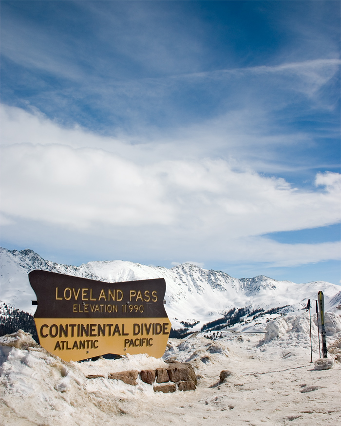
-

The Continental Divide as it passes through Colorado at the Loveland Pass
-

Grays Peak at 4,352 meters (14,278 ft) elevation in Colorado is the highest point on the Continental Divide in North America.
-

The Continental Divide viewed from northwest of Winter Park, Colorado.
-

Divide on US 550 in New Mexico.
-

Divide on I-40 in New Mexico.
-

Hoosier Pass Colorado on May 29, 2006.
-

Logan Pass crosses the Continental Divide in Glacier National Park, Montana.
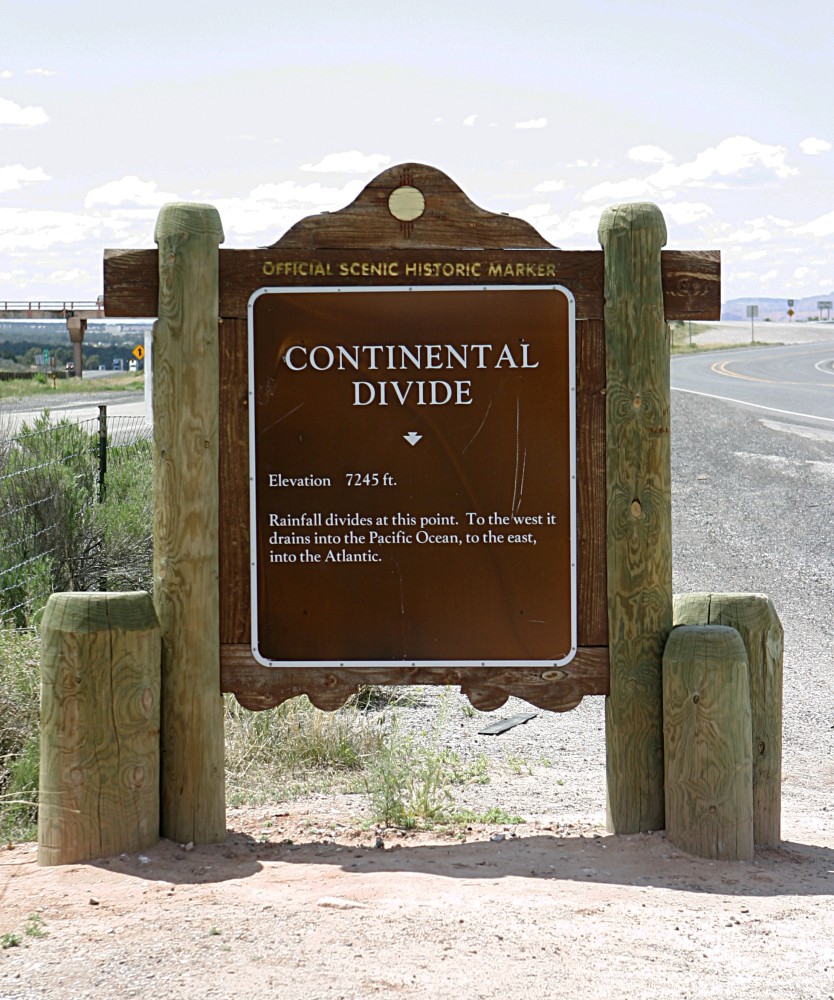
-

South Pass sign in Wyoming.
-
August, 1964 atop Loveland Pass, Colorado.
See also
- Continental divide
- Continental Divide Trail
- Great Divide Trail
- Eastern Continental Divide
- Lemhi Pass
- List of railroad crossings of the North American continental divide
- Laurentia
- Laurentian Divide (Northern Divide)
- Valparaiso Moraine
References
- ^ [1]
- ^ Lewis, Edward Lyn; Jones, E. Peter; North Atlantic Treaty Organization. Scientific Affairs Division (2000). The Freshwater Budget of the Arctic Ocean. Springer. p. 101. ISBN 9780792364399. http://books.google.com/books?id=sZX_p5IKAxUC&pg=PA101. Retrieved 26 November 2010.
- ^ Birrel, Dave (2007). "Snow Dome". Peaks of the Canadian Rockes. PeakFinder (Rocky Mountain Books). http://peakfinder.com/peakfinder.ASP?PeakName=Snow+Dome. Retrieved 2007-12-28.
- ^ Sanford, Robert W. (2010). Our World's Heritage: Creating a Culture Worthy of Place in Canada's Western Mountain Parks. Athabasca University Press. p. 160. ISBN 9781897425572. http://books.google.com/books?id=2aPnUlT5HAkC&pg=PA160.
- ^ Timmer, Henry (2006). "Snow Dome - The Hydrological Apex of North America". Snow Dome. climbwild.net. http://climbwild.net/MP_Snow_Dome_page_one.html. Retrieved 2007-12-28.
- ^ Andersen, Robert N. (2006). "Triple Divide Points and North American Drainage Basins". University of Wisconsin - Eau Claire. http://www.uwec.edu/andersrn/Triple_Divide_Pts.htm. Retrieved 2007-12-29.
- ^ monica driscollian rivers atlas (2006). "Minnesota Rivers Map". Minnesota State Map Collection. Geology.com. http://geology.com/state-map/minnesota.shtml. Retrieved 2007-12-29.
- ^ Gonzalez, Mark A. (2002). "Continental Divides in North Dakota and North America". NGDS Newsletter. North Dakota Geological Survey. https://www.dmr.nd.gov/ndgs/Newsletter/NLS03/pdf/Divide.pdf. Retrieved 2007-12-29.
- ^ Lynx, Dustin (2000). Hiking Canada's Great Divide Trail. Rocky Mountain Books. ISBN 0921102798. http://rmbooks.com/book_details.php?isbn_upc=9781894765893.
External links
- A detailed map of watersheds in North America
- A detailed overview of isolated wetlands from the USFWS
- Detailed article, maps, and boundary data from The National Atlas of the United States
- Parting of the Waters: a creek that flows to two oceans
- U.S. Geological Survey Geographic Names Information System: Continental Divide (New Mexico, Colorado, Wyoming, Idaho, Montana)
- U.S. Geological Survey Geographic Names Information System: Continental Divide (Alaska)
Subfields of physical geography 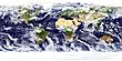 Categories:
- Geography of North America
- Water divides
- Great Divide of North America
- Drainage basins of North America


Wikimedia Foundation. 2010.