- Coonamble Shire
-
Coonamble Shire
New South Wales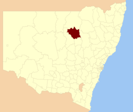
Location in New South WalesPopulation: 4,306(2009)[1] • Density: 0.46/km² (1.2/sq mi) Area: 9926 km² (3,832.5 sq mi) Mayor: Tim Horan Council Seat: Coonamble (80 Castlereagh Street) Region: Orana State District: Barwon Federal Division: Parkes LGAs around Coonamble Shire: Brewarrina Walgett Narrabri Warren Coonamble Shire Warrumbungle Warren Gilgandra Warrumbungle Coonamble Shire is a local government area in the Orana region of New South Wales, Australia. It is located on the Castlereagh Highway and the Castlereagh River.
Coonamble Shire includes Coonamble, Gulargambone and Quambone.
Council
Coonamble Shire Council is composed of seven councillors elected proportionally. The mayor is not directly elected.[2] The current makeup of the council is as follows:[2]
Party Councillors Independents and Unaffiliated 7 Total 7 The current council, elected in 2008, is:[2]
Councillor Party Notes Ahmad Karanouh Unaffiliated Tim Horan Independent Mayor Don Schieb Unaffiliated Michael Webb Independent Barbara O'Brien Independent Tom Cullen Unaffiliated Jack Canham Unaffiliated References
- ^ Australian Bureau of Statistics (30 March 2010). "Regional Population Growth, Australia, 2008–09". http://www.abs.gov.au/ausstats/abs@.nsf/Latestproducts/3218.0Main%20Features42008-09?opendocument&tabname=Summary&prodno=3218.0&issue=2008-09&num=&view=. Retrieved 3 June 2010.
- ^ a b c "Coonamble Shire Council". 2008 Election results. Electoral Commission NSW. http://www.lg.elections.nsw.gov.au/LGE2008/result.Coonamble.html. Retrieved 2009-06-16.[dead link]
Coordinates: 30°57′S 148°24′E / 30.95°S 148.4°E
Local Government Areas of New South Wales Metropolitan Sydney Inner SydneyAshfield · Botany Bay · Burwood · Canada Bay · Canterbury · Hurstville · Kogarah · Lane Cove · Leichhardt · Manly · Marrickville · Mosman · North Sydney · Randwick · Rockdale · Strathfield · Sydney · Waverley · Willoughby · WoollahraOuter SydneyAuburn · Bankstown · Blacktown · Camden · Campbelltown · Fairfield · The Hills · Holroyd · Hornsby · Hunter's Hill · Ku-ring-gai · Liverpool · Parramatta · Penrith · Pittwater · Ryde · Sutherland · WarringahSydney SurroundsMid North Coast Bellingen · Clarence Valley · Coffs Harbour · Greater Taree · Kempsey · Nambucca · Port Macquarie-Hastings · Lord Howe IslandMurray Murrumbidgee Carrathool · Coolamon · Cootamundra · Griffith · Gundagai · Hay · Junee · Leeton · Lockhart · Murrumbidgee · Narrandera · Temora · Wagga WaggaHunter Cessnock · Dungog · Gloucester · Great Lakes · Lake Macquarie · Maitland · Muswellbrook · Newcastle · Port Stephens · Singleton · Upper HunterIllawarra Richmond Tweed Southeastern Bega · Bombala · Boorowa · Cooma-Monaro · Eurobodalla · Goulburn Mulwaree · Harden · Palerang · Queanbeyan · Snowy River · Tumut · Upper Lachlan · Yass Valley · YoungNorthern Armadale Dumaresq · Glen Innes-Severn · Gunnedah · Guyra · Gwydir · Inverell · Liverpool Plains · Moree Plains · Narrabri · Tamworth · Tenterfield · Uralla · WalchaCentral West North Western Bogan · Bourke · Brewarrina · Cobar · Coonamble · Dubbo · Gilgandra · Narromine · Walgett · Warren · Warrumbungle · WellingtonFar West Categories:- Local Government Areas of New South Wales
- New South Wales geography stubs

Wikimedia Foundation. 2010.