- Copper Cove Subdivision, California
-
Coordinates: 37°55′37″N 120°37′53″W / 37.92694°N 120.63139°W
Copper Cove Subdivision — Unincorporated community — Location in California
 Copper Cove Subdivision
Coordinates: 37°55′37″N 120°37′53″W / 37.92694°N 120.63139°W Country United States State California County Calaveras County Elevation[1] 1,070 ft (326 m) Copper Cove Subdivision is an unincorporated community in Calaveras County, California. It lies at an elevation of 1070 feet (326 m).
References
Municipalities and communities of Calaveras County, California City 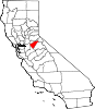
CDPs Arnold | Avery | Copperopolis | Dorrington | Forest Meadows | Mokelumne Hill | Mountain Ranch | Murphys | Rail Road Flat | Rancho Calaveras | San Andreas | Vallecito | Valley Springs | Wallace | West Point
Unincorporated
communitiesAlabama Hill | Big Bar | Big Meadow | Big Trees | Big Trees Village | Big Valley | Blue Lake Junction | Blue Lake Springs | Bummerville | Burson | Calaveritas | Camp Connell | Camp Pardee | Campo Seco | Canyon View | Carmen City | Cave City | Cedar Vista | Copper Cove Subdivision | Copper Cove Village | Cottage Springs | Douds Landing | Douglas Flat | Ebbetts Pass Highlands | Felix | Fisher Place | Fly-In Acres | Fort Jones | Fourth Crossing | Fuchs | Ganns | Glencoe | Goodmans Corner | Grizzly Ridge | Hams | Hanford Hill | Happy Valley | Hathaway Pines | Hathaways Mountain Pines | Independence | Indian Creek | Indian Hills | Jenny Lind | Jesus Maria | La Honda Park | Lake Camanche Ranches | Lakemont Pines | Lakeside Terrace | Lilac Park | Lombardi | Lost City | Lynn Park Acres | Manuel Mill | McKay | Meadowmont | Milton | Mother Lode Acres | Mountain Ranch Subdivision | Mountain Retreat | Mumbert Acres | Oak Grove | Oak Park Estates | Paloma | Pinebrook | Ponderosa Park | Porter | Quail Oaks | Red Apple | Rich Gulch | Rocky Hill | Sandoz | Sandy Gulch | Scenic Valley Ranchos | Sheep Ranch | Sherman Acres | Skyhigh | Snowshoe Springs | South Camanche Shore | Sunset Point | Tamarack | Tamarack Springs | Telegraph City | The Shores of Poker Flat | Timber Trails | Toyanza Subdivision | Toyon | White Pines | Wilseyville | Wyldewood
Former
settlementsAltaville | Antelope House | Balaklava Hill | Blue Mountain | Brownsville | Buckeye Hill | Camanche | Camp Spirito | Carson Hill | Chichi | El Dorado Bar | Fremont Valley | Greasertown | Hodson | Independence Flat | Lower Calaveritas | Mammoth Cave | McLeans Bar | McLeans Ferry | Melones | Mill Valley | North American House | Norval | Oregon Bar | Pattees Ranch | Poverty Bar | Sandy Bar | Spanish Bar | Stony Bar | Stoutenburg | Taylors Bar | Tremont House | Yaqui Camp
Copper Cove is located approximately 40 miles east of Stockton in the town of Copperopolis. It is home to about 1000 families, and includes such amenities as a 33+ acre park and access to Lake Tulloch.
Black Creek Park is a 33+ acre park available to all Copper Cove property owners and includes: a community center, hiking, biking, and equestrian trails, a riding arena, picnic facilities, and playground equipment.
Kiva is a waterfront facility located on Lake Tulloch available to all Copper Cove property owners and includes: a launch ramp, boat docks, swimming area, and picinic facilities.
All property owners belong to the Cove at Lake Tulloch Owners' Association (CCLTOA).
Categories:- Populated places in Calaveras County, California
- Unincorporated communities in California
- Calaveras County, California geography stubs


Wikimedia Foundation. 2010.