- Greenhalgh-with-Thistleton
-
Coordinates: 53°50′00″N 2°54′07″W / 53.833304°N 2.901921°W
Greenhalgh-with-Thistleton 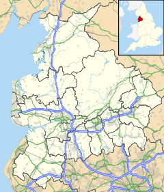
 Greenhalgh-with-Thistleton
Greenhalgh-with-Thistleton shown within LancashirePopulation 462 (2001) OS grid reference SD406378 Parish Greenhalgh-with-Thistleton District Fylde Shire county Lancashire Region North West Country England Sovereign state United Kingdom Post town PRESTON Postcode district PR4 Dialling code 01995 Police Lancashire Fire Lancashire Ambulance North West EU Parliament North West England UK Parliament Fylde List of places: UK • England • Lancashire Greenhalgh-with-Thistleton is a civil parish on The Fylde in Lancashire, England. It has a population of 462.[1]
The parish is in the Borough of Fylde, and contains the hamlets of Greenhalgh, Thistleton, Esprick and Corner Row. It is part of the ward of Singleton and Greenhalgh, which elects one councillor.[2] As of 2008[update] it is represented by Maxine Chew, an independent councillor.[3]
The main road through the parish is the A585 Kirkham to Fleetwood road; there is also a junction with the M55 motorway (M55 J3, Wesham Circle) in the south of the parish. The linear settlement of Esprick is situated along the A585, with Corner Row further south where the road crosses the M55. Greenhalgh is to the west, and Thistleton in the north east corner of the parish. Greenhalgh is adjacent to Wesham. The surrounding area is agricultural land.
Thistleton has been designated as a conservation area since 1975.[4]
There is a bus service, although not frequent, provided by Stagecoach. Route 76, one of the company's "Fylde Villager" services, connects the hamlets to Blackpool, Poulton-le-Fylde, Kirkham, Lytham and St Annes.[5] From May 2009, the Fylde Villager bus service 76 has been operated by Coastal Coaches of Warton. The service now runs on an hourly basis, in both directions, on a route between St. Annes Square and Blackpool.
The nearest railway station is Kirkham and Wesham, with Poulton-le-Fylde a little further away.
References
- ^ Office for National Statistics : Census 2001 : Parish Headcounts : Fylde Retrieved 8 February 2010
- ^ The Stationary Office : The Borough of Fylde (Electoral Changes) Order 2001 Retrieved 8 February 2010
- ^ "Singleton and Greenhalgh". Fylde Borough Council. http://www.fylde.gov.uk/Councillors.aspx?ward=Singleton%20and%20Greenhalgh. Retrieved 2008-12-31.[dead link]
- ^ "Conservation Areas and Article 4 Directions". Fylde Borough Council. http://www.fylde.gov.uk/Category.aspx?cat=1310. Retrieved 2008-12-31.[dead link]
- ^ "The Fylde Villager". Stagecoach North West. http://www.stagecoachbus.com/timetables/FyldeVillager7576808219October2008.pdf. Retrieved 2008-12-31.
External links
- Greenhalgh-with-Thistleton on British History Online
Ceremonial county of Lancashire Unitary authorities Boroughs or districts Major settlements - Accrington
- Adlington
- Bacup
- Barnoldswick
- Blackburn
- Blackpool
- Brierfield
- Burnley
- Burscough
- Carnforth
- Chorley
- Clayton-le-Moors
- Cleveleys
- Clitheroe
- Colne
- Darwen
- Earby
- Fleetwood
- Garstang
- Great Harwood
- Haslingden
- Kirkham
- Lancaster
- Leyland
- Longridge
- Lytham St Annes
- Morecambe
- Nelson
- Ormskirk
- Oswaldtwistle
- Padiham
- Penwortham
- Poulton-le-Fylde
- Preesall
- Preston
- Rawtenstall
- Rishton
- Skelmersdale
- Wesham
- Whitworth
See also: List of civil parishes in Lancashire
Rivers Canals Topics Categories:- Lancashire geography stubs
- Civil parishes in Lancashire
- Geography of Fylde (borough)

Wikimedia Foundation. 2010.