- Cornriggs Meadows
-
Cornriggs Meadows Site of Special Scientific Interest Country England Region North East District Wear Valley Location NY846416 - coordinates 54°46′10″N 2°14′24″W / 54.76944°N 2.24°W Area 15.2 ha (37.6 acres) Notification 1989 Management Natural England Area of Search County Durham Interest Biological 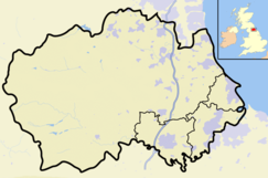
 Location of Cornriggs Meadows SSSI, Co Durham
Website: Map of site Cornriggs Meadows is a Site of Special Scientific Interest in Upper Weardale in north-west County Durham, England. It consists of a group of fields, located in the Wear valley, 1 km north-west of the village of Cowshill. Most of the fields are maintained as hay meadows by traditional farming methods.
Among a varied grassland flora, one field contains a large colony of a rare lady's mantle, Alchemilla acutiloba , which is endemic to Weardale and Teesdale.[1]
References
- ^ "Cornriggs Meadows". English Nature. 1989. http://www.english-nature.org.uk/citation/citation_photo/1005510.pdf. Retrieved 19 July 2010.
Backstone Bank and Baal Hill Woods • Baldersdale Woodlands • Bishop Middleham Quarry • Bollihope, Pikestone, Eggleston and Woodland Fells • Botany Hill • Bowes Moor • Bowlees and Friar House Meadows • Brasside Pond • Brignall Banks • Burnhope Burn • Butterby Oxbow • Cassop Vale • Castle Eden Dene • Causey Bank Mires • Charity Land • Close House Mine • Cornriggs Meadows • Cotherstone Moor • Crag Gill • Crime Rigg and Sherburn Hill Quarries • Dabble Bank • Derwent Gorge and Horsleyhope Ravine • Durham Coast • Fairy Holes Cave • Far High House Meadows • Fishburn Grassland • Foster's Hush • Frog Wood Bog • God's Bridge • Grains o' th' Beck Meadows • Green Croft and Langley Moor • Greenfoot Quarry • Hannah's Meadows • Hawthorn Dene • Hawthorn Quarry • Hell Kettles • Hesledon Moor East • Hesledon Moor West • Hexhamshire Moors • Hisehope Burn Valley • Hulam Fen • Hunder Beck Juniper • Kilmond Scar • Low Redford Meadows • Lune Forest • Mere Beck Meadows • Middle Crossthwaite • Middle Side and Stonygill Meadows • Middleton Quarry • Middridge Quarry • Moorhouse and Cross Fell • Muggleswick, Stanhope and Edmundbyers Commons and Blanchland Moor • Neasham Fen • Newton Ketton Meadow • Old Moss Lead Vein • Park End Wood • Pig Hill • Pike Whin Bog • Pittington Hill • Pow Hill Bog • Quarrington Hill Grasslands • Railway Stell West • Raisby Hill Grassland • Raisby Hill Quarry • Redcar Field • Rigg Farm and Stake Hill Meadows • Rogerley Quarry • Sherburn Hill • Shipley and Great Woods • Sleightholme Beck Gorge - The Troughs • Slit Woods • Stony Cut, Cold Hesledon • Teesdale Allotments • The Bottoms • The Carrs • Thrislington Plantation • Town Kelloe Bank • Trimdon Limestone Quarry • Tuthill Quarry • Upper Teesdale • Waldridge Fell • West Newlandside Meadows • West Park Meadows • West Rigg Open Cutting • Westernhope Burn Wood • Wingate Quarry • Witton-le-Wear • Yoden Village QuarryCategories:- Sites of Special Scientific Interest in County Durham
- United Kingdom Site of Special Scientific Interest stubs
- County Durham geography stubs

Wikimedia Foundation. 2010.