Beresford County

Beresford County
Beresford
New South Wales
Beresford NSW.PNG
Location in New South Wales
Lands administrative divisions around Beresford
Cowley Murray Murray
Wallace Beresford Dampier
Wallace Wellesley Auckland

Beresford County is one of the 141 Cadastral divisions of New South Wales. It contains Cooma and Bredbo. Part of the Murrumbidgee River forms the boundary in the north-west, and a separate part of the river forms part of the western boundary.

Beresford County was named in honour of Viscount William Carr Beresford (1768-1854).[1]

Parishes within this county

A full list of parishes found within this county; their current LGA and mapping coordinates to the approximate centre of each location is as follows:

Parish LGA Coordinates
Abercrombie Cooma-Monaro Shire 36°01′54″S 149°15′04″E / 36.03167°S 149.25111°E / -36.03167; 149.25111 (Abercrombie Parish)
Big Badja Cooma-Monaro Shire 36°02′54″S 149°32′04″E / 36.04833°S 149.53444°E / -36.04833; 149.53444 (Big Badja Parish)
Billilingra Cooma-Monaro Shire 36°00′54″S 149°09′04″E / 36.015°S 149.15111°E / -36.015; 149.15111 (Billilingra Parish)
Binjura Cooma-Monaro Shire 36°11′54″S 149°06′04″E / 36.19833°S 149.10111°E / -36.19833; 149.10111 (Binjura Parish)
Bransby Cooma-Monaro Shire 35°55′54″S 149°09′04″E / 35.93167°S 149.15111°E / -35.93167; 149.15111 (Bransby Parish)
Bredbo Cooma-Monaro Shire 35°59′54″S 149°00′04″E / 35.99833°S 149.00111°E / -35.99833; 149.00111 (Bredbo Parish)
Brest Cooma-Monaro Shire 35°57′54″S 148°56′04″E / 35.965°S 148.93444°E / -35.965; 148.93444 (Brest Parish)
Bulgundramine Cooma-Monaro Shire 36°25′54″S 149°16′04″E / 36.43167°S 149.26778°E / -36.43167; 149.26778 (Bulgundramine Parish)
Bullanamang Cooma-Monaro Shire 35°56′54″S 149°05′04″E / 35.94833°S 149.08444°E / -35.94833; 149.08444 (Bullanamang Parish)
Bunyan Cooma-Monaro Shire 36°16′54″S 149°11′04″E / 36.28167°S 149.18444°E / -36.28167; 149.18444 (Bunyan Parish)
Callaghan Cooma-Monaro Shire 36°03′54″S 149°12′04″E / 36.065°S 149.20111°E / -36.065; 149.20111 (Callaghan Parish)
Clifford Cooma-Monaro Shire 36°05′54″S 149°14′04″E / 36.09833°S 149.23444°E / -36.09833; 149.23444 (Clifford Parish)
Colinton Cooma-Monaro Shire 35°50′54″S 149°12′04″E / 35.84833°S 149.20111°E / -35.84833; 149.20111 (Colinton Parish)
Coolringdon Snowy River Shire 36°13′54″S 148°58′04″E / 36.23167°S 148.96778°E / -36.23167; 148.96778 (Coolringdon Parish)
Cooma Snowy River Shire 36°14′54″S 149°07′04″E / 36.24833°S 149.11778°E / -36.24833; 149.11778 (Cooma Parish)
Cosgrove Cooma-Monaro Shire 35°59′54″S 149°00′04″E / 35.99833°S 149.00111°E / -35.99833; 149.00111 (Cosgrove Parish)
Dangelong Cooma-Monaro Shire 36°17′54″S 149°16′04″E / 36.29833°S 149.26778°E / -36.29833; 149.26778 (Dangelong Parish)
Duncan Cooma-Monaro Shire 35°54′54″S 148°50′04″E / 35.915°S 148.83444°E / -35.915; 148.83444 (Duncan Parish)
Flinders Cooma-Monaro Shire 35°56′54″S 149°00′04″E / 35.94833°S 149.00111°E / -35.94833; 149.00111 (Flinders Parish)
Gladstone Cooma-Monaro Shire 36°19′54″S 149°10′04″E / 36.33167°S 149.16778°E / -36.33167; 149.16778 (Gladstone Parish)
Good Good Cooma-Monaro Shire 36°02′54″S 149°27′04″E / 36.04833°S 149.45111°E / -36.04833; 149.45111 (Good Good Parish)
Gungoandra Cooma-Monaro Shire 35°53′54″S 149°11′04″E / 35.89833°S 149.18444°E / -35.89833; 149.18444 (Gungoandra Parish)
Hill Cooma-Monaro Shire 35°55′54″S 149°28′04″E / 35.93167°S 149.46778°E / -35.93167; 149.46778 (Hill Parish)
Holland Cooma-Monaro Shire 35°46′54″S 149°22′04″E / 35.78167°S 149.36778°E / -35.78167; 149.36778 (Holland Parish)
Jillimatong Snowy River Shire 36°17′54″S 148°59′04″E / 36.29833°S 148.98444°E / -36.29833; 148.98444 (Jillimatong Parish)
Kybeyan Cooma-Monaro Shire 36°22′54″S 149°27′04″E / 36.38167°S 149.45111°E / -36.38167; 149.45111 (Kybeyan Parish)
Kydra Cooma-Monaro Shire 36°27′54″S 149°25′04″E / 36.465°S 149.41778°E / -36.465; 149.41778 (Kydra Parish)
Lucas Cooma-Monaro Shire 36°15′54″S 149°24′04″E / 36.265°S 149.40111°E / -36.265; 149.40111 (Lucas Parish)
Michelago Cooma-Monaro Shire 35°47′54″S 149°10′04″E / 35.79833°S 149.16778°E / -35.79833; 149.16778 (Michelago Parish)
Milford Cooma-Monaro Shire 35°49′54″S 149°22′04″E / 35.83167°S 149.36778°E / -35.83167; 149.36778 (Milford Parish)
Montagu Cooma-Monaro Shire 36°15′54″S 149°16′04″E / 36.265°S 149.26778°E / -36.265; 149.26778 (Montagu Parish)
Murrumbucca Snowy River Shire 36°03′54″S 148°59′04″E / 36.065°S 148.98444°E / -36.065; 148.98444 (Murrumbucca Parish)
Numeralla Cooma-Monaro Shire 36°10′54″S 149°16′04″E / 36.18167°S 149.26778°E / -36.18167; 149.26778 (Numeralla Parish)
Onslow Cooma-Monaro Shire 35°48′54″S 149°17′04″E / 35.815°S 149.28444°E / -35.815; 149.28444 (Onslow Parish)
Palmerston Cooma-Monaro Shire 36°22′54″S 149°27′04″E / 36.38167°S 149.45111°E / -36.38167; 149.45111 (Palmerston Parish)
Rivers Cooma-Monaro Shire 36°17′54″S 149°21′04″E / 36.29833°S 149.35111°E / -36.29833; 149.35111 (Rivers Parish)
Rose Valley Cooma-Monaro Shire 36°07′54″S 149°23′04″E / 36.13167°S 149.38444°E / -36.13167; 149.38444 (Rose Valley Parish)
Rowland Cooma-Monaro Shire 35°55′54″S 149°23′04″E / 35.93167°S 149.38444°E / -35.93167; 149.38444 (Rowland Parish)
Sherlock Cooma-Monaro Shire 35°49′54″S 149°27′04″E / 35.83167°S 149.45111°E / -35.83167; 149.45111 (Sherlock Parish)
Stannard Cooma-Monaro Shire 36°00′54″S 149°21′04″E / 36.015°S 149.35111°E / -36.015; 149.35111 (Stannard Parish)
The Brothers Snowy River Shire 36°19′54″S 149°07′04″E / 36.33167°S 149.11778°E / -36.33167; 149.11778 (The Brothers Parish)
Throsby Cooma-Monaro Shire 36°23′54″S 149°21′04″E / 36.39833°S 149.35111°E / -36.39833; 149.35111 (Throsby Parish)
Tinderry Cooma-Monaro Shire 35°45′54″S 149°15′04″E / 35.765°S 149.25111°E / -35.765; 149.25111 (Tinderry Parish)
Undoo Cooma-Monaro Shire 36°09′54″S 149°28′04″E / 36.165°S 149.46778°E / -36.165; 149.46778 (Undoo Parish)
Wangrah Cooma-Monaro Shire 35°52′54″S 149°19′04″E / 35.88167°S 149.31778°E / -35.88167; 149.31778 (Wangrah Parish)
Winifred Cooma-Monaro Shire 36°30′54″S 149°24′04″E / 36.515°S 149.40111°E / -36.515; 149.40111 (Winifred Parish)
Wise Cooma-Monaro Shire 35°40′54″S 149°20′04″E / 35.68167°S 149.33444°E / -35.68167; 149.33444 (Wise Parish)
Woolumla Cooma-Monaro Shire 36°05′54″S 149°09′04″E / 36.09833°S 149.15111°E / -36.09833; 149.15111 (Woolumla Parish)
York Cooma-Monaro Shire 36°02′10″S 149°05′29″E / 36.03611°S 149.09139°E / -36.03611; 149.09139 (York Parish)

References


Wikimedia Foundation. 2010.

Игры ⚽ Нужно решить контрольную?

Look at other dictionaries:

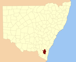
  • Beresford County, New South Wales — Infobox Australian cadastral name = Beresford state = New South Wales caption = Location in New South Wales near nw = Cowley near n = Murray near ne = Murray near w = Wallace near e = Dampier near sw = Wallace near s = Wellesley near se =… …   Wikipedia

  • Beresford (South Dakota) — Beresford Lage in South Dakota …   Deutsch Wikipedia

  • Beresford —   [ berɪsfəd], William Carr [kɑː], Viscount Beresford (seit 1823), britischer General, * 2. 10. 1768, ✝ Bedgebury (County Kent) 8. 1. 1854; nahm 1806 an der Eroberung des Kaplandes teil und leitete im selben Jahr eine erfolglose Militärexpedition …   Universal-Lexikon

  • Beresford, New Brunswick (parish) — Beresford is a parish in northeastern New Brunswick, Canada in Gloucester County on the Chaleur Bay.It s defined in the Territorial Division Act as:West by the County line; east by the Chaleur Bay and south by the easterly prolongation of the… …   Wikipedia

  • Beresford, South Dakota — Infobox Settlement official name = Beresford, South Dakota other name = native name = nickname = settlement type = City motto = imagesize = image caption = flag size = image seal size = image shield = shield size = image blank emblem = blank… …   Wikipedia

  • County Waterford (UK Parliament constituency) — Not to be confused with Waterford City (UK Parliament constituency). Waterford Former County constituency for the House of Commons 1801 (1801)–1885 ( …   Wikipedia

  • Beresford-Peirse Baronets — The Beresford, later Beresford Peirse Baronetcy, of Bagnall in the County of Waterford, is a title in the Baronetage of the United Kingdom. It was created on 21 May 1814 for John Beresford. He was an Admiral in the Royal Navy and also represented …   Wikipedia

  • Beresford, New Brunswick — Infobox Settlement name = Beresford official name = other name = native name = nickname = settlement type = total type = motto = imagesize = image caption = flag size = image seal size = image shield = shield size = image blank emblem = blank… …   Wikipedia

  • Beresford, Charles William de la Poer Beresford, 1st Baron — ▪ British admiral and politician born Feb. 10, 1846, Philipstown, King s County [now Daingean, County Offaly], Ire. died Sept. 6, 1919, Langwell, Caithness, Scot.       British admiral and, intermittently, Conservative member of Parliament who… …   Universalium

  • Beresford — Recorded in many forms as shown below, this is a famous English surname of great antiquity and nobility. It is locational from the village of Beresford in the parish of Alstonfield, North Staffordshire, or perhaps in some cases from Burford… …   Surnames reference

Share the article and excerpts

Direct link
Do a right-click on the link above
and select “Copy Link”