Hawes County

Hawes County
Hawes
New South Wales
Hawes NSW.PNG
Location in New South Wales
Lands administrative divisions around Hawes
Parry Vernon Dudley
Brisbane Hawes Macquarie
Durham Gloucester Gloucester

Hawes County is one of the 141 Cadastral divisions of New South Wales. It is bounded on the south by the Manning River.

Hawes County was named in honour of Sir Benjamin Hawes (1797–1862).[1]

Parishes within this county

A full list of parishes found within this county; their current LGA and mapping coordinates to the approximate centre of each location is as follows:

Parish LGA Coordinates
Barnard Gloucester Shire 31°40′54″S 151°44′04″E / 31.68167°S 151.73444°E / -31.68167; 151.73444 (Barnard)
Barry Upper Hunter Shire 31°37′54″S 151°18′04″E / 31.63167°S 151.30111°E / -31.63167; 151.30111 (Barry)
Brock Walcha Shire 31°22′54″S 151°49′04″E / 31.38167°S 151.81778°E / -31.38167; 151.81778 (Brock)
Campbell Upper Hunter Shire 31°39′54″S 151°28′04″E / 31.665°S 151.46778°E / -31.665; 151.46778 (Campbell)
Cobb Gloucester Shire 31°43′54″S 151°48′04″E / 31.73167°S 151.80111°E / -31.73167; 151.80111 (Cobb)
Coolcumba Walcha Shire 31°25′54″S 151°29′04″E / 31.43167°S 151.48444°E / -31.43167; 151.48444 (Coolcumba)
Cooplacurripa City of Greater Taree 31°36′54″S 151°51′04″E / 31.615°S 151.85111°E / -31.615; 151.85111 (Cooplacurripa)
Couatwong Walcha Shire 31°28′54″S 151°45′04″E / 31.48167°S 151.75111°E / -31.48167; 151.75111 (Couatwong)
Curracabundi Gloucester Shire 31°37′24″S 151°38′04″E / 31.62333°S 151.63444°E / -31.62333; 151.63444 (Curracabundi)
Curricabark Upper Hunter Shire 31°42′54″S 151°27′04″E / 31.715°S 151.45111°E / -31.715; 151.45111 (Curricabark)
Dewitt Gloucester Shire 31°46′54″S 151°43′04″E / 31.78167°S 151.71778°E / -31.78167; 151.71778 (Dewitt)
Giro Gloucester Shire 31°38′54″S 151°48′04″E / 31.64833°S 151.80111°E / -31.64833; 151.80111 (Giro)
Hall Tamworth Regional Council 31°36′54″S 151°32′04″E / 31.615°S 151.53444°E / -31.615; 151.53444 (Hall)
Hastings Port Macquarie-Hastings Council 31°24′54″S 152°14′04″E / 31.415°S 152.23444°E / -31.415; 152.23444 (Hastings)
Hawes Walcha Shire 31°25′54″S 151°56′04″E / 31.43167°S 151.93444°E / -31.43167; 151.93444 (Hawes)
Lowry Walcha Shire 31°29′29″S 151°51′31″E / 31.49139°S 151.85861°E / -31.49139; 151.85861 (Lowry)
Mackay City of Greater Taree 31°45′54″S 151°55′04″E / 31.765°S 151.91778°E / -31.765; 151.91778 (Mackay)
Mernot Gloucester Shire 31°40′54″S 151°34′04″E / 31.68167°S 151.56778°E / -31.68167; 151.56778 (Mernot)
Mukki Walcha Shire 31°22′54″S 151°37′04″E / 31.38167°S 151.61778°E / -31.38167; 151.61778 (Mukki)
Mummel City of Greater Taree 31°35′54″S 151°52′04″E / 31.59833°S 151.86778°E / -31.59833; 151.86778 (Mummel)
Murray Walcha Shire 31°25′54″S 152°02′04″E / 31.43167°S 152.03444°E / -31.43167; 152.03444 (Murray)
Myall Walcha Shire 31°32′54″S 151°33′04″E / 31.54833°S 151.55111°E / -31.54833; 151.55111 (Myall)
Myra Gloucester Shire 31°45′54″S 151°38′04″E / 31.765°S 151.63444°E / -31.765; 151.63444 (Myra)
Naylor Hastings 31°20′54″S 152°10′04″E / 31.34833°S 152.16778°E / -31.34833; 152.16778 (Naylor)
Nowendoc Walcha Shire 31°32′54″S 151°38′04″E / 31.54833°S 151.63444°E / -31.54833; 151.63444 (Nowendoc)
Parkes Walcha Shire 31°29′54″S 151°25′04″E / 31.49833°S 151.41778°E / -31.49833; 151.41778 (Parkes)
Rowley Walcha Shire 31°29′54″S 152°02′04″E / 31.49833°S 152.03444°E / -31.49833; 152.03444 (Rowley)
Rushbrook Walcha Shire 31°20′54″S 152°04′04″E / 31.34833°S 152.06778°E / -31.34833; 152.06778 (Rushbrook)
Schofield Upper Hunter Shire 31°38′54″S 151°21′04″E / 31.64833°S 151.35111°E / -31.64833; 151.35111 (Schofield)
Tobin Hastings 31°23′54″S 152°09′04″E / 31.39833°S 152.15111°E / -31.39833; 152.15111 (Tobin)
Togalo Walcha Shire 31°34′54″S 151°43′04″E / 31.58167°S 151.71778°E / -31.58167; 151.71778 (Togalo)
Tomalla Upper Hunter Shire 31°47′54″S 151°29′04″E / 31.79833°S 151.48444°E / -31.79833; 151.48444 (Tomalla)
Uriamukki Walcha Shire 31°22′54″S 151°44′04″E / 31.38167°S 151.73444°E / -31.38167; 151.73444 (Uriamukki)
Vant Tamworth Regional Council 31°31′54″S 151°17′04″E / 31.53167°S 151.28444°E / -31.53167; 151.28444 (Vant)
Ward City of Greater Taree 31°32′54″S 151°47′04″E / 31.54833°S 151.78444°E / -31.54833; 151.78444 (Ward)
Werrikimbe Hastings 31°14′54″S 152°11′04″E / 31.24833°S 152.18444°E / -31.24833; 152.18444 (Werrikimbe)
White Walcha Shire 31°20′54″S 152°00′04″E / 31.34833°S 152.00111°E / -31.34833; 152.00111 (White)
Woko Gloucester Shire 31°47′54″S 151°52′04″E / 31.79833°S 151.86778°E / -31.79833; 151.86778 (Woko)
Yeerawun Tamworth Regional Council 31°34′54″S 151°14′04″E / 31.58167°S 151.23444°E / -31.58167; 151.23444 (Yeerawun)

References

  1. ^ Geographical Names Board of NSW

Wikimedia Foundation. 2010.

Игры ⚽ Нужна курсовая?

Look at other dictionaries:

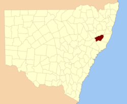
  • Hawes County, New South Wales — Infobox Australian cadastral name = Hawes state = New South Wales caption = Location in New South Wales near nw = Parry near n = Vernon near ne = Dudley near e = Macquarie near se = Gloucester near s = Gloucester near sw = Durham near w =… …   Wikipedia

  • Hawes (disambiguation) — Hawes is a small market town in the Richmondshire district of North Yorkshire, England.Hawes may also refer to:Places*Hawes County, New South Wales, Australia *Hawes Township, Michigan, USA *Hawes Junction, the former name of Garsdale railway… …   Wikipedia

  • Hawes Township, Michigan — Infobox Settlement official name = Hawes Township, Michigan settlement type = Township nickname = motto = imagesize = image caption = image |pushpin pushpin label position =left pushpin map caption =Location within the state of Michigan pushpin… …   Wikipedia

  • Hawes — This interesting surname has (at least) three possible origins, all English. The first is locational from residence at a hause , which maybe a neck of land, but was generally a place for gathering animals. The town of Hawes in Yorkshire, has the… …   Surnames reference

  • Municipio de Hawes (condado de Alcona, Míchigan) — Hawes Municipio de los Estados Unidos …   Wikipedia Español

  • Richard Hawes — Infobox Politician name = Richard Hawes order = 2nd Confederate office = Governor of Kentucky lieutenant = term start = October 4, 1862 term end = April 9, 1865 predecessor = George W. Johnson successor = None office2 = Kentucky State… …   Wikipedia

  • Albert G. Hawes — Albert Gallatin Hawes (April 1, 1804 March 14, 1849) was a U.S. Representative from Kentucky, brother of Richard Hawes, nephew of Aylett Hawes, granduncle of Harry Bartow Hawes, and cousin of Aylett Hawes Buckner.Born near Bowling Green, Virginia …   Wikipedia

  • Albert Gallatin Hawes — (April 1,1804 March 14, 1849) was a Representative from Kentucky who served in the twenty second, twenty third and twenty fourth sessions of Congress.Hawes was born in Caroline County, Virginia, near Bowling Green. He was brother to Richard Hawes …   Wikipedia

  • Harry Bartow Hawes — Harry B. Hawes Harry Bartow Hawes (* 15. November 1869 in Covington, Kenton County, Kentucky; † 31. Juli 1947 in Washington D.C.) war ein US amerikanischer Politiker (Demokratische Partei), der den Bundesstaat …   Deutsch Wikipedia

  • National Register of Historic Places listings in Wharton County, Texas — List of Registered Historic Places in Wharton County, Texas Map of all coordinates from Google Map of all coordinates from Bing …   Wikipedia

Share the article and excerpts

Direct link
Do a right-click on the link above
and select “Copy Link”