- Mendocino County
-
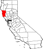
County of Mendocino — County — 
SealLocation in the state of California California's location in the United States
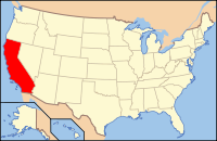
Country  United States
State  California
Region California North Coast Incorporated 1850 County seat Ukiah Largest city Ukiah Area – Total 3,878.14 sq mi (10,044.3 km2) – Land 3,508.97 sq mi (9,088.2 km2) – Water 369.17 sq mi (956.1 km2) Population (2010) – Total 87,841 – Density 22.7/sq mi (8.7/km2) Time zone Pacific Standard Time (UTC-8) – Summer (DST) Pacific Daylight Time (UTC-7) Website www.co.mendocino.ca.us Mendocino County is a county located on the north coast of the U.S. state of California, north of the greater San Francisco Bay Area and west of the Central Valley. As of the 2010 census, the population was 87,841, up from 86,265 at the 2000 census. The county seat is Ukiah.
The county is noted for its distinctive Pacific Ocean coastline, Redwood forests, wine production, microbrews, and liberal views on cannabis. It is estimated that roughly two-thirds of the economy is based on the cultivation of marijuana.[1]
The notable historic and recreational attraction of the "Skunk Train" connects Fort Bragg with Willits in Mendocino County via steam-locomotive trains and other vehicles.
Contents
History
Mendocino County was one of the original counties of California, created in 1850 at the time of statehood. Due to an initially low population, it did not have a separate government until 1859 and was under the administration of Sonoma County prior to that.
The county derives its name from Cape Mendocino, which was probably named in honor of either Antonio de Mendoza, Viceroy of New Spain, 1535–1542 (who sent the Juan Cabrillo Expedition to this coast in 1542), or Lorenzo Suárez de Mendoza, Viceroy from 1580 to 1583. Mendocino is the adjectival form of the family name of Mendoza.
Neither Spanish nor Mexican influence extended into Mendocino County beyond establishing two Mexican land grants in southern Mendocino County: Rancho Sanel in Hopland, in 1844 and Rancho Yokaya that forms the majority of the Ukiah Valley, in 1845.
In the 19th century, the county witnessed many of the most serious atrocities in the extermination of the Californian Native American tribes who originally lived in the area, like the Yuki, the Pomo, the Cahto, and the Wintun. The systematic occupation of their lands, the reduction of many of their members into slavery and the raids against their settlements led to the Mendocino War in 1859, where hundreds of Indians were killed. The segregation continued well into the 20th century.
Geography
According to the 2000 census, the county has a total area of 3,878.14 square miles (10,044.3 km2), of which 3,508.97 square miles (9,088.2 km2) (or 90.48%) is land and 369.17 square miles (956.1 km2) (or 9.52%) is water.[2]
Cities and towns
- Gualala
- Hopland
- Inglenook
- Laytonville
- Leggett
- Little River
- Longvale
- Manchester
- Mendocino
- Navarro
- Noyo
- Old Hopland
- Philo
- Piercy
- Pine Grove
- Point Arena
- Potter Valley
- Redwood Valley
- Rockport
- Talmage
- Ukiah
- Willits
- Westport
- Yorkville
Adjacent counties
- Sonoma County, California—south
- Lake County, California—east
- Glenn County, California—east
- Tehama County, California—northeast
- Trinity County, California—north
- Humboldt County, California—north

Humboldt County & Trinity County Tehama County Pacific Ocean 
Lake County & Glenn County  Mendocino County, California

Sonoma County Indian reservations
Mendocino County has nine Indian reservations lying within its borders, the fourth most of any county in the United States (after San Diego County, California; Sandoval County, New Mexico; and Riverside County, California).
- Coyote Valley Reservation
- Guidiville Rancheria
- Hopland Rancheria
- Laytonville Rancheria
- Manchester-Point Arena Rancheria
- Pinoleville Rancheria
- Redwood Valley Rancheria
- Round Valley Reservation (partly in Trinity County)
- Sherwood Valley Rancheria
National protected areas
- King Range National Conservation Area (part)
- Mendocino National Forest (part)
Transportation infrastructure
Major highways
 State Route 1
 U.S. Route 101
 State Route 20
 State Route 128
 State Route 162
 State Route 175
 State Route 222 (unsigned)
 State Route 253
 State Route 271
Public transportation
The Mendocino Transit Authority provides local and intercity bus service within Mendocino County. Limited service also connects with transit in Sonoma County
The Greyhound Bus Lines currently serves Ukiah.
AMTRAK has bus service that connects Mendocino to passenger service on rail lines such as the "Coast Starlight".
The historic "Skunk Train" connects Fort Bragg, California with Willits in Mendocino County via steam-locomotive trains and other vehicles. Conceivably, it could be used for public transportation, as well as its recreational uses.
Airports
- Ukiah Municipal Airport is a general aviation airport owned by the City of Ukiah. It is located south of downtown Ukiah.
- Little River Airport is a general aviation airport serving the Mendocino coast.
For commercial service, passengers in Mendocino County need to go to Eureka, one county to the north in Humboldt County, or to Sonoma County Airport in Santa Rosa, Sonoma County, one county to the south. More comprehensive service is available from Sacramento to the east or San Francisco, well to the south.
Emergency services for the largely unincorporated county are coordinated through Howard Forest Station, a local Cal Fire station just south of Willits.
Demographics
Historical populations Census Pop. %± 1850 55 — 1860 3,967 7,112.7% 1870 7,545 90.2% 1880 12,800 69.6% 1890 17,612 37.6% 1900 20,465 16.2% 1910 23,929 16.9% 1920 24,116 0.8% 1930 23,505 −2.5% 1940 27,864 18.5% 1950 40,854 46.6% 1960 51,059 25.0% 1970 51,101 0.1% 1980 66,738 30.6% 1990 80,345 20.4% 2000 86,265 7.4% 2010 87,841 1.8% [3][4][5] 2010
The 2010 United States Census reported that Mendocino County had a population of 87,841. The racial makeup of Mendocino County was 67,218 (76.5%) White, 622 (0.7%) African American, 4,277 (4.9%) Native American, 1,450 (1.7%) Asian, 119 (0.1%) Pacific Islander, 10,185 (11.6%) from other races, and 3,970 (4.5%) from two or more races. Hispanic or Latino of any race were 19,505 persons (22.2%).[6]
Population reported at 2010 United States Census The County Total
PopulationWhite African
AmericanNative
AmericanAsian Pacific
Islanderother
racestwo or
more racesHispanic
or Latino
(of any race)Mendocino County 87,841 67,218 622 4,277 1,450 119 10,185 3,970 19,505 Incorporated
cityTotal
PopulationWhite African
AmericanNative
AmericanAsian Pacific
Islanderother
racestwo or
more racesHispanic
or Latino
(of any race)Fort Bragg 7,273 5,439 51 160 108 14 1,165 336 2,313 Point Arena 449 305 2 1 0 0 118 23 150 Ukiah 16,075 11,592 174 601 412 34 2,385 877 4,458 Willits 4,888 3,862 34 216 68 5 479 224 1,008 Census-designated
placeTotal
PopulationWhite African
AmericanNative
AmericanAsian Pacific
Islanderother
racestwo or
more racesHispanic
or Latino
(of any race)Albion 168 150 1 4 5 0 0 8 4 Anchor Bay 340 301 2 5 2 1 12 17 29 Boonville 1,035 630 9 18 7 2 340 29 520 Brooktrails 3,235 2,818 22 87 26 4 109 169 329 Calpella 679 465 3 25 3 0 145 38 256 Caspar 509 474 3 0 8 0 3 21 15 Cleone 618 518 1 3 3 0 79 14 124 Comptche 159 146 0 1 1 0 5 6 10 Covelo 1,255 611 14 475 10 0 49 96 163 Hopland 756 521 4 38 10 0 142 41 263 Laytonville 1,227 839 16 244 10 1 60 57 141 Leggett 122 101 0 3 0 0 0 18 4 Little River 117 113 0 1 0 0 0 3 2 Manchester 195 151 0 4 1 0 29 10 48 Mendocino 894 834 5 8 13 1 6 27 42 Philo 349 171 2 4 5 0 157 10 204 Potter Valley 646 516 2 13 2 0 97 16 154 Redwood Valley 1,729 1,432 7 63 10 1 155 61 305 Talmage 1,130 503 3 27 273 4 278 42 366 Unincorporated
communitiesTotal
PopulationWhite African
AmericanNative
AmericanAsian Pacific
Islanderother
racestwo or
more racesHispanic
or Latino
(of any race)All others not CDPs (combined) 48,881 38,588 301 2,492 541 57 4,851 2,051 9,605 2000
 A vineyard in Mendocino county
As of the census[7] of 2000, there were 86,265 people, 33,266 households, and 21,855 families residing in the county. The population density was 25 people per square mile (9/km²). There were 36,937 housing units at an average density of 10 per square mile (4/km²). The racial makeup of the county was 80.76% White, 0.62% Black or African American, 4.76% Native American, 1.20% Asian, 0.15% Pacific Islander, 8.61% from other races, and 3.90% from two or more races. 16.48% of the population were Hispanic or Latino of any race. 12.2% were of German, 10.8% English, 8.6% Irish, 6.1% Italian and 5.6% American ancestry according to Census 2000. 84.4% spoke English and 13.2% Spanish as their first language.
There were 33,266 households out of which 31.4% had children under the age of 18 living with them, 48.9% were married couples living together, 11.7% had a female householder with no husband present, and 34.3% were non-families. 27.0% of all households were made up of individuals and 10.4% had someone living alone who was 65 years of age or older. The average household size was 2.53 and the average family size was 3.04.
In the county the population was spread out with 25.5% under the age of 18, 8.1% from 18 to 24, 25.6% from 25 to 44, 27.1% from 45 to 64, and 13.6% who were 65 years of age or older. The median age was 39 years. For every 100 females there were 98.9 males. For every 100 females age 18 and over, there were 97.1 males.
The median income for a household in the county was $35,996, and the median income for a family was $42,168. Males had a median income of $33,128 versus $23,774 for females. The per capita income for the county was $19,443. About 10.9% of families and 15.9% of the population were below the poverty line, including 21.5% of those under age 18 and 7.7% of those age 65 or over.
Politics
Mendocino County vote
by party in presidential electionsYear GOP Dem Others 2008 26.8% 10,721 69.6% 27,843 4.0% 1,620 2004 33.7% 12,955 63.5% 24,385 2.8% 1,089 2000 35.7% 12,272 48.3% 16,634 16.0% 5,504 1996 29.9% 9,765 45.7% 14,952 24.4% 7,975 1992 21.8% 7,958 50.2% 18,344 28.0% 10,236 1988 41.9% 12,979 55.4% 17,152 2.6% 816 1984 52.1% 16,369 45.9% 14,407 2.1% 646 1980 44.1% 12,432 38.2% 10,784 17.7% 5,008 1976 45.5 9,784 49.5% 10,653 5.0% 1,072 1972 51.0% 11,128 43.3% 9,435 5.7% 1,251 1968 46.4% 8,305 44.3% 7,935 9.3% 1,664 1964 34.7% 6,322 65.1% 11,869 0.2% 36 1960 49.3% 9,301 50.2% 9,476 0.5% 94 1956 56.9% 10,327 42.8% 7,767 0.2% 43 1952 60.9% 10,897 38.1% 6,813 1.1% 191 1948 50.5% 6,368 44.1% 5,553 5.4% 682 1944 45.9% 4,655 53.8% 5,452 0.4% 36 1940 42.5% 5,345 56.1% 7,055 1.3% 169 1936 35.8% 3,670 62.7% 6,432 1.6% 164 1932 35.2% 3,365 61.4% 5,867 3.3% 319 1928 63.4% 4,810 34.6% 2,628 2.0% 150 1924 56.5% 3,465 12.0% 739 31.5% 1,933 1920 65.8% 4,443 26.5% 1,789 7.7% 517 Mendocino is a strongly Democratic county in Presidential and congressional elections.[8] The last Republican to win a majority in the county was Ronald Reagan in 1980 and 1984. It is part of California's 1st congressional district, which is held by Democrat Mike Thompson. In the state legislature Mendocino is in the 1st Assembly district, which is held by Democrat Wes Chesbro, and the 2nd Senate district, which is held by Democrat Noreen Evans. As of April 2008, the California Secretary of State reports that Mendocino County has 47,168 registered voters. Of those, 22,264 (47.2%) are registered Democratic; 11,422 (24.2%) are registered Republican; 4,179 (8.9%) are registered with other political parties, and 9,303 (19.7%) declined to state a political party.
In 2000, Mendocino County voters approved Measure G, which calls for the decriminalization of marijuana when used and cultivated for personal use.[9] Measure G passed with a 58% majority vote, making it the first county in the United States to declare prosecution of small-scale marijuana offenses the "lowest priority" for local law enforcement. Measure G does not protect individuals who cultivate, transport or possess marijuana for sale. However, Measure G was passed at the local government level affecting only Mendocino County, and therefore does not affect existing state or federal laws. The city of Berkeley has had a similar law (known as the Berkeley Marijuana Initiative II) since 1979 which has generally been found to be unenforceable.[10]
In 2008, the Mendocino County Board of Supervisors placed Measure B on the June 3 county-wide ballot. After three months of hard-fought campaigning and national attention, voters narrowly approved "B", which repealed the provisions of 2000's Measure G.[11][12] However, opponents of Measure B intend to continue the challenge in court as the wording of Measure B relies heavily on S.B. 420's state limitations which were recently ruled unconstitutional by the California supreme court. On July 3, the Sheriff and District Attorneys offices announced that they would not be enforcing the new regulations for the time being, citing pending legal challenges and conflicts with existing state law.[13] In April, 2009, Sheriff Tom Allman issued his department's medical marijuana enforcement policy, which includes the provisions of Measure B and also cites the California Supreme Court Ruling narrowly defining "caregiver" in the state's medical marijuana law.[14]
In 2004, Measure H was passed in Mendocino County with a 57% majority, making it the first county in the United States to ban the production and cultivation of genetically modified organisms.
On Nov. 4, 2008 Mendocino County voted 63.2 % against Proposition 8 which amended the California Constitution to define marriage as a union between one man and one woman.
Government
As of 2011, the elected District Attorney of Mendocino County is C. David Eyster, the elected Sheriff and Coroner is Thomas D. Allman, and the appointed Chief Executive Officer is Carmel Angelo. Mendocino County is governed by a board of five supervisors, each with a separate district.[15] The first district is represented by Carre Brown, and serves the central-eastern region of the county, including Potter Valley, Redwood Valley, Calpella, and Talmage. The second district, represented by John McCowen, serves Ukiah. The third district, in the northeastern quadrant of the county from Willits north to Laytonville and Covelo, is represented by John Pinches. The fourth district covers the northwestern quadrant of the county, including the coast from Caspar northwards through Fort Bragg; its supervisor is Kendall Smith. The supervisor for the fifth district is Dan Hamburg; his district covers the southern portion of the county, including the coast from Mendocino to Gualala, the Anderson Valley, the western outskirts of Ukiah, and portions of the Russian River valley near Hopland. Hamburg also previously served as a county supervisor, and also served one term as a Congressman in Washington, D.C.
Rivers
 Aerial view of Noyo River
from south to north:
- Russian River (inland)
- Gualala River
- Garcia River
- Elk Creek
- Navarro River
- Albion River
- Little River
- Big River
- Noyo River
- Pudding Creek
- Virgin Creek
- Ten Mile River
- Usal Creek
- Eel River (inland)
Beaches
 A Beach Near Elk
- Big River Beach
- Caspar Headlands State Beach
- Van Damme Beach
- Greenwood State Beach
- Seaside Beach
- Wesport-Union Landing State Beach
- Manchester State Beach
- Navarro Beach
- Portuguese Beach
- Schooner Gulch State Beach
- Long Valley Creek
- 10 Mile Creek
 Ecological staircase trail in Jug Handle state nature reserve
 Islands off the Mendocino coast
- Admiral William Standley State Recreation Area
- Caspar Headlands State Recreation Area
- Hendy Woods State Park
- Jug Handle State Reserve
- MacKerricher State Park
- Mailliard Redwoods State Reserve
- Manchester State Park
- Mendocino Coast Botanical Gardens
- Mendocino Headlands State Park
- Mendocino National Forest
- Mendocino Woodlands State Park
- Montgomery Woods State Reserve
- Navarro River Redwoods State Park
- Point Cabrillo Light Station
- Reynolds Wayside Campground
- Round Valley Indian Reservation
- Russian Gulch State Park
- Sea Lion Cove State Marine Conservation Area
- Sinkyone Wilderness State Park
- Smythe Redwoods State Reserve
- Standish-Hickey State Recreation Area
- Van Damme State Park
- Hiking trails in Mendocino County
Education
Community Colleges
- College of the Redwoods (satellite campus) in Fort Bragg
- Mendocino College in Ukiah
- Pacific Union College's Albion Biological Field Station
Local Schools
See also
References
- ^ Regan, Trish (2009-01-23). Marijuana Inc., Inside America's Pot Industry (televised documentary). Mendocino County, California, USA: CNBC, Incorporated. http://www.cnbc.com/id/28281668. Retrieved 2009-03-15.
- ^ "Census 2000 U.S. Gazetteer Files: Counties". United States Census. http://www.census.gov/tiger/tms/gazetteer/county2k.txt. Retrieved 2011-02-13.
- ^ http://www.census.gov/population/www/censusdata/cencounts/files/ca190090.txt
- ^ http://factfinder2.census.gov
- ^ http://mapserver.lib.virginia.edu/
- ^ "2010 Census P.L. 94-171 Summary File Data". United States Census Bureau. http://www2.census.gov/census_2010/01-Redistricting_File--PL_94-171/California/.
- ^ "American FactFinder". United States Census Bureau. http://factfinder.census.gov. Retrieved 2008-01-31.
- ^ "Mendocino County, California". political info. epodunk.com. http://www.epodunk.com/cgi-bin/politicalInfo.php?locIndex=10497. Retrieved 2009-09-23.
- ^ "Mendocino County Personal Use of Marijuana Initiative". CA NORML News. California National Organization for the Reform of Marijuana Laws. November 8, 2000. http://www.canorml.org/news/mendorelse.html. Retrieved 2009-09-23.
- ^ Suzanne La Barre (March 31, 2006). "Legal Limbo for Pot Users?". Berkeley Daily Planet. http://www.berkeleydailyplanet.com/article.cfm?archiveDate=03-31-06&storyID=23788. Retrieved 2009-09-23.
- ^ Measure B on the June 3 ballot, Ballotpedia.
- ^ It's official: Marijuana reform effort passes - Ukiah Daily Journal
- ^ Mike Geniella (July 3, 2008). "Mendocino County won't enforce pot measure". PressDemocrat.com web site (The Press Democrat, Santa Rosa, CA). http://www.pressdemocrat.com/article/20080703/NEWS/807030377/1350. Retrieved 2009-09-23.
- ^ "Directive on Medical Marijuana 2009-04-03-NO.1". Mendocino County Sheriff's Office. April 3, 2009. http://www.mendocinosheriff.com/pdfs/2009-04-03-No1_JN.pdf. Retrieved 2009-09-23.
- ^ Mendocino County district boundaries, retrieved 2010-08-21.
External links
- Official website
- Mendocino County Official Travel Website
- Mendocino County Online Information
- Mendocino County and Coast Travel Directory
- Mendocino County Travel Information
- Mendocino Connection
- Mendocino County Museum
- Mendocino's Movie History - Information and Video
Humboldt County and Trinity County Tehama County Pacific Ocean Lake County and Glenn County Mendocino County, California Sonoma County Municipalities and communities of Mendocino County, California Cities Fort Bragg | Point Arena | Ukiah | Willits
CDPs Albion | Anchor Bay | Boonville | Brooktrails | Calpella | Caspar | Cleone | Comptche | Covelo | Hopland | Laytonville | Leggett | Little River | Manchester | Mendocino | Philo | Potter Valley | Redwood Valley | Talmage
Unincorporated
communitiesAlpine | Andersonia | Arnold | Asylum | Bell Springs | Bowman Place | Branscomb | Bredehoft Place | Burbeck | Cameron | Cape Horn | Card Place | Carpenter Place | Clare Mill | Cooks Valley | Crowley | Cubbler Place | Cummings | Dawes | DeCamp | DeHaven | Delmonico Place | Dos Rios | Duncan Springs | Dunlap Place | El Roble | Elk | Fair Oaks | Farley | Fish Rock | Flumeville | Four Pines | Gallaway | Glenblair | Grove | Gualala | Hales Grove | Hardy | Hardy Place | Hays Place | Hearst | Heath Place | Heeser Addition | Hendy Grove | Indian Springs | Inglenook | Ingram | Irmulco | Jim Leggett Place | Kibesillah | Largo | Laughlin | Little Penny | Longvale | Marble Place | Marks Place | McClure Place | Melbourne | Mina | Montgomery | Nacomis Indian Rancheria | Nashmead | Navarro | Newport | Northspur | Noyo | Oasis | Old Bailey Place | Old Hopland | Old Ornbaun Hot Springs | Old Red Rock Place | O'Neil Place | Orrs Springs | Philbrick Mill | Piercy | Pieta | Pine Grove | Pomo | Pratt Place | Presswood | Ralph Leggett Place | Ramsey | Redwood Lodge | Reeves Place | Regina Heights | Reilly Heights | Reyes Place | Ridge | Ridgewood Park | Riverdale | Shake City | Simerson | Soda Springs (Boonville) | Soda Springs (Burbeck) | South Fork | South Leggett | Spyrock | Stronetta | Tan Oak Park | Tatu | The Forks | The Oaks | Twin Rocks | Ukiah Rancheria | Underwood Park | Union Landing | Upp | Vichy Springs | Wanhala | Westport | Whiskey Springs | Whitesboro | Woodman | Yorkville
Indian
reservationsCoyote Valley Reservation | Guidiville Rancheria | Hopland Rancheria | Iverson Indian Rancheria | Manchester-Point Arena Rancheria | Pinoleville Rancheria | Potter Valley Rancheria | Sherwood Valley Rancheria | Redwood Valley Rancheria | Round Valley Indian Reservation
Former
settlementsAnderson | Arthur | Bentley | Bokea | Bucknell | Buldam | Cahto | Carbon | Carey | Chomchadila | Christine | Christine Junction | Clearbrook | Comfort | Crittendon | Dapishul | Dellavan | Duffey | Dunlap | Echo | Empire | En Cimo | Fairbanks | Fountain | Gracy | Half Way | Hardin | Hermitage | Iverson | Junction | Kenny | Lane Redwood Flat | Lema | Masut | Melborne Camp | Moiya | Muir Springs | North Fork House | Northwestern | Noyo Lodge | Ornbaun | Poonkiny | Rankin | Redwine | Reynolds | River Garden | Rockport | Rodgers | Rowes | Salmon Creek | Salsig | Sawyers | Sherburns | Shiegho | Signal Port | Sunnyside | Sylvandale | Tilly | Tolson | Tomki | Tomkiah | Ubakhea | Ulco | Usal | Wendling | Wheeler | Whitehall
North Coast Counties Cities and towns
25k-99kCities and towns
10k-25kCities and towns
3k-10kCategories:- California counties
- Mendocino County, California
- Metropolitan areas of California


Wikimedia Foundation. 2010.