- O'Connor–Parkview
-
O'Connor-Parkview — Neighbourhood — Houses in Topham Park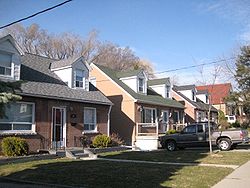 The three neighbourhoods of the area
Coordinates: 43°42′20″N 79°18′46″W / 43.70556°N 79.31278°WCoordinates: 43°42′20″N 79°18′46″W / 43.70556°N 79.31278°W Country  Canada
Province  Ontario
City  Toronto
Community Toronto & East York Changed Municipality 1924 East York from York
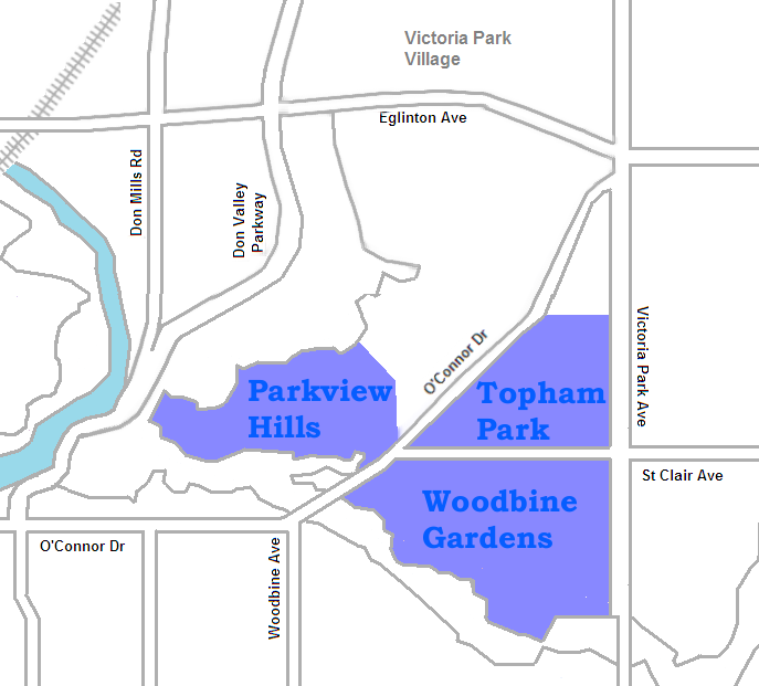
1998 Toronto fromEast YorkGovernment – MP [Matthew Kellway]] (Beaches-East York) – MPP Michael Prue (Beaches-East York) – Councillor Janet Davis (Ward 31 Beaches-East York) O'Connor–Parkview is a neighbourhood in the East York area of Toronto, Ontario, Canada. While the name is taken from the definition used by the city of Toronto, local residents are more familiar with the niche areas that define the larger neighbourhood. It is a very diverse neighbourhood that includes English and Greeks in the west to the Tamil speakers in the east. It includes low-income highrises, to huge property lots. The smaller areas included inside the neighbourhood[citation needed] are Topham Park, Woodbine Gardens and Parkview Hills.
Located southeast of the Don Valley, the neighbourhood is bordered on the South by Taylor-Massey Creek (which flows west into the Don), to the east by Victoria Park Avenue and to the north by Holland Avenue.
Neighborhood sections
Topham Park represents the upper East side of this neighbourhood and could well be described as quaint. A quick trip through the neighbourhood (which is all it takes) and you will see Topham Park, many residents enjoying their front parks and a very consistent feel. The rising tide in Toronto real estate fortunes over the years does not seem to have affected the style of this neighbourhood.
Woodbine Gardens, located south of Topham Park (they border on St.Clair) is bordered to the south by Taylor-Massey Creek (Don). The houses range from bungalows, two story houses all the way to high-rise affordable housing units. The high rise units which oversee the former golf course give onlookers a view at the relatively large properties in the area.
Parkview Hills, while significantly north of the Danforth, boasts a large Greek styled community. Parkview Hills, like most of O'Connor Parkview, has a large mix of ethnicity, income levels and housing types. The property values in this niche area continue to far surpass (on average) those in the rest of the neighbourhood. Again, property sizes are quite large and more recent work on these homes have boosted their value over the past 10 years. This area is considered the "Rosedale" of the former borough of East York.
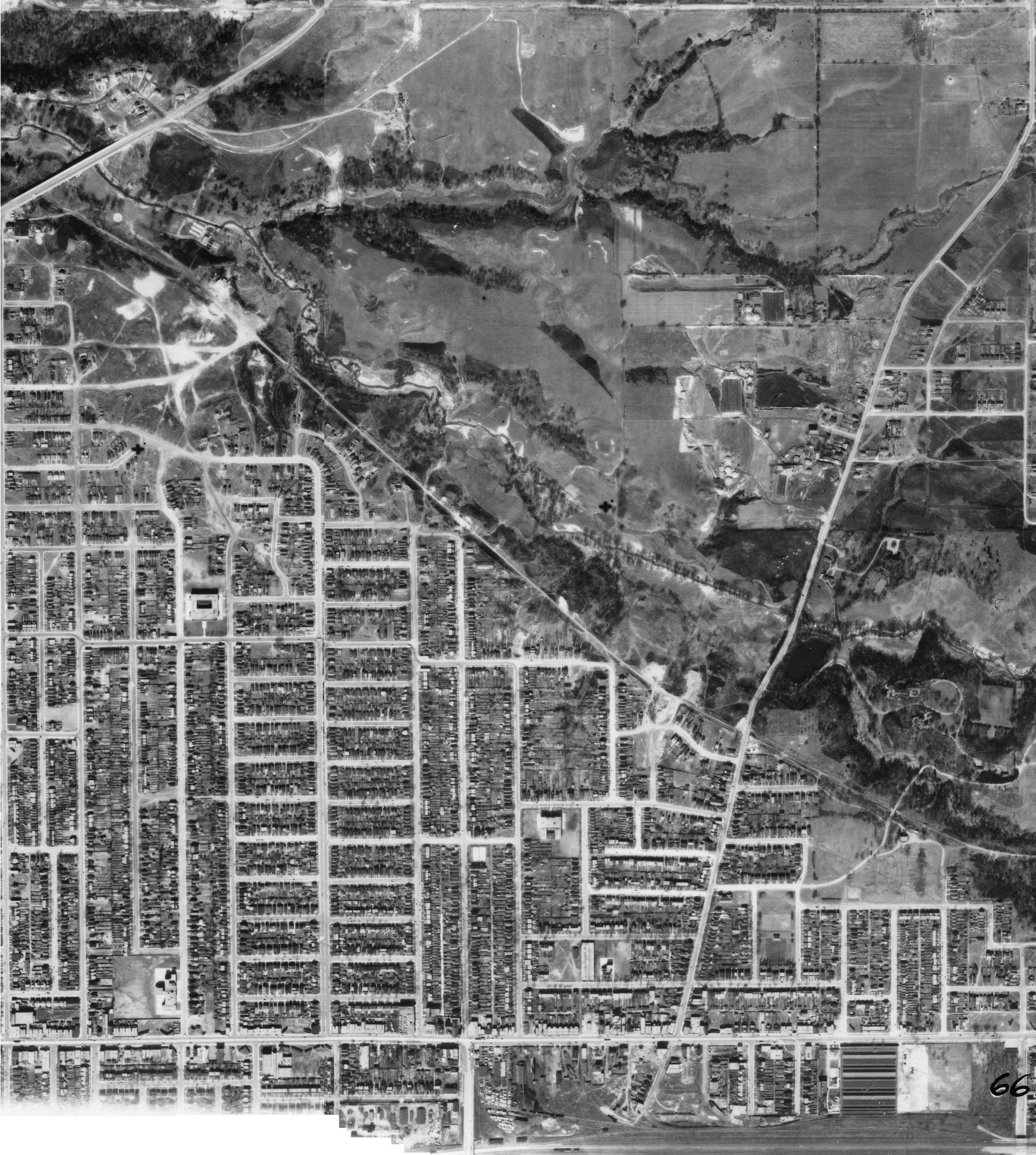
 Aerial view of the area, 1942
Schools
- Crescent Town Elementary School - An elementary public school located at 4 Massey Square. The school was established in 1973. Notable alumni of the school include Kiefer Sutherland.
- Presteign Heights Elementary School- An elementary public school located at 2570 St.Clair Ave E. The school was established in 1951.
External links

Bermondsey Old East York 
Clairlea (Scarborough)  O'Connor-Parkview

Crescent Town Categories:- Neighbourhoods in Toronto

Wikimedia Foundation. 2010.