- Crestmore Heights, California
-
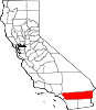
Crestmore Heights — census-designated place — Position in California.
 Crestmore Heights
Coordinates: 34°01′48″N 117°23′45″W / 34.03°N 117.39583°WCoordinates: 34°01′48″N 117°23′45″W / 34.03°N 117.39583°W Country  United States
State  California
County Riverside Area[1] – Total 0.288 sq mi (0.745 km2) – Land 0.288 sq mi (0.745 km2) – Water 0 sq mi (0 km2) 0% Elevation[2] 1,033 ft (315 m) Population (2010) – Total 384 – Density 1,335/sq mi (515.4/km2) Time zone Pacific (PST) (UTC-8) – Summer (DST) PDT (UTC-7) ZIP Code GNIS feature ID 2629130 U.S. Geological Survey Geographic Names Information System: Crestmore Heights, California Crestmore Heights is a census-designated place in Riverside County, California.[2] Crestmore Heights sits at an elevation of 1,033 feet (315 m).[2] The 2010 United States census reported Crestmore Heights's population was 384.
Geography
According to the United States Census Bureau, the CDP covers an area of 0.3 square miles (0.7 km²), all of it land.
Demographics
The 2010 United States Census[3] reported that Crestmore Heights had a population of 384. The population density was 1,335.1 people per square mile (515.5/km²). The racial makeup of Crestmore Heights was 229 (59.6%) White, 2 (0.5%) African American, 2 (0.5%) Native American, 6 (1.6%) Asian, 0 (0.0%) Pacific Islander, 133 (34.6%) from other races, and 12 (3.1%) from two or more races. Hispanic or Latino of any race were 263 persons (68.5%).
The Census reported that 384 people (100% of the population) lived in households, 0 (0%) lived in non-institutionalized group quarters, and 0 (0%) were institutionalized.
There were 112 households, out of which 41 (36.6%) had children under the age of 18 living in them, 54 (48.2%) were opposite-sex married couples living together, 14 (12.5%) had a female householder with no husband present, 11 (9.8%) had a male householder with no wife present. There were 9 (8.0%) unmarried opposite-sex partnerships, and 3 (2.7%) same-sex married couples or partnerships. 21 households (18.8%) were made up of individuals and 8 (7.1%) had someone living alone who was 65 years of age or older. The average household size was 3.43. There were 79 families (70.5% of all households); the average family size was 4.03.
The population was spread out with 99 people (25.8%) under the age of 18, 62 people (16.1%) aged 18 to 24, 77 people (20.1%) aged 25 to 44, 109 people (28.4%) aged 45 to 64, and 37 people (9.6%) who were 65 years of age or older. The median age was 33.7 years. For every 100 females there were 107.6 males. For every 100 females age 18 and over, there were 108.0 males.
There were 123 housing units at an average density of 427.6 per square mile (165.1/km²), of which 79 (70.5%) were owner-occupied, and 33 (29.5%) were occupied by renters. The homeowner vacancy rate was 2.4%; the rental vacancy rate was 10.8%. 276 people (71.9% of the population) lived in owner-occupied housing units and 108 people (28.1%) lived in rental housing units.
References
- ^ U.S. Census
- ^ a b c U.S. Geological Survey Geographic Names Information System: Crestmore Heights, California
- ^ All data are derived from the United States Census Bureau reports from the 2010 United States Census, and are accessible on-line here. The data on unmarried partnerships and same-sex married couples are from the Census report DEC_10_SF1_PCT15. All other housing and population data are from Census report DEC_10_DP_DPDP1. Both reports are viewable online or downloadable in a zip file containing a comma-delimited data file. The area data, from which densities are calculated, are available on-line here. Percentage totals may not add to 100% due to rounding. The Census Bureau defines families as a household containing one or more people related to the householder by birth, opposite-sex marriage, or adoption. People living in group quarters are tabulated by the Census Bureau as neither owners nor renters. For further details, see the text files accompanying the data files containing the Census reports mentioned above.
Municipalities and communities of Riverside County, California Cities Banning | Beaumont | Blythe | Calimesa | Canyon Lake | Cathedral City | Coachella | Corona | Desert Hot Springs | Eastvale | Hemet | Indian Wells | Indio | Jurupa Valley | La Quinta | Lake Elsinore | Menifee | Moreno Valley | Murrieta | Norco | Palm Desert | Palm Springs | Perris | Rancho Mirage | Riverside | San Jacinto | Temecula | Wildomar
CDPs Aguanga | Anza | Bermuda Dunes | Cabazon | Cherry Valley | Coronita | Crestmore Heights | Desert Center | Desert Edge | Desert Palms | East Hemet | El Cerrito | El Sobrante | French Valley | Garnet | Glen Avon | Good Hope | Green Acres | Highgrove | Home Gardens | Homeland | Idyllwild-Pine Cove | Indio Hills | Lake Mathews | Lake Riverside | Lakeland Village | Lakeview | March ARB | Mead Valley | Meadowbrook | Mecca | Mesa Verde | Mira Loma | Mountain Center | North Shore | Nuevo | Oasis | Pedley | Ripley | Romoland | Rubidoux | Sky Valley | Sunnyslope | Temescal Valley | Thermal | Thousand Palms | Valle Vista | Vista Santa Rosa | Warm Springs | Whitewater | Winchester | Woodcrest
Unincorporated
communitiesAlberhill | Alessandro | Arcilla | Arnold Heights | Belltown | Biskra Palms | Bly | Bonnie Bell | Box Springs | Cactus City | Cahuilla | Cahuilla Hills | Chiriaco Summit | East Blythe | Edgemont | El Cariso | Gilman Hot Springs | La Cresta | Lost Lake | Mortmar | Murrieta Hot Springs | River Bend Lodge | Sun City Palm Desert
Indian
reservationsAgua Caliente Indian Reservation | Cabazon Indian Reservation | Cahuilla Reservation | Colorado River Indian Reservation | Los Coyotes Reservation | Morongo Reservation | Ramona Indian Reservation | Santa Rosa Indian Reservation | Soboba Reservation | Torres-Martinez Indian Reservation
Ghost towns Alamo Bonito | Auld | Bergman | Caleb | Eagle Mountain | Hell | La Placita | Midland | Pinacate | Saahatpa | Terra Cotta
Categories:- Census-designated places in Riverside County, California
- Populated places in California with Hispanic majority populations


Wikimedia Foundation. 2010.