- Crooked Lake Outlet Historic District
-
Crooked Lake Outlet Historic District
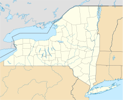

Location: Torrey, New York, between Penn Yan and Dresden Coordinates: 42°40′37″N 76°57′49″W / 42.67694°N 76.96361°WCoordinates: 42°40′37″N 76°57′49″W / 42.67694°N 76.96361°W Area: 300 acres (120 ha) Governing body: Private MPS: Yates County MPS NRHP Reference#: 95001545[1] Added to NRHP: January 19, 1996 Crooked Lake Outlet Historic District is a national historic district located near Penn Yan in Yates County, New York. The district is located along a seven mile recreational trail (the Keuka Lake Outlet Trail) that parallels the Keuka Lake Outlet. The district includes several mill sites along the gorge. It also includes nine areas that contain surface and subsurface archaeological remains.[2]
It was listed on the National Register of Historic Places in 1996.[1]
References
- ^ a b "National Register Information System". National Register of Historic Places. National Park Service. 2009-03-13. http://nrhp.focus.nps.gov/natreg/docs/All_Data.html.
- ^ M. Lisa Spaulding (July 1995). "National Register of Historic Places Registration: Crooked Lake Outlet Historic District". New York State Office of Parks, Recreation and Historic Preservation. http://www.oprhp.state.ny.us/hpimaging/hp_view.asp?GroupView=10234. Retrieved 2009-06-14. See also: "Accompanying 36 photos". http://www.oprhp.state.ny.us/hpimaging/hp_view.asp?GroupView=10195.
Categories:- Historic districts in New York
- National Register of Historic Places in New York
- Archaeological sites in New York
- Historic districts in Yates County, New York
- Yates County, New York Registered Historic Place stubs


Wikimedia Foundation. 2010.