- Crystal Springs Air Force Station
-
Crystal Springs Air Force Station 
Part of Air Defense Command (ADC) Type Air Force Station Coordinates 31°58′45″N 090°20′40″W / 31.97917°N 90.34444°W Location code ADC ID: TM-195, NORAD ID: Z-195 Built 1958 In use 1958-1968 Current
conditionclosed Controlled by  United States Air Force
Garrison 627th Aircraft Control and Warning Squadron 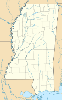
 Crystal Springs AFSLocation of Crystal Springs AFS, Mississippi
Crystal Springs Air Force Station is a closed United States Air Force General Surveillance Radar station. It is located in Crystal Springs, Mississippi. It was closed in 1968.
Crystal Springs Air Force Station came into existence as part of Phase III of the Air Defense Command Mobile Radar program. On October 20, 1953 ADC requested a third phase of twenty-five radar sites be constructed.
Contents
History
 627 Radar Squadron patch
The 627th Aircraft Control and Warning Squadron was assigned on 1 September 1958 and began testing the AN/FPS-27 frequency-diversified search radar. During 1959 Crystal Springs AFS joined the Semi Automatic Ground Environment (SAGE) system, initially feeding data to DC-09 at Gunter AFB, Alabama. After joining, the squadron was re-designated as the 627th Radar Squadron (SAGE) on 1 October 1959. The radar squadron provided information 24/7 the SAGE Direction Center where it was analyzed to determine range, direction altitude speed and whether or not aircraft were friendly or hostile.
In addition to the main facility, Crystal Springs operated an AN/FPS-14 Gap Filler sites:
- Summit, MS (TM-195A): 31°17′28″N 090°27′29″W / 31.29111°N 90.45806°W
Two height-finder radars, types AN/FPS-6A and AN/FPS-90, were also installed in the early 1960s. The 627th Radar Squadron was deactivated on 6 September 1968 and Crystal Springs AFS was closed due to a draw-down of ADC and budget constraints. The site has been turned into a Job Corps training center by the State of Mississippi. Most of the former USAF buildings remain along with base housing. The radar tower footprints are still visible in aerial photography
See also
- List of USAF Aerospace Defense Command General Surveillance Radar Stations
References
 This article incorporates public domain material from websites or documents of the Air Force Historical Research Agency.
- A Handbook of Aerospace Defense Organization 1946 - 1980, by Lloyd H. Cornett and Mildred W. Johnson, Office of History, Aerospace Defense Center, Peterson Air Force Base, Colorado
- Winkler, David F. (1997), Searching the skies: the legacy of the United States Cold War defense radar program. Prepared for United States Air Force Headquarters Air Combat Command.
- Crystal Springs AFS, MS
External links
Bases CONUSAdair · Beale · Bong (unbuilt) · Charleston · Davis-Monthan · Dobbins · Dover · Dow · Duluth · England · Ent · Ethan Allen · Fairfax · Fort Lee · Geiger · George · Glasgow · Grand Forks · Grenier · Griffiss · Gunter · Hamilton · Hancock · Homestead · Hurlburt · Imeson · K.I. Sawyer · Kincheloe · Kingsley · Kirtland · Larson · Luke · March · Malmstrom · McCoy · McChord · McClellan · McGhee Tyson · McGuire · Minneapolis-St. Paul · Minot · Mitchel · New Castle · Niagara Falls · Norton · O'Hare · Oklahoma City · Otis · Oxnard · Paine · Perrin · Peterson · Pittsburgh · Pope · Portland · Presque Isle · Richards-Gebaur · Selfridge · Seymour Johnson · Sioux City · Snelling · Stead · Stewart · Suffolk County · Tinker · Travis · Truax · Tyndall · Vandenburg · Webb · Westover · Willow Run · Wright-Patterson · Wurtsmith · Youngstown
OverseasErnest Harmon · Frobisher Bay · Goose Bay · Keflavik · Pepperrell · Thule · Topsham

Stations CONUSAlmaden · Charleston · Clear · Cross City · Benton · Empire · Mill Valley · Montauk · Mount Hebo · North Truro · Point Arena · Rye · Thomasville · Watertown
OverseasAlbrook
Air
Defense
unitsForcesAir
DivisionsSectorsAlbuquerque · Bangor · Boston · Chicago · Detroit · Duluth · Goose · Grand Forks · Great Falls · Iceland · Kansas City · Los Angeles · Minot · Montgomery · New York · Oklahoma City · Phoenix · Portland · Reno · Sault Sainte Marie · San Francisco · Seattle · Sioux City · Spokane · Stewart · Syracuse · Washington
WingsGroups1st · 4th · 10th · 14th · 15th · 23rd · 32nd · 33rd · 50th · 52nd · 53rd · 54th · 56th · 57th · 73rd · 78th · 79th · 81st · 82nd · 84th · 325th · 326th · 327th · 328th · 329th · 337th · 355th · 408th · 412th · 414th · 473rd · 475th · 476th · 478th · 500th · 501st · 502d · 503d · 507th · 514th · 515th · 516th · 517th · 518th · 519th · 520th · 521st · 525th · 527th · 528th · 529th · 530th · 533d · 534th · 564th · 566th · 567th · 568th · 575th · 678th · 701st · 4676th · 4700th · 4721st · 4722d · 4727th · 4728th · 4729th · 4730th · 4731st · 4732d · 4733d · 4734th · 4735th · 4756th
SquadronsAerospace Defense Command Fighter Squadrons · Aircraft Control and Warning Squadrons
Major
weapon
systemsElectronicFightersMissiles1 · 2 · 3 · 4 · 5
ShipsGuardian · Interceptor · Interdictor · Interpreter · Investigator · Locator · Lookout · Outpost · Pickett · Protector · Scanner · Searcher · Skywatcher · Tracer · Watchman · Vigil
Miscellaneous Air Defense Command Emblem Gallery (On Wikimedia Commons) · General Surveillance Radar StationsCategories:- SAGE sites
- Radar stations of the United States Air Force
- Closed facilities of the United States Air Force
- Military facilities in Mississippi
- Aerospace Defense Command


Wikimedia Foundation. 2010.