- Cuero Municipal Airport
-
Cuero Municipal Airport 
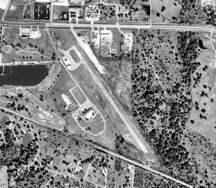
1995 USGS Photo IATA: T71 – ICAO: none Summary Airport type Public Owner City of Cuero Location Cuero, Texas Elevation AMSL 214 ft / 65 m Coordinates 29°04′57″N 097°15′58″W / 29.0825°N 97.26611°WCoordinates: 29°04′57″N 097°15′58″W / 29.0825°N 97.26611°W Runways Direction Length Surface ft m 14/32 5,020 1,530 Asphalt Cuero Municipal Airport (FAA LID: T71) is a public airport located approximately 1 mile (1.6 km) east-southeast of Cuero, Texas. It provides general aviation service.
Contents
History
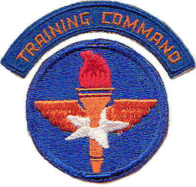
Opened on 1 April 1941 with 5,000'(Now 2800') all-way turf runway. Began training United States Army Air Corps flying cadets under contract to Brayton Flying Service, Inc.. Assigned to United States Army Air Forces Gulf Coast Training Center (later Central Flying Training Command) as a primary (level 1) pilot training airfield. had four local axillary airfields for emergency and overflow landings. Flying training was performed with Fairchild PT-19s as the primary trainer. Also had several PT-17 Stearmans and a few old Curtiss P-1 Hawks and Airco DH.4s assigned.
Inactivated on 4 August 1944 with the drawdown of AAFTC's pilot training program. Declared surplus and turned over to the Army Corps of Engineers on 30 September 1945. Eventually discharged to the War Assets Administration (WAA) and became a civil airport.
Today, there are 6 tiedown areas and 3 hangars at the Cuero Municipal Airport. One of the hangars is open, a roof over 2 tiedown areas. The second hangar, ajacent to the area where the airport office was once at (taken down in 2008), can only house 1 aircraft. And the third can house a few small aircraft. The hangar rental fees are expensive, which is the reason why a lot of pilots keep their aircraft at Victoria Regional Airport to save money. The runway is asphalt, 2800' long and 60' wide, with slight grass encrochments on either side of the runway.
The city of Cuero, which owns the airport, has now been debating whether the airport should be moved somewhere else or to simply change the runway heading (direction of where it should point). If so, the runway should be extended back to 5000' so that larger aircraft can land. The whole reason for this is because the oil industry in Dewitt County is getting to be a great deal, and real estate agents or anyone else who works in this booming industry can land larger aircraft without being limited to where they can land. Also, there have been rumors about starting a soaring club in Cuero, which glider aircraft will be pulled in the air by another aircraft, needing more runway to do so.
At the same time, the City of Cuero has also considered perhaps moving the entire airport, because aircraft pilots need all the concentration they can get to ensure a safe landing. The lights at the Cuero baseball complex can make it hard for the pilots to see the runway upon takeoff and landing at night, creating a safety hazard, so the FAA (Federal Aviation Administration) specifically ensured that medium runway lighting would be used to compensate for the brightness of the baseball complex lights. With that, buildings such as Cuero JH, Cuero HS, and Walmart provide an even greater challenge to pilots with 50' trees at the other end of the field.
See also
References
 This article incorporates public domain material from websites or documents of the Air Force Historical Research Agency.
- Shaw, Frederick J. (2004), Locating Air Force Base Sites History’s Legacy, Air Force History and Museums Program, United States Air Force, Washington DC, 2004.
- Manning, Thomas A. (2005), History of Air Education and Training Command, 1942–2002. Office of History and Research, Headquarters, AETC, Randolph AFB, Texas ASIN: B000NYX3PC
External links
- FAA Terminal Procedures for T71, effective 20 October 2011
- Resources for this airport:
- AirNav airport information for T71
- FlightAware airport information and live flight tracker
- SkyVector aeronautical chart for T71
 Army Air Forces Training Command
Flying Training Flying Schools Eastern Flying Training Command · Central Flying Training Command · Western Flying Training CommandSpecialized Schools Bombardier · Contract Flying · Glider Training · Gunnery · Navigator
Technical Training Eastern Technical Training Command · Central Technical Training Command · Western Technical Training CommandCategories:- 1941 establishments
- USAAF Contract Flying School Airfields
- Airfields of the United States Army Air Forces in Texas
- Buildings and structures in DeWitt County, Texas
- Transportation in DeWitt County, Texas
Wikimedia Foundation. 2010.