- Kymi, Greece
-
For other uses, see Kymi (disambiguation) and Cuma (disambiguation).
Kymi
ΚύμηLocation 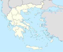
 Kymi
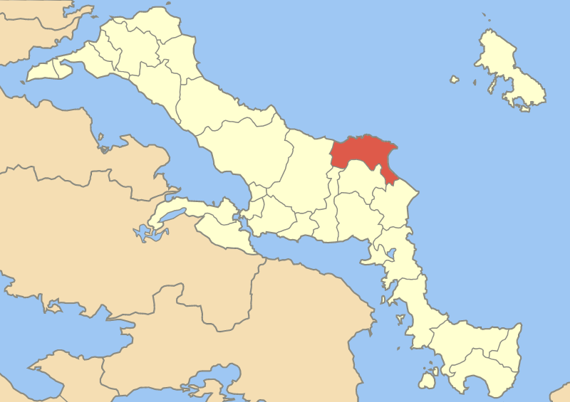
KymiCoordinates 38°38′N 24°6′E / 38.633°N 24.1°ECoordinates: 38°38′N 24°6′E / 38.633°N 24.1°E Location within the peripheral unit
Government Country: Greece Region: Central Greece Regional unit: Euboea Municipality: Kymi-Aliveri Population statistics (as of 2001) Municipal unit - Population: 8,772 - Area: 167.6 km2 (65 sq mi) - Density: 52 /km2 (136 /sq mi) Other Time zone: EET/EEST (UTC+2/3) Auto: ΧΑ Kymi (Greek: Κύμη, Kýmē) is a coastal town and a former municipality (8,772 inhabitants in 2001) in the island of Euboea, Greece, named after an ancient Greek place of the same name. Since the 2011 local government reform it is part of the municipality Kymi-Aliveri, of which it is a municipal unit.[1] The ancient Euboean Kyme is mentioned as a harbor town related to the more prominent poleis of Chalkis and Eretria in antiquity. Together with these, it is sometimes named as the founding metropolis of the homonymous Kymē (Cumae) in Italy, an important early Euboean colony, which was probably named after it.
There are few or no archaeological traces of ancient Euboean Kyme, and its exact location is not known. A Bronze Age settlement has been excavated in nearby Mourteri. Some modern authors believe that Kyme never existed as an independent polis in historical times but that it was a mere village dependent on either Chalkis or Eretria.[2]
Notable people
- Georgios Papanikolaou (1883-1962), physician, a pioneer in cytology and early cancer detection, and the inventor of the Pap test for cervical cancer
- Ioannis Velissariou, fighter in the Balkan Wars
References
- ^ Kallikratis law Greece Ministry of Interior (Greek)
- ^ Walker, Keith G. (2004). Archaic Eretria: a political and social history from the earliest times to 490 BC. London: Routledge. p. 143.
Categories:- Central Greece geography stubs
- Populated places in Euboea
- Ancient Euboea
- Ancient Greek cities
- Former populated places in Greece

Wikimedia Foundation. 2010.