- Prokletije
-
Prokletije Albanian: Bjeshkët e Namuna/Alpet Shqiptare Range  Maja Jezercë in the distance in the Prokletije
Countries Albania, Kosovo[a], Montenegro Part of Dinaric Alps Highest point Maja Jezercë - elevation 2,694 m (8,839 ft) - coordinates 42°26′30″N 19°48′45″E / 42.44167°N 19.8125°E 
Prokletije or Albanian Alps (Albanian: Bjeshkët e Namuna or Alpet Shqiptare; Serbian: Проклетије, Prokletije, pronounced [prɔklɛ̌tijɛ]) is a mountain range in the Balkans that extends from northern Albania, to southwestern Serbia and eastern Montenegro. Its highest point, Jezercë in Albania at 2,694 m (8,839 ft), is the tallest peak in the entire Dinaric Alps. Other peaks include Đeravica in Kosovo at 2,656 m (8,714 ft).
Both the highest peak in Montenegro, Zla Kolata at 2,534m and Kosovo, Đeravica at 2,656m are located here. The highest peak in Albania though is Mount Korab which is 2,764 m (9,068 ft) high and is located in the east of the country on the border with Macedonia.
The southernmost glaciers in Europe were recently discovered in the Albanian part of the range. The regional economy is based mainly on agriculture, immigrant remittances and tourism.
Contents
Name
The earliest written mention of the Prokletije (from Ptolemy's map) is Mons Bertiscus.[1][2] Bertiscus is still a learned form of the mountain and is used as epithet in the form 'bertiscae' for an endemic species or species which have their locus classicus in the mountains and which have used the name such as Valeriana bertiscae, Crepis bertiscae, Iris bertiscae.[3]
In Montenegrin/Serbian and Albanian, the name means "cursed mountains" ("Accursed mountains"), possibly because they are perceived as unsurmountable and wild.[4] Albanians also call it Alpet Shqiptare, meaning 'Albanian Alps'.
Location and relief
The Prokletije broad forms is more than 40 miles from southwest to northeast from Scutari Lake along the Montenegrin-Albanian border to Kosovo, between 42°45' and 42°15' N in the mediterranean zone of the western Balkan Peninsula.[5][6] The southern boundary of the Prokletije is from the river Drin and its tributary Valbona. In a broader sense the Prokletije also includes the mountain ranges to Mitrovica with Hajla and Mokna massifs of Prokletije. Other authors, however, see the river Lim as the northern boundary of the geological Prokletije.
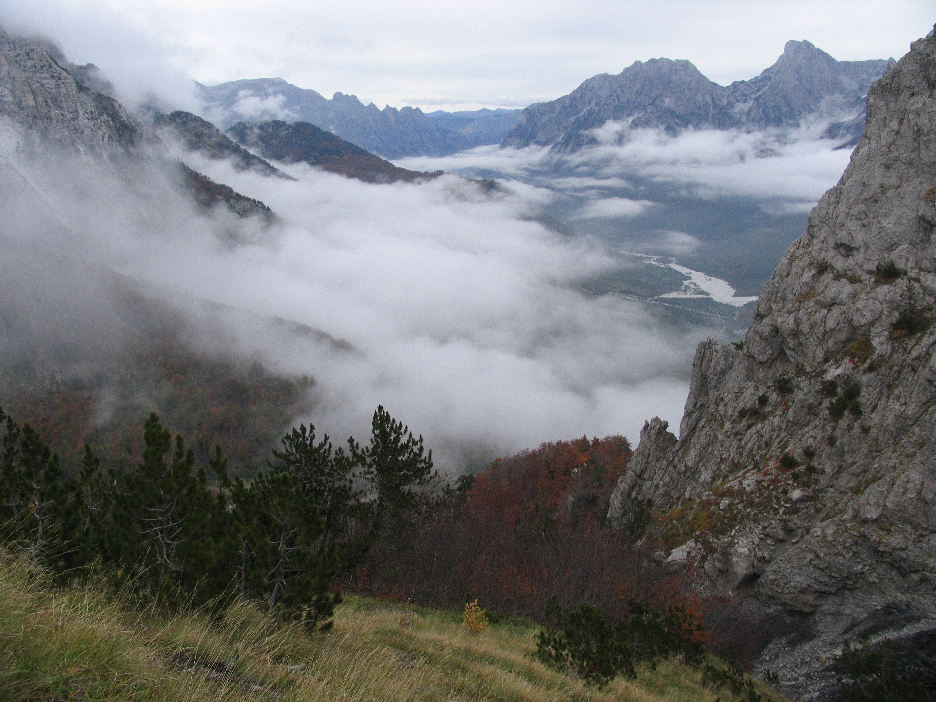
The Kalktafel of Prokletije is deeply incised with valleys in a variety of powerful rock blocks cut by the mountains north of Përroi i Thatë, the Biga e Gimajive south of it, the Jezerca block between Shala and Valbona valley, the massif of the Maja e Hekurave, the plateau of the Maja e Kolats north of Valbona or Shkëlzen northeast of Valbona. The valleys were formed by ice-age glaciers pronounced trough valleys formed by very steep walls and hollows on the top section with up to 1000 meters distinguish. The south wall of the Maja Harapit is 800 meters making it the highest rock face of the Balkan Peninsula.[7]
The Prokletije is ethnographically and sociologically diverse due to many tribes living in the region as sheep herders. Names of various tribes - Hoti, Gruda, Kelmendi, Kastrati, Dukagjini, Shkreli, Shala, Nikaj, Krasniqi, Gashi and Rugova - refer to their geographical habitats within the range.
Geology
 Đeravica, eastern face
 Ski resort of Bogë
 Maja Harapit - 1000m unclimbed wall face, as seen from Thethi
 Prokletije from Qafa e Bordolecit
 Pine forests of the Mokna massif
 Valbona Pass
 Lake in Buni i Jezercës
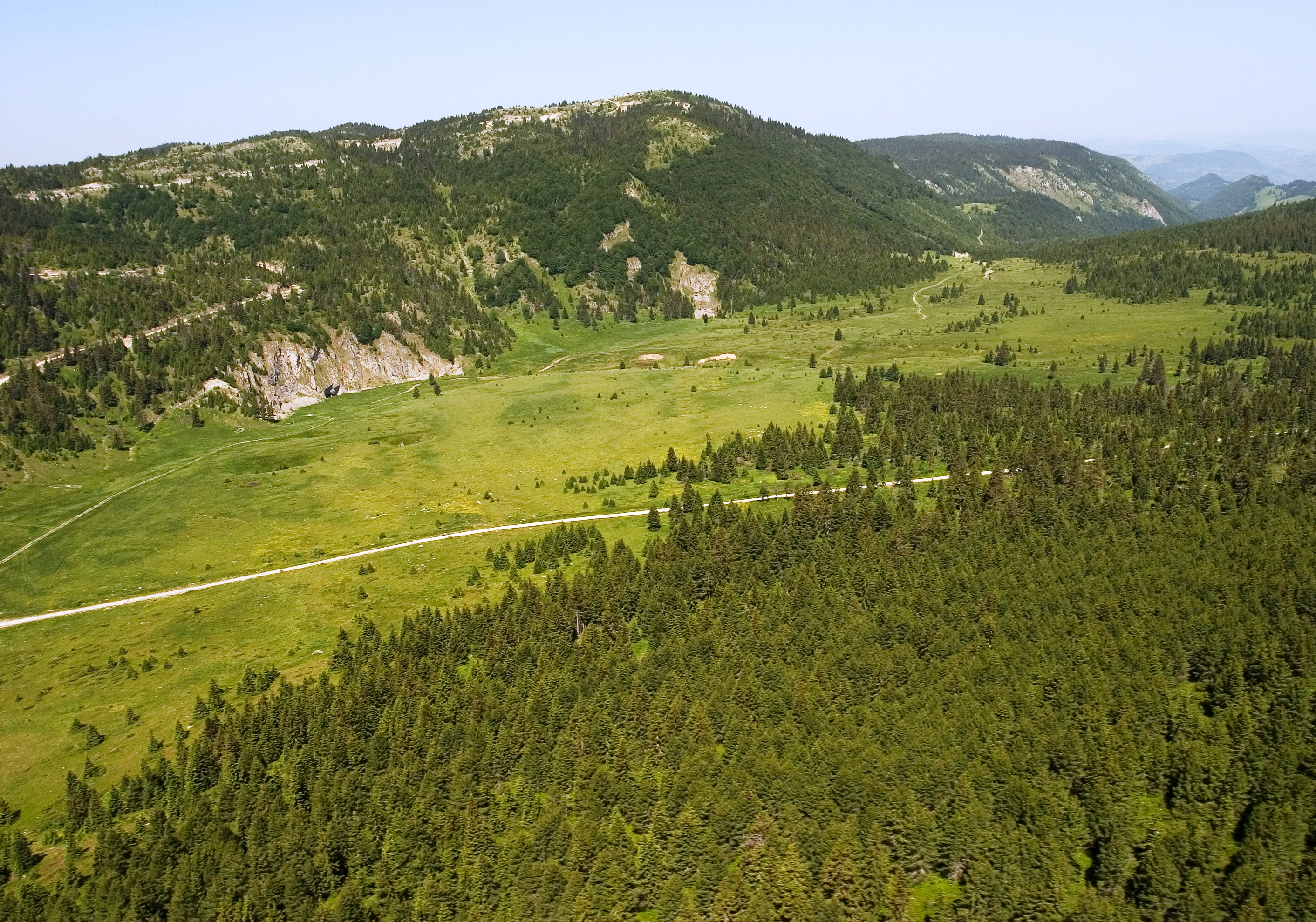
The Prokletije mountain range is located in the west of the Balkans. It occupies the north of Albania, southwest of Kosovo and the east of Montenegro. It is a subrange or part of the 1,000 km (621 mi) long Dinaric Alps. The Prokletije is a typical high mountain range with a pronounced steep topography and glacial features. Absolute relief energies of 1800m found in the Valbona, Grbaja and Ropojani and Cijevna Valley, overhanging walls and pointed ridges like pointed peaks are typical of the western and central Prokletije, however in the eastern mountainous part the mountains are less rugged prior to milder forms of relief. For the strong Pleistocene glaciation also Kartreppen and trough valleys are characteristic. The Prokletije is a large, rugged, pathless and hardly passable mountain range stretching from Skadar lake in the north-eastern direction over Cijevna river area, then slightly curving to the east in direction of Đeravica summit above Metohija (450m) basin in Kosovo. From here, geomorpohologically the Prokletije turn northwards over the Bogićevića massif and Čakor pass, and continue with another row of mountains finally finishing with the Suva Planina (1,750 m) massif, that encircles Metohija basin from north and north-west and finish in the area of upper Ibar river valley near the city of Kosovska Mitrovica.
The Prokletije range was formed by the folding actions of the African Plate which lies under the European one. Nowhere in the Balkans have glaciers left so much evidence of erosion. After the Alps these mountains are the most glaciated in Europe south of the Scandinavian ice sheet. They have very steep slopes made out of limestone and are the most karstic mountains in the Balkans. The Prokletije range one of the rare mountain ranges in Europe which has not been explored entirely. It is mostly a limestone built chain except its eastern and south-eastern parts, which have slate rock around its base. Most of the area was formed by glacial influences with karstic areas in the western parts of the Group. Prokletije form the southernmost end of Dinaric mountain chain. In this area the Prokletije run almost parallel with the Šar Mountains system in Macedonia, Albania and Kosovo. This tectonic crash has produced an unusual zig-zag shape of Prokletije range, and also their curving from the dominant Dinaric northwestern - southeastern direction toward the north-eastern one.[8] In its western and central part of the range the composition of the mountains is of mainly uniform and Mesozoic limestones and dolomites of the Jurassic and Cretaceous ages. In the eastern Prokletije there is found in addition to limestone and dolomite series late Palaeozoic and Triassic periods, medium-Triassic volcanic rocks and Jurassic metamorphic rocks .
Although there are some serious scientific searchings that give Prokletije a status of a separate mountain chain and not a part of Dinaric chain, in most other ways this chain is still considered as the highest of all Dinaric areas, connected with Dinaric mountain chain in more ways as are geology, unbroken morphological unit and even ethnologically.
Massifs
The Prokletije itself is made up of many large sections or mountain massifs/groups all of which are connected to one another. These massifs include the Popluks group with a height of 2,694 m, Shkurt group at 2,554 m, Radohimës group at 2,570 m, Zaborës e Krasniçës at 2,625 m, Bjelic group at 2,556 m, Karanfili-Brada group at 2,554 m, Rabës group at 2,232 m, Ershellit group at 2,06 6m, Kakinjes group at 2,359 m, Shkëlzen group at 2,407 m, Bogićevica group at 2,533 m, Horolac group at 2,199 m, Kershi Kocaj group at 2,399 m, Maja e Zezë group at 2,400 m, Lumbardhit group at 2,52 2m, Kopranik group at 2,460 m, Strellc group at 2,377 m, Đeravica group at 2,656 m, Junik group at 2,296 m, Starac-Qokorr group 2,426 m, Hajla group at 2,403 m, Stedim-Ahmica group at 2,272 m, Zleb-Rusulija group at 2,382 m, Mokna group at 2,155 m and finally the Suva Planina group at 1,750 m.[8]
Canyons and Valleys
 Tamara Gorge in Albania
The Prokletije mountains being eroded and cut through by many glaciers have left many features behind to tell their tale. Deep river canyons and flat valleys are found winding their way around the ridges of the mountains. The largest and most popular canyon is Rugova Canyon. It is situated in Kosovo and is 25 km (16 mi) long from the border with Montenegro up to the city of Peć and is 1,000 m (3,281 ft) deep.[9] It consists of very steep vertical mountain slopes on both sides. Valleys common on lower altitudes are also found on alpine level creating mountain passes and valley troughs. The most known valley to be located high up on mountains is 'Buni Jezerce' in Albania. Buni Jezerce means Valley of the Lakes and contains 6 small glacial lakes the biggest of whom is Big lake of Buni Jezerce.
Canyons in Prokletije
- Rugova Canyon
- Dečani Canyon
- Gashi Canyon
- Cemi Canyon
Valleys in Prokletije
- Vermosh Valley
- Valbona Valley
- Thethi Valley
- Ropojona Valley
- Gerbja Valley
- Buni Jezerce
- Cemi i Nikçit Valley
Rivers & Lakes
 Lićenat Lake
In Prokletije consists of many important rivers of the southeastern West Balkans. Rivers in this range fall roughly into two main categories, those that flow in to the Lim and those that enter the White Drin which flows to a further extent to meet the Black Drin at the Drin confluence. The southern and eastern slopes of Prokletije fall into the latter category. On the northern borders the Tara and Lim have their origins, two major sources of the Dinaric river system. The Vërmosh later Lim said river rises in the northwest Gebrigsteil in Mntenegro close to the border with Albania. As a tributary of the Drina he drains in to the Danube and flows into the Black sea. The Lim flows through the Plav Lake. The Ibar, which originates on the slopes of the Hajla, takes a similar route into the Danube via the Morava in Serbia.
The southern Prokletije by the inter penetration, the Drin dominates. It drains mosts of the rages with its tributaries and when measured with the source of the White Drin in Radavc down to the mouth of the Drin near Lezha, it is 335 km long. However not all the rivers lows near or parallel to the Prokletije. Drin tributaries include the Valbona which drains into the Adriatic Sea. The Valbona takes Gashi River on as an eastern tributary. To the west of the mountains is the Cijevna. The Cijevna drains the northwestern part of the Montenegrin-Albanian border area to the Adriatic. Because of the Karestnatur Prokletije water levels fluctuate due to the karst hydrological drought which is characterized strongly. some rivers or streams such as Përroi i Thatë in Albania dry out completely during the summer droughts. Although the Pećka Bistrica in Kosovo is short it is very powerful and has carved the Rugova Canyon which is up to 25 km (16 mi) long and 1,000 m (3,281 ft) deep.
There are about 20 small alpine lakes of glacial origin in the Prokletije. A high accumulation of lakes includes the Bogiçevica border area between Kosovo and Albania and the Buni i Jezercë trough near the Jezerca and Bojs peaks. Some lakes such as Liqenat Lake in Kosovo and Hrid Lake in Montenegro have been transferred into touristic areas because of their ideal locations and beautiful scenery. Hrid lake today is a clear example of well preserved glacial relief. In the Pleistocene period (1.8-0.01 million y.a.) there a was collecting area for ice that fell down over more steps from surrounding peaks, dragging with it heterogeneous material. Precipitatins had washed away smaller rocks, but larger ones still remained on the south-western and western lake shore. The lake is 295meters long, 110m wide and around 5 meters deep, in average. Beside precipitations it receives water from more sources located near its shores.[10]
The largest lake is Lake Plav in Montenegro. The lake lies on an altitude of 906m above sea level in the Plav valley, nestled between Prokletije and Visitor range. The surface area of Lake Plav is 1.99km2 and extends north-south for some 2,160m.
Waterfalls are also found in some parts of the range. The White Drin Waterfall in Kosovo is a large waterfall reaching a height of 25 m (82 ft). Because it is not far from the city of Peć it is not hard to get there and it is visited by many visitors. The Grunas Waterfall in Albania is 30 m (98 ft) in height and is located in the Thethi National Park. The 'Ali Pasha' natural springs in Montenegro near the town of Gusinje are the premium attraction for the town.
Highest peaks
Peaks over 2,600 m (8,530 ft)
- Maja Jezercë (2,694 m/8,839 ft; in Albania)
- Đeravica (2,656 m/8,714 ft; in Kosovo)
- Maja Grykat e Hapëta (2,625 m/8,612 ft; in Albania)
Peaks over 2,500 m (8,202 ft)
- Maja e Radohimës (2,570 m/8,432 ft; in Albania)
- Maja e Popljuces (2,569 m/8,428 ft; in Albania)
- Maja Briaset (2,567 m/8,422 ft; in Albania)
- Maja e Hekurave (2,561 m/8,402 ft; in Albania)
- Maja e Shënikut (2,554 m/8,379 ft; in Albania)
- Maja Tat (2,543 m/8,343 ft; in Albania)
- Gusan (mountain) (2,539 m/8,330 ft; in Albania & Kosovo)
- Zla Kolata (2,534 m/8,314 ft; in Albania & Montenegro)
- Marijaš (2,533 m/8,310 ft; in Kosovo)
- Kolata e Mirë (2,524 m/8,281 ft; in Albania & Montenegro)
- Maja e Rosit (2,524 m/8,281 ft; in Albania & Montenegro)
- Žuti kamen (2,522 m/8,274 ft; in Kosovo)
- Maja Kokervhake (2,508 m/8,228 ft; in Albania)
- Rops (peak) (2,502 m/8,209 ft; in Kosovo)
Peaks over 2,400 m (7,874 ft)
- Maja Shkurt (2,499 m/8,199 ft; in Albania)
- Maja e Malësores (2,490 m/8,169 ft; in Albania)
- Maja e Ragamit (2,472 m/8,110 ft; in Albania)
- Maja Bojs (2,461 m/8,074 ft; in Albania)
- Kopranik (2,460 m/8,071 ft; in Kosovo)
- Maja Vukoces (2,450 m/8,038 ft; in Albania)
- Veternik (2,410 m/7,907 ft; in Albania)
- Shkëlzen (2,407 m/7,897 ft; in Albania)
- Pasji Peak (2,405 m/7,890 ft; in Kosovo & Montenegro)
- Maja Bogiçaj (2,404 m/7,887 ft; in Albania & Kosovo)
- Hajla (2,403 m/7,884 ft; in Kosovo & Montenegro)
Peaks under 2,400 m (7,874 ft)
- Rusulija (2,382 m/7,815 ft)
- Streoc (2,377 m/7,799 ft)
- Tromeđa (2,366 m/7,762 ft)
- Žljeb (2,365 m/7,759 ft)
- Maja e Kakisë (2,360 m/7,743 ft)
- Lićenat (2,341 m/7,680 ft)
- Rrasa e Zogut (2,305 m/7,562 ft)
- Vranovačka Hajla (2,281 m/7,484 ft)
- Junik (2,280 m/7,480 ft)
- Maja e Elbunit (2,231 m/7,320 ft)
- Mali i Deçanit (2,200 m/7,218 ft)
- Maja Harapit (2,218 m/7,277 ft)
- Maja Trojan (2,190 m/7,185 ft)
- Pogled (2,155 m/7,070 ft)
- Dramadol (2,120 m/6,955 ft)
- Beleg (2,102 m/6,896 ft)
- Maja e Ershellit (2,067 m/6,781 ft)
- Volujak (2,014 m/6,608 ft)
- Škreljska Hajla (2,011 m/6,598 ft)
- Maja e Madhe (2,011 m/6,598 ft)
- Maja e Grebenit (1,864 m/6,115 ft)
- Lice Mountain (1,799 m/5,902 ft)
- Maja e Veleçikut (1,725 m/5,659 ft)
Climate
The Prokletije is on the whole the wettest area of Europe. In the village of Boga in the dry valley, precipitation is 3,033 millimetres (119.4 in) per year, and otherwise 2,000 millimetres (79 in) to 2,500 millimetres (98 in) per year is to be expected.[6] In higher elevations snow is found even in summer except in very dry years.[11] In winter, some villages in the Albanian part of the Prokletije are completely cut off from the rest of the world for months due to the very heavy snow.[12]
Glaciation
Today on the shady northern slopes, there are at least five active glaciers which probably formed during the late Holocene, as well as a number of inactive glaciers between 1,980 and 2,420 m altitude.[11][13][14] The trough valleys of Ropojani, Grbaja and Valbona were carved by miles of glaciers during the last Ice Age. Detailed geomorphological mapping was used to reconstruct the positions of former glaciers. The longest glacier of Ropojana had a length of 12.5 kilometres (7.8 mi) and surface of 20 square kilometres (7.7 sq mi); others include Valbona glacier at 9.5 kilometres (5.9 mi) and 10.5 square kilometres (4.1 sq mi)), Grbaja Glacier at 5 kilometres (3.1 mi) and 6.7 square kilometres (2.6 sq mi) and Bogićevića Glacier at 6 kilometres (3.7 mi) and6.9 square kilometres (2.7 sq mi).[11] In addition, about 20 small lakes of glacial origin are found, among them the lake group Buni i Jezerce to the north side of Jezerca, the Ridsko Lake, Lake Bukumisko and Rikavacko Lake.
A recent report from geographers at the University of Manchester details the discovery of four previously unknown glaciers in the Albanian part of the Prokletije range at 1980–2100 m altitude, in the area close to Maja e Jezerces. The glaciers, the largest of which is currently the size of six football pitches, vary in size every year according to the amount of winter snowfall and temperatures during the following summer. Their average total surface area is 5 hectares (0.019 sq mi). Glacier-climate modeling suggests that these glaciers require annual accumulation of between 4,137 millimetres (162.9 in) and 5,531 millimetres (217.8 in) (rainfall equivalent) to balance melting, which would correspond to between 49.7 metres (163.1 ft) and 66.4 metres (217.8 ft) of snow. A significant proportion of this accumulation is likely to be sourced from windblown snow and, in particular, avalanching snow. It is estimated that the total accumulation needed to balance melting is potentially up to twice the value received from direct precipitation[citation needed]. The presence of these glaciers, the southernmost in Europe, at altitudes well below the general regional equilibrium line altitude highlights the importance of local controls[clarification needed] on glacier development. The geographers think at least eight glaciers were present in neighbouring mountains[clarification needed] during the 19th century, correlating with the culmination of the 'Little Ice Age' in the European Alps.[14]
Flora
 Pinus heldreichii in front of Popluks and Jezerca peaks.
 Wulfenia baldaccii, an endemic species
 Ancient forests around Đeravica
The vegetation of the Prokletije is one of the richest in the Balkan Peninsula and is one of the central European regions for flora. To date, 1611 wild plants have been described alone in the Albanian part.[15] In total, 50 flora species are endemic, sub-endemic and endangered plant species.[citation needed] The southern edge of mountains show a sub-Mediterranean character. Various evergreen bushes are found in the deepest valleys of the canyons and sunny slopes,[16] in the higher valleys deciduous Shibljak -shrub are common. In the mountains, over 100 medicinal herbs are found, including species of the genus Primula, Satureja and Sideritis.[citation needed] Because of its altitude the range and its favored habitat, it is one of the centers of arcto-alpine relict flora of the Balkan Peninsula.[17] From 77 arcto-alpine species of the former glacial flora of the Balkan Peninsula, a little more than 50 species can be found in the Prokltije.
The levels of vegetation in Prokletije meet the alpine level, from upland valleys through the montane mountain stage on forest-free alpine and subalpine mats and subnivale tundra caused by the effect of the permafrost in vast heaps of rubble with raw soils.[citation needed] A real snow level is not widely spread, although in the high altitudes snow and firn fields can also keep during the summer four very small glaciers at high altitudes the highest one beind shaded by Jezerca.
Beech and fir forests and in other areas silicate spruce forests dominate the mountain areas. These forests of beech Fagus sylvatica, consists mostly of white fir. Rarely, however, are the Northern Europe species, typically the Scots pine Pinus sylvestris, common however are also the drought-resistant Mediterranean-sized black pine Pinus nigra. Aspens Populus tremula grow in damp sites where other species such as mountain maple Acer pseudoplatanus and Norway spruce Picea abies grow. The Prokletije is one of the most southern areas of distribution of spruce in Europe. The "combat zones" of the forest are formed with dense thickets of mountain pine Pinus mugos. Conifers like the snake-skin pine Pinus heldreichii are located on carbonate rocks and the Macedonian pine Pinus peuce of silicates are typical elements of the endemic Balkan flora and natural history of special interest.
The alpine communities are associations of the cushion-sedge and blue grass lawn of Seslerion juncifoliae and, on shallow limestone soils, Oxytropidion dinaricae to which the alpine grass Krumm grows in accordance with the Alps. Among the many, even with known species in the Alps, include Alpine Aster alpinus Aster, Edelweiss Leontopodium nivalis and White Mountain Avens Dryas octopetala.[18] These plants are atypical alpine plants adapted to the short growing season, UV radiation, cold and thin soils specially adapted morphologically and ecologically high.
The rock communities in Prokletije are particularly noteworthy, because they are rare and rare and rich and endemic species: including the Tertiary relic Amphoricarpos neumayeri. Many species of flora are either endemic of are mainly found in the Prokletije. A plantain plant Plantaginaceae, which is found in the central Prokletije as a disjoint nature of the alpine Wulfenie, however 700 km distance from that it is widely removed, Petasites doerfleri is only found on the peaks Jezerca, the Albanian lily Lilium albanicum and the Viola ducagjinica are only found at the top of the Maja Radohimës slope.[16] Worth mentioning is also the Viola vilaensis Hayek, and the way Viola chelmea belong to violet species that occur on the Montenegrin-Albanian border area, especially at the lake Bukumirsko jezero 2100 meters and are distributed only in Asia Minor and the Balkans where widespread clans have been created by a woody, robust rhizome, cleistogamous flowers and because of the lack of foothills. The Prokletije is also the only European distribution area of the tertiary relic of Forsythia europaea.
Fauna
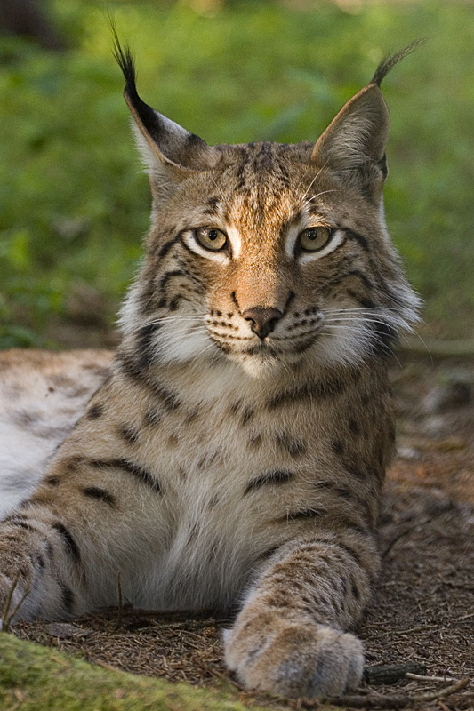
 Lynxs are one of the largest predators in area
Among the large mammals species which have elsewhere been long extinct, species like the Eurasian brown bear, grey wolf, red fox, European wildcat, roe deer, fallow deer, red deer, wild boar and European otter are found in the Prokletije.[12][16][19]
The highly endangered Balkan lynx a subspecies of the Eurasian lynx is mainly found in the Thethi National Park where about roughly 20-50 individuals still roam although poaching is still a big threat. The distribution of the chamois is all over the high altitudes. Around 720 chamois are found between the borders of Kosovo and Montenegro alone.[20] It is speculated that the mouflon roamed the Prokletije until World War I when it disappeared.[21]
Bird species include the golden eagle, snake eagle, honey Buzzard, peregrine falcon, capercaillie, rock partridge, scops owl, Eurasian eagle owl and the snow finch.[22] The rivers are home to a growing number of Marble trout. Among the amphibians ther are the alpine salamander (southern most distribution),[23] fire salamander, yellow-bellied toad and fire bellied toad . The rich herpetofauna include the fence lizard, green Lizard, Greek tortoise and snakes such as the true vipers including the poisonous horned viper and adder.
So far 140 species of butterflies are found which makes Prokletije the richest area in Europe for butterflies. The Prokletije contains one endemic species of lizard, the Prokletije Rock Lizard, Dinarolacerta montenegrina, named after the range.[24]
Early Ascents
British climbers Sleeman, Elmalie and Ellwood reached the summit of Maja Jezercë on 26 July 1929. These three climbers were the first to do so. Years later Austrian mountaineers scaled the summit too. Many explorers and scientists visited the Prokletije mountains collecting rocks and samples and then displayed them in museums, all of them bringing comments back.
Before any of these expeditions took place the highest peak of the range was believed to be Shkëlzen at 2,407 m (7,897 ft) high and then Maja Radohimës at 2,570 m (8,432 ft). By early summer 1929 all the summits were measured by Italian geodetes.
National Parks
 Waterfall in Thethi National Park
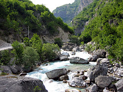 Valbona River in Valbona Valley National Park
Three national parks exist in Prokletije, one in Montenegro, the other two in Albania. A fourth national park in the area has been proposed to be located in Kosovo. The Theth National Park in Albania was declared as such in 1966.[25] It covers an area of 2,630 hectares and is located along the Thethi River. The main attraction in the park is the Grunas Waterfall.[25] The Valbona Valley National Park in Albania was declared as such in 1996. It is 8,000 hectares and is also called the Gem of Albania. It consists of the Valbona Valley and the Valbona River.[26] Kosovo, Albania, and Montenegro are planning to create another tri-state park in the area, that will be called Balkanik Park of Peace.[27] In the relevant ministry, there are plans to implement a large National Park in Albania which would cover a massive area of 144,000h.[citation needed] The park on the Kosovan side would include an area of 50,000h covering the high alpine areas and the Rugova Canyon and important rivers. The Montenegrin part of the Prokletije range has been declared a national park in 2009, comprising an area of 16.000ha.
A part of Maja e Ropës mountain has been declared a floral mountain reserve in 1955 covering an area of 25 hectares, chiefly uder Macedonian Pine, pine and beech. In the same year the Kozhnjar area was declared a fauna reserve covering an area of 161h especially because of the presence of chamois.[28]
Illegal deforestation today is still a major problem. In some extent some National Parks are also affected. In dry summers, forest fires are common. All the large mammals such as wolves, chamois, foxes, badgers and wild boar without regard to national park boundaries are hunted.[29]
Settlement, economy and transport
 View from Bajram Curri in the mountains north of the city
 The interpenetration Koman Gorge serves as a transport route for ferries
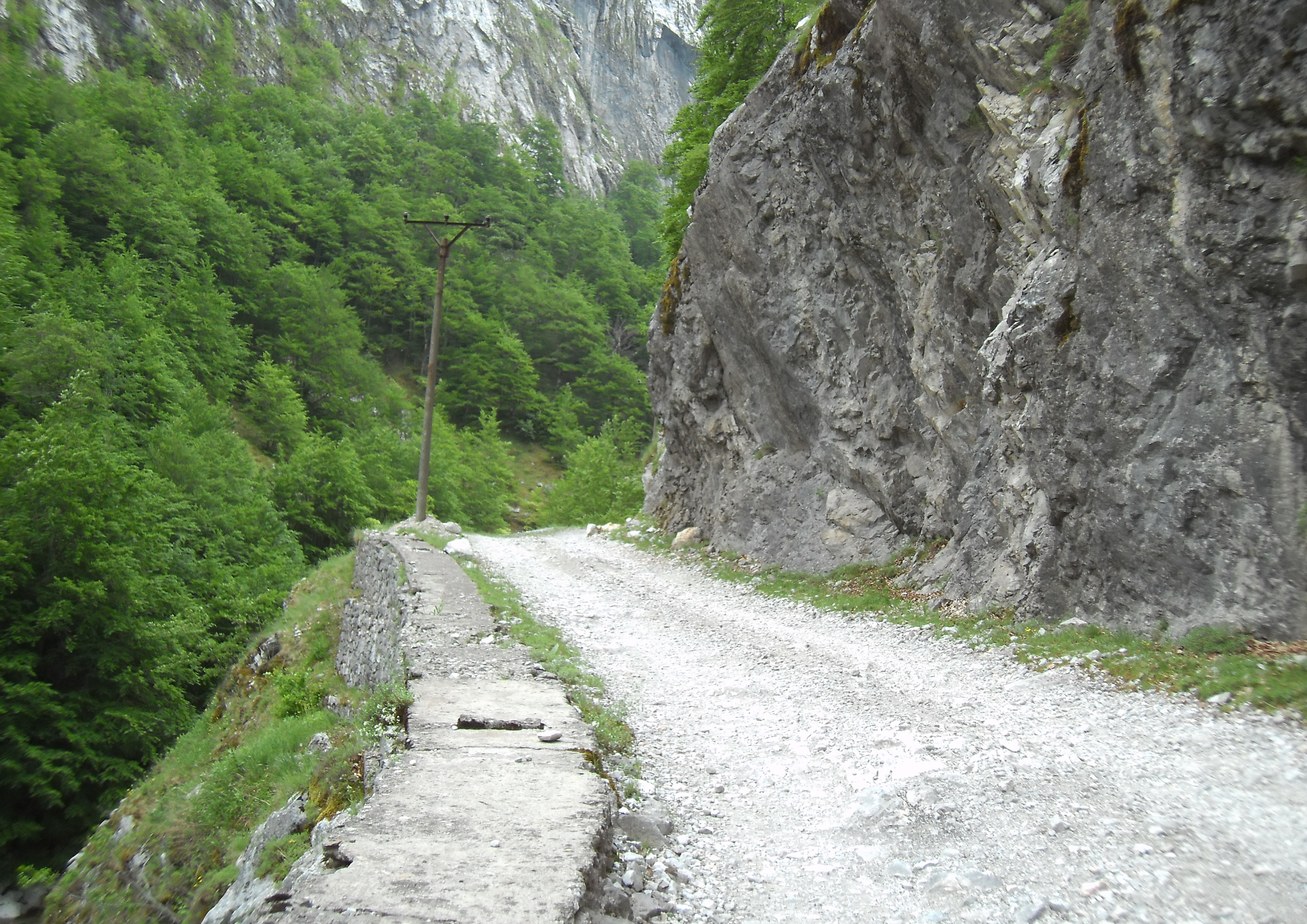
 Roads in the Prokletije of Albania are mostly of bad quality having built since Austro-Hungarian times.
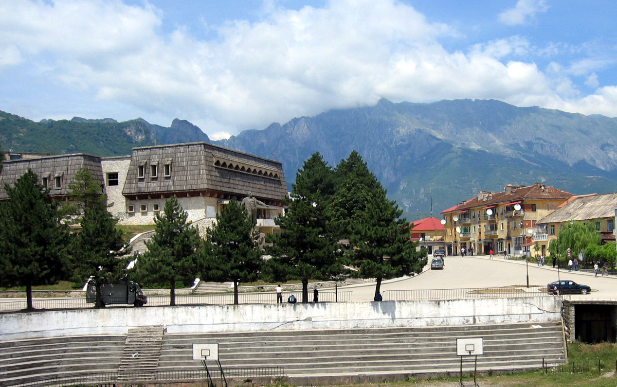
The Proketije is home to Albanians, Montenegrians, Serbs and Bosnians, but is only very sparsely populated. At the edges there are some settlemts: the Albanian Koplik and the Montenegrian Tuzi in the west near the Scutari Lake, Plav and Gusinje in of the northern valley of the upper Lim river in Montenegro, Bajram Curri, the main town of the district Tropoja, in the eastern Prokletije. Even the somewhat more distant, larger cities of Shkodra, Podgorica, Đakovica and Peć create their sphere of influence and are part of the inhabitants of the highlands for errands, administrative procedures and market sales are frequented.
Within the mountains there are villages with only up to a few hundred inhabitants. They are often pronounced scattered settlements without a clear core. Among the biggest likely to be Tamara and Selca, both are in the valley of the Cem and belonging to the community of the Kelmend. The community of eight villages - including Vermosh - 6,600 inhabitants.[citation needed] Tamara has today the only place in the central mountains of infrastructure facilities such as a secondary school and in addition to Vermosh, a maternity hospital. Until the collapse of communism there was such facilities, for example, in the Shala Valley. Many residents of the villages in the interior such as Boga, Theth or Valbona live only in the summer months there, as these villages during winter are cut for many weeks.[12]
Besides the seasonal migration, the whole mountain is suffering from a severe brain drain, as its only agriculture income is scarce. Many move in the hope of work and a little more comfort to the region of Shkodra and Koplik, Tirana or abroad.[30] As the number of year-round population wanes as the terrain becomes less accessible, there are few state or local government employees such as teachers. Besides agriculture, and semi-illegal forestry, local income is also based to a less modest extent to tourism.
In a few places like Theth, recreational hiking for tourism has been revitalized. With the help of GTZ, 40 private houses (also referred to as Guest Houses or Han, in Albanian) have been transformed into tourist accommodations or B&Bs. In 2010, there were 130 beds available in total - 100 more than in 2007. Additionally, hiking trails have been marked, and trails maps and guides published. In the period between 2006 to 2009, the number of tourists rose from 300 to around 7500 per year. Unlike in the rest of Albania, the increase was due to foreign tourists. Lakes such as Plav and Hrid receive many tourists during the summer months. In many villages there are small hydro power plants that supply the village with electricity.[31]
Many villages were already settled by the 15th century.[citation needed] Some individual valleys have been inhabited since the Stone Age. At the end of communism, several thousand people emigrated and depopulated the area. The former caravan route between Podgorica and Plav crossed the mountains along Lim and Cijevna.[32][33]
Only in the north west there is a road that crosses the Prokletije. It leads from the eastern shore of Lake Scutari at Han i Hotit border crossing from Montenegro to the first pass into the valley of Cem, following this to the source elevation of the Qafa e Predelecit after Vermosh, border crossing there, after Montenegro and ends at Gusinje. The road in 2007 was mostly unpaved. From west to east, there is only one road from Koplik to Boga and Qafa gates leading to Theth. From Theth, there is a bad track down into the valley of the Shala Valley Church and the river leads to Shkodra - it's just walking path to the north (Qafa e Pejës) and east (Qafa e Valbonës) further. The road over the Qafa e Morinës at Bajram Curri after Đakovica has been reconstructed. In the past, the only route for crossing the border between Montenegro and Kosovo was via Rugova Canyon which was very dangerous and steep. With the construction of the Peć–Rožaje highway the situation has greatly improved.[34]
Literature
- Boenzi Federico, Giovanni Palmentola: "Glacial features and snow-line trend during the last glacial age in the Southern Apennines (Italy) and on Albanian and Greek mountains", in: Journal of Geomorphology, 41, 21-29, Berlin 1997.
- Cook, Steve and Marash Rakaj. "Social Changes in the Albanian Alps During Communism". Middle States Geographer 28, 1995:84-90.
- Jovan Cvijić : "Ice age in Prokletije and surrounding mountains". The - Glass SKAN, XCI, Belgrade 1913th (Original: Cvijic, J. 1921: Ledeno doba u i Prokletijama okolnim planinama .- Glasnik Srpske Akad Kraljevske XCL, 1913, XCIII.)
- Jovan Cvijić: Geomorphology I-II, Belgrade 1924/26.
- Edith Durham : High Albania, London 1909
- Helmut Eberhart, Karl Kaser (Editor): Albania - tribal life between tradition and modernity, Böhlau Verlag, Wien 1995, ISBN 3-205-98378-5
- Milovan Milivojevića, Ljubomir Menkovića and Jelena Calic: "Pleistocene glacial relief of the central part of Mt Prokletije". In: Quaternary International, v. 190, 1, 1 November 2008, 112-122
- Franz Nopcsa : Geography and geology of northern Albania, Institutum Regni Hungariae Geologicum, Budapest 1929
- Christian Zindel, Barbara House Amman: Hiking north Albania - Thethi and Kelmend, Huber Verlag, Munich 2008, ISBN 978-3-940686-19-0
See also
- Malesija
- Mokna
- Bogićevica
- Rugova Canyon
- Rugova
- Valbona
- Theth
- Žljeb mountain
- Lake Komani Ferry
- Tourism in Albania
- Tourism in Kosovo
- Tourism in Montenegro
Notes and references
References
- ^ John Lemprière, Lorenzo L. Da Ponte, John David Ogilby: Bibliotheca classica: or, a dictionary of all the principal names and terms relating to the geography, topography, history, literature and mythology of antiquity and of the ancients with a chronological table, New York 1838
- ^ Friedrich Sickler: Handbuch der alten Geographie für Gymnasien., Vol. 2, Kassel 1833
- ^ Karl Heinz Rechinger: Ergebnisse einer botanischen Reise in den Bertiscus (Nordalbanische Alpen), 1935, in: Feddes Repert. Spec. Nov., 38: 137 — 152, 319-389.
- ^ Annalisa Rellie, Montenegro, 3rd, p. 237, http://books.google.com/books?id=j39fWAZ8A5sC&pg=PA237
- ^ Website des Montenegrinischen Tourismusministeriums
- ^ a b Akademia e Shkencave e RPSSH: Fjalor enciklopedik shqiptar, Tirana 1985 und Gjeografia fizike e Shqipërisë, Tirana 1990
- ^ Maja e Arapit, Geoquest Kletterführer. In: Geoquest Verlag. 2010-08-00. Retrieved on 2010-09-03.
- ^ a b http://www.summitpost.org/dinaric-alps/155326
- ^ http://www.tripadvisor.com/Attraction_Review-g304082-d1167653-Reviews-Rugova_Canyon-Kosovo.html
- ^ http://www.summitpost.org/bogi-263-evica-bogi-231-evica/354583
- ^ a b c Milovan Milivojević, Ljubomir Menković and Jelena Ćalić (November 2008). "Pleistocene glacial relief of the central part of Mt. Prokletije (Albanian Alps)". Quaternary International V. 190 (1, 1): pp. 112–122. http://www.sciencedirect.com/science?_ob=ArticleURL&_udi=B6VGS-4SGD4S1-1&_user=10&_rdoc=1&_fmt=&_orig=search&_sort=d&view=c&_acct=C000050221&_version=1&_urlVersion=0&_userid=10&md5=e418128ba6f43c33d484b65efb838d3b.
- ^ a b c Michael Galaty: Dr. Michael Galaty in Northern Albania. In: Millsaps College – News & Events. Retrieved on 2008-08-16. (Englisch)
- ^ Phil Hughes: Twenty-first Century Glaciers and Climate in the Prokletije Mountains, Albania. Arctic, Antarctic, and Alpine Research, Vol. 41, No. 4, 2009, pp. 455–459.
- ^ a b Glaciers discovered in 'cursed' mountains of Albania, The University of Manchester, 2010-01-27, http://www.manchester.ac.uk/aboutus/news/display/?id=5393
- ^ Marash Rakaj: Floristic and chorological news from north Albania, in: Botanica Serbica, 33 (2), Institute of Botany and Botanical Garden Jevremovac, Belgrad 2009, Seiten 177-183
- ^ a b c Petrit Imeraj, Joost Smets, in: Gilian Gloyer: Albania Bradt Travel Guide, Bucks 2006 (zweite Ausgabe), ISBN 978-1-84162-149-4
- ^ Stevanović V, Vukojičić S, Šinžar-Sekulić J, Lazarević M, Tomović G & Tan K. 2009. Distribution and diversity of Arctic-Alpine species in the Balkans. Plant Syst. Evol. 283: 219-235. Distribution and diversity of Arctic-Alpine species in the Balkans.
- ^ Treasures
- ^ Wolfgang Fremuth (Herausgeber): Albania - Guide to its Natural Treasures, Verlag Herwig Klemp, Tirana 2000, ISBN 3-931323-06-4
- ^ http://www.srbijalov.com/print.php?type=F&thread=184
- ^ Euronatur: Albaniens Wilder Norden – Schatzkammer der ökologischen Vielfalt in Europa. Retrieved on 27. Juli 2009.
- ^ BirdLife IBA Factsheet. Retrieved on 19. Juni 2009.
- ^ http://www.iucnredlist.org/apps/redlist/details/19843/0/rangemap
- ^ http://www.euroherp.com/species/Dinarolacerta_montenegrina/
- ^ a b Thethi-Guide. "Historia e Parkut Kombetar Theth" (in Albanian). http://www.thethi-guide.com/index.php?option=com_content&view=article&id=75%3Ahistoria-e-parkut-kombetare-theth&catid=39%3Ainfo&lang=sq. Retrieved 28 July 2010.
- ^ Albanian National Agency of Tourism. "Valbona Valley National Park" (in Albanian). http://www.akt.gov.al/natyra/item.php?id=31&lang=2. Retrieved 28 July 2010.
- ^ Sulejmani, Edlira. "Bashkepunimi rajonal bisedime per nje park kombetar shqiptaro-kosovaro-malazez" (in Albanian). Alsattv. http://www.alsat.tv/lajme-nga-vendi/bashkepunimi-rajonal-bisedime-per-nje-park-kombetar-shqiptaro-kosovaro-malazez.html. Retrieved 28 July 2010.
- ^ Summit Post - Bogiçevica
- ^ Illegal Logging Ravages Albania's Forests. In: BalkanInsight.com. 2009-12-16. Retrieved on 13. August 2010. (Englisch)
- ^ Renate Ndarurinze: Albanien entdecken, Trescher Verlag, Berlin 2006, ISBN 3-89794-091-4
- ^ Ismail Beka: Grenzüberschreitende Destinationsentwicklung für Bergtourismus (Albanien, Montenegro, Kosovo). 2010-04-24. Retrieved on 2010-08-17.
- ^ Shala Valley Project – Final Report of the 2006 Field Season
- ^ James Pettifer: Albania & Kosovo – Blue Guide, A & C Black, London 2001, ISBN 0-7136-5016-8
- ^ Volker Grundmann: Albanien: Das komplette Reisehandbuch, Unterwegs-Verlag, Singen 2008, ISBN 978-3-86112-257-9
Notes
a. ^ Kosovo is the subject of a territorial dispute between the Republic of Serbia and the self-proclaimed Republic of Kosovo. The latter declared independence on 17 February 2008, while Serbia claims it as part of its own sovereign territory. Its independence is recognised by 85 UN member states. External links
Academic
- Prokletije on BirdLife
- Peace parks of Prokletije
- Montenegrin Prokletije
- Prokletije at summitpost.org
- Successful Cooperation – Sustainable Results: Examples from Europe, Caucasus and Central Asia, GTZ, 2010
Tourism
- Prokletije on Wikitravel
- Guest House Accommodation in Albania
- Thethi Guide in Albania
- Rugova Canyon Travel Guide in Kosovo
- Prokletije National Park Travel Guide in Montenegro
 Albania topics
- Index
- Outline
Symbols People History - Origins
- Praevalitana
- Epirus Nova
- Middle Ages
- Albania under the Bulgarian Empire
- Albania under the Serbian Empire
- Principality of Arbër
- Kingdom of Albania
- Albanian Principalities in Middle Ages
- League of Lezhë
- Venetian Albania
- Ottoman Albania
- Albanian Pashaliks
- Massacre of the Albanian Beys
- Albanian National Awakening
- Revolts of 1833–1839
- Revolt of 1843–1844
- Revolt of 1847
- League of Prizren
- League of Peja
- Revolt of 1910
- Battle of Deçiq
- Independence Declaration
- Provisional Government of Albania
- Albania during the Balkan Wars
- Principality of Albania (1914–1925)
- Italian Protectorate on southern Albania
- Vlora War
- Republic of Mirdita
- Albanian Republic (1925–1928)
- Albanian Kingdom (1928–1939)
- Albania under Italy (Invasion
- Colonization)
- Albania under Germany
- Resistance
- Communist Albania (1946–1992)
- Post-Communist Albania (since 1992)
- Timeline to 1993, 1994–Present
Politics Geography - Cities:
- Geographical Regions:
- Northern Mountain Range
- Southern Mountain Range
- Western Lowlands
- Central Mountain Range
- Mountains:
- Seas:
- Rivers:
- Drin River
- Buna River
- Vjosë
- Black Drin
- Lakes:
- Lake Skadar
- Lake Ohrid
- Lake Prespa
- Lagoons:
- Karavasta
- Narta
- Plains:
- Myzeqe
- Korçë Plain
- Zadrima
- Capes:
- Cape of Gjuhëz
- Cape of Rodon
- National Parks:
- Butrint
- Lura
- Llogara
- Thethi
- Valbona Valley
- Shebenik-Jabllanica
- Fir of Hotova
- Karaburun-Sazan
Economy Military - Military
- Air Force
- Rapid Reaction Brigade
- Naval Defense Forces
- Joint Forces Command
- Support Command
Culture - Languages
- Costume
- Nationalism
- Literature
- Cinema
- Cuisine
- Emigration
- Music
- Sports
- Holidays
- Religion
- Television
- Radio
- Mythology
- Epic Poetry
Religion - Islam
- Albanian Orthodox Church
- Roman Catholicism
- Protestanism
- Byzantine Catholicism
Categories  Serbia topics
History Prehistoric Serbia:Roman Serbia:Middle Ages:White Serbs · Serbian Sklavinia · Medieval Serbian Principality (provinces of Rascia, Bosnia, Diocleia, Travunia, Zachlumia, Pagania) · Serbian Grand Principality · Serbian Kingdom · Serbian Empire · Ottoman Serbia
Politics Constitution · President · Prime Minister · National Assembly · Political parties · Elections · Foreign relations · Government · History · Armed Forces · Air Force · Law enforcement · Nationality law · LGBT rightsGeography Administrative:Landforms:Economy Culture Architecture · Beer · Cinema (Films) · Cuisine · Literature (Medieval) · Cultural Heritage (UNESCO sites) · Media · Music · Serbian Orthodox Church · Sport · Television · Public holidays · History · Education · Human rights (LGTB rights) · Languages · Religion · Subdivisions · Districts · Crime · Serb people (List)Categories:- Mountain ranges of Europe
- National parks of Montenegro
- Mountain ranges of Albania
- Mountains of Kosovo
- Mountains of Montenegro
- Prokletije Mountains


Wikimedia Foundation. 2010.