- Tropical Storm Dongo
-
Severe Tropical Storm Dongo Severe tropical storm (MFR) Tropical storm (SSHS) 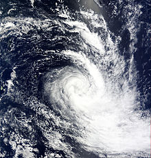
Severe Tropical Storm Dongo on January 11 Formed January 7, 2009 Dissipated January 12, 2009 Highest winds 10-minute sustained:
95 km/h (60 mph)
1-minute sustained:
100 km/h (65 mph)Lowest pressure 984 mbar (hPa; 29.06 inHg) Fatalities None reported Damage None Areas affected No land areas Part of the 2008–09 South-West Indian Ocean cyclone season Severe Tropical Storm Dongo (Joint Typhoon Warning Center designation: 06S) was the fifth tropical disturbance and fourth named storm of the 2008–09 South-West Indian Ocean cyclone season. Dongo developed out of an area of low pressure near the remnants of Severe Tropical Cyclone Billy early on January 7. The low was quickly declared a tropical disturbance later that day, and a tropical depression the following day. Shortly after being declared a tropical depression, it was further upgraded to a moderate tropical storm and given the name Dongo. Convection associated with Dongo decreased as it began to exhibit hybrid features. Late on January 10, convection quickly increased and Dongo intensified into a severe tropical storm early the next morning. Upon becoming a severe tropical storm, Dongo reached its peak intensity with winds of 95 km/h (60 mph 10-minute winds). Despite approaching cooler waters, the storm remained a severe tropical storm until transitioning into an extratropical cyclone early on January 12. The extratropical remnants of Dongo persisted for another two days before becoming non-tropical.
Contents
Meteorological history
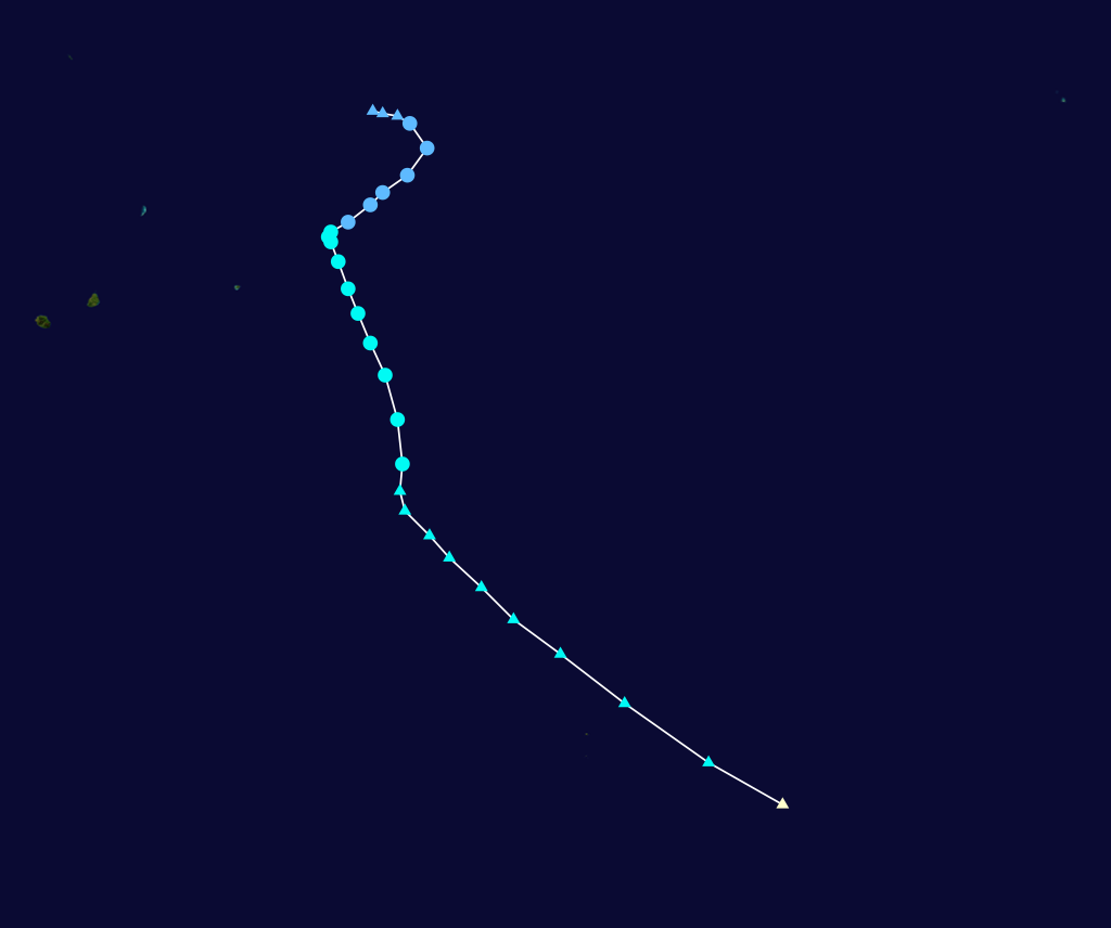
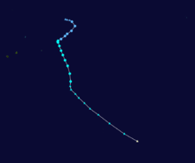 Storm path
The origins of Dongo can be traced back to an area of low pressure which developed near the remnants of Severe Tropical Cyclone Billy late on January 7.[1][2] The low, located within a strong monsoonal flow, quickly developed poleward outflow. At 06:00 UTC, the Regional Specialized Meteorological Centre (RSMC) Météo-France designated it as Zone of Disturbed Weather 05-20082009 while located 1,530 km (950 mi) northeast of Mauritius.[1] Shortly after, the Joint Typhoon Warning Center (JTWC) determined the chances of a significant tropical cyclone developing within 48 hours as fair. This was based on winds up to 65 km/h (40 mph) derived from QuickSCAT satellite estimates and a continuing development of the structure. However, strong wind shear was expected to inhibit short term development.[3] A few hours later, Météo-France further upgraded the low to a tropical disturbance as deep convection persisted around the center of circulation.[4] At 15:00 UTC, the JTWC issued a Tropical Cyclone Formation Alert, as the low was likely to intensify into a tropical storm. At this time, One-minute sustained winds were estimated at 55 km/h (35 mph).[5]
Situated along the edge of a low-mid level ridge, the disturbance tracked towards the southwest. Convection diminished slightly later that day due to the shear.[6] At 06:00 UTC on January 9, Météo-France upgraded the disturbance to a tropical depression as convection began to redevelop.[7] Shortly after, the depression was upgraded to Moderate Tropical Storm Dongo as winds were estimated to have reached 75 km/h (45 mph 10-minute winds). At the time of the upgrade, Dongo began to turn more towards the south. Decreasing wind shear and high seas surface temperatures, both necessary factors for intensification, were present and further development of the storm was anticipated.[8] Roughly three hours later, the JTWC began issuing advisories on Tropical Cyclone 06S (Dongo).[9] Deep convection continued to develop around the center, signifying intensification.[10] Slight weakening occurred early on January 10 as the center of circulation relocated to the northwest of the original center.[11] As Dongo began to turn towards the southeast, convection rapidly decreased, leaving the center partially exposed. At this time, Dongo was exhibiting hybrid features (those of tropical and subtropical cyclones) despite conditions remaining favourable for intensification.[12]
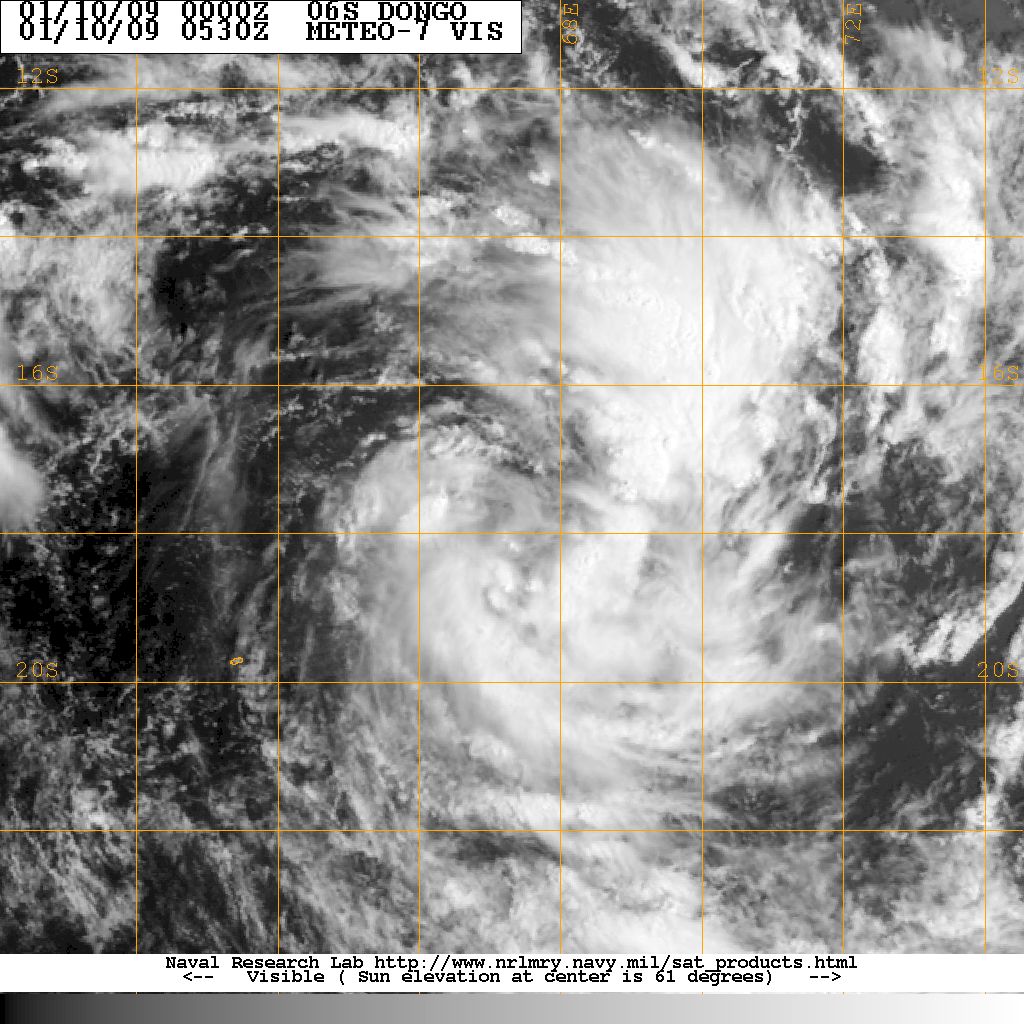
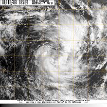 Moderate Tropical Storm Dongo exhibiting hybrid features on January 10
By 18:00 UTC, convection began to increase,[13] and six hours later, Dongo intensified into a severe tropical storm. At this time, Dongo reached its peak intensity with winds of 95 km/h (60 mph 10-minute winds)[14] with a minimum pressure of 984 hPa (mbar)[2] according to Météo-France and 100 km/h (65 mph 1-minute winds) according to the JTWC.[15] At this time, Dongo was located about 1,240 km (770 mi) east-southeast of Mauritius.[2] Tracking towards the south-southeast, Dongo approached cooler waters[16] and began to transition into an extratropical cyclone. Wind shear was also increasing over the storm in response to an approaching upper-level trough.[17] Despite moving over cooler waters, the storm remained a severe tropical storm until being declared extratropical at 06:00 UTC on January 12.[2] Several hours later, the JTWC issued their final advisory on Ex-Tropical Cyclone 06S (Dongo).[18] Early on January 13, Météo-France issued their final advisory on the extratropical remnants of Dongo.[19] Around 00:00 UTC on January 14, Dongo passed within 190 km (120 mi) of Île Amsterdam. In the operational best track supplied by Météo-France, it was discovered that Dongo remained extratropical for an additional day, reaching its secondary peak with winds of 110 km/h (70 mph) and a minimum pressure of 978 hPa (mbar) around 12:00 UTC on January 14 shortly before becoming non-tropical.[2]
Impact
As Dongo remained out over open waters for the duration of its existence, there was no impact on any land-masses.[15][20]
See also
- 2008–09 South-West Indian Ocean cyclone season
- Timeline of the 2008–09 South-West Indian Ocean cyclone season
References
- ^ a b "Météo-France Advisory One". Météo-France. January 8, 2009. http://www.webcitation.org/5dfZ1WuiB. Retrieved January 16, 2009.
- ^ a b c d e "Météo-France Operational Best Track: Dongo". Météo-France. January 17, 2009. http://www.meteo.fr/temps/domtom/La_Reunion/TGPR/saison/05_table.html. Retrieved January 17, 2009.
- ^ "Significant Tropical Weather Advisory for the Indian Ocean 01-08-09 0830Z". Joint Typhoon Warning Center. January 8, 2009. http://www.webcitation.org/5dfbnyIfA. Retrieved January 16, 2009.
- ^ "Météo-France Advisory Two". Météo-France. January 8, 2009. http://www.webcitation.org/5dg3Ogu18. Retrieved January 16, 2009.
- ^ "Tropical Cyclone Formation Alert". Joint Typhoon Warning Center. January 8, 2009. http://www.webcitation.org/5dg44RCwl. Retrieved January 16, 2009.
- ^ "Météo-France Advisory Three". Météo-France. January 8, 2009. http://www.webcitation.org/5dgLMzCst. Retrieved January 16, 2009.
- ^ "Météo-France Advisory Five". Météo-France. January 9, 2009. http://www.webcitation.org/5dh4FxeoV. Retrieved January 16, 2009.
- ^ "Météo-France Advisory Six". Météo-France. January 9, 2009. http://www.webcitation.org/5dhYxw4aW. Retrieved January 16, 2009.
- ^ "JTWC Advisory One". Joint Typhoon Warning Center. January 9, 2009. http://www.webcitation.org/5dhZ5Uwd0. Retrieved January 16, 2009.
- ^ "Météo-France Advisory Seven". Météo-France. January 9, 2009. http://www.webcitation.org/5dhpyauzE. Retrieved January 16, 2009.
- ^ "Météo-France Advisory Nine". Météo-France. January 10, 2009. http://www.webcitation.org/5diYFExiC. Retrieved January 16, 2009.
- ^ "Météo-France Advisory Ten". Météo-France. January 10, 2009. http://www.webcitation.org/5dleYdFkb. Retrieved January 16, 2009.
- ^ "Météo-France Advisory Eleven". Météo-France. January 10, 2009. http://www.webcitation.org/5djMJBbVn. Retrieved January 16, 2009.
- ^ "Météo-France Advisory Twelve". Météo-France. January 11, 2009. http://www.webcitation.org/5djiFCwJ2. Retrieved January 16, 2009.
- ^ a b Joint Typhoon Warning Center (2009). "JTWC Best Track". United States Naval Research Laboratory. http://199.9.2.143/tcdat/tc09/SHEM/06S.DONGO/trackfile.txt. Retrieved January 16, 2009.
- ^ "Météo-France Advisory Thirteen". Météo-France. January 11, 2009. http://www.webcitation.org/5dk4qrt4K. Retrieved January 16, 2009.
- ^ "Météo-France Advisory Sixteen". Météo-France. January 12, 2009. http://www.webcitation.org/5dlKU65jq. Retrieved January 16, 2009.
- ^ "JTWC Advisory Seven". Joint Typhoon Warning Center. January 12, 2009. http://www.webcitation.org/5dmnKJkrZ. Retrieved January 17, 2009.
- ^ "Météo-France Advisory Twenty". Météo-France. January 13, 2009. http://www.webcitation.org/5dmkcSCGZ. Retrieved January 16, 2009.
- ^ Associated Press (January 13, 2009). "Madagascar officials expect severe storms". International Herald Tribune. http://www.webcitation.org/5duCxWsCj. Retrieved January 16, 2009.
External links
Categories:- 2008–09 South-West Indian Ocean cyclone season
- South-West Indian Ocean severe tropical storms
Wikimedia Foundation. 2010.