- Cyclone Tam (2006)
-
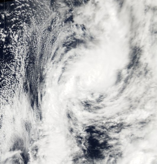
Tropical Cyclone Tam Category 1 cyclone (Australian scale) Tropical cyclone (SSHS) 
Cyclone Tam on January 14 Formed January 6, 2006 Dissipated January 14, 2006 Highest winds 10-minute sustained:
85 km/h (50 mph)
1-minute sustained:
75 km/h (45 mph)Lowest pressure 987 mbar (hPa; 29.15 inHg) Fatalities None reported Damage $26,000 (2006 USD) Areas affected American Samoa, Rotuma Niue, Tonga, and Futuna Part of the 2005–06 South Pacific cyclone season Tropical Cyclone Tam (RSMC Nadi designation: 04F, JTWC designation: 06P) was the first named storm of the 2005–06 South Pacific cyclone season. Forming out of a tropical depression on January 6, the storm gradually intensified, becoming a tropical cyclone on January 12 and receiving the name Tam. Although it was traveling at a quick pace, the storm gained organization and reached its peak intensity with winds of 85 km/h (50 mph) the following day. However, the increasing forward motion of the storm, combined with strengthening wind shear, caused Tam to rapidly weaken on January 14. Around that time, it entered the Tropical Cyclone Warning Centre in Wellington, New Zealand's area of responsibility. Shortly thereafter, the storm transitioned into an extratropical cyclone and dissipated early the next day. Cyclone Tam produced heavy rainfall and strong winds over American Samoa upon being named. The precipitation caused several mudslides and flooding, which inflicted $26,000 in damage. The storm also had minor effects on Niue, Tonga, and Futuna.
Contents
Meteorological history
 Storm path
Tropical Cyclone Tam originated out of tropical depression while located about 370 km (230 mi) to the north-northeast of Fiji on January 6.[1] The system, designated 04F by the Regional Specialized Meteorological Centre (RSMC) in Nadi, Fiji tracked slowly towards the west.[2] Although the depression was located within an area of low wind shear, little intensification occurred, as a lack of low-level moisture hindered the development of deep convection.[1] By January 9, shower and thunderstorm activity associated with the disturbance increased as it began to interact with the South Pacific Convergence Zone. Another tropical depression, 05F, also became increasingly organized and at one point was forecast to absorb 04F. Following the weakening of Tropical Depression 05F, 04F intensified.[1] Around 2000 UTC on January 11, the Joint Typhoon Warning Center (JTWC) issued a Tropical Cyclone Formation Alert as deep convection persisted around the center of circulation for several hours.[3]
The following day, the RSMC Nadi upgraded Tropical Depression 04F to a tropical cyclone and gave it the name Tam, making it the first named storm of the 2005–06 season. Several hours later, the storm passed close to Niuafo'ou with winds of 65 km/h (40 mph).[2] By 0000 UTC on January 13, the JTWC classified Tam as Tropical Cyclone 06P. Although the storm was tracking towards an area with stronger winds aloft, it was forecast to intensify.[3] Due to the relatively fast movement of the storm, the increasing winds aloft had little effect on the storm,[1] allowing it to intensify and attain winds of 85 km/h (50 mph) around 0600 UTC.[2] However, with both wind shear and the forward motion of the storm continuing to increase, convection rapidly became dislocated from the center.[3] Around 0000 UTC on January 14, Tam entered the area of responsibility of the Tropical Cyclone Warning Centre in Wellington, New Zealand.[2] With forward movement estimated at 75 km/h (45 mph) almost due south,[3] the cyclone reached an unusually high latitude as a tropical cyclone. Coinciding with the time when Tam reached 33°S, it transitioned into an extratropical cyclone. The remnants of the storm persisted for several hours before dissipating early on January 15.[1]
Preparations and impact
Wettest tropical cyclones in Fiji
Highest known recorded totalsPrecipitation Storm Location Rank (mm) (in) 1 755 29.72 Bebe (1972) Suva[4] 2 615 24.21 Gavin (1997) Monasavu dam[5] 3 495 19.48 Mick (2009) Monasavu dam[6] 4 386 15.19 04F (2009) Monasavu dam.[7] 5 350 13.77 Tomas (2010) [8] 6 341 13.43 June (1997) Monasavu dam[5] 7 311 12.24 Ami (2003) Taveuni Island[9] 8 293 11.53 Tam (2006) Rotuma[10] 9 190 7.50 Cliff (2007) Lakeba[11] 10 110 4.33 Daman (2007) Rotuma[12] As Tam was developing, residents attempted to evacuate the island by plane, with the primary target of Fiji. Only a few flights took off before officials closed the airport, stranding numerous passengers.[13] Late on January 11, RSMC Nadi placed Tonga and Futuna under a tropical cyclone alert and also placed Tonga and Wallis under a strong wind warning.[14][15] Early the next day RSMC Nadi placed northern Tonga under a tropical cyclone gale warning.[16] Later that morning they canceled the tropical cyclone alert for Wallis and Futuna as Tam was not expected to directly affect Futuna anymore.[16] During that afternoon RSMC Nadi placed Niue under a Tropical cyclone alert, as they predicted that Niue would be affected by Tam within 24 hours.[16][17] Early on January 13 RSMC Nadi cancelled the tropical cyclone warnings and alerts for Tonga, whilst at the same time placing Niue under a tropical cyclone gale warning, however this gale warning was canceled later that day as Tam moved into the southern ocean.[18]
On January 11, Tropical Depression 04F produced a record 293.2 mm (11.5 in) of rain in a 24 hour span on Rotuma. However, little damage resulted from the heavy precipitation.[19] Cyclone Tam produced heavy rainfall in American Samoa which triggered damaging floods. Several buildings were flooded, and an estimated 70% of the island's crops were destroyed. Sustained winds of up to 55 km/h (35 mph), with gusts reaching 95 km/h (59 mph), tore a few roofs off unsecured homes.[20] Scattered power outages were reported throughout the island.[13] A few landslides were also reported as a result of the storm. Damage from the storm totaled $26,000 on the island.[20] Relatively little damage was recorded in Futuna; there, the storm downed several trees and stranded a yacht on a reef.[21] On Niuafo'ou, a weather station recorded sustained winds of 55 km/h (35 mph) with gusts of up to 75 km/h (45 mph), along with a minimum pressure of 991 hPa (mbar).[22] Minor damage, consisting of fallen branches and isolated power outages also occurred on Niue.[1]
See also
References
- ^ a b c d e f Gary Padgett (April 25, 2006). "Monthly Tropical Weather Summary for January 2006". Typhoon 2000. http://www.typhoon2000.ph/garyp_mgtcs/jan06sum.txt. Retrieved March 12, 2009.
- ^ a b c d Fiji Meteorological Service (2006). "Tropical Cyclone Summary: 2005-2006 Season" (PDF). World Meteorological Organization. http://www.met.gov.fj/documents/TC_Seasonal_Summary_05-061190690520.pdf. Retrieved March 12, 2009.
- ^ a b c d Joint Typhoon Warning Center (January 14, 2006). "JTWC Advisories for Tropical Cyclone 06P (Tam)". Australia Severe Weather. http://australiasevereweather.com/cyclones/2006/tropical_cyclone_tam.htm. Retrieved March 12, 2009.
- ^ Russell D. Thompson (1986). "Hurricanes in the Fiji Area: Causes and Consequences". New Zealand Journal of Geography 81 (1): 7–12. doi:10.1111/j.0028-8292.1986.tb00222. http://www3.interscience.wiley.com/journal/120833292/abstract?CRETRY=1&SRETRY=0.
- ^ a b James P. Terry, Rishi Raj (1999). "Island Environment and Landscape Responses to 1997 Tropical Cyclones in Fiji". Pacific Science (University of Hawai'i Press) 53 (3): 257–272. http://www.webcitation.org/5tSaV0OUh. Retrieved 2010-10-14.
- ^ "Fiji Islands Climate Summary December 2009". Fiji Meteorological Service. 2010-01-13. http://www.webcitation.org/5nQ9JNIq0. Retrieved 2010-02-15.
- ^ "Preliminary rainfall data for January 2009". Fiji Meteorological Service. 2009-02-03. http://www.webcitation.org/5jduapW10. Retrieved 2009-09-08.
- ^ "'Few' deaths, 18,000 evacuated as Tomas smashes Fiji". NZ Herald. 2010-03-10. http://www.nzherald.co.nz/world/news/article.cfm?c_id=2&objectid=10632415&pnum=0. Retrieved 2010-03-20.
- ^ James P. Terry, Simon McGree, and Rishi Raj (2004-09-01). "The exceptional flooding in Vanua Levu Island during Tropical Cyclone Ami in January 2003". Journal of Natural disaster science (Japan Science and technology information aggregator) 26 (1): 27–36. doi:10.2328/jnds.26.27. http://www.webcitation.org/5pMOJtq9T. Retrieved 2010-04-29.
- ^ "Fiji Islands Climate Summary January 2006". Fiji Meteorological Service. 2006-02-15. http://www.wamis.org/countries/fiji/fiji200601.pdf. Retrieved 2010-03-31.
- ^ "Fiji Islands Climate Summary April 2007". Fiji Meteorological Service. 2007-05-16. http://www.webcitation.org/5njjbmEGO. Retrieved 2009-09-08.
- ^ "Fiji Islands Climate Summary December 2007". Fiji Meteorological Service. 2008-01-04. http://www.webcitation.org/5njiLDqgV. Retrieved 2009-09-08.
- ^ a b Staff Writer (January 27, 2006). "Hurricanes fizzle out in Samoa, where some of the policemen wear skirts". Lohontan Valley News. http://www.lahontanvalleynews.com/article/20060127/Opinion/101270011. Retrieved March 12, 2009.
- ^ "Weather warnings issued on January 11, 2006". MT Archive. 2006-01-11. http://mtarchive.geol.iastate.edu/2006/01/11/text/Severe/Severe_11.txt. Retrieved 2009-04-27.
- ^ Kevin Vang (January 12, 2006). "Tropical Depression 04F Intensifying; Cyclone Alerts for Futuna and Tonga". Asia-Pacific Disaster Alerts. http://www.afap.org/apcedi/2006/01/apcedi-alert-spfj-tropical-depression_12.html. Retrieved March 12, 2009.
- ^ a b c "Weather warnings issued on January 12, 2006". MT Archive. 2006-01-12. http://mtarchive.geol.iastate.edu/2006/01/12/text/Severe/Severe_12.txt. Retrieved 2009-04-27.
- ^ Kevin Vang (January 13, 2006). "Cyclone Tam Passing Through Tonga on way to Niue". Asia-Pacific Disaster Alerts. http://www.afap.org/apcedi/2006/01/apcedi-alert-spfj-cyclone-tam-04f-6.html. Retrieved March 12, 2009.
- ^ "Weather warnings issued on January 13, 2006". MT Archive. 2006-01-13. http://mtarchive.geol.iastate.edu/2006/01/13/text/Severe/Severe_13.txt. Retrieved 2009-04-27.
- ^ "Fiji Islands Weather Summary January 2006" (PDF). Fiji Meteorological Service. January 2006. http://www.wamis.org/countries/fiji/fiji200601.pdf. Retrieved March 13, 2009.
- ^ a b "NCDC Event Report: American Samoa High Winds". National Climatic Data Center. 2006. http://www4.ncdc.noaa.gov/cgi-win/wwcgi.dll?wwevent~ShowEvent~642378. Retrieved March 12, 2009.
- ^ Kevin Vang (January 14, 2006). "Cyclone Urmil develops from Tropical Depression 06F; Urmil over Tafahi and Niuatoputapu". AFAP Asia-Pacific Disaster Alerts. http://www.afap.org/apcedi/2006/01/apcedi-alert-spsm-cyclone-urmil-06f-2.html. Retrieved March 12, 2009.
- ^ Ministry of Civil Aviation (February 15, 2006). "A report on Tropical Cyclones Tam and Urmil" (PDF). Tonga Meteorological Service. http://www.met.gov.to/index_files/tc_tam_urmil_2006.pdf. Retrieved March 12, 2009.
External links
Categories:- Category 1 South Pacific cyclones
- 2005–06 South Pacific cyclone season
- Tropical cyclones in American Samoa
- Tropical cyclones in Tonga
- Tropical cyclones in Fiji

Wikimedia Foundation. 2010.