- Cypress Park, Los Angeles
-
Cypress Park — Neighborhood of Los Angeles — Location within Central Los Angeles
 Cypress Park
Coordinates: 34°05′35″N 118°13′30″W / 34.09293°N 118.22504°W Country United States State California County County of Los Angeles City City of Los Angeles Government - City Council Ed Reyes - State Assembly Kevin De León (D) - State Senate Gil Cedillo (D) - U.S. House Xavier Becerra (D) Area[1] - Total 0.72 sq mi (1.9 km2) Population (2000)[1] - Total 9,764 - Density 13,478/sq mi (5,203.9/km2) Population changes significantly depending on areas included and recent growth. ZIP Code 90065 Area code(s) 323 Cypress Park is a neighborhood in Northeast Los Angeles. It is located at the confluence of the Los Angeles River and Arroyo Seco and is less than 2.5 miles north of Downtown Los Angeles. Cypress Park is currently becoming closely associated with the movement to revitalize the Los Angeles River, due to the Los Angeles River Center and the Rio de Los Angeles State Park within its boundaries.[2]
Contents
Demography
Cypress Park is a mostly Latino, working class neighborhood. According to the 2000 US Census, the neighborhood has 9,764 residents and is 82.1% Latino, 11.1% Asian, 4.9% White, 0.9% Black, and 1.3% Other. The median household income is $42,615.[1]
Geography
Cypress Park lies within a historic alluvial floodplain shared with the Elysian Valley neighborhood, which is bounded by Elysian Park and Mt. Washington. The boundaries of Cypress Park are roughly considered to be the Los Angeles River to the west, the Arroyo Seco to the south, Mt. Washington to the east, and Division St. to the north.[1]
History
The land on which Cypress Park currently occupies was first settled by the Tongva tribe of the Shoshone Native Americans. When Gaspar de Portolà and his expedition first encountered the Los Angeles River in August 1769 and described the area of the confluence of the Arroyo Seco as “a very lush green valley”. The Pueblo de Los Angeles was later founded adjacent to this location.
The area was granted as Rancho San Rafael to Jose Maria Verdugo in October 1784. In 1859, Julio Verdugo sold the Southern tip of the Rancho to Jessie D. Hunter, who had first arrived in Los Angeles in 1847 as a Captain in the Mormon Battalion during the Mexican-American War. Hunter had previously acquired the Rancho Cañada de Los Nogales, which contains most of present day Glassell Park. Hunter had established the first kiln-fired brickyard in Los Angeles, but sold it and took up farming when he acquired the Rancho land.
After Hunter’s death the land was subdivided as the Hunter Tract and, in 1882, Cypress Park became the first of the Arroyo Seco communities to come into existence, predating Highland Park by three years.[3]
The murder of Stephanie Kuhen occurred around 1:45 AM on September 17, 1995, in Cypress Park when members of the "Avenues" gang shot a vehicle containing a family. A 3-year old girl named Stephanie Kuhen died, and another occupant of the car sustained injuries. The perpetrators were arrested and convicted.[4][5][6][7][8] The killing caused a lot of media attention in the United States and lead to crackdowns on Los Angeles street gangs.[9][10]
Transportation
Cypress Park is served by two stations on the Gold Line, the Lincoln Heights/Cypress Park Station located at W. Avenue 26/Lacy St. and Heritage Square/Arroyo Station located at French Ave./Marmion Way. It is also served by Metro Local bus lines 81, 83, 84, 90, 91, 94, and 794.
The neighborhood's main thoroughfares are Cypress Ave., San Fernando Rd., and North Figueroa St., and is served by the Golden State Freeway
 I-5 and Arroyo Seco Parkway
  SR 110, also known as the Pasadena Freeway.
Parks
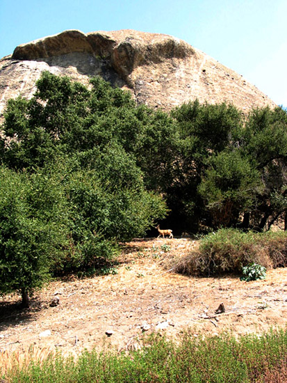
Rio de Los Angeles State Park: One of only two California State Recreation Areas in Los Angeles County, this 40-acre park boasts one of first steps toward revitalization of the Los Angeles River by restoring natural river wetlands to the area. During the rainy season this part of the park floods and during spring it becomes a premiere location in the City of Los Angeles for wildflower viewing. Through a partnership with City of Los Angeles Department of Parks and Recreation, the park also includes numerous sports fields, a children's playground and a recreation building.[11]
LA River Center and Gardens: Located at the former site of Lawry’s California Center, over 6 acres of mission-style buildings and gardens, this complex is operated by the Santa Monica Mountains Conservancy and is host to numerous environmental non-profits, such as Friends of the Los Angeles River, Northeast Trees, the Los Angeles Conservation Corps, LA Works, and the National Parks Service Rivers, Trails and Conservation Assistance Program. The River Center gardens as well as the adjacent River Garden Park are open to the public during daylight hours; 570 W. Avenue 26.[12]
Cypress Park Recreation Center: A public park with a baseball field, basketball courts, children's playground, and auditorium; 2630 Pepper Ave.
Greayer’s Oak Park: A pocket park named after WWI aviator Greayer Clover; corner of N. Figueroa St. and Marmion Way.
Education
Residents are zoned to Los Angeles Unified School District schools:
- Loreto Street Elementary School
- Aragon Elementary School
- Florence Nightingale Middle School
- A choice between Lincoln High School , Franklin High School
Landmarks
Cypress Park has several Los Angeles Historic-Cultural Monuments on the East and Northeast Sides designations.
HCM No. 404: the Huron Substation; A Los Angeles Railway traction power substation, built in 1906 and used until 1958 for the Yellow Car system.
HCM No. 735: the Jeffries House; The last remaining houses of the Jeffries family, made prominent by James J. Jeffries, boxing heavyweight Champion of the World. Built in 1911, this house was his brother’s.
HCM No. 849: the Nickel-Leong Mansion ; a large Antebellum-style Greek Revival Mansion at Isabel St. and Thorpe Ave. This house was built in 1905 for restaurateur Max Nickel and later owned by the Leong family of Chinatown. The house was designed by John C. Austin, a Los Angeles architect who was one of the designers of Los Angeles City Hall, Griffith Observatory, and the Arroyo Seco Bank Building at Figueroa St. and York Blvd.
HCM No. 908, Riverside-Figueroa Bridge.
Additionally, the Richard Henry Dana Branch (3320 Pepper Avenue), a former branch library of the Los Angeles Public Library, is #47 on the National Register of Historic Places in Los Angeles.
In the media
Cypress Park and businesses within it are frequently used as filming locations in feature films and music videos. The movies The Fast and the Furious, Catwoman, and Date Night as well as the television series Heroes filmed scenes in the Huron Substation.[13] Local bar Footsie’s was used for the music video to the song “Live Your Live” by T.I., featuring Rihanna.[14]
Future
Cypress Park is currently in the beginning stages of economic revitalization, having been noted by the Los Angeles City Council and Community Redevelopment Agency of Los Angeles (CRA/LA) to have potential for economic growth. The CRA/LA has included Cypress Park in two of their proposed redevelopment plans, the Northeast Los Angeles River Project and the Cornfield Arroyo Seco Redevelopment Project.[15][16]
In order to stem economic blight, the City Council of Los Angeles in January 2010 approved an ordinance that banned any new auto-related businesses from opening in Cypress Park and Glassell Park.[17]
The neighborhood's wealth of Victorian, Craftsman, and California bungalow houses is currently being restored by private real estate investors.
References
- ^ a b c d "Los Angeles Times Neighborhood Project". The Los Angeles Times. http://projects.latimes.com/mapping-la/neighborhoods/neighborhood/cypress-park/. Retrieved 2010-12-01.
- ^ "Los Angeles River Revitalization". The Los Angeles Times. http://councilcommittee.lacity.org/lariver/. Retrieved 2010-12-01.
- ^ "Historic Cypress Park." Charles J. Fisher, Highland Park Heritage Trust - Volume XIV, Issue 1. Retrieved 2010-12-01.
- ^ "Slaying Still Haunts Cypress Park." Los Angeles Times. July 18, 1999.
- ^ "Wrong turn costs a child's life." CNN. September 18, 1995.
- ^ "Gang Members Sentenced in ‘Wrong Way’ Shooting." Los Angeles Times. August 2, 1997.
- ^ "Three more arrested in toddler's shooting." CNN. September 23, 1995.
- ^ "Community Law Enforcement And Recovery (CLEAR)." The Los Angeles Police Department. Accessed August 27, 2008.
- ^ "Child killing sparks action against Los Angeles gangs." The Christian Science Monitor. September 25, 1995. Volume 87, Issue 210. Page 4.
- ^ Pelisek, Christine. "Avenues of Death." LA Weekly. July 14, 2005.
- ^ "California State Parks". http://www.parks.ca.gov/default.asp?page_id=22277. Retrieved 2010-12-01.
- ^ "LA River Center & Gardens". http://www.lamountains.com/planning_river.html. Retrieved 2010-12-01.
- ^ "Huron Substation About Us". http://www.huronsubstation.com/About_Us.html. Retrieved 2010-12-01.
- ^ "Amoeba Music Neighborhood Blog". http://www.amoeba.com/blog/2009/07/eric-s-blog/cypress-park.html. Retrieved 2010-12-01.
- ^ "CRA/LA NELA River Plan". http://www.crala.org/internet-site/Projects/NELA/index.cfm. Retrieved 2010-12-01.
- ^ "CRA/LA Cornfield Arroyo Seco Plan". http://www.crala.org/internet-site/Projects/Proposed_Cornfield_Arroyo_Seco/index.cfm. Retrieved 2010-12-01.
- ^ "The Eastsider LA". http://www.theeastsiderla.com/2010/01/city-to-put-the-brake-on-new-auto-repair-shops-in-cypress-park-glassell-park/. Retrieved 2010-12-01.
External links
- Website of Charles J. Fisher, Historian
- Northeast Los Angeles Arts Organization
- L.A. City Council District 1
- Greater Cypress Park Neighborhood Council

Glassell Park, Los Angeles Mount Washington, Los Angeles 
 Cypress Park, Los Angeles
Highland Park, Los Angeles 
Elysian Valley, Los Angeles Lincoln Heights, Los Angeles Coordinates: 34°05′35″N 118°13′30″W / 34.09293°N 118.22504°W
Eastside/Northeast, Los Angeles Districts and
neighborhoodsAtwater Village · Boyle Heights · Brooklyn Heights · Cypress Park · Eagle Rock · El Sereno · Garvanza · Glassell Park · Hermon · Highland Park · Lincoln Heights · Montecito Heights · Monterey Hills · Mt. Washington · University Hills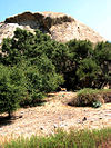
Points of
interestSee also Downtown · Eastside/Northeast · Harbor Area · Greater Hollywood · Westlake/Silver Lake/Los Feliz · San Fernando and Crescenta Valleys · South Los Angeles · Westside · Wilshire Categories:- Neighborhoods in Los Angeles, California
- Populated places established in 1882

Wikimedia Foundation. 2010.