- D7 road (Croatia)
-
D7 state road
Route information Part of 
Length: 115.2 km (71.6 mi) Major junctions From:  Duboševica border crossing to Hungary
 D517 in Branjin Vrh
 D212 near Branjin Vrh
 D2 near Osijek
 D515 near Đakovo
 A5 in Đakovo interchange
 D38 near Đakovo
 D46 near Đakovo
 A3 in Velika Kopanica interchange
 D520 near Slavonski Šamac
To: Slavonski Šamac border crossing to Bosnia and HerzegovinaLocation Counties: Osijek-Baranja, Brod-Posavina Major cities: Beli Manastir, Osijek, Čepin, Đakovo, Slavonski Šamac Highway system State roads in Croatia
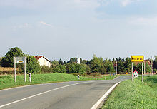 D7 in Kozarac
 New Drava Bridge, carrying D7
 Osijek - a section of D7 comprises its western bypass
 D7 in Vrpolje
D7 is a state road connecting Beli Manastir, Osijek, Čepin and Đakovo to Slavonski Šamac border crossing to Bosnia and Herzegovina and to Duboševica border crossing to Hungary. The road is 115.2 km (71.6 mi) long.[1]
The D7 state road runs parallel to the A5 motorway along its entire length, connecting to virtually all A5 interchanges directly (Đakovo)[2] or indirectly, thus serving as an alternate and backup road to the motorway. Since the A5 motorway is not completed to the national borders, the D7 road also serves as connecting road for A5 traffic to the border crossings to Hungary and Bosnia and Herzegovina.
The road, as well as all other state roads in Croatia, is managed and maintained by Hrvatske ceste.[3]
Contents
Traffic volume
Traffic is regularly counted and reported by Hrvatske ceste, operator of the road.[4]
D7 traffic volume Road Counting site AADT ASDT Notes  D7
D72501 Duboševica 1,125 1,426 Between the border crossing (Hungary) and the Ž4011 junction. D72503 Karanac (Beli Manastir) 6,411 6,694 Between the D517 and D212 junctions. D72505 Čeminac north 5,008 5,458 Adjacent to the Ž4054 junction. D72513 Osijek bypass 7,486 7,656 Between the Ž4257 and Ž4068 junctions. D72512 Čepin 6,700 6,508 Between the D2 and Ž4011 junctions. An ADT figure is provided instead of AADT. D73705 Vuka 4,467 5,452 Between the Ž4120 and Ž4108 junctions. D73606 Vrpolje 3,987 4,394 Adjacent to the Ž4202 junction. D73615 Sikirevci south 3,032 3,781 Adjacent to the Ž4220 junction. Road junctions and populated areas
D7 major junctions/populated areas Type Slip roads/Notes 
Duboševica border crossing to Hungary.
Hungarian route 56 to Mohács, Hungary.
The northern terminus of the road.
Ž4017 to Kneževo 
Branjin Vrh
D517 to Belišće.
Ž4036 to Šećerana. D212 to Kneževi Vinogradi and Batina border crossing to SerbiaKozarac Čeminac
Ž4054 to Novi ČeminacŠvajcarnica
Ž4041 to Bolman
Ž4257 to Darda.
Drava River Bridge - 642 m long.  D2 - Osijek Retfala interchange on the southern Osijek bypass road connecting Osijek as well as Vukovar to the east, and to A5 motorway (Osijek interchange) and Našice to the west.
Ž4247 to Ž4085 and Čepin Ž4085 to Čepin Ž4105 to A5 motorway, Čepin interchange Ž4109 to Ernestinovo Vuka
Ž4120 to KoritnaŠiroko Polje
Ž4108 to Jurjevac PunitovačkiKuševac
Ž4130 to Viškovci and Ž4239 to Ivanovci Gorjanski D515 to Našice
Ž4145 to Đakovo A5 in Đakovo interchange via a short connecting road. D38 to Pleternica
Ž4147 to Đakovo D46 to Đakovo and VinkovciVrpolje Velika Kopanica A3 in Velika Kopanica interchangeŽ4210 to Jaruge, Oprisavci, Trnjanski Kuti and Slavonski Brod (D423). Sikirevci
Ž4220 to GundinciSlavonski Šamac D520 to Babina Greda interchange on A3 motorwaySlavonski Šamac border crossing to Bosnia and Herzegovina.
The southern terminus of the road.See also
- Hrvatske ceste
- State roads in Croatia
Sources
- ^ "Decision on categorization of public roads as state roads, county roads and local roads" (in Croatian). Narodne novine. February 17, 2010. http://narodne-novine.nn.hr/clanci/sluzbeni/2010_02_17_410.html.
- ^ "Regulation on motorway markings, chainage, interchange/exit/rest area numbers and names" (in Croatian). Narodne novine. April 24, 2003. http://www.mmpi.hr/UserDocsImages/nn-73-03-Pravilnik-oznacav-ac.htm.
- ^ "Public Roads Act" (in Croatian). Narodne novine. December 14, 2004. http://narodne-novine.nn.hr/clanci/sluzbeni/2004_12_180_3130.html.
- ^ "Traffic counting on the roadways of Croatia in 2009 - digest" (in English). Hrvatske ceste. May 1, 2010. http://www.hrvatske-ceste.hr/WEB%20-%20Legislativa/brojenje-prometa/CroDig2009.pdf.
Categories:- State roads in Croatia
- Osijek-Baranja County
- Brod-Posavina County


Wikimedia Foundation. 2010.