- Tainan
-
Tainan
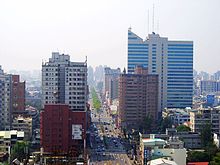
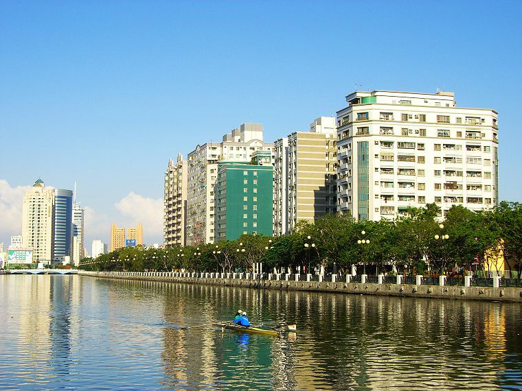
臺南— Special municipality — Tainan City · 臺南市 Clockwise from top: The skyline of Tainan metropolitan area, Fort Provintia, Southern Taiwan Science Park, Anping dock, the shopping district nearby Tainan Station, National Cheng Kung University, Barclay Memorial Park.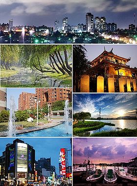

Flag
SealNickname(s): Southern City (南市)
The Phoenix City (府城),[1]
The Prefecture City
Country  Republic of China (Taiwan)
Region Southwestern Taiwan Capital Anping District (安平區) Government – Mayor William Lai Area(Ranked 7 of 22) – Total 2,191.6531 km2 (846.2 sq mi) Population (October 2011) – Total 1,876,312 – Density 854.917/km2 (2,214.2/sq mi) Population ranked 5 of 22 Districts 37 Bird Black-billed magpie[1] Flower Royal Poinciana (Delonix regia) Tree Royal Poinciana (Delonix regia) Website English Chinese Tainan City Traditional Chinese 臺南市 or 台南市 Simplified Chinese 台南市 Transcriptions Mandarin - Hanyu Pinyin Táinán Shì - Wade–Giles T'ai2-nan2 Shih4 Min - Hokkien POJ Tâi-lâm-Chhī Tainan City (臺南市) is a city in southern Taiwan. It is the fifth largest after New Taipei, Kaohsiung, Taichung, and Taipei. It was formerly a provincial city, and in 2010, the provincial city merged with the adjacent Tainan County to form a single special municipality. Tainan faces the Taiwan Strait in the west and south. Tainan's complex history of comebacks, redefinitions and renewals inspired its popular nickname "City of the Phoenix."[2]
Tainan was initially established by the Dutch VOC as a ruling and trading base which called Fort Zeelandia during the period of Dutch rule on Taiwan. After Dutch colonists were defeated by Koxinga in 1661, Tainan was remained as the capital of the Tungning Kingdom until 1683 and afterwards the capital of Taiwan prefecture under the rule of Qing Dynasty until 1887, when the Qing Dynasty established Taipei as the new provincial capital. Tainan has been historically regarded as one of the oldest cities in Taiwan, and its former name, Tayouan (大員), has been claimed to be the source of the name Taiwan. It is also one of Taiwan's cultural capitals, for its rich folk cultures including the famous local snack food, extensively preserved Taoist rites and other living local traditions covering child birth to funeral. The city houses the first Confucian school–temple, built in 1665,[3] the remains of the Eastern and Southern gates of the old city, and countless other historical monuments. Tainan claims more Buddhist and Taoist temples than any other city in Taiwan.
Contents
History
Early History
Archaeological revelations of Zuozhen people in the township of Zuozhen suggest that the Tainan region has been inhabited for at least 20,000 to 31,000 years. The Siraya tribe dominated the region around the time the first foreigners arrived. While the Sakam people of Sinkan sub-tribe inhabited in the present day city proper,[4] other Sirayan sub-tribes including Soelangh, Mattauw and Baccloangh inhabited in the surrounding suburbs.
By late 16th century, Chinese tradesmen and fishermen had set up several bases along the west coast of Taiwan including a sandbar across the Taijiang inner sea off the bay of Sakam. "Tayouan" (大員, Pe̍h-ōe-jī: Tāi-ôan), meaning foreigners in Sirayan, was adopted by the Chinese as the name of the sandbar and later become the name of entire island – Taiwan.[4][5][6] Slightly north of Tayouan along the shoreline near Beixianwei were Japanese tradesmen’s territories. These settlements were the bases of underground Chinese-Japanese trade.[5]
The early Chinese and Japanese traded with the Sirayan people. They used salt and food to trade for deer hides and dried deer meat. Due to Chinese and Japanese influences, Sirayan gradually changed their culture and lifestyle. They started to use Chinese words in their language, use Japanese tantō in ritual events, and also migrated inland due to the expansion of newcomers. By the time the Europeans arrived, the influence of Chinese and Japanese traders and fishermen had already changed this region of the once-wild coastline.[5][7]
Dutch Colony
 Anping Fort (site of the Fort Zeelandia)
Early Dutch colonists had attempted but failed to control Macau and the Penghu islands. In July 1622, V.O.C. admiral Cornelis Reyersz set sailed for Taiwan in search of a suitable new location to build a trading post. They established a small fort named Orange on Tayouan two years later. The fort was then expanded and renamed Fort Zeelandia. The settlement was initially designed as a base to attack their Spanish rivals and as a trading post between China and Batavia. Later the post became the Dutch center of trade between China, Japan and Europe.[5][7]
The area surrounding Zeelandia expanded as a result of the Dutch trading post in the area. In 1625, they built a new settlement called "The Provintia" in the Sakam area as a center for an agricultural colony. Dutch laid out policies to encourage Chinese farmers to migrate to the colony to grow rice and sugar cane. The settlement at Sakam was so successful it had overtaken Batavia, already a large cultivation area, in the 1650s.[5]
After several expeditions and a forced occupation of the Spanish garrison in Keelung, the Dutch V.O.C. became the first authority to claim control of Taiwan Island; Castle Zeelandia was served as the seat of government.[8]
Several incidents, most notably the Hamada Yahee incident (which took governor Pieter Nuyts as hostage), made the occupation of the area difficult. This was the result of conflicts between the Japanese and the Dutch colonists.[7][9] Increased Chinese settler activity also diminished the power of the Dutch authorities in the area. Stresses from heavy Dutch taxation on Chinese peasants and the Dutch soldiers' role in the plunder and collapse of Ming dynasty, eventually led to the Guo Huaiyi Rebellion in 1652.[7] Civil order was only restored after the support of the local Sinkanese, and then a new fort was built in Provintia to strengthen and maintain the defense of Dutch officials after the rebellion.
Zheng’s Regime
 Statue of Koxinga in Koxinga's Shrine
At the dawn of April 30, 1661, after being defeated by the Manchus in Nanjing, Ming loyalist Zheng Chenggong (Koxinga) lead a fleet of 25,000 soldiers and entered Taijiang via the narrow waterway of Luermen north of Tayouan. In five days, Zheng took down the Provintia and besieged the Zeelandia. The siege dragged on for both sides into a nine month stalemate. Zheng took over Zeelandia on February 7, 1662 after a Dutch surrender.[5]
Zheng renamed Provintia to Dongdu (東都) or East Capital and Zeelandia to Anping. He sent his troops deep into the plain to establish agricultural settlements.[5] Many suburbs surrounding Tainan City include in their names "Ying", "Jia", and "Tian", all derived from this event.
The city was renamed to Dongning soon after Zheng’s death in 1662. Chen Yonghua, the civil affair minister introduced Chinese bureaucracy, built the first Confucius temple on the island, and introduced the method of salt production to coastal areas. Chen also invited the British to set up their trading post in Anping to continue the trade relations between Japan and South East Asia, and to maintain its position as a center of trade.[10]
Early Qing Dynasty Rule
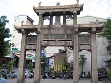 Jieguanting in Wutiaogang, Tainan gateway to the sea during Qing Dynasty
On July 17, 1683, Qing naval commander Shi Lang defeated Zheng’s navy in Penghu Islands. Two days later, the fleet landed on Dongning with little resistance. In 1684 after heated discussions, the Qing decided to claim the island to keep it out of the hands of potential enemies.[7] The Taiwan prefecture was established, and Tainan served as the prefecture city "Taiwan-fu" (臺灣府).
Under Qing legislation, building city walls was prohibited in Taiwan. In 1721, a rebellion initiated by Zhu Yiguei broke out in Tainan. The rebels took over the Prefecture City and then the entire island. The rebellion soon became a massacre between the Fujian descendents and the Guangdong descendents. It was only after the Qing army, who was dispatched from mainland China, intervened did the restoration of order came about the Prefecture City. After the rebellion, Qing decided to create a boundary around the city for control, by growing bamboo around the perimeter. After several rebellion outbreaks across the island, the Qing started to work on building the city wall of the Prefecture City in late 1780s.[4]
A flood in 1823 brought rich silt from nearby rivers, which formed a widespread new fertile land across the Taijiang bay area between the Prefecture City and Anping. A canal system called "Wutiaogang" was built to keep the port in Prefecture City functioning but prevented large ships from entering the bay.[4]
Late Qing Dynasty Rule
After 174 years of maritime restriction, the Qing reopened Anping port as part of the Tianjin treaty in 1858 followed by the establishment of the Anping Custom in 1864. Western merchants started to reside and build their trading posts in town near the remains of Fort Zeelandia.
In the spring of 1874, the Japanese launched a large-scale expedition to Taiwan. Following this, the Qing sent the imperial commissioner Shen Baozhen to Taiwan to strengthen its defense. In Prefecture City, Shen made several efforts to modernize the defense including: advocating a telegraph cable link between Prefecture City and Amoy,[7] and inviting French engineers to design the Eternal Golden Castle in Erkunshen.[4] It is notable that some parts of the castle were built using bricks demolished from Fort Zeelandia.[11] After over 200 years of development the Prefecture City remained as the largest city in Taiwan and a Chinese city with foreign influence. The following is a description of the city by the Scottish missionary William Campbell in 1870s:
As to Taiwan-fu itself, I may say that the brick wall which surrounds it is about fifteen feet in thickness, twenty-five in height, and some five miles in circumference. Lofty watch-towers are built over the four main gateways, and large spaces within the city are given to the principal temples and yamens—or quarters occupied by the civil and military mandarins. There is much need in Taiwan-fu for the carrying out of a City Improvement Scheme. Pleasant walks, no doubt, there are, and some of the shops have an appearance which is decidedly attractive; but, as a rule, the streets are narrow, winding, ill-paved, and odorous.[12]
Taiwan became a province in 1885 and the city was renamed to the name it bears today – Tainan prefecture(台南府). Tainan retained the status as a prefecture city while the capital of Taiwan province moved to Taichung, then to Taipei in 1887.
Japanese Colonial Era
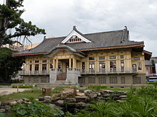 Tainan Butokuden (Martial Art Hall)
As a consequence of the Chinese losing the first Sino-Japanese War in 1895, Taiwan and the Penghu Islands were surrendered to Japan under the Treaty of Shimonoseki. After a bloody repression along the western corridor, the Japanese army arrived under the Tainan city gate on October 20, 1895. Liu Yongfu, the great general of the short-lived Republic of Formosa fled to Amoy, and left the city under the threat of civil disarray. English missionary Thomas Barclay was chosen by local elites and foreign tradesmen to direct Japanese force to enter the city. As a result, Tainan was taken without resistance.[4]
The Japanese established Tainanken in 1895 but soon changed to Tainanchō in 1901, then Tainanshū in 1920. Tainanshū includes today’s Yunlin, Chiayi, and Tainan regions. Tainan served as the capital city. The Japanese introduced modern infrastructure in Tainan, including modern schools, creating a courthouse and a city hall, extensive freight and passenger rail network based on narrow gauge, a new Anping canal replacing Wutiaogang, new telecommunication facilities, Tainan airport, and an irrigation system across the Tainan and Chiayi regions. Modern urban designs were also introduced; old narrow streets and city walls were demolished, replaced with wide streets that formed the cityscape of the modern day Tainan city center.[9]
On April 9, 1915, the Xilaian incident broke out in Yujing near Tainan. The leader, Yu Qingfang, launched a revolution to establish a Taiwanese nation. The revolution spread across the island, of which both Chinese and indigenous Taiwanese participated. The Japanese sent heavily armed troops to repress the event. The repression soon became a large scale massacre which eliminated many rural villages and thousands of people were killed during the repression, most being innocent villagers. Yu Qingfang was caught on August 22, 1915; more than 800 people were sentenced to death in Tainan court. Over 100 of them were executed and the birthplace of the rebellion, Xilai Temple in Tainan, was demolished. The Xilaian incident was the largest uprising in the history of Japanese colonial rule in Taiwan.[4]
Post War and Republic of China
The Republic of China took over the island in 1945 after World War II. Tainan City and Tainan County became separate local entities under Taiwan Province in 1946. The 228 Incident broke out on February 28, 1947 in Taipei following widespread civil unrest. Tang Dezhang, a Taiwanese lawyer and a member of government which set up "The 228 Incident Commission", was arrested by the Chinese army on March 11. Claiming him as a separatist and after being questioned and tortured overnight the Chinese executed him the next day in the park in front of Tainan City Hall (now named Tang Dezhang Memorial Park). Tang was pronounced not guilty by court later in March.[13] Like other regions in Taiwan, many political activists in Tainan suffered from KMT repression during this autocratic era
Tainan held its first councilor and mayoral election in 1950. On March 19, 2004, President Chen Shuibien was shot in Tainan during his campaign for a new term in office. The city has been a major center for pro-independent movement since the Japanese rule. On October 21, 2008, Chinese ARATS Vice President Zhang Mingqing was injured when he encountered protestors in Tainan Confucius Temple.[14]
During the second half of 20th century, the city grew into a metropolis with over 1 million inhabitants.
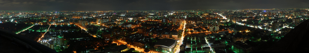 North←Panoramic photography of Tainan Metropolitan areas.→South
Culture
 Ritual adulthood celebration for all 16-year-olds
Tainan claims its name as one of the Taiwanese cultural capitals for its abundant historic monument and citizen lifestyle. The city is dotted by Taoist temples, Buddhist temples as well as churches. Many of them are among the oldest on Taiwan Island. The city also has its own unique traditions and cuisines developed by Chinese frontiers over its long history.
Folk cultures
The lives of Tainan citizens are closely related to many Chinese gods and temples. Parents bring their children to Qiniangma, the children’s goddess, to wish for good will. Traditionally Chinese people step into adulthood when they are 16. In Tainan there is a big ritual celebration for all 16-year-olds on the seventh day of the seventh lunar month, Qiniangma’s birthday. This extended celebration is unique to Tainan: In the past, families with children working in the harbor took the advantage of this ceremony to show the employers that their children should be paid in adult rate after this day.
Before any form of exam people would visit the Wenchangdijun, the literacy god, to pray for good luck. One of the Wenchang temples is on the top floor of the Chikanlou. Many final year high school students preparing for university exams visit the temple in June, before the exam. Those asking for marriage would visit Yuelao, the god for marriages. People also visit temples for many reasons, from simply praying for good luck to celebrating god’s birthday to even consulting with the other world.[15]
A wedding ceremony in Tainan is a series of complex process where perfection will be asked in every detail. Both broom and bride need to prepare 12 specific gifts representing different meanings during their engagement ceremony with more to come in the wedding. People believe this complexity is a sign of being civilized.[15]
Anping residents use a special symbol called Sword Lion to keep bad spirits away. During Zheng’s regime, Anping was a main naval station of Koxinga. When returning home from military drills, soldiers would put lion-face shields on the main gates of their houses and insert their swords crosswise in the lion’s mouth. Locals learned this and incorporate this symbol into the design of their houses as a symbol of security.[16]
Tainan cuisine
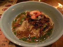 Duxiaoyue Danzimian
Many well known Taiwanese cuisines originated from Tainan. Tainan was a center for sugar production industry. As a result Tainan cuisines tend to be sweeter compared to other Taiwanese cuisines. Milk fish cuisines are very popular in Tainan where locals also call it Guóxìngyú or Koxinga’s fish. People believe the Chinese name of the fish Shīmùyú (Pe̍h-ōe-jī: Sabhahi ) was given by Koxinga. The fish are bred in the farms located in the outskirt coastal areas of the city. Many Tainan restaurants and snack stands have a history that traces back to Qing Dynasty or Japanese colonial era.[15]
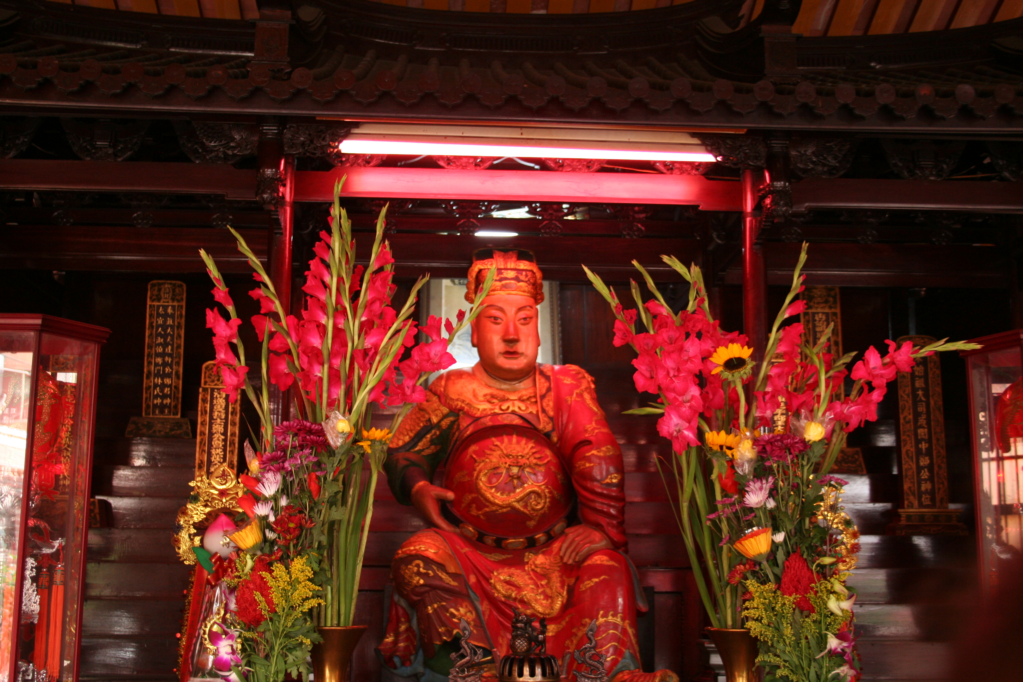
Temples
 Zhuxi Temple
Tainan is famous for its diversity and density of temples and shrines. Some of them are the only of its kind on Taiwan Island. Among all, there are officially listed seven Buddhist temples and eight Taoist shrines (七寺八廟).[4]
The seven Buddhist temples are:
- Kaiyuen Temple, originally the royal gardens of the Tungning Kingdom, became a Buddhist temple in 1690.
- Zhuxi Temple, founded in the Tungning Kingdom period.
- Fahua Temple, founded in the Tungning Kingdom period.
- Mituo Temple, founded in the Tungning Kingdom period.
- Longshan Temple, founded in the Qing Dynasty.
- Chongqing Temple, founded in the Qing Dynasty.
- Huangbo Temple, founded in the Qing Dynasty but demolished by the Japanese. The worshiped statues were migrated to the Altar of Heaven temple.
The eight Taoist shrines are:
- Datianhou Gong (大天后宮), the Grand Sea Goddess temple. Originally the residence of the King Ningjing of the Tungning Kingdom.
- Sidian Wumiao (祀典武廟), the Official God of War temple, built in 1665.
- Dongyue Dian (東嶽殿), the God of Hell temple, built in 1673.
- Fuchenghuang Miao (府城隍廟), the temple of the Prefecture City God, built in 1669.
- Longwang Miao (龍王廟), the shrine of the East Sea Dragon God, built in 1716 but demolished by the Japanese.
- Fengshen Miao (風神廟), the Wind God temple, built in 1739. It is the only Wind God temple on Taiwan Island.[4]
- Yaowang Miao (藥王廟), the Medicine God temple, built in 1685.
- Shuixian Gong (水仙宮), the Water Gods temple, built in Qing Dynasty after Wutiaogang was constructed.
There are many other well-known temples and shrines not on this list, such as the Altar of Heaven temple (天壇) and the re-built Xilai temple (西來庵) etc. They are all the centers of religion in Tainan.
Due to its abundant numbers of temples and shrines, the traditional temple decoration crafters and their business flourishes in Tainan. There are masters still passing their knowledge to maintain the temples in the traditional way.[15]
Music
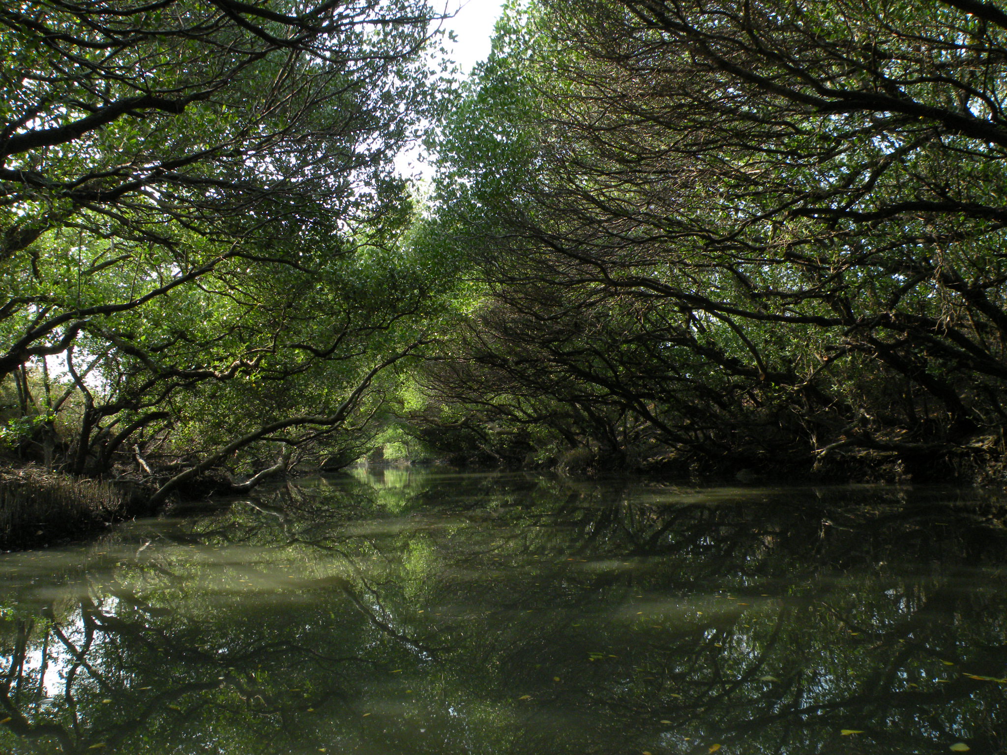
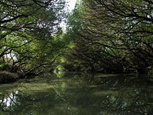 Taijiang National Park, Sicao green tunnel of Manggroves
Nanyin and Shisanyin were the first Chinese music families to introduce to Tainan; Nanyin is performed mostly for entertainment while Shisanyin is performed in the Confucius worship ceremony. There are two Nanyin clubs in Tainan: Zhenshengshe, a 200-year-old club once dissolved in the 1980s for ten years and Nanshengshe, a 95-year-old club performing globally.[15]
Music performance is being promoted in Tainan. Tainan City has its own Chinese orchestra[17] and symphony orchestra. There are also private performance groups such as Chimei Mandolin Performance Group, Chimei Philharmonic Orchestra[18] and Chang Jung Christianity University Symphony Orchestra.[19]
Ten Drum Art Percussion Group (十鼓擊樂團) is a percussion performance group established in the year 2000. The group is dedicated in producing percussion performances that highlights the history, the culture and the image of Taiwan. The group first performed internationally in the festivals during the 2000 Sydney Olympic Games. Following this event, the group has performed in many occasions both internationally and domestically. The group has its own campus located in an old sugar factory in Rende District. The campus provides education on percussion performances at all levels and regular performances to general public.[20]
Museums and parks
On top of its plentiful living culture, Tainan host several museums and parks. The National Museum of Taiwan Literature is in the former city hall; National Museum of Taiwan History is in the Annan district; Chimei Museum is in the Rende district; Taijiang National Park follows the coast; Anping Historic Scenic Park includes the entire old Anping town and the north ward of Anping harbor; and Siraya National Scenic Area includes the Wushantou reservoir built by Yoichi Hatta. In the city center, many historic monuments from Zheng’s regime, Qing dynasty, and the Japanese colonial era are preserved including the Confucius temple, two major city gates and former city hall.
Tourism
Tainan is a tangible sense of history and pleasing city, which is the site of several spectacular religious festivals. As well as its string of forts, the first capital of Taiwan has some 300 ancient sanctuaries, from the island's first Confucian temple to its first Taoist temple.
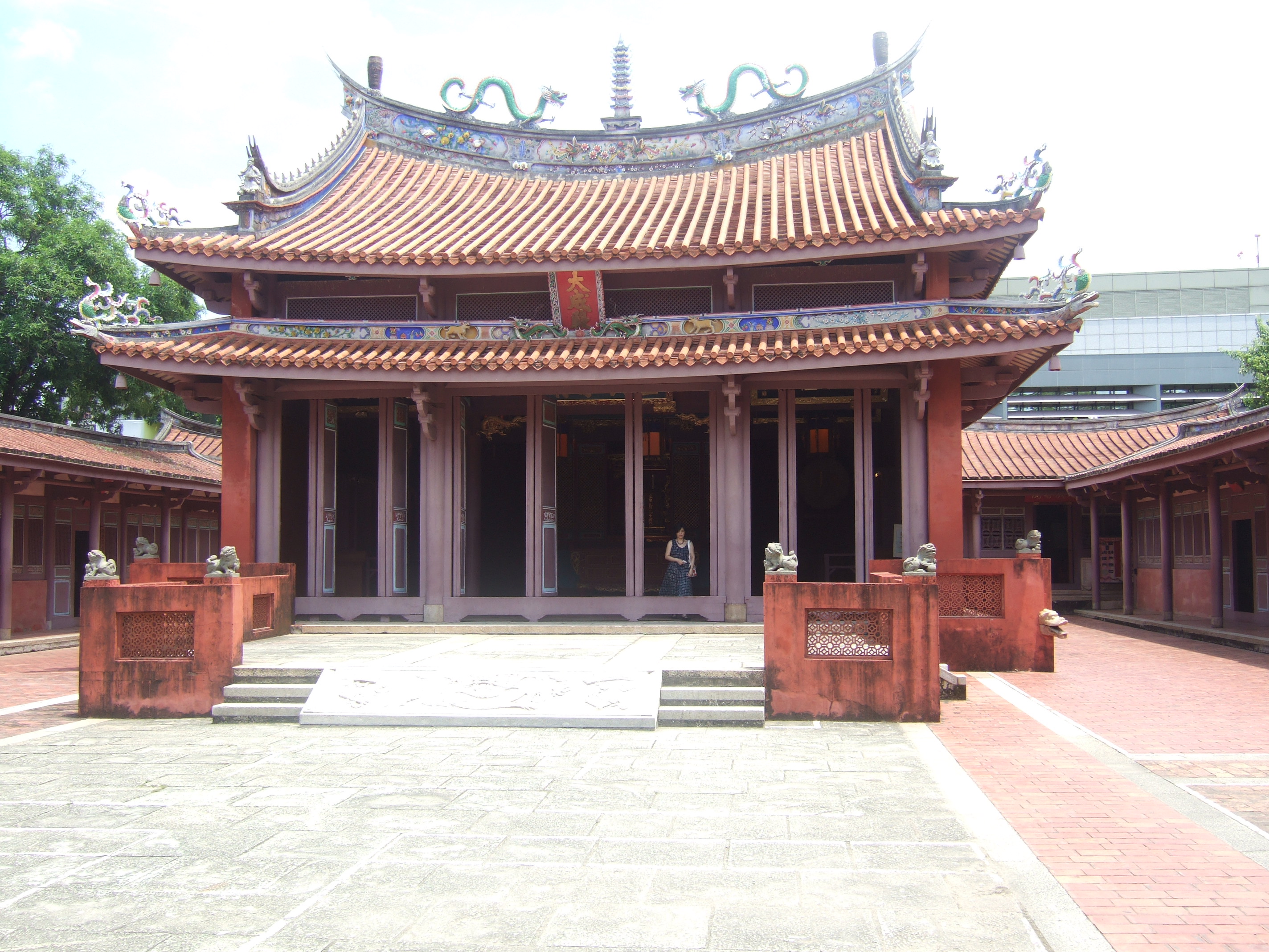
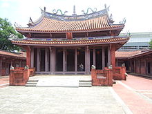 Tainan's Taiwan Confucian Temple
Taiwan Confucian Temple
The Taiwan Confucius Temple, also called the Scholarly Temple was built in 1665 when Cheng Ching,son of Koxinga so as to offer lectures and cultivate intellectuals. It was the first learning institute of children when Taiwan was ruled by Qing Dynasty .As the result, it is also called the First Academy of Taiwan. The Confucian temple serves as a popular tourist attraction and also preserves ancient Confucian ceremonies, which are conducted on a regular basis. The temple also includes storerooms for the ritual implements and musical instruments that are used in these ceremonies.
National Museum of Taiwan History
The Museum is located in Annan District,The construction of the Exhibition and Education Building began in 2005, and opened in 29 October 2011.The main objectives of this museum are included collection, categorization, preservation, research, exhibition, education and promotion of artifacts related to Taiwan’s history and culture. Visitors will also be able to learn and understand more about the history and culture of Taiwan through the exhibitions and educational activities of the Museum.
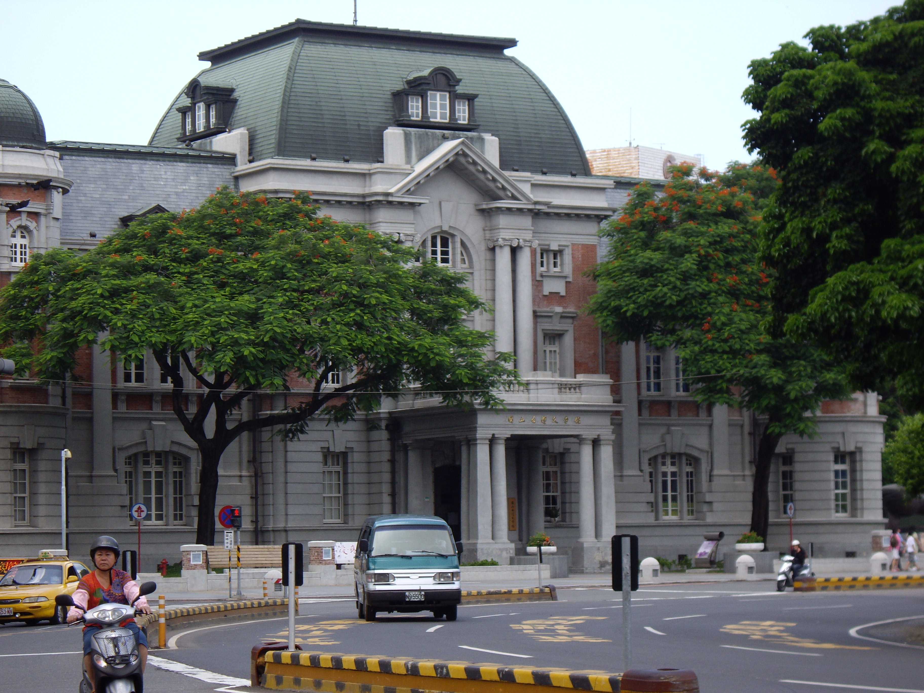
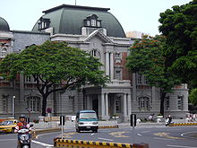 National Museum of Taiwan Literature
 Fort Provintia is located at West Central District.
National Museum of Taiwan Literature
The National Museum of Taiwan Literature researches, catalogs, preserves, and exhibits local literary artifacts. As part of its multilingual, multi-ethnic focus. The museum is housed in the former Tainan City Hall constructd in 1916,as Tainan was also famous for its historical significance.
Fort Provintia
Formerly Fort Provintia,was built in 1653 by the Dutch during their colonization of Taiwan. The fort was surrendered to Koxinga. Since 1945 the site has been known as 'Red-topped Tower' (Chihkan Tower). This name derives from the Taiwanese aboriginal word Chakam. In addition to the site's architectural and artistic significance, its library of dictionaries and business transactions documents the Siraya language spoken by the native inhabitants of the region during Dutch rule.
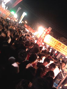 The Mass in the Tainan Flower Night Market.
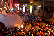 "Bee hives" were thrilling rapidly in all directions,the spectators might be wounded by rocketing fireworks while standing too close to the erupting hive.
Shopping and Recreation
As Tainan is the one of Metropolitan areas in Taiwan, it have lots of department stores,shopping mall and prestigious boutiques.Several world's luxury brands have branches or counters in Tainan. To enjoy the lifestyle of Taiwanese, Flower Night Market is good place to visit.It is known as the one of famous night markets and it is often considered to be the largest night markets of Taiwan, but unlike the others, the night market is open for business three days a week.(Thursday, Saturday and Sunday)
Bee hives
In Yanshui District,the most important prominent fireworks in Lantern Festival are the so-called "bee hives", essentially multiple launchers of bottle rockets. These rocket forts are actually thousands of bottle rockets arranged row atop row in an iron-and-wooden framework. The setup looks like a beehive full of unleashed gunpowder. When the contraption is ignited, rockets shoot out rapidly in all directions. Dazzling explosives whiz and whirl across the sky and often into the crowd itself, both thrilling and intimidating the spectators.
Climate
Tainan has a humid subtropical climate that borders on a tropical wet and dry climate. The city is characterized by year-round high relative humidity and temperatures (although temperatures do dip somewhat in the winter months), with a rainy season (April to September) and a dry season (October to March).
Climate data for Tainan (1971-2000) Month Jan Feb Mar Apr May Jun Jul Aug Sep Oct Nov Dec Year Average high °C (°F) 23.0
(73.4)23.8
(74.8)26.5
(79.7)29.4
(84.9)31.3
(88.3)32.2
(90.0)32.9
(91.2)32.3
(90.1)32.2
(90.0)30.7
(87.3)27.7
(81.9)24.3
(75.7)28.9 Daily mean °C (°F) 17.4
(63.3)18.2
(64.8)21.1
(70.0)24.5
(76.1)27.0
(80.6)28.4
(83.1)29.0
(84.2)28.5
(83.3)28.0
(82.4)25.9
(78.6)22.4
(72.3)18.8
(65.8)24.1 Average low °C (°F) 13.6
(56.5)14.5
(58.1)17.1
(62.8)20.8
(69.4)23.8
(74.8)25.5
(77.9)26.1
(79.0)25.7
(78.3)24.9
(76.8)22.4
(72.3)18.8
(65.8)15.1
(59.2)20.7 Rainfall mm (inches) 19.9
(0.783)28.8
(1.134)35.4
(1.394)84.9
(3.343)175.5
(6.909)370.6
(14.591)345.9
(13.618)417.5
(16.437)138.4
(5.449)29.6
(1.165)14.7
(0.579)11.3
(0.445)1,672.5
(65.846)% humidity 78.3 78.7 77.4 77.3 78.0 80.1 78.8 81.2 78.6 77.4 77.0 77.5 78.4 Avg. rainy days (≥ 0.1 mm) 4.5 5.4 5.1 7.2 9.9 13.1 13.4 16.7 9.3 3.6 2.5 9.3 100 Sunshine hours 182.4 158.7 187.3 188.7 192.0 190.6 221.5 195.7 200.5 197.7 174.9 173.7 2,263.7 Source: 中央氣象局 Cityscape
The Great Cross Street
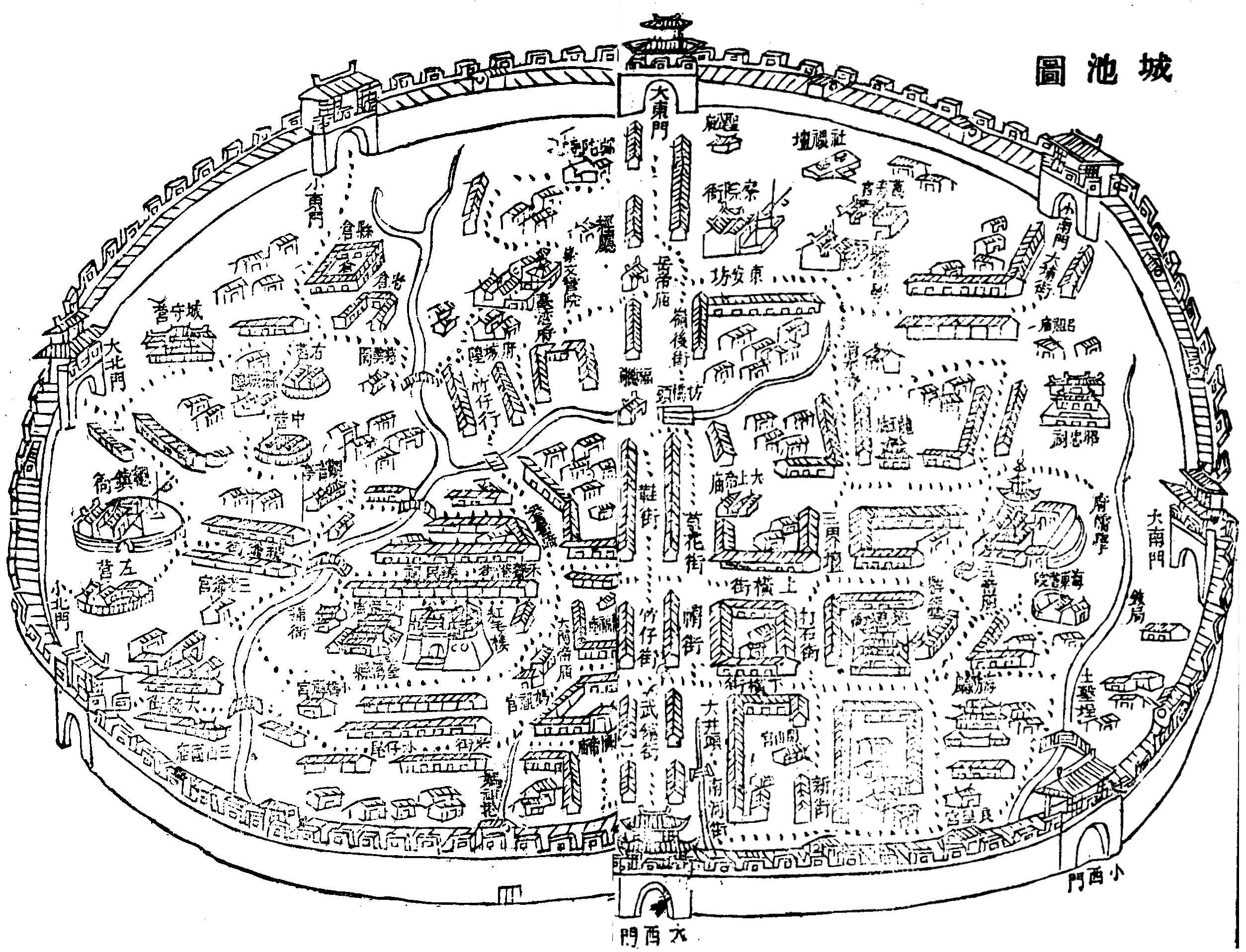
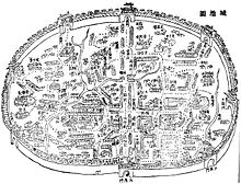 Map of Tainan during Qing Dynasty
Earliest form of the city was designed by Dutch colonist. Cornelis Jansz. Plockhoy, the designer of this new settlement laid a 25-30m wide main street (on today’s Minquan Rd Sec. 2) across the settlement and radial roads run deep into agricultural developments .[5] Han Chinese settlement “Heliaogang Jie” (today’s Zhongyi Rd) later crosses the main street of Provintia and formed the so called Shizi Dajie (十字大街) or The Great Cross Street.[4]
Japanese Redevelopment Program
 Tainan city center during WWII
The foundation of the cityscape of Tainan today was laid under the urban redevelopment programs carried out by Japanese colonial government. The city center adopts a Haussmann's approach, the plan connected major facilities via a system of wide streets and five square-roundabouts. Among the five squares, Tang Dezhang memorial park at the center is the most important crossing point, it connects the old city government with the train station, the airport, military bases and the dock at the end of the Anping cannel. A road corridor from old Anping also terminates here. Many historic monuments and major temples are located within the area bounded by the other four squares, including Chikanlou (former Castle Provintia) and the Confucius Temple.
Three Ring Belts
 Zhonghua East Rd crossing East and Yongkang District.
A three-belt system was adopted by the provincial city official [21]: the green boulevard ring, the blue belt Anping cannel and the Zhonghua road system. The green boulevard ring system connects the Shuipingwen Park to the west, Tainan Park to the north, NCKU to the east and the Athletic park complex to the south. The Anping cannel blue belt divides the Fifth Redevelopment Area or New Anping from the rest of the city to form an artificial island. Zhonghua Rd system is an arterial road system, the system now connects major new development areas surrounding old city center. In contrast to the low rise old city center, many high rise buildings are built along these three rings.
The River South Region
Beyond the city center, Tainan city can be divided into two regions: the River South Region and the River North Region bounded by the Zengwen River.
River South Region belongs to the Tainan metropolitan area. Satellite towns spread across the region in a radial pattern from the city center. Southern Taiwan Science Park Tainan campus is located at the north of the region. According to the Council for Economic Planning and Development, this region is designated to grow further into suburban sprawl.[22]
The River North Region
 A typical scene of River North Region
This region is one of the major agricultural centers in Taiwan. There are several regional centers; some of them are just as old as Tainan city. These centers are: Xinying, Yujing, Jiali and Madou.
Xinying was the seat of the former Tainan County Government and currently serve as the administration center for the region. Yujing is a regional center for the low hills districts east to the city; it is famous for its mango and was the scene of the Xilaian (Ta-pa-ni) Incident. Jiali is the regional center of the coastal Tainan. It was the base of the Soelangh sub-tribe. Near the bank of the Zengwen River, Madou is the regional center of the lower plain area bears the name of the river. The town was home to the Mattauw sub-tribe.
Government
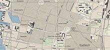
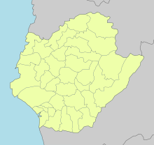 District map of Tainan
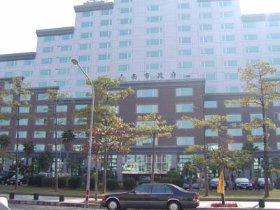
 Tainan City Hall
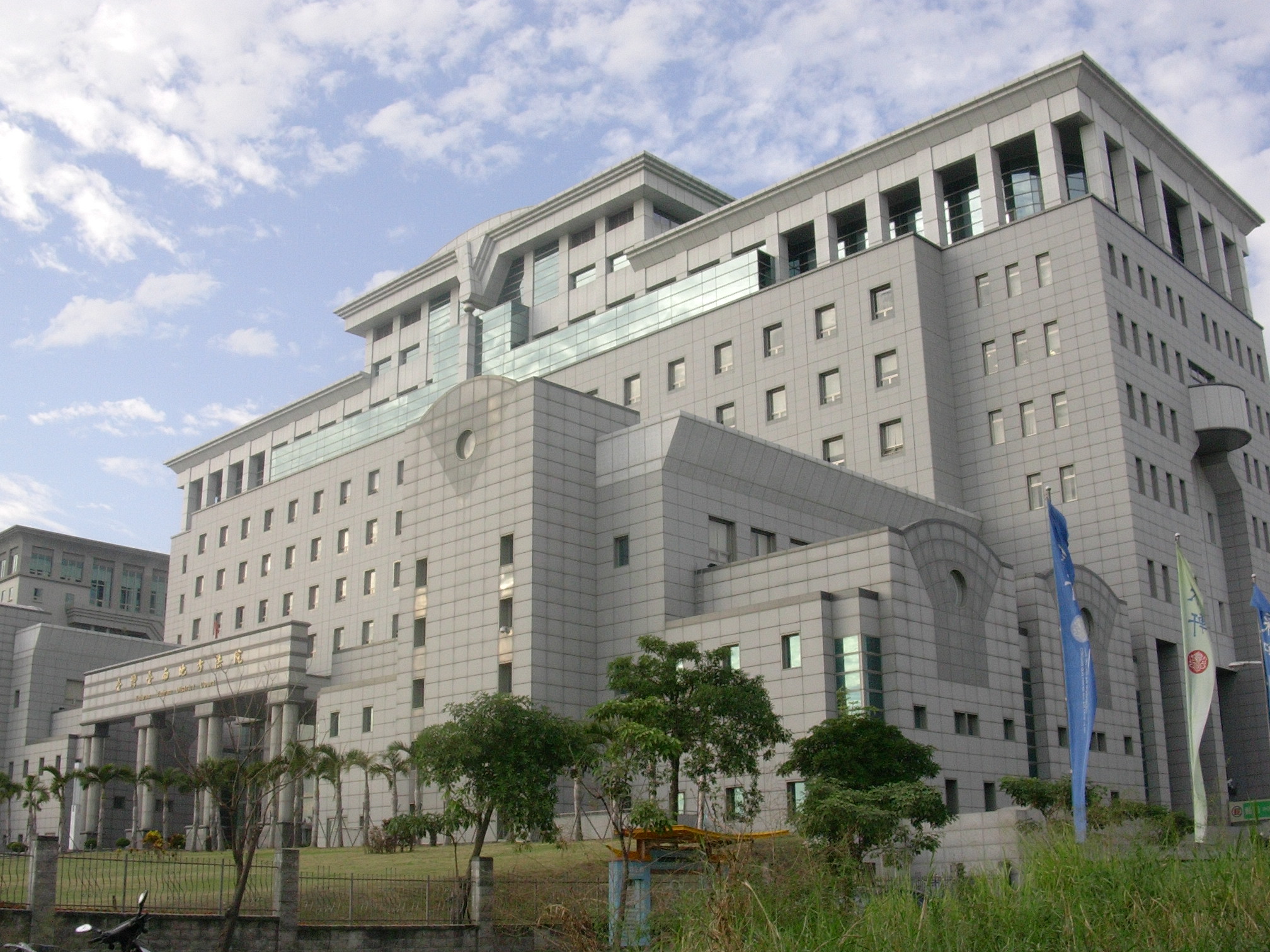
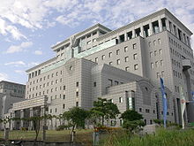 Tainan District Court
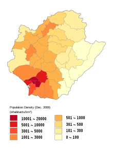 Population density map of Tainan.
Tainan City is a special municipality, which is the highest level local government under Local Government Law of Republic of China. Technically it is at the same level as Province, although Province is being streamlined. The city is led by the elected city mayor and supervised by the city council. Its subdivisions qu or districts do not have the autonomy power, instead they are administration units only. Further to the citywide election, there are urban villages (里 li) and neighborhood (鄰 lin) functioning as primary local autonomy entity.
Currently there are two administration centers, one in Anping District and another in Xinying District. They are former Provincial Tainan city government and Tainan county government respectively. Administration centers manages city wide affairs and developments such as education and city planning. Apart from administration centers, there are district offices functioning as local access point to the governmental services.
Administrative districts
Tainan has 37 districts (區 qu):
Name Hanzi Population (2010) Area (km2) Anping District 安平區 62,520 11.0663 Annan District 安南區 177,960 107.2016 East District 東區 194,608 14.4281 West Central District 中西區 79,286 6.2600 South District 南區 126,293 27.2681 North District 北區 131,939 10.4340 Xinying District 新營區 78,155 38.5386 Yongkang District 永康區 217,194 40.275 Baihe District 白河區 31,514 126.4046 Jiali District 佳里區 59,290 38.9422 Madou District 麻豆區 45,953 53.9744 Shanhua District 善化區 43,443 55.309 Xinhua District 新化區 44,116 62.0579 Xuejia District 學甲區 27,943 53.9919 Yanshui District 鹽水區 27,220 52.2455 Anding District 安定區 30,200 31.2700 Beimen District 北門區 12,504 44.1003 Danei District 大內區 10,903 70.3125 Dongshan District 東山區 23,182 124.91 Guanmiao District 關廟區 36,109 53.6413 Guantian District 官田區 22,284 70.7953 Guiren District 歸仁區 65,816 55.7913 Houbi District 後壁區 26,002 71.2189 Jiangjun District 將軍區 21,633 41.9796 Liujia District 六甲區 23,787 64.5471 Liuying District 柳營區 22,746 61.2929 Longqi District 龍崎區 4,395 64.0814 Nanhua District 南化區 8,919 171.5198 Nanxi District 楠西區 10,687 109.6316 Qigu District 七股區 24,857 110.1492 Rende District 仁德區 69,228 50.7664 Shanshang District 山上區 7,912 27.8780 Xiaying District 下營區 26,165 33.5291 Xigang District 西港區 25,242 33.7666 Xinshi District 新市區 34,794 47.8096 Yujing District 玉井區 15,442 76.366 Zuozhen District 左鎮區 5,531 74.9025 Annan District was originally the An-Shun township of Tainan County, but was merged into Tainan City in 1946. In 2004, Central District and West District were merged into the new West Central district.
Economy
Once relied on traditional manufacturing industry, the approval of Southern Taiwan Science Park in 1995 transformed the region into a major high-tech industrial hub. Optoelectronics, integrated circuits, green energy and biotechnology are the dominant industry in the park; prominent companies are Chimei-Innolux Corp., United Microelectronics Corp. and TSMC. With the establishment of Tainan Technology Park, Shugu (Tree Valley) LCD Park and Yonkang Technology Park, the city now becomes a major center for optoelectronics industry in Taiwan with a completed supply chain.[23] Tainan also plays an important role on Auto parts, food processing, textile, plastics and other traditional manufacturing. Most notable companies including the Uni-president Corp., Chimei Corp. and Tainan Spinning Ltd., of which they also headquarters in the city. Overall, industrial production accounts for 62.6% of the gross city product in 2010.[24]
Agriculture is important to the city especially the River North Region. While fishery and fish farming signifies the coastal districts, rice and fruit farms shaped the landscape of the inland agriculture region. The city is famous for its milk fish, oyster, rice, mango, sugar cane, pomelo (文旦), pineapple and lotus seed. Once a dominant industry, salt and sugar production are now declined to almost non-existence. Taiyen (Taiwan salt) co. and Taiwan Sugar Corp., both headquartered in Tainan, now transformed to businesses in biotechnology, quality agriculture, retail and tourism. Among those businesses, orchid farming is the most symbolic for its well known brand name in the floristry world. A nationally founded special plantation district is established with R&D resources in Houbi district.[25]
Tourism is an industry with increasing importance. As the first capital of Taiwan, the wealth resource of cultural heritages and its potential is currently under exploration. In 2010, there are 3.5 million tourist visitors to the city, mostly domestic.[24] There are several high class hotels in the city, including the Shangri-la Hotel near Tainan train station.
Retail and services is the largest employment sector in Tainan, margined at 52% in 2010.[24] Currently the city hosts two Shin Kong-Mitsukoshi department stores and two Far-eastern department stores in the West-Central district. Also there are several shopping precinct around the city, with the strongest presence in East, North and Yongkang districts.
Transportation
Rail
Tainan Station is a major stop on the Taiwan Railway Administration Western Line, with direct connections to Taipei, Kaohsiung, Taichung, Hsinchu, and Keelung. There are also local trains to reach closer destinations.
Taiwan High Speed Rail Tainan Station is located just outside the city center, in Gueiren district. The service is accessible to the city center via two connection bus lines, the TRA Shalun Line and the express way line 86. Using the High Speed Rail system passengers can reach Taipei in under ninety minutes.
Mass Rapid Transit
There have been muted plans for a Tainan MRT system. However, there has not been any progress on the issue for several years.[26] To improve connections with the HSR station and reduce the outlay for an MRT system, a new rail branch line was opened in 2011 (the Shalun Line), and some new train stations are also planned to be added in the future.
Road
National Highway Nos. 1 and 3 run close by and connect via local highways to the city itself. Tainan City has a total of 142.9 km of highways, including national, local, and rural highways.[27]
Air
Tainan Airport is located in the South District of the city. It is a domestic airport, currently operating flights to Kinmen and Makung.[28] Previously there were also services to Taipei's Songshan Airport, but these were dropped in light of falling revenues (generally agreed to be a result of the High Speed Rail commencing operation and rising fuel costs).[29]
Education
 Tainan Chengkung University
 Tainan canal
- National University of Tainan (國立臺南大學) NUTN used to be the Institute of Teachers' In-service Education in 1988, promoted and renamed National Tainan Teachers College in 1991. In 2004, it was established as National University of Tainan until now. The motto of NUTN includes benevolence, intelligence, sincerity and uprightness.
- National Cheng Kung University (國立成功大學), one of the leading universities in Taiwan, is located in the East District. It is famous for its engineering programs. In 1931, NCKU was established as Tainan Technical College, located on the present Cheng-Kung Campus, with a total area of 183,000 square metres. As the number of colleges expanded, it was upgraded to a provincial university in 1956, then national university in 1971.[30] Today, National Cheng Kung University serves nearly 21,000 students through 9 colleges, 39 departments, and 49 graduate institutes.[31]
- Tainan National University of the Arts (國立臺南藝術大學) TNNUA exists to prepare talented individuals for careers in visual and performing arts, sound and image design, building arts, conservation arts, and art history and critique. The university emphasizes learning through individual attention and independent work creation. It is a public institution first established in 1996.
- Tainan Theological College and Seminary (臺南神學院) was established in 1876 by Thomas Barclay.[32]
- Chang Jung Christian University is a private university affiliated with the Presbyterian Church in Taiwan. CJU offers masters and doctoral degree programs and aims to promote fraternity, justice, and service for Taiwan. It is located south of the city, in Gueiren.
- Southern Taiwan University of Technology (南台科技大學), founded in 1969, is located near the northeastern border of Tainan City, within a 30-minute driving distance from the Tainan Airport.
- The Tainan University of Technology (臺南應用科技大學) is a private university founded in 1964. The university offers graduate degrees in music, visual art, and applied sciences.
Senior high schools
Public
- National Tainan First Senior High School
- National Tainan Second Senior High School
- National Tainan Girls' Senior High School
- National Hsin Hua Senior High School
- National Chia-Chi Girls' Senior High School
- National Tainan Commercial Vocational School
- National Tainan Industrial Vocational School
- The Affiliated Senior Industrial Vocational Continuing Education High School of National Cheng Kung University
- National Tainan Marine & Fishery Vocational School
- Municipal Tainan Nan-Ning Senior High School
- Municipal Tainan Tu-Cheng High School
Private
- Feng-Ho Senior High School
- Chang Jung High School
- Sheng Kung Girls' High School
- Nan Ying Vocational High School of Business & Technology
- Salesian Technical School
- Chang Jung Girls' Senior High School
- Deguang Catholic High School [2]
- Kuang Hua Girls' Senior High School
- Tainan Liuhsin Senior High School
- Kuen-Shan Senior High School
- Ying-Hai High School
Politics
The city has generally been seen as a powerbase for the Democratic Progressive Party, especially in nationwide elections. However, the Kuomintang (KMT) have always had more seats in city council.[citation needed] In the most recent presidential elections (2008), a narrow majority of the city's residents voted for the eventual winner, Ma Ying-jeou of the Kuomintang.
City mayor
2001 Mayoral elections
Hsu Tain-Tsair of the Democratic Progressive Party was elected with 43.23% of the vote. His closest rival was the Kuomintang legislator Chen Rong-sheng, who garnered 37.40%.
2005 Mayoral elections
In 2005 Mayor Hsu was re-elected, polling 45.65% to Chen Rong-sheng's 41.40%.
Presidential elections
A majority of city residents have voted for the winning candidates in every presidential election since the position was first chosen by popular vote in 1996.
1996 Presidential election
Main article: Republic of China presidential election, 1996In common with every other city and county in the Republic of China, with the exception of Nantou, a majority of Tainan residents voted for eventual winner Lee Teng-hui and vice-president Lien Chan.
2000 Presidential election
Main article: Republic of China presidential election, 2000Party Candidate Votes Percentage President Vice president Independent James Soong Chang Chau-hsiung 114,299 27.53% Kuomintang Lien Chan Vincent Siew 107,679 25.93% New Party Li Ao Elmer Fung 580 0.14% Independent Hsu Hsin-liang Josephine Chu 1,408 0.34% Democratic Progressive Party Chen Shui-bian Annette Lu 191,261 45.06% 2004 Presidential election
Main article: Republic of China presidential election, 2004Party Candidate Votes Percentage President Vice president Democratic Progressive Party Chen Shui-bian Annette Lu 251,397 57.77% Kuomintang Lien Chan James Soong 183,786 42.23% 2008 Presidential election
Main article: Republic of China presidential election, 2008Party Candidate Votes Percentage President Vice president Democratic Progressive Party Frank Hsieh Su Tseng-chang 216,815 49.29% Kuomintang Ma Ying-jeou Vincent Siew 223,034 50.71% Notable natives
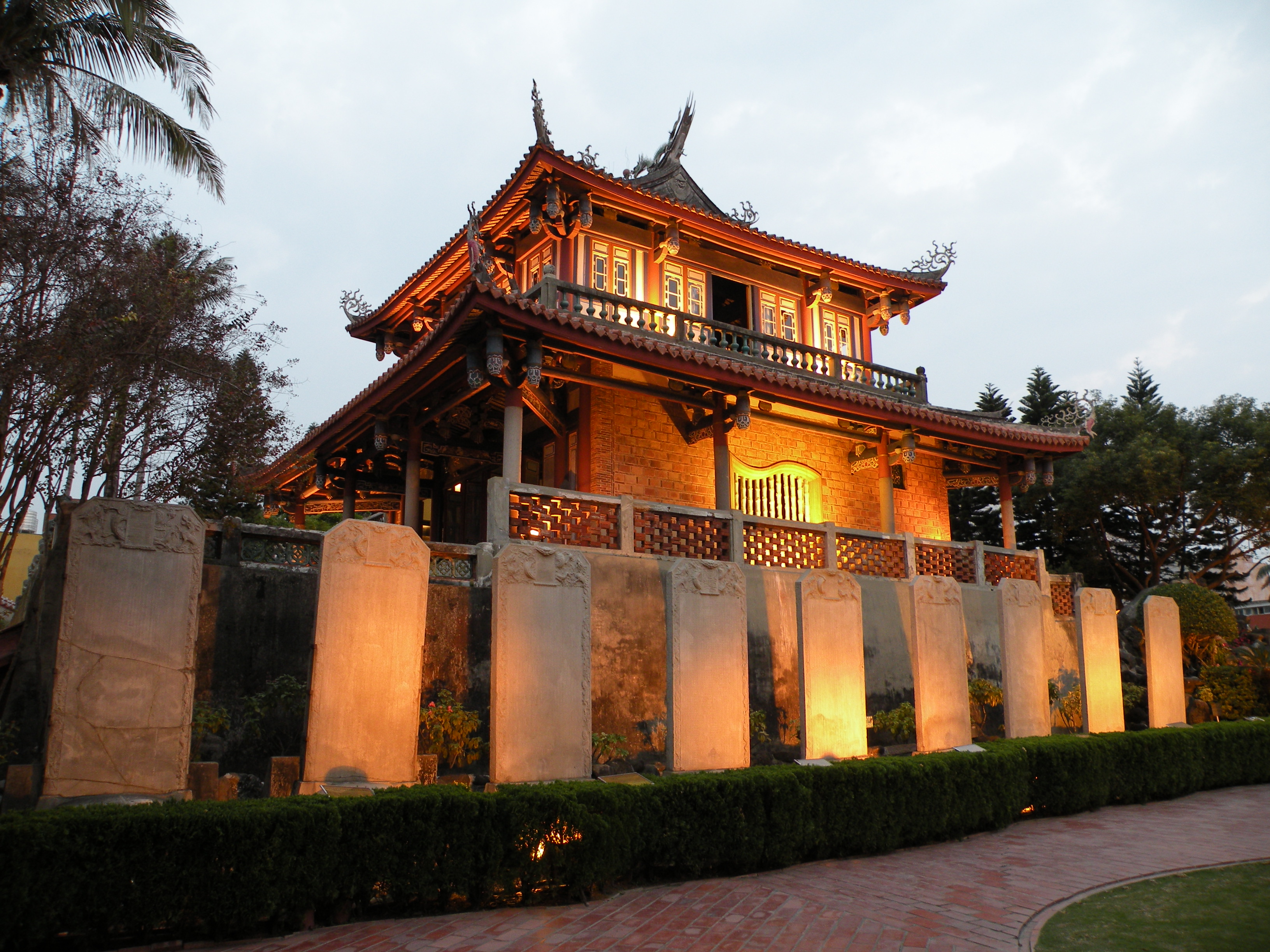
 Koxinga Temple
The following is a non-exhaustive list of famous people born in Tainan, educated there, prominent in the life of the city, or otherwise associated with the city.
- Momofuku Ando (安藤百福) (1910–2007), founder of Nissin Foods and inventor of instant noodles[33]
- Thomas Barclay (1849–1935), Christian missionary, lived in the city from 1875 to 1935
- William Campbell (1841–1921), Christian missionary, lived in the city from 1871 to 1917
- George Chang (張燦鍙) (born 1936), politician, former mayor of Tainan (1997–2001)
- Chin-Feng Chen (陳金鋒) (born 1977), first Taiwanese-born player to play Major League Baseball
- Chen Wei-Ling (陳葦綾), 2008 Olympic bronze medal-winning weightlifter
- Mao Gao-wen (毛高文) (born 1936), chemist, former president of National Tsinghua University (1981–1987) and Minister of Education (1987–1993)
- Hsu Shih-Hsien (許世賢) (1908–1983), first female Taiwanese PhD
- Chin-Lung Hu (胡金龍), MLB infielder for the New York Mets
- Jutoupi (born 1966), recording artist
- Kao Ching-yuen (高清願) (born 1929), businessman, founder and chairman of Uni-president
- Hong-Chih Kuo (郭泓志), MLB pitcher for the Los Angeles Dodgers
- Tai-Yuan Kuo (郭泰源), retired pitcher for the Seibu Lions, foreign player with the most wins in Nippon Professional Baseball history
- Ang Lee (李安) (born 1954), Academy Award–winning film director
- Chen-Yuan Lee (李鎮源) (1915–2001), pharmacologist and political activist, famous for research on snake venom
- Lien Heng (連橫) (1878–1936), historian, writer of The General History of Taiwan
- En-Yu Lin (林恩宇), baseball pitcher currently playing for Tohoku Rakuten Golden Eagles
- Lin Hsin-i (林信義) (born 1946), businessman and politician, Minister of Economic Affairs (2000–2002), Vice Premier (2002–2004)
- Lin Mosei (林茂生) (1887–1947?), first Taiwanese philosophy PhD, academic, educator and calligrapher thought to have been killed following the 228 Incident.
- Ong Iok-tek (王育德) (1924–1985), scholar and authority of the Taiwanese Hokkien dialects
- Judy Ongg (翁倩玉) (born 1950), actress, singer, author and artist
- Shi Wen-long (許文龍) (born 1928), businessman, founder of Chi Mei Corporation
- Su Nan-cheng (蘇南成) (born 1936), politician, former mayor of Tainan (1977–1985) and advisor to Chen Shui-bian
- Robert Swinhoe (1836–1877), first British consul sent to Tainan 1861; ornithologist, highly regarded researcher writer on the natural history and zoology of Taiwan and China.
- Chien-Ming Wang (王建民), MLB pitcher for the Washington Nationals
- Wu Hui Ju (吳蕙如), archer and also a member of the team that won the bronze medal for Chinese Taipei in 2004 Summer Olympics in the women's team archery competition
- Jacky Wu (吳宗憲) (born 1962), entertainer and talk-show host
Sports
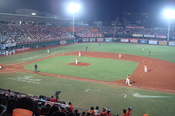
 Uni-President Lions have been playing their home games at Tainan Municipal Baseball Stadium since 1999.
Tainan is home to the Uni-President Lions, who play their home games at the Tainan Municipal Baseball Stadium.[34] It is also the birthplace of Chien-Ming Wang, Hong-Chih Kuo, Tai-Yuan Kuo, En-Yu Lin, and many other prominent Taiwanese baseball players.
International relations
Twin towns — Sister cities
The following municipals are sister cities to Tainan City:[35]
 Monterey, California, United States (1965)
 Gwangju, South Korea (1968)
- San Jose, California United States (1977)
- Kansas City, Missouri United States (1978)
 Pasay City, Philippines (1980)
- Cavite City, Philippines (1980)
- Tagaytay City, Philippines (1980)
- Trece Martires City, Philippines (1980)
- Columbus, Ohio United States (1980)
- Kinmen, Taiwan (1981)
 Santa Cruz de la Sierra, Bolivia (1981)
 Port Elizabeth, Eastern Cape, South Africa (1982)
- Orlando, Florida United States (1982)
 Gold Coast, Queensland, Australia (1982)
- Fairbanks, Alaska United States (1983)
- Oklahoma City, United States (1986)
- Huntsville, Alabama United States(1986)
- Carbondale, Illinois United States(1991)
 Leuven, Belgium (1993)
 Ra'anana, Israel (1999)[36]
 Zacapa, Guatemala (2003)
 Elbląg, Poland (2004)
 Ribe, Denmark (2005)
 Keçiören, Turkey (2005)
- Cagayan de Oro, Philippines (2005)
 Kanpur, India (2005)[citation needed]
Friendship cities
Tainan City also celebrates friendly relationships with four other municipalities, although they are not considered official sister cities.
- Penghu County, Taiwan (2004)
 Sendai, Japan (2006)
- Nikkō, Tochigi, Japan (2009)
 Almere, Netherlands (2009)
See also
- Administrative divisions of the Republic of China
- List of cities in the Republic of China (Taiwan)
- List of mayors of Tainan
- Dead whale exploded
References
- ^ Tainan University of Technology official site
- ^ http://taiwanjournal.nat.gov.tw/ct.asp?xitem=53774&ctnode=413&mp=9
- ^ "Tainan Confucian Temple". Council for Cultural Affairs. Archived from the original on 2008-05-01. http://web.archive.org/web/20080501181411/http://confucius.cca.gov.tw/english/navigator/map02.htm. Retrieved 2008-08-19.
- ^ a b c d e f g h i j 蔡玉仙等編. 府城文史. 臺南市政府. ISBN 978 986 00 9434 3.
- ^ a b c d e f g h 石守謙主編. Ilha Formosa: the Emergence of Taiwan on the World Scene in the 17th Century. National Palace Museum. ISBN 957 562 441 6.
- ^ 加藤光貴著 黃秉珩譯. 昨日府城 明星台南: 發現日治下的老臺南. 臺南市文化資產保護協會. ISBN 978 957 28079 9 6.
- ^ a b c d e f Murray A. Robinstein. Taiwan: a new history, expanded edition.. M.E. Sharpe, Inc.. ISBN 0 7656 1495 2.
- ^ "Anping Harbor National Historical Park". Tainan City Government. http://anping.tncg.gov.tw/tour/tua_01.jsp?ID=1&Lang=E. Retrieved 2010-03-31.
- ^ a b 加藤光貴著 黃秉珩譯. 昨日府城 明星臺南: 發現日治下的老台南. 臺南市文化資產保護協會. ISBN 978 957 28079 9 6.
- ^ 蔡玉仙等編. 府城文史. 台南市政府. ISBN 978 986 00 9434 3.
- ^ "Anping Harbor National Historical Park". Tainan City Government. http://anping.tncg.gov.tw/tour/tua_01.jsp?ID=2&Lang=E. Retrieved 2010-03-25.
- ^ William Campbell (1913). Sketches of Formosa. London: Marshall Brothers. pp. 16–17
- ^ "湯德章". http://www.228.org.tw/history228_elite_detail.php?id=27. Retrieved 2010-04-17.
- ^ "張銘清訪台遇襲事件". http://zh.wikipedia.org/zh-tw/%E5%BC%B5%E9%8A%98%E6%B8%85%E8%A8%AA%E5%8F%B0%E9%81%87%E8%A5%B2%E4%BA%8B%E4%BB%B6. Retrieved 2010-04-18.
- ^ a b c d e "台南市文資導讀". Tainan City Government. http://www.tnc.gov.tw/book/fron/index.html. Retrieved 2011-05-12.
- ^ "Sword Lion". Anping Harbor National Historical Park. http://anping.tncg.gov.tw/tour/tud_01.jsp?ID=25&Lang=E. Retrieved 2011-05-12.
- ^ "Tainan Traditional Orchestra". Tainan Traditional Orchestra. http://tcto.ezgo.to/cms/CMSMain.php?CMMNBR=1. Retrieved 6 November 2011.
- ^ "Chimei Orchestra (Chinese)". Chimei Museum. http://www.chimeimuseum.com/_chinese/a01_foundation/foundation.aspx?MID=6. Retrieved 6 November 2011.
- ^ "Chang Jung University Orchestra". Chang Jung University. http://www.wretch.cc/blog/cjcuwind. Retrieved 6 November 2011.
- ^ "Ten Drum Official Website (Chinese)". Ten Drum Art Percussion Group. Ten Drum Art Percussion Group. http://www.ten-hsieh.com.tw/newchinese/news.html. Retrieved 6 November 2011.
- ^ "Green and blue belts reference". http://www.gisgroup.com/events/download/5_3/3-4.pdf. Retrieved 2011-11-02.
- ^ "CEPD". http://www.cepd.gov.tw/m1.aspx?sNo=0011780&ex=1&ic=0. Retrieved 2011-11-02.
- ^ "LCD manufacturing in Tainan". Tainan City Government. http://web1.tainan.gov.tw/InvestInTainan_eng/CP/11710/present.aspx. Retrieved 20 November 2011.
- ^ a b c "Report on the economic structure to CPED". Tainan City Government. http://www.cepd.gov.tw/dn.aspx?uid=10314. Retrieved 20 November 2011.
- ^ "Taiwan Orchid Plantation". Taiwan Orchid Plantation. http://top.tainan.gov.tw/a.php. Retrieved 20 November 2011.
- ^ "MRT Plans" (in Chinese). Bureau of High Speed Rail. http://www.hsr.gov.tw/homepage.nsf/038ecb2053a216c44825688c000d7a45/c03b4eef9cb62868482570ba0035c379?OpenDocument. Retrieved 2008-08-20.
- ^ "2005 statistics". Tainan City Government. http://www.tncg.gov.tw/warehouse/0708/94totalstat.pdf. Retrieved 2008-08-19.
- ^ "Airlines". Tainan National Airport. http://www.tna.gov.tw/English/E_airlines.asp. Retrieved 2008-08-20.
- ^ "FAT to sell investments to cover costs". Taipei Times. 2008-03-01. http://www.taipeitimes.com/News/biz/archives/2008/03/01/2003403575. Retrieved 2008-08-20.
- ^ "Brief History". National Cheng Kung University. http://www.ncku.edu.tw/ver2006/en/ncku/history.htm. Retrieved 2008-08-20.
- ^ "Organization". National Cheng Kung University. http://www.ncku.edu.tw/ver2006/en/ncku/organization.htm. Retrieved 2008-08-20.
- ^ "Introduction". Tainan Theological College and Seminary. http://www.ttcs.org.tw/~en/Introduction.htm. Retrieved 2008-08-20.
- ^ "Inventor of the Week: Momofuku Ando". MIT. http://web.mit.edu/invent/iow/ando.html. Retrieved 2008-08-19.
- ^ "Parking near the Municipal Stadium" (in Chinese). Uni-President Lions. http://www.uni-lions.com.tw/traffic-park.asp. Retrieved 2008-08-20.
- ^ "Sister Cities". Tainan City Government. http://www.tainan.gov.tw/tainan/Intro.asp?nsub=L1A400. Retrieved 2008-08-19.
- ^ "Ra'anana: Twin towns & Sister cities - Friends around the World". raanana.muni.il. http://www.raanana.muni.il/English/Topics/My+City/Sister+Cities/. Retrieved 24 March 2010.
External links
- Tainan travel guide from Wikitravel
- Tainan City Government Official Website (English)
- Tainan City Travel Information
- Tainan City Dynamic Bus Information System
- The Confucian temple in Tainan
District of Tainan City seat: AnpingDistricts  Note: Although Hanyu Pinyin is the national standard; East, South, West Central, and North District uses English instead. Administrative divisions of the Republic of China(Otherwise known as Taiwan).
Special municipalities 
Taiwan Province CitiesFujian Province See also: Free Area of the Republic of China.Metropolitan areas in Taiwan Taipei–Keelung metro area • Kaohsiung metro area • Taichung–Changhua metro area • Taoyuan–Zhongli metro area • Tainan metro area • Hsinchu metro area • Chiayi metro areaCoordinates: 22°59′N 120°11′E / 22.983°N 120.183°E
Categories:- Tainan
- Capitals of former nations


Wikimedia Foundation. 2010.