Tamsui River

Tamsui River
Tamsui River

Tamsui in downtown Taipei
Origin Pintien Mountain
Mouth Taiwan Strait
Basin countries  Republic of China (Taiwan)
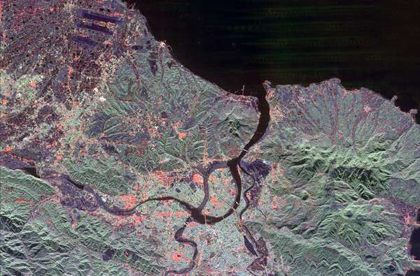
Length 158.7 kilometres (98.6 mi)
Source elevation 3,529 metres (11,578 ft)
Mouth elevation 0 metres (0 ft)
Avg. discharge 210 cubic metres per second (7,400 cu ft/s)
Basin area 2,726 square kilometres (1,053 sq mi)
Satellite image of the Tamsui River mouth

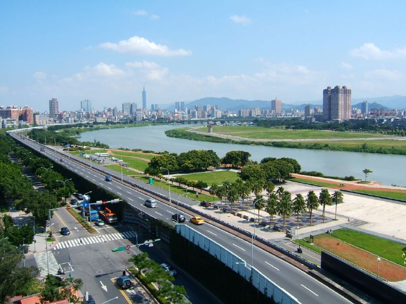
The Tamsui River (formerly Danshui River, Chinese: 淡水河; pinyin: Dànshǔi Hé; Wade–Giles: Tan-shui Ho; Pe̍h-ōe-jī: Tām-súi Hô; literally ""Freshwater River"") is a river in northern Taiwan. Its source is at Pintian Mountain in Hsinchu County. The river flows through New Taipei City, Taoyuan County, Taipei City, and Hsinchu County and has a length of 159 km (99 mi) and a drainage area of 2,726 km2 (1,053 sq mi).[1] It empties into the Taiwan Strait.

Map of the Tamsui River watershed

Pollution

The Tamsui River is heavily polluted by both raw sewage and industrial pollution from illegal industry. The natural river restoration is in the agenda of the Taipei City Government, Taiwan Central Government and several citizen organizations. [2]

See also

References

Coordinates: 25°10′30″N 121°24′30″E / 25.175°N 121.408333333°E / 25.175; 121.408333333


Wikimedia Foundation. 2010.

Игры ⚽ Поможем написать курсовую

Look at other dictionaries:

  • Tamsui District — 淡水區   District   Lovers Bridge …   Wikipedia

  • Tamsui, Taipei — Tamsui Township (zh tht|t=淡水鎮|hp=Dànshuǐ Zhèn|tp=Danshuei Jhèn; Taiwanese: Tām súi tìn/Tām chúi tìn) is a sea side town in Taipei County, Taiwan. It is named after the Tamsui River whose name means Freshwater . The town is also popular as a site… …   Wikipedia

  • Tamsui Station — 淡水站 Tamsui Station platform Location Municipality New Taipei District(s) …   Wikipedia

  • Keelung River — Infobox River river name = Keelung River caption = Keelung River upstream origin = Huo Shou Liao Mountain (火燒寮山) mouth = Danshui River basin countries = ROC length = 96 km elevation = 560 m mouth elevation = ?? m discharge = ?? m³/s watershed =… …   Wikipedia

  • Danshui River — Infobox River river name = Danshui River caption = Satellite image of the Danshui River mouth origin = Pintien Mountain mouth = Taiwan Strait basin countries = ROC length = 158.7 km elevation = 3529 m mouth elevation = ?? m discharge = 210 m³/s… …   Wikipedia

  • Dahan River — Origin Pintian Mountain Mouth Tamsui River Basin countries …   Wikipedia

  • Taipei — Not to be confused with New Taipei or Chinese Taipei. For other uses, see Taipei (disambiguation). Taipei 臺北   Special municipality   Taipei City · 臺北市 …   Wikipedia

  • Tamshui Fisherman's Wharf — (zh t|淡水漁人碼頭) is a scenic spot at the western tip of Tamsui, Taipei County, Taiwan. Its predecessor was the Tamsui Second Fishing Port on the right bank of the Tamsui river estuary, an important fishing harbor in the early history of north Taiwan …   Wikipedia

  • Taipei Metro — (Taipei Rapid Transit System) Info Locale Taipei and New Taipei …   Wikipedia

  • Hobe Fort — or Huwei Fort (滬尾砲台; POJ: Hō͘ bé/Hō͘ bóe Phàu tâi) is located a short distance away from Fort Santo Domingo, near the town of Tamsui, Taipei on the island of Taiwan.In the 1880s Imperial China (Qing Dynasty) and France fought a war over today s… …   Wikipedia

Share the article and excerpts

Direct link
Do a right-click on the link above
and select “Copy Link”