- Debarca Municipality
-
Debarca municipality
Општина Дебарца— Rural municipality — 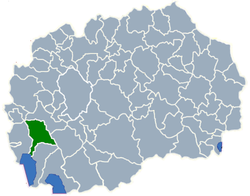
region Southwestern Statistical Region Municipal seat Belčišta Government - mayor Ljupčo Kojčinovski Area - Total 425.39 km2 (164.2 sq mi) Population - Total 5,507 - Density 12.95/km2 (33.5/sq mi) Time zone CET (UTC+1) Area code(s) 046 Website http://www.debarca.gov.mk Debarca (Macedonian: Дебарца) is a municipality in southwestern Republic of Macedonia. The village of Belčišta is the municipal seat. Debarca Municipality is part of the Southwestern Statistical Region.
Contents
Geography
The municipality borders Drugovo Municipality to the northeast, Demir Hisar Municipality to the east, Ohrid Municipality to the south, and Struga Municipality to the west.
The municipality encompasses the Debarca Valley, part of the Sateska River watershed that flows into Lake Ohrid and belongs to the Lake Ohrid Drainage Basin.
The majority of the villages are nestled between the Karaorman Mountain in the west and Ilinska Mountain in the east.
Demographics
According to the last national census from 2002 this municipality has 5,507 inhabitants.[1]
Ethnic groups in the municipality include:
- Macedonians = 5,324 (96.7%)
- Albanians = 153 (2.8%)
- Others = 30 (0.5%)
Inhabited Places
The municipality consists of 30 villages.
Inhabited places in Debarca Municipality Village(s): Arbinovo | Belčišta | Botun | Brežani | Velmej | Volino | Vrbjani | Godivje | Gorenci | Gorno Sredorečie | Grko Pole | Dolno Sredorečie | Zlesti | Izdeglavje | Klimeštani | Laktinje | Lešani | Mešeišta | Mramorec | Novo Selo | Ozdoleni | Orovnik | Pesočani | Slatino | Slatinski Čiflik | Slivovo | Sošani | Trebeništa | Turje | Crvena Voda References
- ^ 2002 census results in English and Macedonian (PDF)
Municipalities Aračinovo • Berovo • Bitola • Bogdanci • Bogovinje • Bosilovo • Brvenica • Čaška • Češinovo-Obleševo • Centar Župa • Čučer-Sandevo • Debar • Debarca • Delčevo • Demir Hisar • Demir Kapija • Dojran • Dolneni • Drugovo • Gevgelija • Gostivar • Gradsko • Ilinden • Jegunovce • Karbinci • Kavadarci • Kičevo • Kočani • Konče • Kratovo • Kriva Palanka • Krivogaštani • Kruševo • Kumanovo • Lipkovo • Lozovo • Makedonska Kamenica • Makedonski Brod • Mavrovo and Rostuša • Mogila • Negotino • Novaci • Novo Selo • Ohrid • Oslomej • Pehčevo • Petrovec • Plasnica • Prilep • Probištip • Radoviš • Rankovce • Resen • Rosoman • Sopište • Staro Nagoričane • Štip • Struga • Strumica • Studeničani • Sveti Nikole • Tearce • Tetovo • Valandovo • Vasilevo • Veles • Vevčani • Vinica • Vraneštica • Vrapčište • Zajas • Zelenikovo • Želino • Zrnovci

Greater Skopje Aerodrom • Butel • Čair • Centar • Gazi Baba • Gjorče Petrov • Kisela Voda • Karpoš • Saraj • Šuto OrizariCategories:

Wikimedia Foundation. 2010.