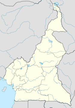
- Debundscha
-
Debundscha — Village — Coordinates: 4°6′N 8°59′E / 4.1°N 8.983°ECoordinates: 4°6′N 8°59′E / 4.1°N 8.983°E Country  Cameroon
Region Southwest Region Division Fako Elevation 36 m (118 ft) Time zone WAT (UTC+1) Debundscha is a village in the Southwestern Region, of the republic of Cameroon. It is found at the foot of the Mount Cameroon,at its south western slope, directly facing the south Atlantic ocean on the Cameroon coast.
Debundscha has been popular, for been the wettest town on the African continent due to the super heavy annual rainfalls it receives,[1] but rainfall records have placed it behind the town of Ureka, on the island of Bioko in Equatorial Guinea, Ureka receives about 10,450 millimeters (418 ins) of rainfall annually, making it the wettest place in Africa,[2] this is followed closely by Debundscha, coming second with an annual rainfall of about 10,299 millimeters (411.9 ins)[2] in overall rainfall average in Africa.
The village of Debundscha is included among five rainiest places in the world which includes Lloró, Mawsynram, Mount Waialeale and Cherrapunji, with each of them receiving over 10,000 millimeters (400 ins) of rain annually.[3]
Contents
History
The Germans installed a lighthouse in Debundscha in 1904.[4] [5]
Climate
Debundscha's proximity to the Equator, which is hot and humid throughout the year, gives Debundscha a continuous rainy season and a short dry season in a year. Debundscha is located on the coast and Mount Cameroon behind the town intercepts warm moist ocean winds to supply Debundscha with abundant rainfall throughout the year.
Rainfall
Debundscha's coastal location with the giant Mount Cameroon behind it, a giant mountain massive rising from the coast of the South Atlantic ocean to a height of about 4,095 metres (13,435 ft) above sealevel.[6] results in an almost all year round rainy season, with little dry season breaks.
Mount Cameroon has a profound influence on the climate of Debundscha. Orographic cloud building activities on the mountain supply most of Debundscha's precipitation. As warm moist air masses from the South Atlantic ocean meet the mountain at the coast[7] and are forced to rise adiabatically, rapid cooling of the warm Atlantic airmass causes condensation of the water vapour in the airmass, increasing as the airmass rises up Mount Cameroon, and leads to heavy cloud building and heavy rainfall on and around the mountain.
The rain falls on the ocean-facing south-western slope of Mount Cameroon and on Debundscha, at the foot of this slope.[8][9]
References
- ^ ""L'Africaine Tours et Conseils – Cameroon DMC – Travel Incentives – PCO"."]. AfricainToursConseils.com. Archived from the original on 2011-02-02. http://web.archive.org/web/20110202135506/http://africainetoursconseils.com/.[dead link][not in citation given]
- ^ a b Frankham, Richard; Ballou, Jonathan D.; Briscoe, David Anthony (2004). "A primer of conservation genetics". Cambridge University Press. p. 180. ISBN 978-0521538275. http://books.google.com.ng/books?id=mdEHpSmFVAIC&pg=PA180#v=onepage&f=false. Retrieved 2011-11-12.
- ^ "The World's Wettest Places". Thetravelalmanac.com. http://www.thetravelalmanac.com/lists/temperature-wettest.htm. Retrieved 2011-11-12.
- ^ "Lighthouses of Cameroon". Unc.edu. http://www.unc.edu/~rowlett/lighthouse/cmr.htm. Retrieved 2011-11-12.
- ^ "Picasa Web Albums - R. Burnstone - Cameroon". Picasaweb.google.com. 2008-02-14. http://picasaweb.google.com/R.Burnstone/Cameroon#5167670946550078754. Retrieved 2011-11-12.
- ^ Česky. "Mount Cameroon Volcano, Africa (world) - facts & information / VolcanoDiscovery". Volcanodiscovery.com. http://www.volcanodiscovery.com/en/volcanoes/africa/mount_cameroon/. Retrieved 2011-11-12.
- ^ Bowke, Ann. "Mount Cameroon". Mad about mountains. Archived from the original on 2008-04-20. http://web.archive.org/web/20080420070331/http://web.ukonline.co.uk/mountains/cam.htm.
- ^ Harrison, Ian (June 20, 2008). "The Rainiest Places on Earth". blog.ratestogo.com. http://blog.ratestogo.com/the-rainiest-places-on-earth/.
- ^ "Extreme precipitation events in Cameroon". ictp.it. The Abdus Salam International Centre for Theoretical Physics. http://clima-dods.ictp.it/d10/smr2019/Tuesday/session3/EXTREME%20PRECIPITATION%20EVENTS%20IN%20CAMEROON.ppt.
Categories:- Populated places in Cameroon
- Southwest Region (Cameroon)
- Cameroon geography stubs
Wikimedia Foundation. 2010.

