- Deir El Aachayer
-
Deir El Aachayer
ديرالعشاير.— Village — Country  Lebanon
Governorate Beqaa Governorate District Rashaya District Area – Total 9.9 sq mi (25.6 km2) Population (2010) – Total 500 Deir El Aachayer Temple 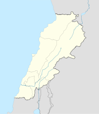
 Shown within Lebanon
Location near Rashaya Region Bekaa Valley Coordinates 33°35′21″N 36°01′09″E / 33.589181°N 36.019169°E Length 30 metres (98 ft) History Builder Romans Material Stone Cultures Greek, Roman Site notes Condition Ruins Public access Yes Deir El Aachayer (Arabic: ديرالعشاير.) is a village north of Rashaya, in the Rashaya District and south of the Beqaa Governorate in Lebanon.[1]
The municipality is located on the border frontier of the Kaza of Rashaya, one of eight mohafazats (governorates). It sits at a height of 1,250 metres (4,100 ft) above sea level an its surface area covers 2,563 hectares (9.90 sq mi) hectares. The registered population of the village is around 500, predominantly Druze.[2] Actual residents may number only around 250, distributed among about 90 households. The village has a municipal council made up of nine members, and a town mayor. Residents rely on farming as a main source of income, especially grapes, fruit and wheat. Residents also raise and herd sheep and cows, which have been a good source of milk. Farmers in the village have had difficulty selling their products in modern times.[3]
Deir El Aachayer has a number of local springs, including Ain Halalweh, Ain Shayeb, Ain Rouk, Ain Dibb. It also contains the remains of a substantial Greco-Roman style temple dedicated to an unknown deity, with 30 metres (98 ft) long foundations and columns re-used in local construction.[4] The village was once known by the name Deir Mar Sema’an, owing to the Monastery of Saint Simon, known locally as Al Borj, said to have been built by the Romans for preaching, religious ceremonies and practices by disciples of Saint Simon the Baptist. The monastery having been a stronghold for the students, enabling them to expand their teaching in Syria. [5]
References
- ^ Geographic.org - Entry about Deir El Aachayer from data supplied by the National Geospatial-Intelligence Agency, Bethesda, MD, USA a member of the Intelligence community of the United States of America
- ^ British Druze Society - Druze communities in the Middle East
- ^ Localiban Entry about Deir El Aachayer
- ^ George Taylor (1969). The Roman temples of Lebanon: a pictorial guide. Argonaut. http://books.google.com/books?id=XXchNqgyNdkC. Retrieved 29 March 2011.
- ^ Qada' (Caza) Rachaya - Promenade Tourist Brochure, published by The Lebanese Ministry of Tourism - Entry about Deir El Achayer
External links
- Megalithic Portal Entry about Roman Temple in Deir El Achayer
- Discover Lebanon Map Source for Deir El Aachayer
- Republic of Lebanon Government Portal for Information and Forms
Archaeological sites in LebanonAadloun • Aaiha • Aammiq • Ain Harcha • Akbiyeh • Amioun • Anjar, Lebanon • Antelias cave • Ard Tlaili • Arqa • Baalbek • Batroumine • Batroun • Beirut • Beit Mery • Byblos • Dahr El Ahmar • Dakoue • Deir El Aachayer • Deir el Ahmar • Dekwaneh • Douris (Baalbek) • Elaea (Lebanon) • Hadeth south • Haret ech Cheikh • Hashbai • Hermel plains • Iaat • Jabal es Saaïdé • Jbaa • Jdeideh • Jebel Aabeby • Jeita Grotto • Joub Jannine • Jieh • Kamid al lawz • Kaukaba • Kefraya • Kfar Qouq • Kfarhata • Ksar Akil • Labweh • Lake Qaraoun (Ain Jaouze) • Lion Tower • Majdal Anjar • Mansourieh • Maronite mummies • Mayrouba • Moukhtara · Mtaileb · Nabi Zair • Nachcharini • Neba'a Faour • Niha Bekaa • Qaraoun • Ras Baalbek I • Ras Beirut • Ras El Kelb • Sands of Beirut • Sidon • Sin el Fil • Sarepta • Stone of the Pregnant Woman • Tahun ben Aissa • Tell Ain Nfaikh • Tell Ain Saouda • Tell Deir • Tell el-Burak • Tell Khardane • Tell Jisr • Tell Mureibit • Tell Neba'a Litani • Tell Zenoub • Tell Zeitoun • Temple of Bacchus • Temple of Eshmun • Toron • Tripolis (region of Phoenicia) • Tyre Necropolis • Tyre, Lebanon • Yanta • Ain W Zain • Zahlé •Categories:- Populated places in the Beqaa Governorate
- Archaeological sites in Lebanon
- Ancient Roman temples
- Lebanon geography stubs

Wikimedia Foundation. 2010.